National Weather Summary for Monday, July 31, 2017
by David Moran, on Jul 31, 2017 10:56:21 AM
Tropical storm conditions will continue across Florida on Monday as Tropical Storm Emily approaches. Across the Southern High Plains, excessive rainfall will continue as showers and thunderstorms persist. There will be a risk for thunderstorms across the far Northern Plains ahead of a cold front.
- Tropical Storm Conditions and Excessive Rainfall for Florida on Monday
- Thunderstorms for the Far Northern Plains Monday
- Excessive Rainfall Risk Continues Monday across the Southern High Plains
- Risk for Thunderstorms Tuesday across the Northern Plains
- Thunderstorm Potential for the Northern and Central Plains on Wednesday
- Tropical Update
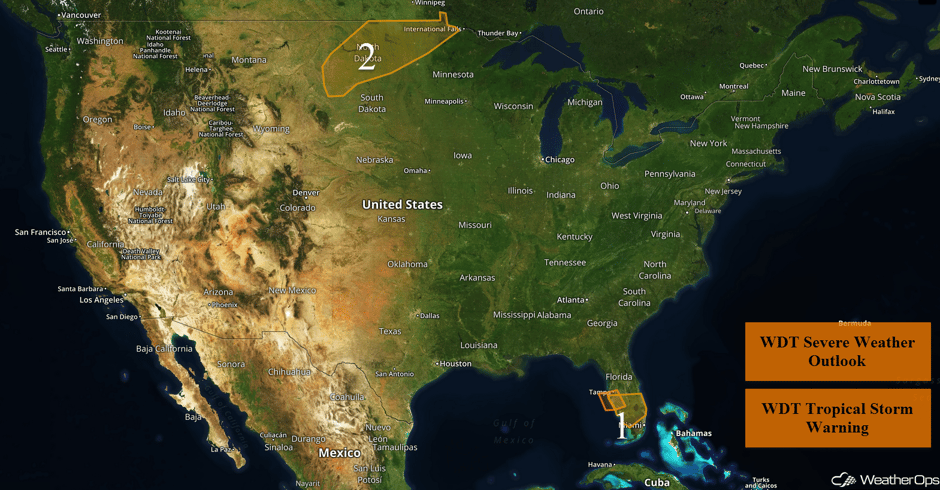 US Hazards
Tropical Storm Conditions and Excessive Rainfall for Florida on Monday
Tropical Storm Emily has formed over the eastern Gulf of Mexico and will move inland across western Florida today. Deep tropical moisture and favorable low level winds will allow for some rotating thunderstorms within Emily's rainbands. A brief tornado or waterspout cannot be ruled out with some of these storms. Along the coast of western Florida, winds of 35 knots with gusts in excess of 45 knots are forecast, allowing for swells of 5-8 feet. Rainfall amounts will range 2-3 inches with locally higher amounts in excess of 5 inches.
A boat sits beached near Hart's Landing after the storm blew it aground this morning south of John Ringling Cswy. #Emily #FLwx @NWSTampaBay pic.twitter.com/qj9CTYe4dW
— Carlos R. Munoz (@ReadCarlos) July 31, 2017
Major Cities in Region: St. Petersburg, FL, Naples, FL, Palm Beach, FL
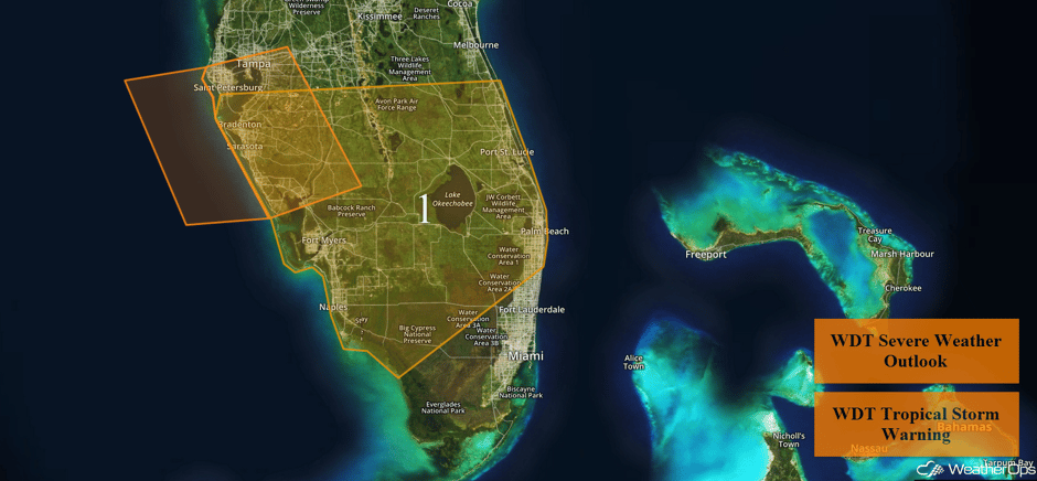 Region 1
Thunderstorms for the Far Northern Plains Monday
A cold front tracking southeastward across the Northern Plains is likely to generate scattered thunderstorms beginning mid to late afternoon before tapering off. A few storms may be strong to severe capable of hail and damaging winds.
Major Cities in Region: Minot, ND, Bismarck, ND, Grand Forks, ND
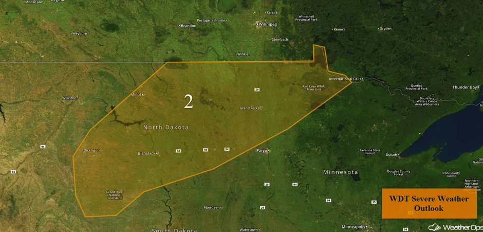 Region 2
Excessive Rainfall Risk Continues Monday across the Southern High Plains
Heavy rainfall leading to a threat for flash flooding will shift southward on Monday, with the greatest chance for excessive rainfall being over eastern New Mexico and west Texas. Showers and thunderstorms will impact the region for much of the day with an increase during the late afternoon and evening. Rainfall amounts of 1-3 inches with locally higher amounts in excess of 5 inches are expected.
Major Cities in Region: Amarillo, TX
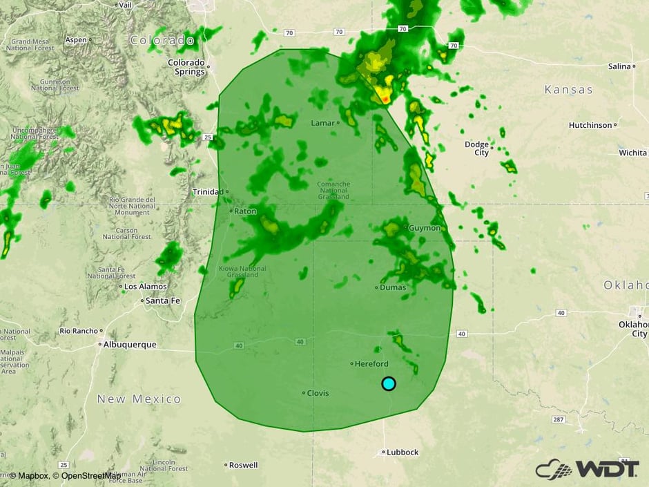 Excessive Rainfall Risk Outline for Monday
Risk for Thunderstorms Tuesday across the Northern Plains
A cold front will stall across the Northern Plains on Tuesday, allowing for a marginal risk for strong to severe thunderstorms within the threat region. Showers and thunderstorms will develop by the afternoon, with the greatest coverage expected over the High Plains. Over the Midwest, thunderstorms will likely be more isolated, but will pose a risk for large hail and damaging winds. Across the High Plains, strong to damaging winds will be the primary hazards into the early evening.
Major Cities in Region: Rapid City, SD, Pierre, SD, Sioux Falls, SD, Minneapolis, MN
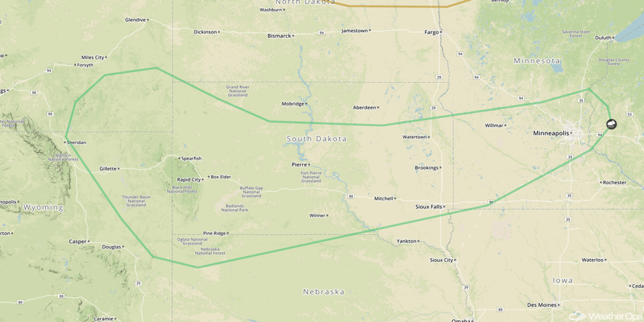 SPC Convective Outlook for Tuesday
Thunderstorm Potential for the Northern and Central Plains on Wednesday
An area of low pressure will intensify on Wednesday, which will push a cold front southward into the Central Plains. Showers and thunderstorms will be likely during the afternoon along and ahead of the cold front, some of which may become strong to severe. Damaging winds will be the primary threat, with the threat diminishing during the evening.
Major Cities in Region: Rapid City, SD, North Platte, NE, Pierre, SD, Sioux Falls, SD, Sioux City, IA
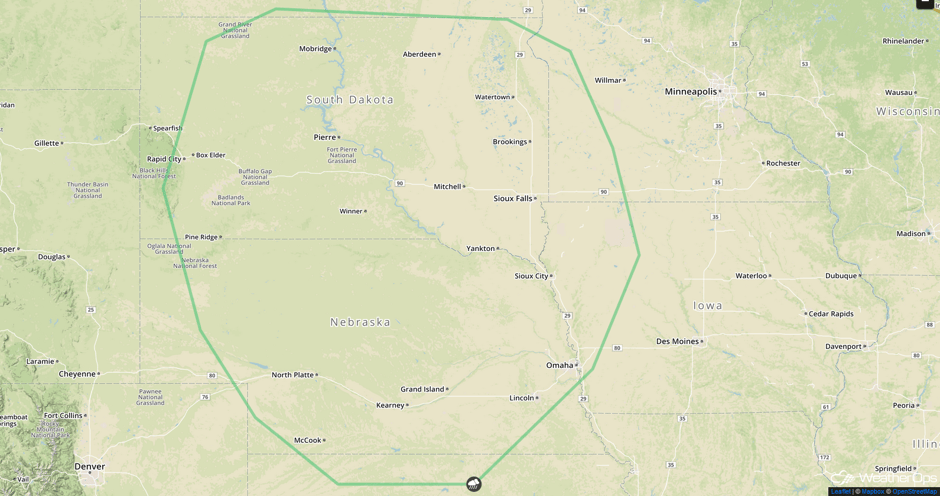 SPC Convective Outlook for Wednesday
Tropical Update
Tropical Storm Emily is expected to continue to progress eastward with a turn toward the northeast and an increase in forward speed. Maximum sustained winds are at 45 mph with higher gusts. Emily is forecast to weaken to a tropical depression later today or tonight. The center of Emily is forecast to move over the west central portions of Florida this afternoon and central Florida tonight. Emily should move offshore Tuesday Morning.
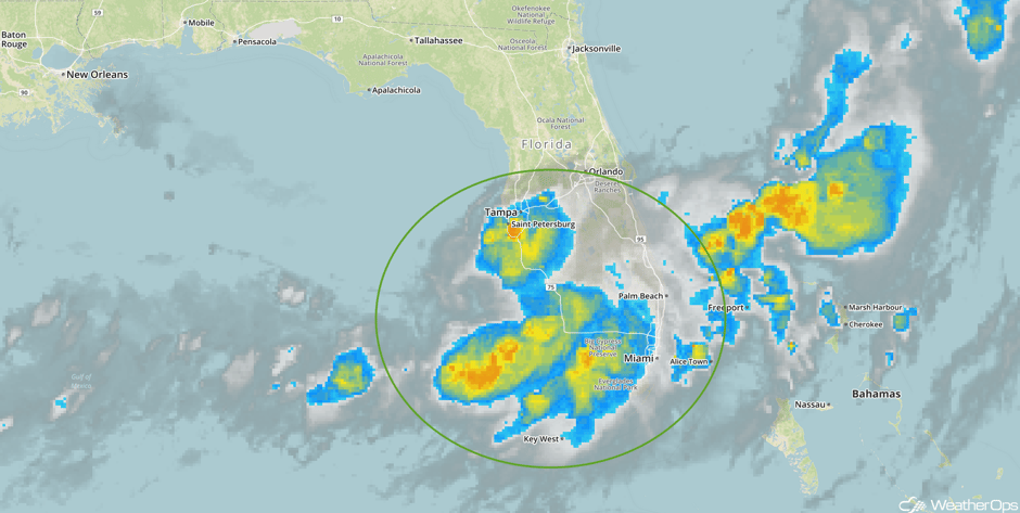 Tropical Enhanced Infrared Satellite
A Look Ahead
Showers and thunderstorms may develop across the Midwest Thursday as an area of low pressure and cold front continue to move across the region. Along the Gulf Coast, heavy rain may develop along a stalled front; this threat will continue through Saturday. By Friday, showers and thunderstorms may develop over the Plains and into the Ohio Valley along a cold front. As the cold front continues to push eastward on Saturday, thunderstorms may develop along the East Coast.
This is just a brief look at current weather hazards. We can provide you site-specific weather forecast information for the purpose of protecting your personnel and assets and to assess your weather risk. Try a 7-day demo right away and learn how timely precision weather information can enhance your bottom line.


