National Weather Summary for Monday, February 27, 2017
by David Moran, on Feb 27, 2017 11:20:57 AM
A warm front associated with an area of low pressure moving out of the Rockies will bring a risk for thunderstorms to portions of the Plains and Mississippi Valley on Monday. Snow will continue across portions of the Intermountain West and Desert Southwest as an upper level disturbance approaches.
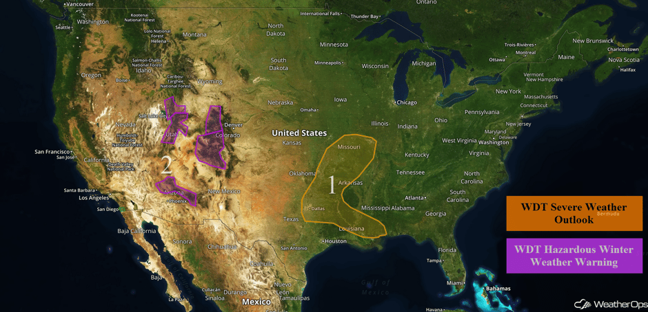 US Hazards
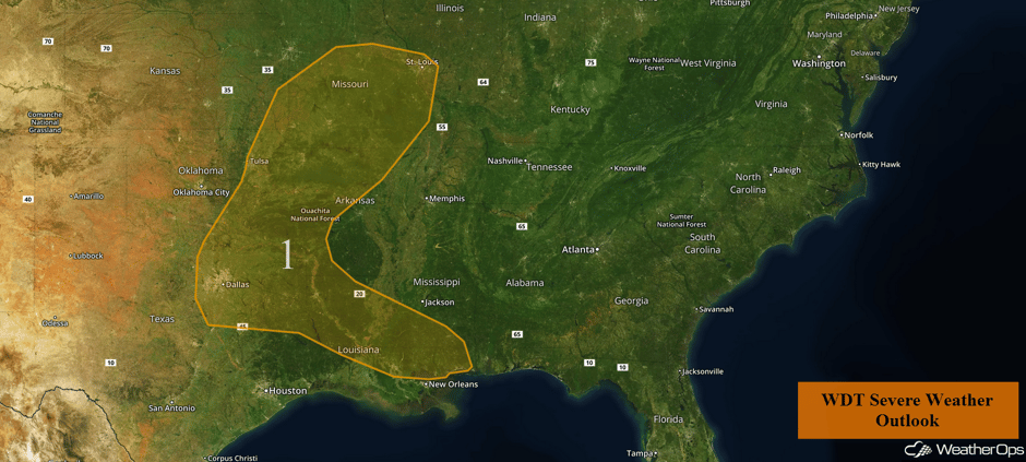
Region 1
Thunderstorms may develop this afternoon across portions of the Plains and Mississippi Valley as a warm front moves northward. While thunderstorms are currently ongoing, additional thunderstorms are expected to develop this afternoon and continue into the evening and overnight hours. Any thunderstorms that develop will have the potential for large hail, damaging winds, and tornadoes.
Hail covering the ground just south of Dallas creating fog over this empty cropfield. #txwx @NWSFortWorth pic.twitter.com/OlMMD75iPa
— Hayden Mahan (@WeatherMahan) February 27, 2017
Update 12:37pm CST: Severe Thunderstorm Warning ESE of Dallas. Half dollar size hail is the main hazard with this storm.
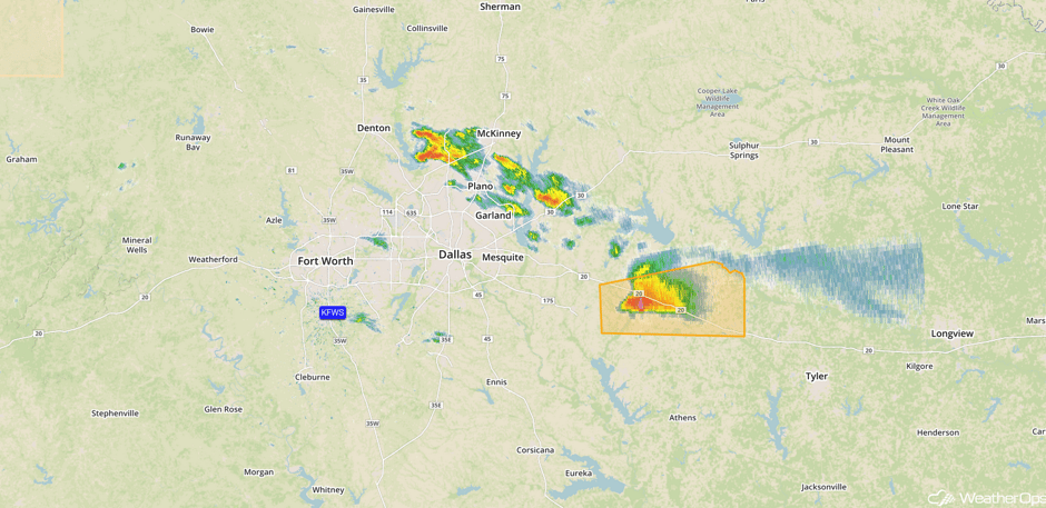 Radar 12:37pm CST
Update 12:51pm CST: Severe thunderstorm approaching McKinney, TX. Large hail will be the primary hazard.
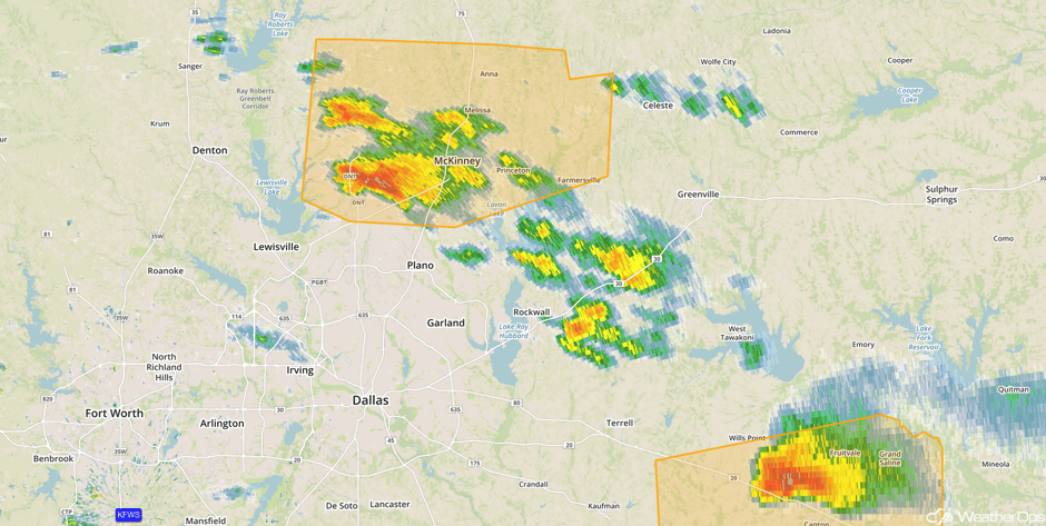 Radar 12:51pm CST
Update 1:02pm CST: Severe thunderstorms capable of damaging winds in southeastern Louisiana.
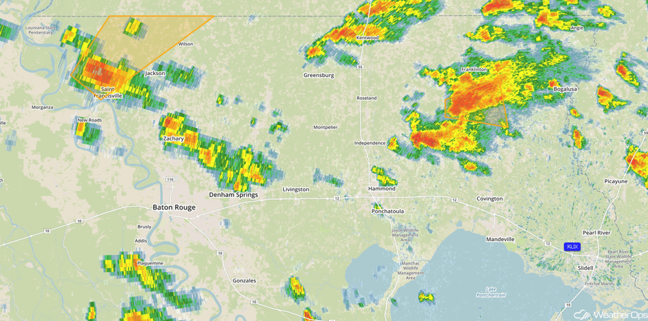 Radar 1:02pm CST
Major Cities in Region: Dallas, TX, Tulsa, OK, Shreveport, LA, Baton Rouge, LA, St. Louis, MO
 Region 1
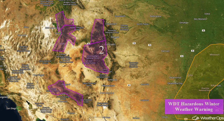
Region 2
A strong upper level disturbance will bring heavy snow to Region 2 today through Tuesday, with the highest amounts expected in the higher elevations. For northern portions of Utah, 2-5 inches of snow are forecast in the valleys and 6-12 inches in the higher elevations. Winds of 20-30 mph with gusts in excess of 55 mph will limit visibilities of less than a quarter of a mile. Across central and southern Utah, snow accumulations of 1-2 feet are expected before tapering off Monday evening and Tuesday morning. Further south across central and eastern Arizona, snow accumulations of 5-10 inches with locally higher amounts in excess of 15 inches are expected above 6500 feet. Across northeastern Colorado, snow accumulations of 5-10 inches and locally higher amounts in excess of 2 feet are forecast above 7,000 feet. Snow accumulations of 12-18 inches with locally higher amounts in excess of 2 feet are possible across southwestern Colorado through Tuesday.
Major Cities in Region: Salt Lake City, UT, Flagstaff, AZ, Grand Junction, CO, Aspen, CO, Vail, CO
 Region 2
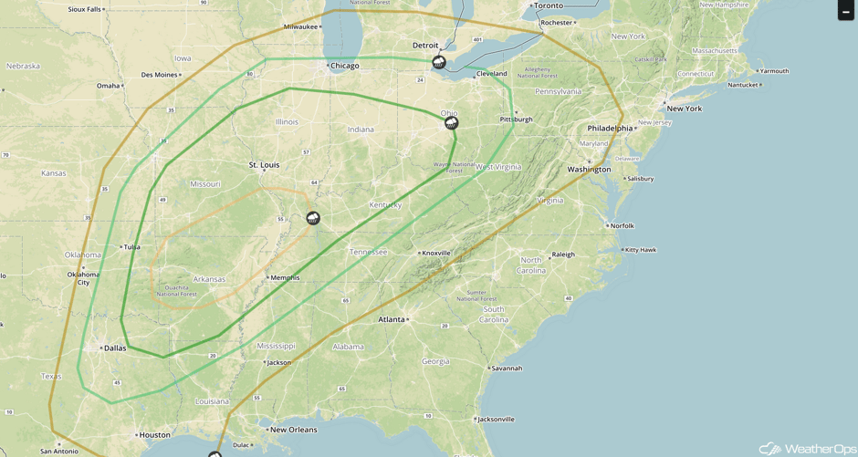
Strong to Severe Thunderstorms Possible from the Gulf Coast through the Great Lakes on Tuesday
An area of low pressure intensifying across the Central US will allow moisture to move northward across the region. Thunderstorm activity may be somewhat limited due to activity from Monday and cloud cover. However, strong to severe thunderstorms will be likely. Thunderstorms that develop will have the potential for large hail, damaging winds, and tornadoes. Later into the evening, thunderstorms will become linear. As this occurs, damaging winds and tornadoes will be the main hazards. Heavy rainfall will also be possible across the region as storms train over the same area and heavy downpours occur. Widespread rainfall amounts of 1-2 inches are forecast with locally higher amounts.
Major Cities in Region: Dallas, TX, Little Rock, AR, Memphis, TN, St. Louis, MO, Chicago, IL, Indianapolis, IN, Cincinnati, OH
 SPC Convective Outlook for Tuesday
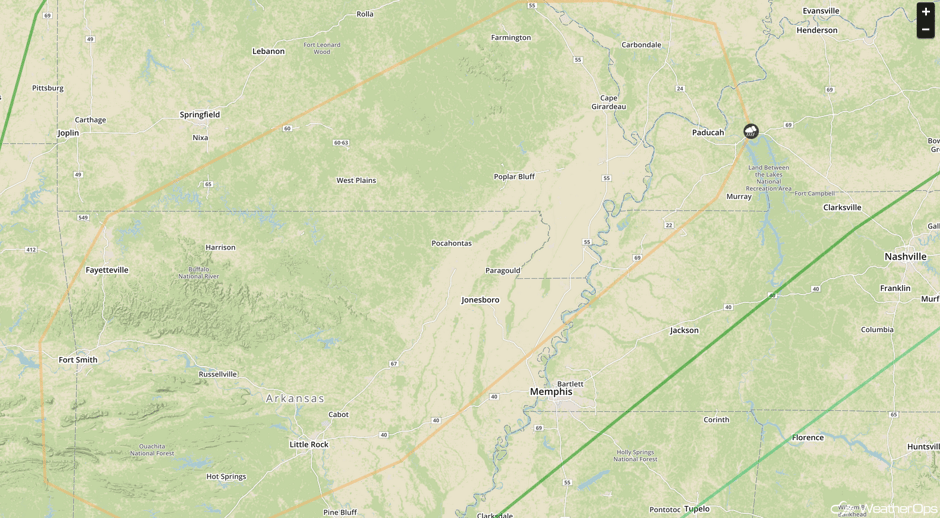
Severe Thunderstorms Expected for Portions of Arkansas and the Mississippi Valley on Tuesday
This region will see the highest threat for severe weather Tuesday afternoon into the evening. Large hail and tornadoes will be the primary hazards with these storms.
Major Cities in Region: Fort Smith, AR, Fayetteville, AR, Little Rock, AR
 SPC Convective Outlook for Tuesday
Strong to Severe Thunderstorms Possible for the Southeastern US on Wednesday
As the area of low pressure and cold front continues to move northeastward toward the Atlantic Coast, a squall line will continue to progress across the southeastern US. Damaging winds will be the primary hazard, but there will also be the potential for tornadoes. In addition, heavy rainfall will also be a concern from northwestern West Virginia southwestward into northeastern Kentucky. Rainfall amounts of 1-3 inches with locally heavier amounts are forecast.
Major Cities in Region: Memphis, TN, Jackson, MS, Birmingham, AL, Nashville, TN, Cincinnati, OH, Atlanta, GA, Pittsburgh, PA, Raleigh, NC, Washington, DC, Philadelphia, PA
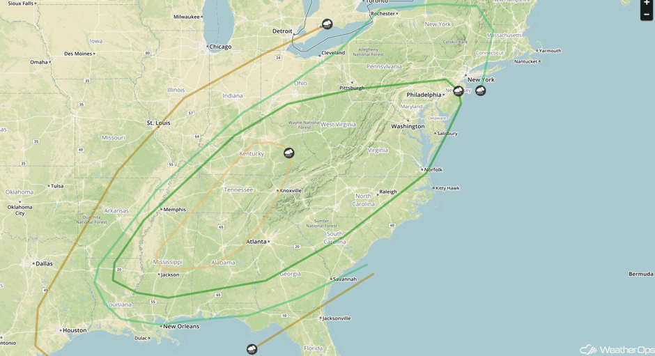 SPC Convective Outlook for Wednesday
Severe Thunderstorms Expected from Mississippi through Kentucky on Wednesday
The highest risk for severe weather will extend from Mississippi through Kentucky on Wednesday. Damaging winds and tornadoes will be the primary hazards with any storms that develop.
Major Cities in Region: Birmingham, AL, Chattanooga, TN, Knoxville, TN, Nashville, TN
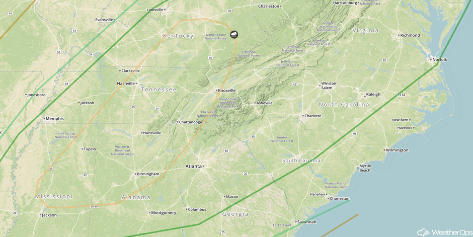 SPC Convective Outlook for Wednesday
A Look Ahead
High elevation snow will be possible for portions of the Intermountain Northwest on Friday as an area of low pressure moves through the region. Snowfall will continue into Saturday with two day snowfall accumulations in excess of two feet possible.
This is just a brief look at current weather hazards. We can provide you site-specific weather forecast information for the purpose of protecting your personnel and assets and to assess your weather risk. Try a 7-day demo right away and learn how timely precision weather information can enhance your bottom line.


