by David Moran, on Dec 10, 2018 10:20:53 AM
Freezing rain and snow will continue across the Mid Atlantic on Monday as moisture lingers over the region.
- Freezing Rain and Snow Continue across the Mid Atlantic on Monday
- Potential for Snow and Freezing Rain Tuesday across the Northern Cascades
- Snow for Idaho and Western Montana Tuesday and Wednesday
US Hazards
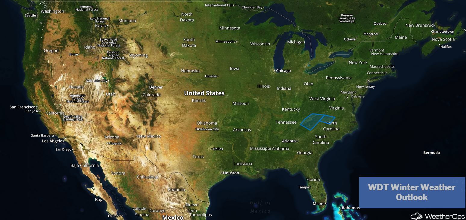
Freezing Rain and Snow Continue across the Mid Atlantic on Monday
The area of low pressure that brought significant winter weather to the region over the weekend has moved offshore. However, some moisture lingers over the Mid Atlantic, which continues to bring snow and freezing rain to the region. As temperatures rise, most of the precipitation should transition to rain before tapering off this afternoon. An additional inch or two of snowfall and a trace of ice is forecast across the Carolinas and Virginia before moving out of the region.
Major Cities in Region: Asheville, NC, Raleigh, NC, Norfolk, VA
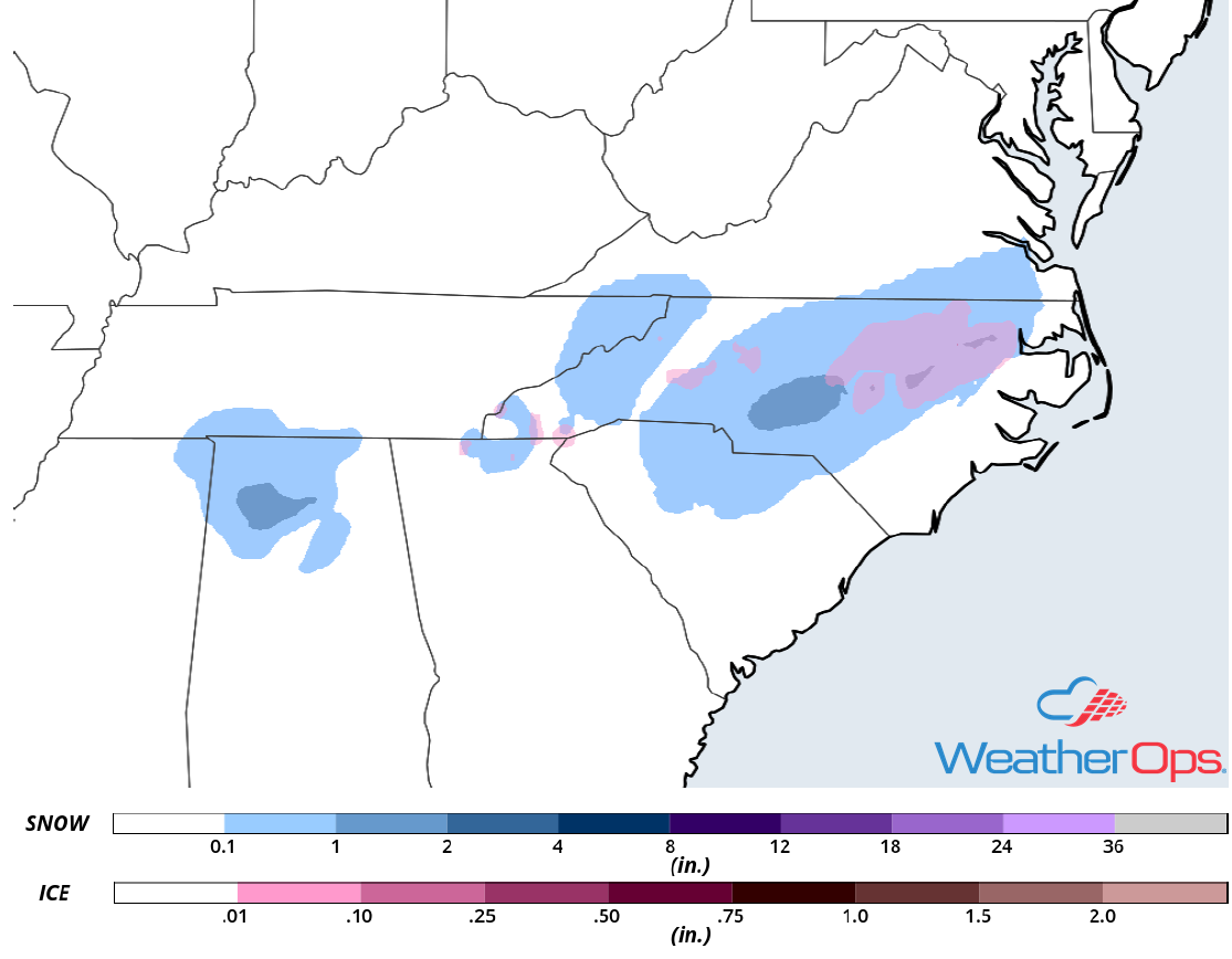
Snow and Ice Accumulation for Monday
Potential for Snow and Freezing Rain Tuesday across the Northern Cascades
A strong area of low pressure is forecast to move across the region Tuesday, bringing with it the potential for snowfall. Accumulations of 4-8 inches to more than 12 inches are expected in the lower elevations. In the higher elevations, 6-12 inches with locally higher amounts in excess of 18 inches are forecast. In addition, some light icing may develop in the valleys where temperatures are expected to be a bit warmer. The area of low pressure should move east of the region by Tuesday evening, but a few snow showers may linger into mid morning on Wednesday. In the higher elevations, wind gusts in excess of 45 mph are expected, leading to low visibilities and drifting snow.
Major Cities in Region: Yakima, WA, Spokane, WA
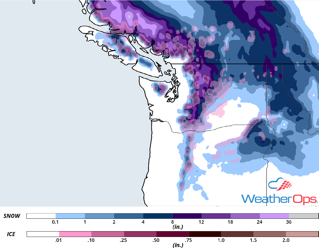
Snow and Ice Accumulation for Tuesday
Snow for Idaho and Western Montana Tuesday and Wednesday
The area of low pressure described above will continue to move across the region Tuesday into Wednesday. With ample moisture in place across the region, light snowfall will begin early Tuesday morning. As the day progresses, snow will spread eastward and should increase in intensity. Widespread snowfall totals will range 3-6 inches with locally higher amounts in excess of 8 inches. In the higher elevations, 6-12 inches with locally higher amounts of more than 18 inches are forecast. In addition, winds in excess of 45 mph could result in blowing snow and low visibilities across the region.
Major Cities in Region: Missoula, MT, Butte, MT, Helena, MT
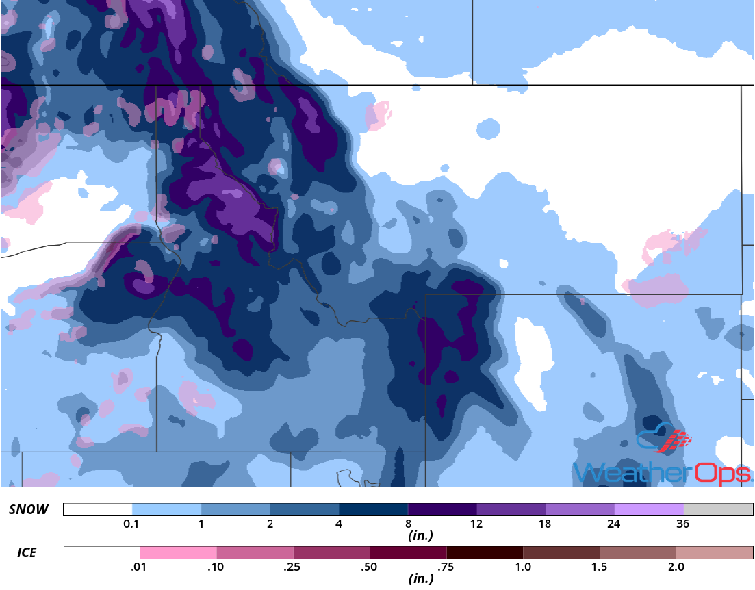
Snow Accumulation for Tuesday and Wednesday
A Look Ahead
Snow is expected to continue across the Northern and Central Rockies on Thursday as the area of low pressure described above continues to move eastward. An area of low pressure will develop across the Southern Plains on Thursday, bringing snow to the Central Plains and showers and thunderstorms to the Lower Mississippi Valley. Snow will move into the Southern Plains on Friday, meanwhile showers and thunderstorms may develop from the Mid Mississippi Valley into the Southeast. Showers and thunderstorms are forecast for portions of the Ohio Valley on Saturday. Across the Appalachians, snow may develop Saturday as an upper level low moves across the region. Rain and freezing rain are forecast for portions of the Northeast on Sunday.