National Weather Summary for Monday, August 14, 2017
by David Moran, on Aug 14, 2017 10:59:32 AM
A shortwave trough will allow for the development of showers and thunderstorms across the High Plains on Monday. Excessive rainfall will continue from the Southern Plains into the Lower Mississippi Valley Monday along a stalled front.
- Thunderstorms across the Northern High Plains on Monday
- Potential for Thunderstorms Monday across the Southern High Plains
- Excessive Rainfall continuing from the Southern Plains to the Lower Mississippi Valley Monday
- Risk for Thunderstorms Tuesday across the Northern and Central Plains
- Thunderstorm Potential across the Northeast on Tuesday
- Tropical Update
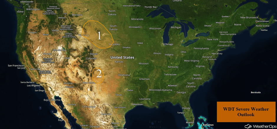 US Hazards
Thunderstorms across the Northern High Plains on Monday
An upper level trough is forecast to progress to the east throughout the day and move into the region by the afternoon. With increasing moisture and warmer temperatures, increasing instability will lead to the development of thunderstorms. Initial thunderstorms will have the potential for large hail, damaging winds, and tornadoes. Storms will eventually cluster with severe winds and large hail the primary threats.
Major Cities in Region: Rapid City, SD
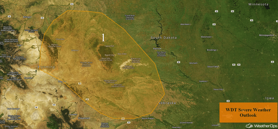 Region 1
Potential for Thunderstorms Monday across the Southern High Plains
Into the late afternoon and evening, widely scattered thunderstorms are expected across the region. With upper level support increasing, strong winds and large hail will be the primary hazards with these storms.
Major Cities in Region: Tucumcari, NM
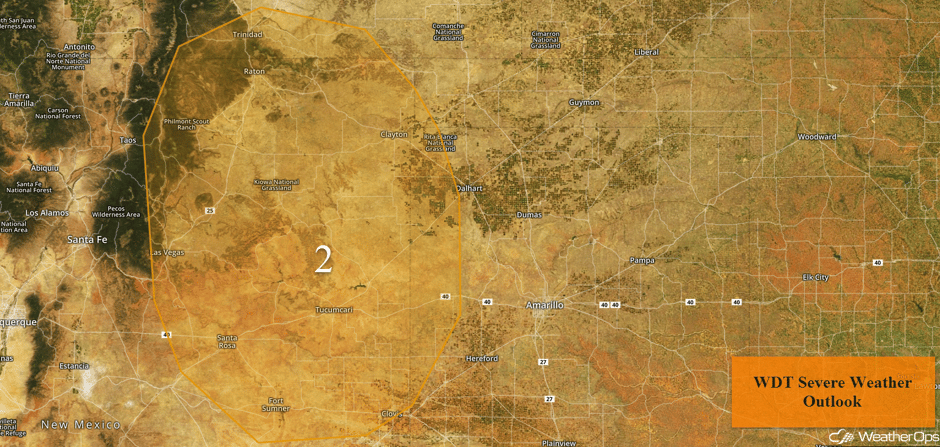 Region 2
Excessive Rainfall continuing from the Southern Plains to the Lower Mississippi Valley Monday
A stalled front will remain in place across portions of the Southern Plains and Lower Mississippi Valley on Monday with general showers and thunderstorms continuing. Additional rainfall amounts of 0.5-1.00 inches are forecast with locally higher amounts in excess of an inch. Given recent rainfall from previous days, flooding and flash flooding will be a threat.
Major Cities in Region: Sherman, TX, Texarkana, AR
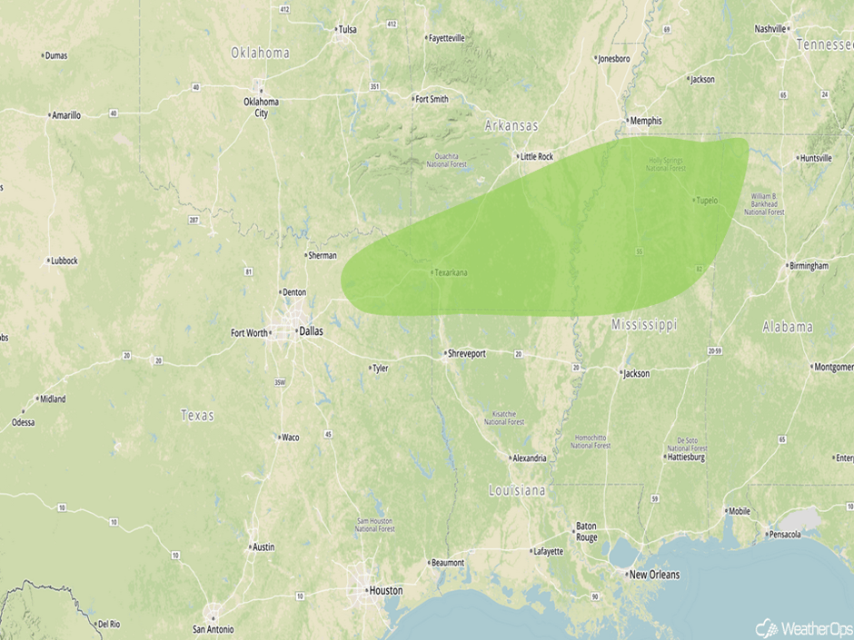 Excessive Rainfall Risk Outline for Monday
Risk for Thunderstorms Tuesday across the Northern and Central Plains
A shortwave trough will slowly progress eastward across the Northern Plains, bringing a risk for strong to severe thunderstorms on Tuesday. Activity will be ongoing during the early morning hours before intensifying later in the day as instability increases. Morning activity may produce outflow boundaries that will serve as a focus for the development of new thunderstorms. Strong winds and hail will be the primary hazards with these storms.
Major Cities in Region: Lubbock, TX, Amarillo, TX, North Platte, NE, Dodge City, KS
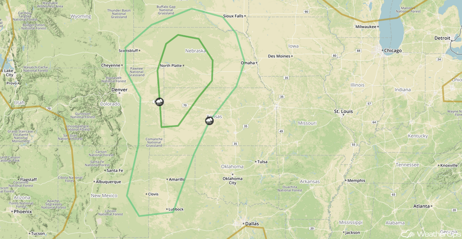 SPC Convective Outlook for Tuesday
Thunderstorm Potential across the Northeast on Tuesday
Scattered strong to severe thunderstorm development is forecast during the afternoon ahead of a cold front. Southerly winds ahead of the front will bring in warm, moist air, which will increase instability. Severe winds will be the primary hazards with these storms.
Major Cities in Region: Burlington, VT
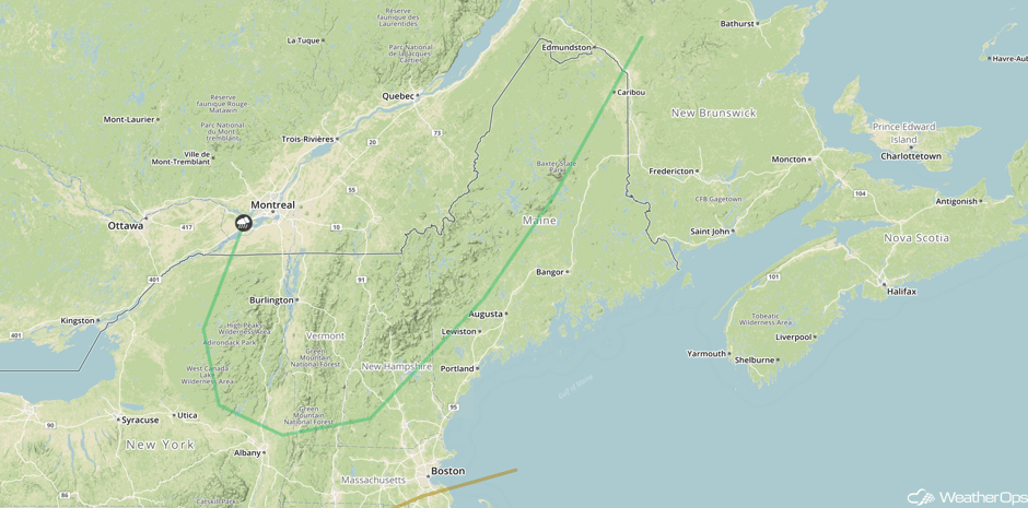 SPC Convective Outlook for Wednesday
Tropical Update
Tropical Storm Gert (green oval) is continuing to move toward the north at 8 mph. Gert will turn toward the northeast and increase in forward speed over the next 48 hours. Maximum sustained winds are at 60 mph with higher gust. Some additional strengthening is expected and Gert is expected to become a hurricane tomorrow night.
Shower and thunderstorm activity associated with an area of low pressure southwest of the Cabo Verde Islands (red oval) has increased overnight. Environmental conditions are expected to be conducive for development over the next several days as it moves westward at 15 mph.
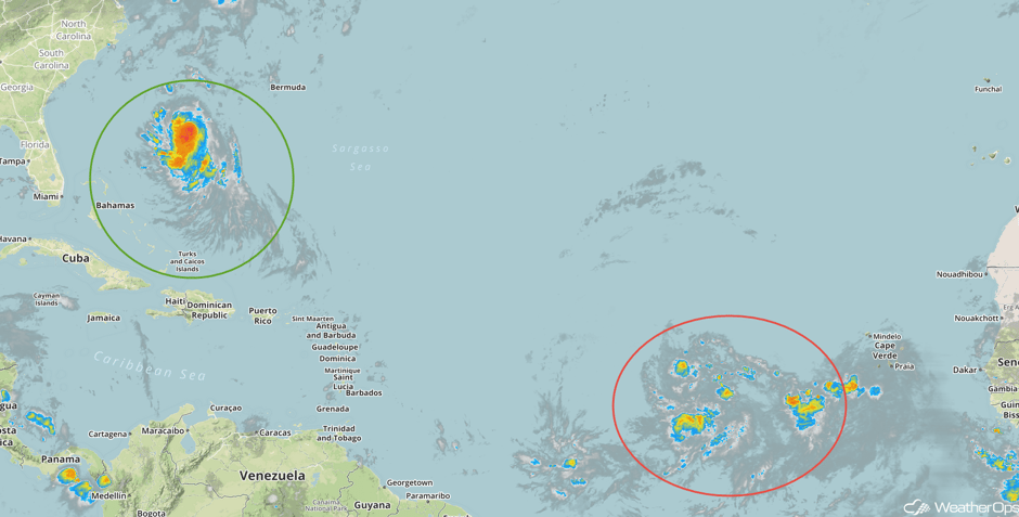 Enhanced Infrared Tropical Satellite
A Look Ahead
Showers and thunderstorms may develop across the Upper Midwest on Wednesday ahead of a cold front, but no severe threat is anticipated. This cold front will move across the Great Lakes on Thursday, bringing showers and thunderstorms to the region. Once again, severe weather is not expected. As the cold front pushes offshore on Friday, showers and general thunderstorms may develop across portions of the Southeast on Friday. This risk may continue through the weekend as the front stalls across the Southeast.
This is just a brief look at current weather hazards. We can provide you site-specific weather forecast information for the purpose of protecting your personnel and assets and to assess your weather risk. Try a 7-day demo right away and learn how timely precision weather information can enhance your bottom line.


