


by David Moran, on Apr 23, 2018 10:37:40 AM
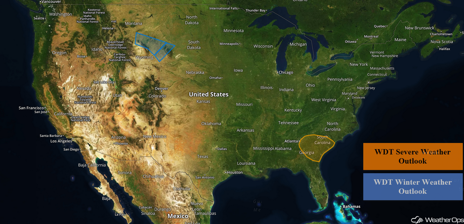
Snow will continue for portions of the Northern Rockies and High Plains on Monday as an area of low pressure moves through the region. Thunderstorms may develop across the Southeast ahead of a cold front. Excessive rainfall is forecast for the Carolinas ahead an area of low pressure and cold front.
- Snow Continuing for the Northern Rockies and High Plains on Monday
- Thunderstorms Monday across the Southeast
- Excessive Rainfall for the Carolinas on Monday
- Potential for Thunderstorms Tuesday across Texas
 US Hazards

Snow Continuing for the Northern Rockies and High Plains on Monday
A weak area of low pressure will continue to promote light to moderate snowfall from the Northern Rockies into the High Plains region through the morning hours on Tuesday. Widespread accumulations of 2-4 inches are expected with locally heavier amounts in excess of 6 inches in the higher elevations. Winds may gust more than 30 mph, allowing for low visibilities.
Major Cities in Region: Billings, MT, Sheridan, WY
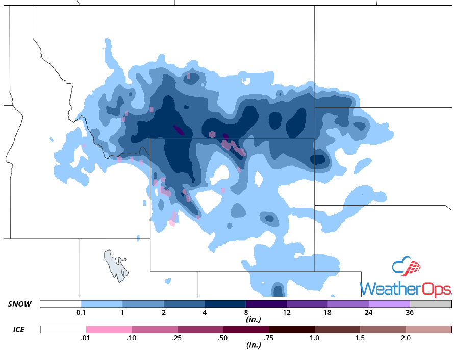 Snow Accumulation for Monday
Thunderstorms Monday across the Southeast
As an area of low pressure and the associated fronts slowly move eastward on Monday, severe thunderstorms may develop from eastern Georgia through the coastal Carolinas. Although ongoing showers and thunderstorms, along with cloud cover, will limit instability, a few strong to severe thunderstorms may develop. Large hail, damaging winds, and tornadoes will all be potential hazards with these storms. As these storms move eastward into the night time hours, damaging winds and isolated tornadoes will become the primary concerns.
Major Cities in Region: Macon, GA, Augusta, GA, Savannah, GA, Columbia, SC, Charleston, SC
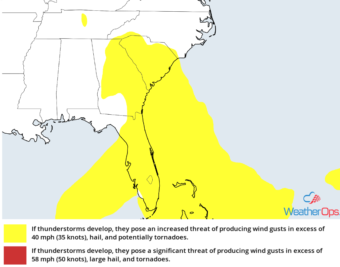 Thunderstorm Risk for Monday
Excessive Rainfall for the Carolinas on Monday
An area of low pressure slowly moving eastward across the Southeast will continue to produce showers and thunderstorms across the region. Rainfall totals of 1-2 inches are expected with localized amounts in excess of 3 inches. The most significant risks for flooding will come from repeated rounds of thunderstorms, as well as severe thunderstorms, that may cause heavy downpours and flash flooding.
Major Cities in Region: Macon, GA, Charlotte, NC, Columbia, SC, Charleston, SC
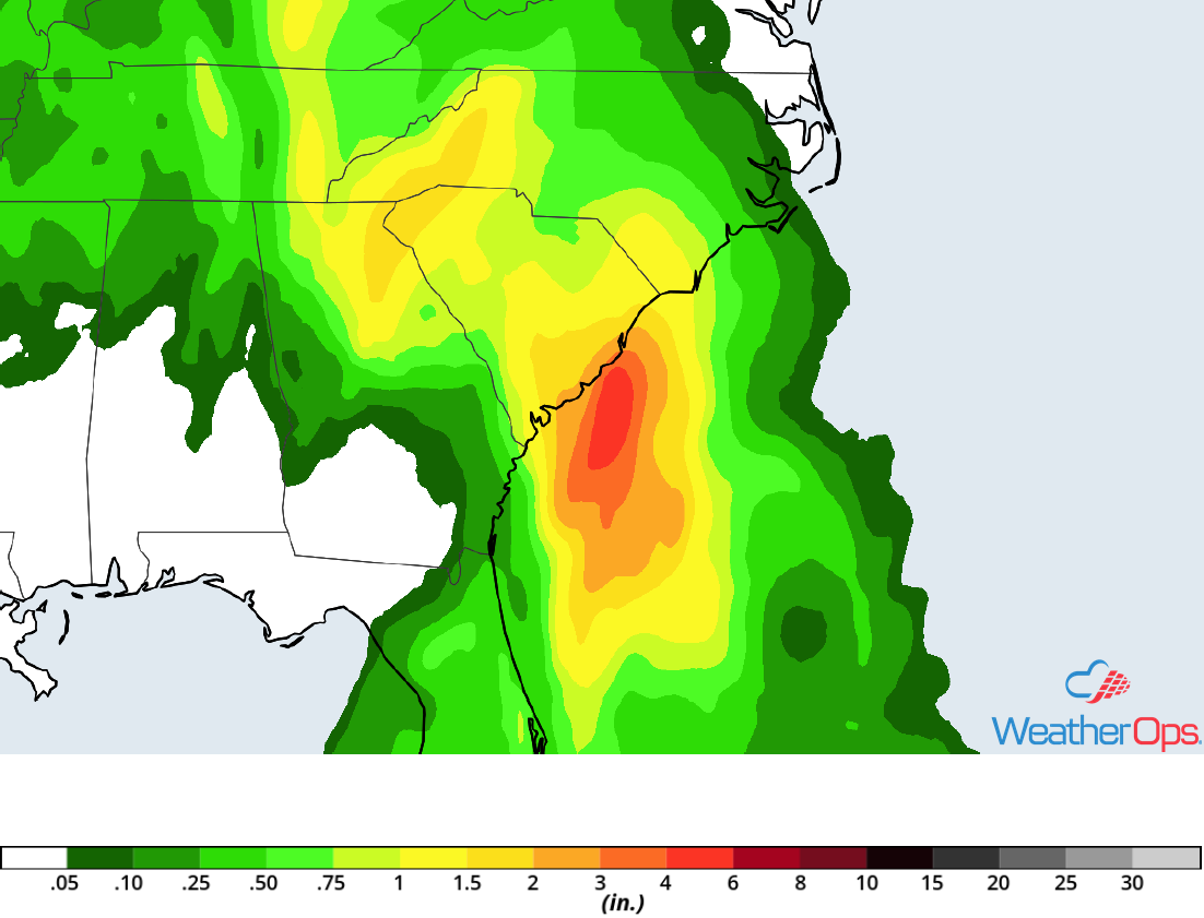 Rainfall Accumulation for Monday
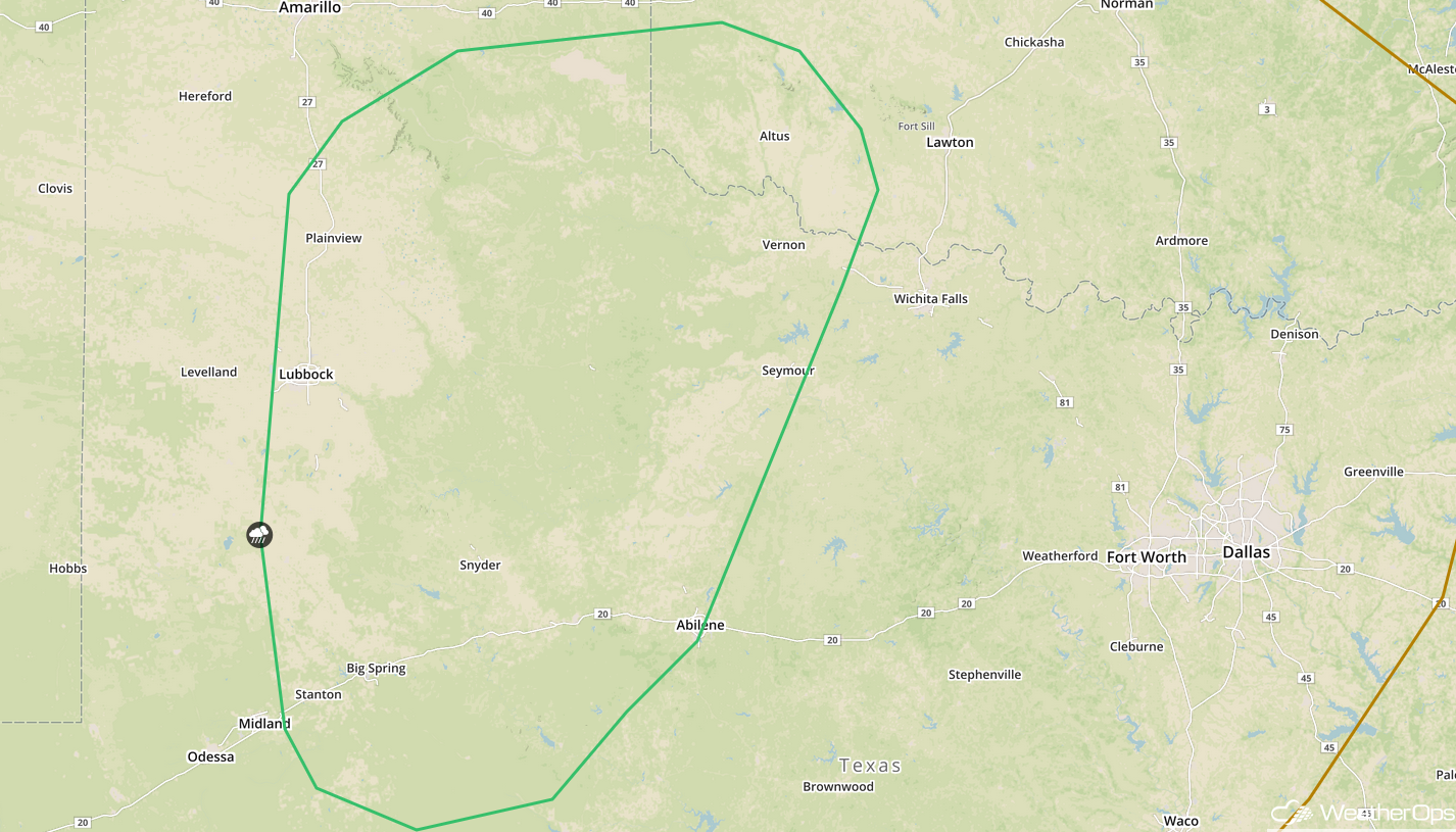
Potential for Thunderstorms Tuesday across Texas
Isolated to scattered thunderstorms are forecast for portions of the High Plains of Texas into the Red River on Tuesday. Although moisture will be lacking across the region, destabilization should allow for the development of strong to severe thunderstorms. Some storms may become supercells with large hail and damaging winds the primary hazards.
Major Cities in Region: Lubbock, TX, Abilene, TX
 SPC Convective Outlook for Tuesday
A Look Ahead
Showers and thunderstorms may develop across portions of the Northern Plains on Wednesday ahead of a cold front. Activity should move into the Upper Midwest and Great Lakes on Thursday. By Friday, showers and thunderstorms will extend from the Great Lakes into the Mid Mississippi Valley.
This is just a brief look at current weather hazards. We can provide you site-specific weather forecast information for the purpose of protecting your personnel and assets and to assess your weather risk. Try a 7-day demo right away and learn how timely precision weather information can enhance your bottom line.
