National Weather Summary for Monday, April 17, 2017
by David Moran, on Apr 17, 2017 10:41:33 AM
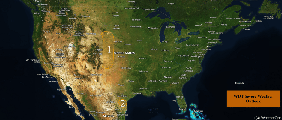
An upper level disturbance may allow for the development of thunderstorms across the High Plains on Monday. Instability will build across South Texas through the day, bringing a potential for thunderstorms to the region.
- Strong to Severe Thunderstorms Possible Monday across the High Plains
- Thunderstorm Potential for South Texas on Monday
- Development of Thunderstorms Across Central Plains into Mid-Missouri Valley on Tuesday
- Thunderstorms Wednesday from Central Plains to Great Lakes
Strong to Severe Thunderstorms Possible Monday across the High Plains
An area of low pressure over the Oregon/Idaho border will progress eastward across the Rockies today, bringing a potential for strong to severe thunderstorms to the region. Moderate instability and strong shear should be present, allowing for the potential for supercell thunderstorms capable of large hail, damaging winds, and tornadoes.
Major Cities in Region: Goodland, KS
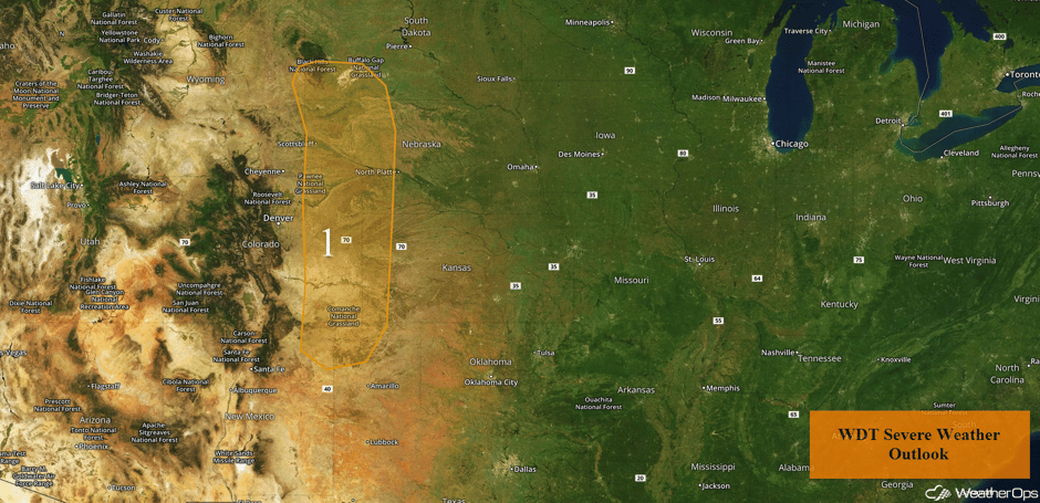 Region 1
Thunderstorm Potential for South Texas on Monday
A line of thunderstorm activity moving toward the Texas coastline will continue to have the potential to produce severe weather through the day before moving out of the region by early evening. Stronger storms may produce hail and/or damaging winds.
Major Cities in Region: Laredo, TX, Corpus Christi, TX, Brownsville, TX
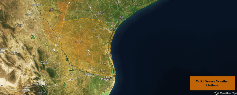 Region 2
Development of Thunderstorms Across Central Plains into Mid-Missouri Valley on Tuesday
A cold front dropping southeastward out of the Northern Plains on Tuesday will provide a focus for thunderstorm development during the afternoon and evening hours across southwestern Iowa and northwestern Missouri. A few thunderstorms may produce gusty winds and hail. Later in the evening and into the overnight hours, more widespread thunderstorm development is expected across the Central Plains as an area of low pressure intensifies. A strengthening low level jet will allow for strong to severe thunderstorms in this region. Large hail will be the primary hazard with any storms in this region, but gusty winds will also be possible as storms become more organized.
Major Cities in Region: North Platte, NE, Grand Island, NE, Omaha, NE, Des Moines, IA
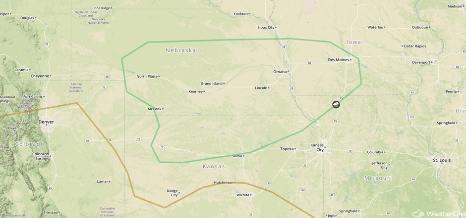 SPC Convective Outlook for Tuesday
Thunderstorms Wednesday from Central Plains to Great Lakes
An area of low pressure and cold front will track eastward across the Great Plains and into the Midwest on Wednesday. Scattered thunderstorms are anticipated by the afternoon in the Mid-Mississippi Valley and southwestern Great Lakes. Further west across the Plains, thunderstorms are expected to be more isolated and likely developing a bit later. Any thunderstorms that develop will have the potential for large hail, damaging winds, and a few tornadoes.
Major Cities in Region: Wichita, KS, Kansas City, MO, Omaha, NE, Des Moines, IA, Chicago, IL
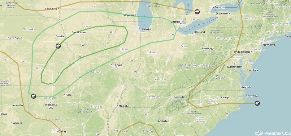 SPC Convective Outlook for Wednesday
A Look Ahead
An intensifying upper level trough will move across the Central Plains on Friday. This will allow for the development of an area of low pressure. To the south of the low, a cold front and dryline will provide a focus for the development of thunderstorms. Further north, a warm front across the Central Plains will allow for the potential for heavy rain across portions of the Central Plains. Rainfall accumulations of 1-3 inches with isolated higher amounts in excess of 4 inches are expected. This may lead to an increased risk of flooding or flash flooding.
This is just a brief look at current weather hazards. We can provide you site-specific weather forecast information for the purpose of protecting your personnel and assets and to assess your weather risk. Try a 7-day demo right away and learn how timely precision weather information can enhance your bottom line.


 US Hazards

