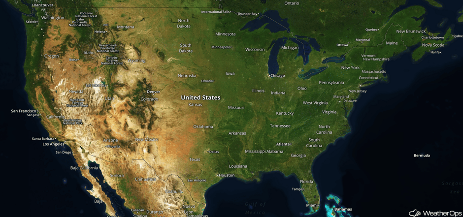
National Weather Summary for Friday, November 17, 2017
by David Moran, on Nov 17, 2017 10:16:30 AM
Snow will continue for portions of the Rockies on Friday in association with an upper level system.
- Snow Continuing Friday for the Northern and Central Rockies
- Thunderstorms for the Tennessee and Ohio Valleys on Saturday
- Tropical Update
 US Hazards
Snow Continuing Friday for the Northern and Central Rockies
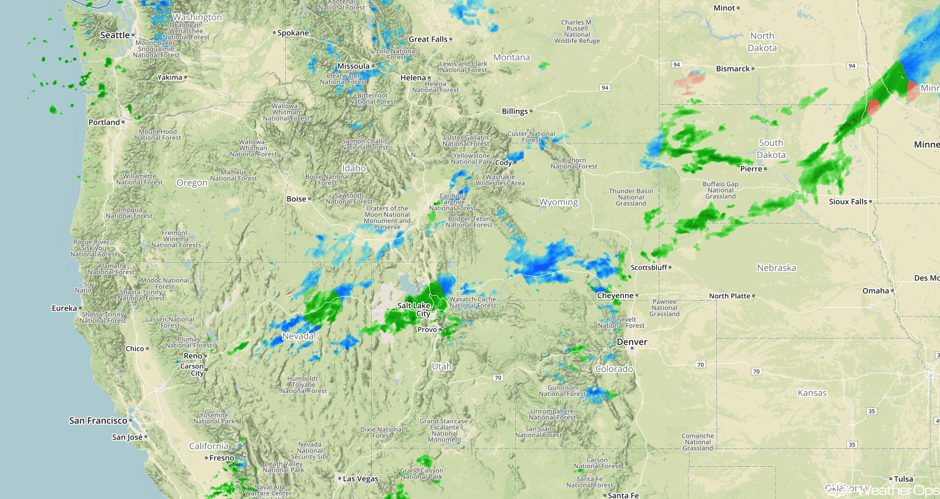
Snow is expected to continue for portions of the Northern and Central Rockies through the day as an upper level trough moves through the region. Accumulations of 4-6 inches are expected for portions of Idaho and Montana. Further south across Colorado, Utah, and Wyoming, some areas may pick up 6-12 inches of snow with locally higher amounts in excess of 18 inches. Combined with gusty winds, hazardous travel conditions and low visibilities are expected.
Major Cities in Region: Missoula, MT, Salt Lake City, UT, Grand Junction, CO, Cheyenne, WY
 Radar 7:52am PST
Thunderstorms for the Tennessee and Ohio Valleys on Saturday
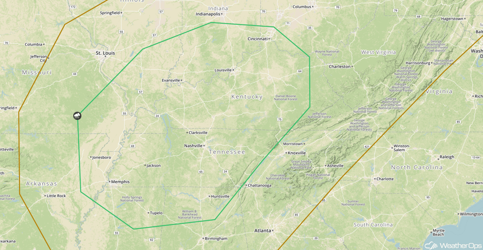
An intensifying area of low pressure and associated cold front moving into the Tennessee and Ohio Valleys will lead to a potential for thunderstorms on Saturday. Though widespread cloud cover should limit instability somewhat, instability should be sufficient for the development of strong to severe thunderstorms capable of producing gusty winds. The timing for this severe risk will likely be during the afternoon hours.
Major Cities in Region: Memphis, TN, Evansville, IN, Nashville, TN, Louisville, KY, Cincinnati, TN
 SPC Convective Outlook for Saturday
Tropical Update
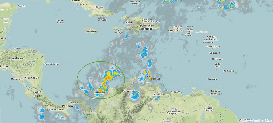
Disorganized showers and thunderstorms continue over the Caribbean Sea in association with an elongated area of low pressure. Strong upper level winds should limit the development of this system while it generally drifts northward during the next few days. Regardless of development, heavy rainfall is forecast over portions of Colombia, Hispaniola, and Puerto Rico through the weekend.
 Enhanced Infrared Tropical Satellite
A Look Ahead
The cold front responsible for the thunderstorms across the Tennessee and Ohio Valleys on Saturday will continue to move eastward on Sunday, allowing for showers and thunderstorms along the East Coast. Some light snow may develop Sunday in the higher elevations of the Appalachians. Another system will move into the Pacific Northwest on Sunday bringing the potential for rain and high elevation snow. This activity will continue into Monday.
This is just a brief look at current weather hazards. We can provide you site-specific weather forecast information for the purpose of protecting your personnel and assets and to assess your weather risk. Try a 7-day demo right away and learn how timely precision weather information can enhance your bottom line.


