National Weather Summary for Friday, November 11, 2016
by David Moran, on Nov 11, 2016 10:50:35 AM
No WeatherOps hazards are currently in effect. Showers and thunderstorms will be possible across portions of the Southwest on Friday.

US Hazards
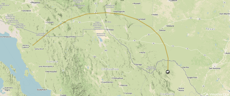
Thunderstorms Possible Friday for Portions of the Desert Southwest
Instability will build across portions of Arizona, New Mexico, and western Texas ahead of a cold front, allowing for the development of thunderstorms. These thunderstorms are expected to remain below severe limits, but will have the potential to produce heavy rain and frequent lightning.
Major Cities in Region: El Paso, TX

SPC Convective Outlook for Friday
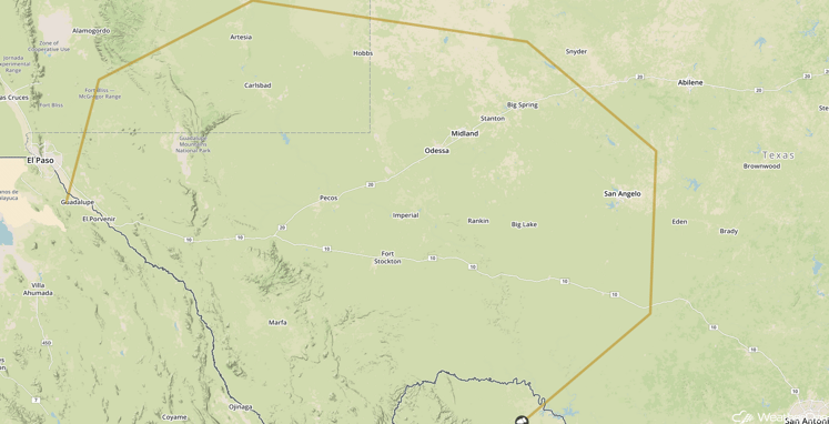
Thunderstorms Possible Saturday for Portions of New Mexico and Texas
As an upper level low moves across the Southern Rockies on Saturday, thunderstorms will be possible across portions of New Mexico and Texas. Any thunderstorms that develop should remain isolated and below severe limits.
Major Cities in Region: Midland, TX, San Angelo, TX

SPC Convective Outlook for Saturday
Tropical Update
No tropical activity is expected during the next 48 hours.
A Look Ahead
Heavy rainfall will be possible for portions of the Pacific Northwest on Sunday as a cold front approaches the region. Widespread accumulations of around an inch, with isolated higher amounts, will be possible. Rain chances across the region will continue into midweek. Off the coast of the Southeast, an area of low pressure is forecast to develop off the Carolina coast on Sunday, bringing rain from the Carolinas and moving northward along the coast through the week. Some light snow will also be possible in the higher elevations of the Appalachians of New Hampshire and Maine on Wednesday as the low continues to move northward. By Thursday, as cold air moves southward out of Canada, heavy snow will be possible for portions of the Rockies.
This is just a brief look at current weather hazards. We can provide you site-specific forecast information for the purpose of protecting your personnel and assets. Try a 7-day demo right away and learn how timely precision weather information can enhance your bottom line.


