National Weather Summary for Friday, May 5, 2017
by David Moran, on May 5, 2017 11:23:31 AM
Thunderstorms will continue along the East Coast Friday, as a cold front continues to progress eastward. As a cold front moves onshore the West Coast, thunderstorms may develop across portions of the Pacific Northwest on Friday.
- Excessive Rainfall Possible for Northeast on Friday
- Elevated Winds and Seas Continuing Friday across Northern Gulf of Mexico
- Risk for Thunderstorms across Pacific Northwest on Friday
- Thunderstorms Continuing Friday along Atlantic Coast
- Excessive Rainfall Possible for Northeast on Friday
- Elevated Winds and Seas Continuing Friday across Northern Gulf of Mexico
- Thunderstorm Potential for Montana Saturday
- Excessive Rainfall Potential Saturday for Maine
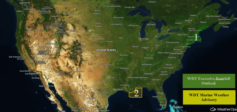 US Hazards
Excessive Rainfall Possible for Northeast on Friday
A slow-moving area of low pressure is generating copious amounts of rain over the area. The rain should continue through the day, with rainfall amounts of 1-3 inches expected in most areas. Some locations may receive in excess of 4 inches of rain. The steady rain is expected to slowly move eastward today, finally clearing the coastal areas by late tonight.
Heavy #rain causing #flash flooding in #statenisland on Bay Street. #NYCwx #NYwx @spann @Morecast_USA @JaniceHuff4ny @ABC7NY #flooding pic.twitter.com/eKZgoGqSFZ
— Jebweather (@Jebweather) May 5, 2017
Major Cities in Region: New York, NY, Providence, RI, Boston, MA, Portland, ME
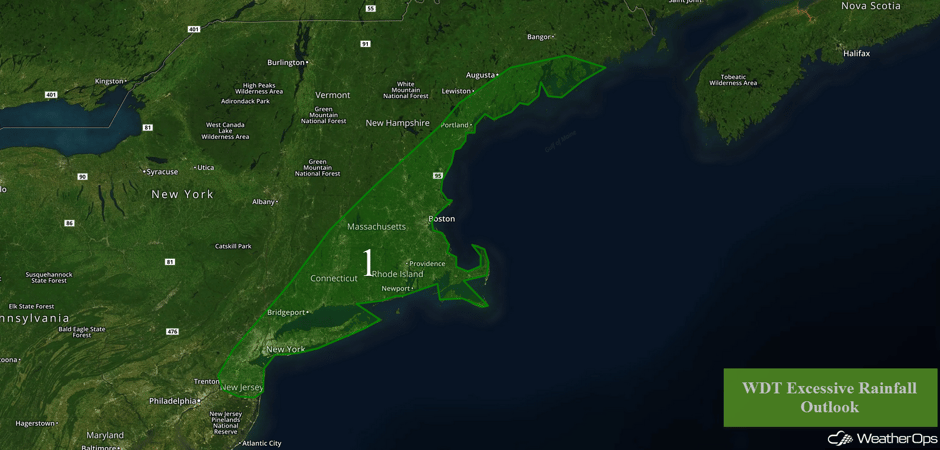 Region 1
Elevated Winds and Seas Continuing Friday across Northern Gulf of Mexico
Northwesterly to north-northwesterly winds, as well as elevated seas, will continue across the region through tomorrow afternoon in the wake of a cold front. Sustained winds of 20-30 knots with gusts in excess of 35 knots are expected. Seas will build to 6-9 feet. Conditions will improve late Friday afternoon through Friday night.
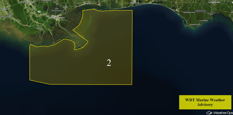 Region 2
Risk for Thunderstorms across Pacific Northwest on Friday
Strong to severe thunderstorms will be possible across the Northwest ahead of a cold front progressing through the region. At the surface, moisture is forecast to increase ahead of a Pacific front moving onshore. With an upper level trough and associated cold front to move to the east on Friday, marginal instability is forecast to develop into the afternoon and evening. As a result, thunderstorm development will be possible with some thunderstorms strong to severe. The primary severe weather potential will include damaging winds, large hail, frequent lightning, and heavy rainfall.
Major Cities in Region: Boise, ID, Missoula, MT
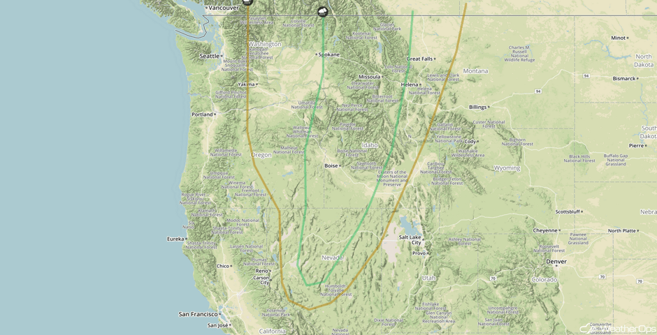 SPC Convective Outlook for Friday
Thunderstorms Continuing Friday along Atlantic Coast
A large area of low pressure is forecast to continue to track to the northeast across the East Coast of the United States on Friday. To the northeast of the low center and east of the cold front, ongoing strong to severe thunderstorms are occurring into the morning hours. Along and ahead of the cold front, the conditions are forecast to remain conducive for strong to severe thunderstorm development over the region. Into the afternoon, some recovery of the atmosphere is needed. However, marginal instability is forecast to build over the region leading to strong to severe thunderstorms into the afternoon. The primary severe weather threat will be strong gusty winds, although an isolated tornado may be possible along with some hail. Frequent lightning and heavy rain will additionally be a common occurrence within any developing thunderstorm.
Major Cities in Region: Washington, DC, Norfolk, VA, Philadelphia, PA
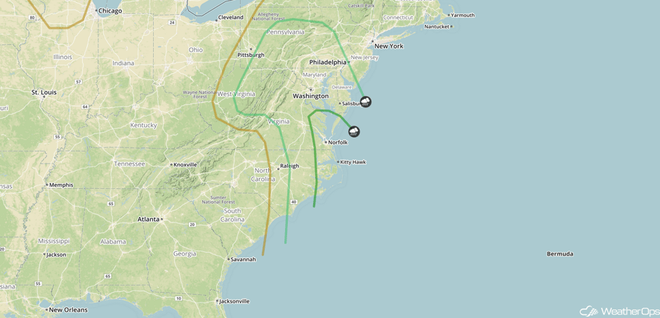 SPC Convective Outlook for Friday
Thunderstorm Potential for Montana Saturday
As a cold front and upper level trough moving through the Pacific Northwest continues to progress eastward, the threat of strong to severe thunderstorms will shift over portions of Montana. Plentiful moisture and upper level support, as well as additional lift due to upslope flow, is expected. As a result, strong to severe thunderstorms may develop during the afternoon and evening. Strong gusty winds, large hail, frequent lightning, and heavy rainfall will be the primary hazards.
Major Cities in Region: Butte, MT, Helena, MT, Great Falls, MT
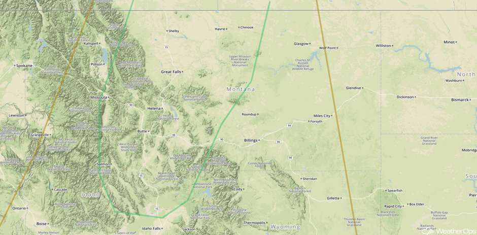 SPC Convective Outlook for Saturday
Excessive Rainfall Potential Saturday for Maine
As the area of low pressure that has been impacting the East Coast over the last few days continues to track to the northeast, heavy to excessive rainfall is forecast to the northeast of the low. Total rainfall accumulations of 2-3 inches are forecast ahead and along the warm front with locally heavier amounts in excess of 5 inches. Flooding will be a concern.
Major Cities in Region: Portland, ME, Augusta, ME, Bangor, ME
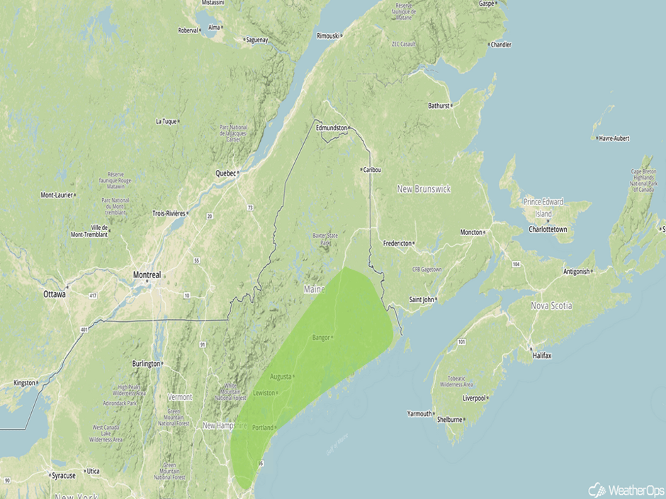 Excessive Rainfall Risk Outline for Saturday
A Look Ahead
Fairly quiet conditions are expected across the country for the first half of the week. By Wednesday, an area of low pressure will develop in the lee of the Rockies. This may allow for the development of thunderstorms across the Southern Plains Wednesday into Thursday.
This is just a brief look at current weather hazards. We can provide you site-specific weather forecast information for the purpose of protecting your personnel and assets and to assess your weather risk. Try a 7-day demo right away and learn how timely precision weather information can enhance your bottom line.


