National Weather Summary for Friday, July 8, 2016
by David Moran, on Jul 8, 2016 11:22:20 AM
Strong to severe thunderstorms will be possible across the Mid Atlantic on Friday ahead of a cold front. Across the Central and Southern Plains, strong to severe thunderstorms will be possible ahead of a weak area of low pressure and along a stationary front. Additional thunderstorms will be possible across portions of the Central and Southern Plains on Saturday along the stationary front. An area of low pressure developing across the Northern Rockies will move into portions of the Northern Plains, allowing for the development of thunderstorms. As this area of low pressure moves northeast on Sunday, thunderstorms will once again be possible for portions of the Northern Plains. A weak stationary front will be the focal point for the development of thunderstorms across the Tennessee Valley into the Ozarks.
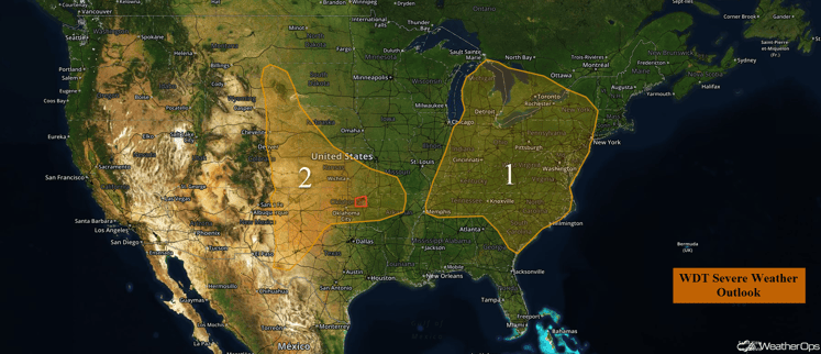
US Hazards
Region 1
Thunderstorms are continuing this morning across portions of southern Indiana and northwestern Kentucky. These storms should move to the east-northeast during the day, bringing a threat of severe weather across northern Kentucky, southern Indiana, and southern Ohio. Later in the day, favorable upper air conditions will contribute to the formation of isolated strong to severe thunderstorms within Region 1. Storms should begin forming by mid afternoon, with the primary threat being damaging wind gusts. The storms will persist into the evening hours, and begin to weaken after sunset.
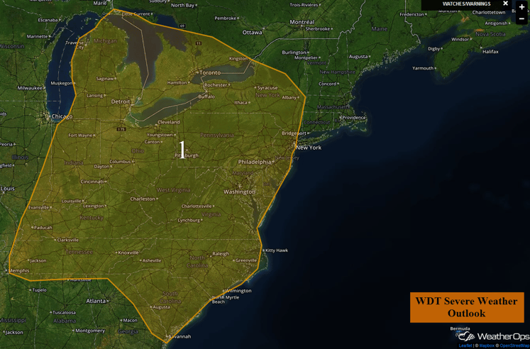
Region 1
Region 2
Strong daytime heating, along with upslope flow will help generate isolated strong to severe thunderstorms across Region 2. These storms should begin developing by the mid to late afternoon and move east during the evening hours. The primary threats will be isolated large hail and damaging wind gusts. Although weakening is expected as the sun sets, some storm clusters may persist into the overnight hours.
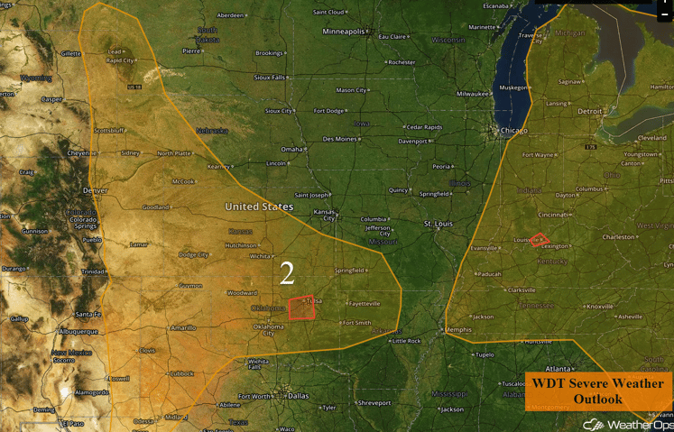
Region 2
Strong to Severe Thunderstorms Possible for Central and Southern Plains on Saturday
A stationary front will linger over the Central and Southern Plains on Saturday, allowing for additional strong to severe thunderstorm development on Saturday. Moderate instability is forecast to build due to daytime heating, with isolated thunderstorm development along the boundary. Additionally, into the evening and overnight hours, the increase in the low level jet will lead to favorable development. Hail, damaging winds, frequent lightning, and heavy rain will be the main hazards with these storms.
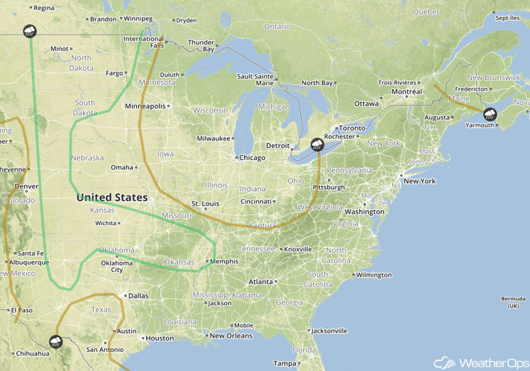
SPC Convective Outlook for Saturday
Strong to Severe Thunderstorms Possible Saturday Across the Northern Plains
Isolated thunderstorm development will be possible into the afternoon on Saturday, as a surface trough becomes better organized. Moderate instability will be in place during the afternoon and evening, with large hail and damaging wind possible with any thunderstorms that develop.
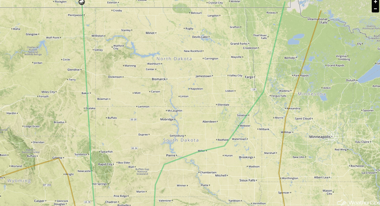
SPC Convective Outlook for Saturday
Strong to Severe Thunderstorms Possible Across the Northern Plains on Sunday
Strong to severe thunderstorms will be possible across much of the Northern Plains into Southern Canada. A strong upper low is forecast to move across the Rockies, accompanied by a surface low developing across southeastern Montana. As the low deepens and moves to the northeast, strong to severe thunderstorm development is expected ahead of the front. Severe weather hazards on Sunday are forecast to include damaging winds, large hail, frequent lightning, and heavy rainfall across the region.
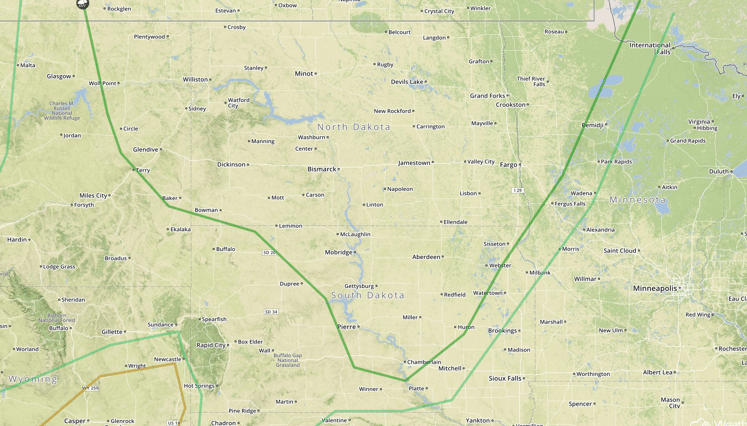
SPC Convective Outlook for Sunday
Strong to Severe Thunderstorms Possible Sunday Across the Ozarks and Tennessee Valley
A weak stationary front is forecast to reside across the region with moderate instability building into the afternoon due to daytime heating. There remains a potential for strong to severe thunderstorm development along the front due to instability and lift. If thunderstorms develop, large hail and damaging winds will be the main hazards, along with frequent lightning and heavy rain.
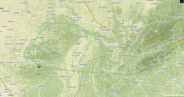 SPC Convective Outlook for Sunday
This is just a brief look at current weather hazards. We can provide you site-specific forecast information. Try a 7-day demo right away.


