National Weather Summary for Friday, July 14, 2017
by David Moran, on Jul 14, 2017 10:31:10 AM
A cold front stretching from the Ohio Valley into the Plains will be the focus for thunderstorms Friday from the Mississippi Valley to the Northeast. Thunderstorms may develop across the Northern High Plains ahead of a cold front on Friday. Daytime heating may allow for the development of thunderstorms Friday afternoon across the Central Plains. Excessive rainfall may develop across portions of the Central Plains on Friday.
- Thunderstorms from the Mississippi Valley to the Northeast on Friday
- Strong to Severe Thunderstorms for the Western Great Lakes on Saturday
- Potential for Thunderstorms Saturday from Georgia into the Carolinas
- Risk for Thunderstorms across the Northern Rockies on Saturday
- Continued Thunderstorms Saturday for Southern Arizona
- Risk for Excessive Rainfall Continues across the Central Plains on Saturday
- Thunderstorms Sunday for the Ohio Valley
- Strong to Severe Thunderstorms Possible for the Northern Rockies on Sunday
 US Hazards
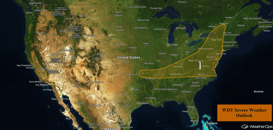
Thunderstorms from the Mississippi Valley to the Northeast on Friday
Morning shower and thunderstorm activity across the Mid Atlantic and Northeast may redevelop later this afternoon and evening with a risk for severe winds. The greatest area at risk for severe impacts will likely be from Upstate New York into eastern Pennsylvania, and also for portions of the Delmarva region. Storms that are able to develop will have the potential for severe winds and small hail. The threat should diminish just after dark.
Further to the southwest across northern Arkansas and into the Tennessee Valley, there will be a threat for marginally severe storms, primarily during the daytime hours. Storms should diminish after dark.
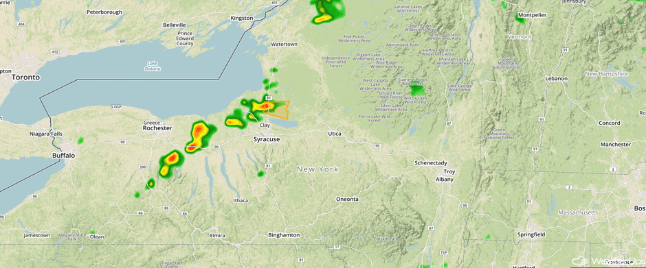
Update 1:01pm EDT: Severe thunderstorm capable of hail and damaging winds north of Syracuse, NY.
 Radar 1:01pm EDT
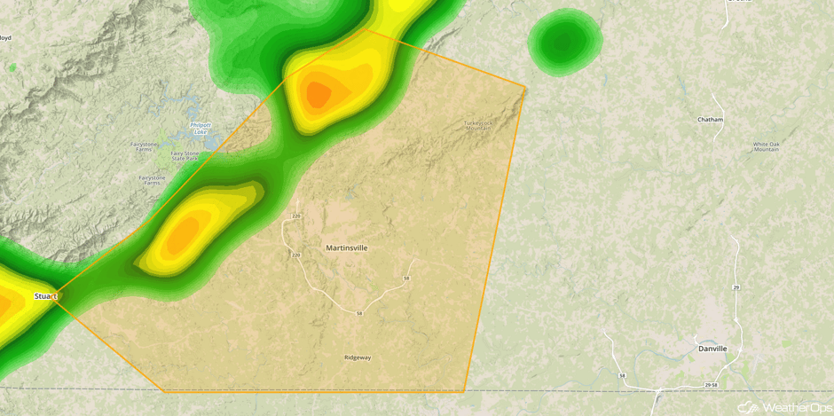
Update 1:06pm EDT: Severe thunderstorm capable of hail and damaging winds approaching Martinsville, VA.
 Radar 1:08pm EDT
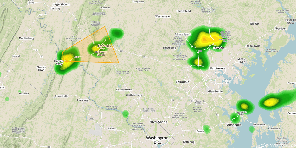
Update 1:39pm EDT: Severe thunderstorm capable of damaging winds west of Frederick, MD.
 Radar 1:39pm EDT
Update 1:49pm EDT: Severe Thunderstorm Watch in effect for portions of Delaware, Maryland, New Jersey, Pennsylvania, Virginia, and West Virginia until 9pm EDT.
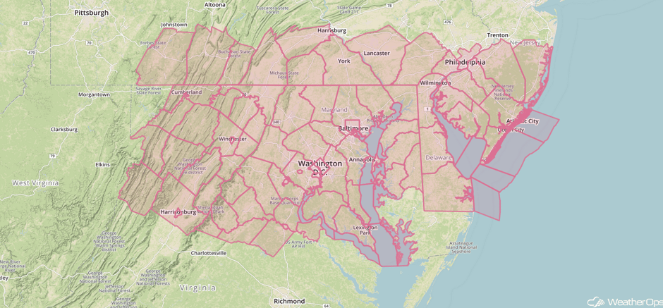 Severe Thunderstorm Watch
Update 2:38pm EDT: Severe thunderstorm capable of small hail and damaging winds west of Philadelphia.
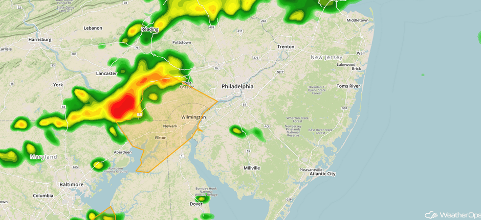 Radar 2:38pm EDT
Major Cities in Region: Memphis, TN, Nashville, TN, Knoxville, TN, Pittsburgh, PA, Raleigh, NC, Washington, DC, Philadelphia, PA, New York, NY
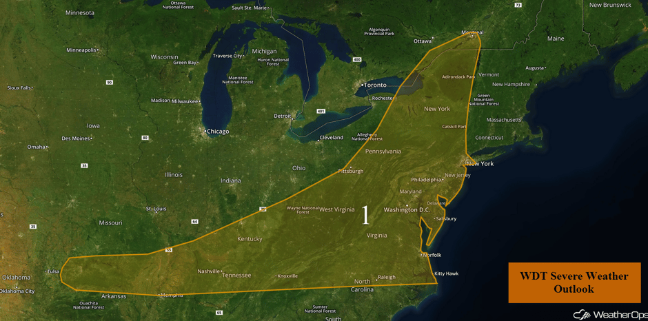 Region 1
Strong to Severe Thunderstorms for the Western Great Lakes on Saturday
An upper level system moving over the region and an area of low pressure developing in Canada will move eastward. The cold front associated with the area of low pressure will move eastward. With moisture increasing ahead of the front, thunderstorms may develop during the afternoon and move south and southeast.
Major Cities in Region: Minneapolis, MN, Green Bay, WI, Milwaukee, WI
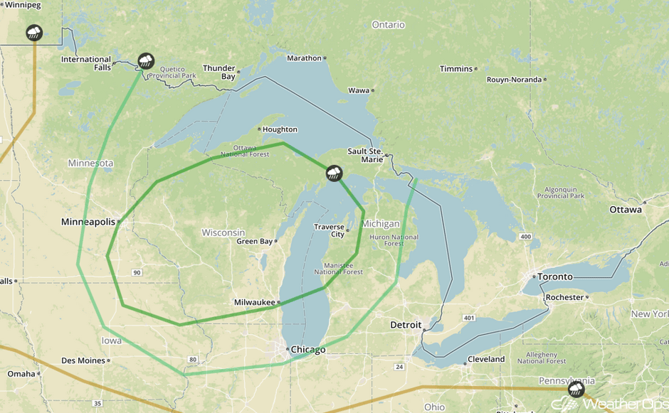 SPC Convective Outlook for Saturday
Potential for Thunderstorms Saturday from Georgia into the Carolinas
Isolated severe thunderstorms capable of producing damaging winds will exist from north central Georgia extending northeastward into the Outer Banks of North Carolina. A weak cold front approaching from the north, daytime heating, and coastal sea breeze activity will contribute to the development of thunderstorms.
Major Cities in Region: Atlanta, GA, Raleigh, NC, Norfolk, VA
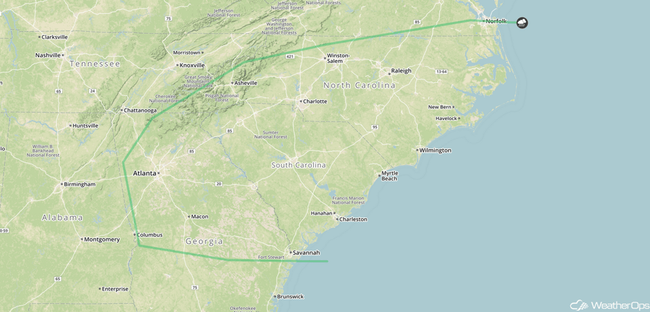 SPC Convective Outlook for Saturday
Risk for Thunderstorms across the Northern Rockies on Saturday
A few strong thunderstorms are expected to develop over the higher terrain. These storms will likely spread eastward-northeastward with time and pose a risk for some severe hazards, such as strong to severe wind gusts and hail.
Major Cities in Region: Missoula, MT, Butte, MT, Helena, MT, Great Falls, MT
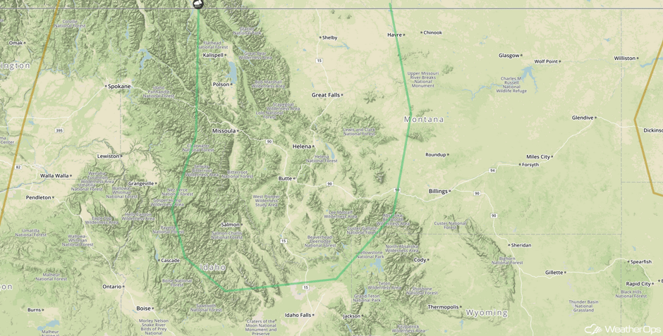 SPC Convective Outlook for Saturday
Continued Thunderstorms Saturday for Southern Arizona
A few strong thunderstorms are expected to develop across the higher terrain of southern Arizona during the afternoon. Given the moderate wind shear expected to be in place, these storms will be capable of strong wind gusts.
Major Cities in Region: Phoenix, AZ, Tucson, AZ
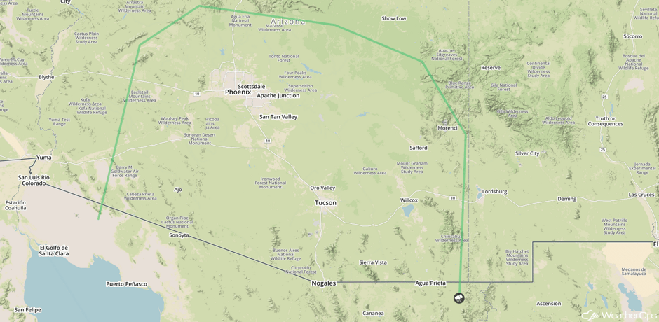 SPC Convective Outlook for Saturday
Risk for Excessive Rainfall Continues across the Central Plains on Saturday
Excessive rainfall can be expected in southeast Colorado, southwest Kansas, and a portion of the Oklahoma Panhandle on Saturday. Showers and thunderstorms are expected to develop along and ahead of a cold front, which could lead to moderate to heavy rainfall. Rainfall amounts of 0.50-1.50 inches are forecast with locally higher amounts.
Major Cities in Region: Dodge City, KS
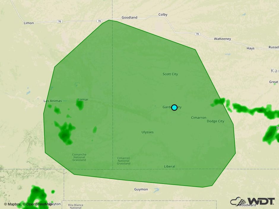 Excessive Rainfall Risk Outline for Saturday
Thunderstorms Sunday for the Ohio Valley
A cold front will stretch across the northern states from Michigan across Iowa and into the Central Plains. Moist air ahead of the front will allow for the development of strong to severe thunderstorms as an upper level disturbance moves southward across the region. Strong to severe wind gusts and hail will be the primary hazards.
Major Cities in Region: Indianapolis, IN, Cincinnati, OH, Detroit, MI, Cleveland, OH, Pittsburgh, PA, Buffalo, NY
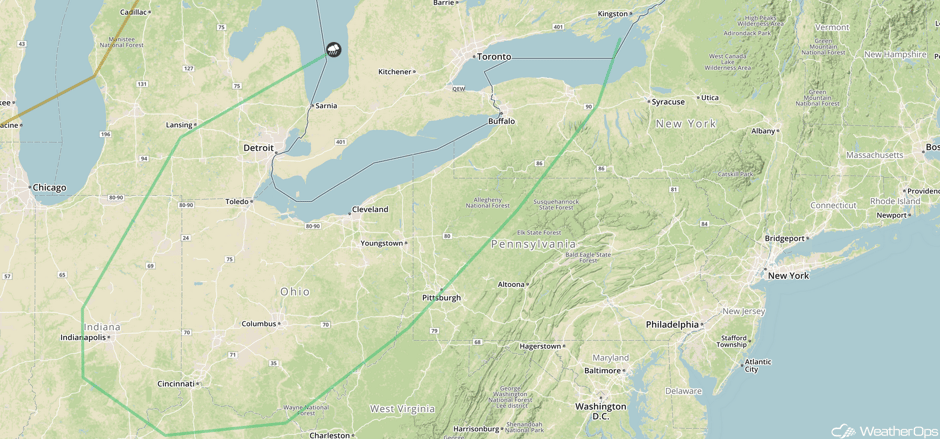 SPC Convective Outlook for Sunday
Strong to Severe Thunderstorms Possible for the Northern Rockies on Sunday
An upper level trough will continue to move eastward toward the Northern Rockies. A weak surface disturbance located over Canada will be the primary area of concern with southerly winds pulling in warm, moist air, which will help destabilize the atmosphere. Strong to severe thunderstorms are likely to develop in this region over areas of higher terrain, or along and ahead of the cold front. Severe wind gusts and possibly some hail are expected.
Major Cities in Region: Billings, MT, Bismarck, ND
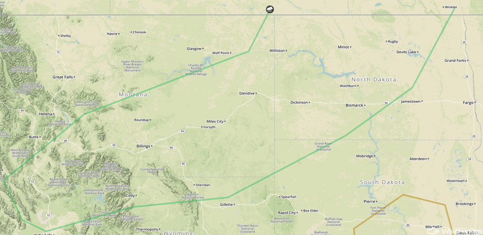 SPC Convective Outlook for Sunday
A Look Ahead
Showers and thunderstorms may develop from the Mid Atlantic to the Gulf Coast on Monday along a stalled front. This activity will continue into Tuesday. Elsewhere, generally calm conditions are expected.
This is just a brief look at current weather hazards. We can provide you site-specific weather forecast information for the purpose of protecting your personnel and assets and to assess your weather risk. Try a 7-day demo right away and learn how timely precision weather information can enhance your bottom line.


