


by David Moran, on Feb 15, 2019 10:38:44 AM
Snow will continue across the Sierra Nevadas through Saturday as moisture continues to stream into the region. An upper level trough will continue to produce snow across the Northern and Central Plains on Friday. Freezing rain and snow are expected from the Ozarks into the Mid Atlantic through Saturday as an area of low pressure moves eastward.
- Continued Snow for the Sierra Nevadas through Saturday
- Snow Friday across the Northern and Central Plains
- Freezing Rain and Snow from the Ozarks into the Mid Atlantic through Saturday
- Potential for Snow Saturday and Sunday across the Northern Plains
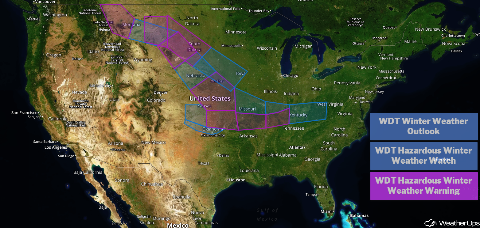
US Hazards
Continued Snow for the Sierra Nevadas through Saturday
Snow will continue across the Sierra Nevadas as deep moisture streams in from the west through Saturday. Accumulations could exceed 5 feet in higher terrain. In addition, strong winds could gust above 60 mph, leading to blowing snow, reduced visibilities, hazardous travel conditions, and dangerous wind chills.
Major Cities in Region: South Lake Tahoe, CA
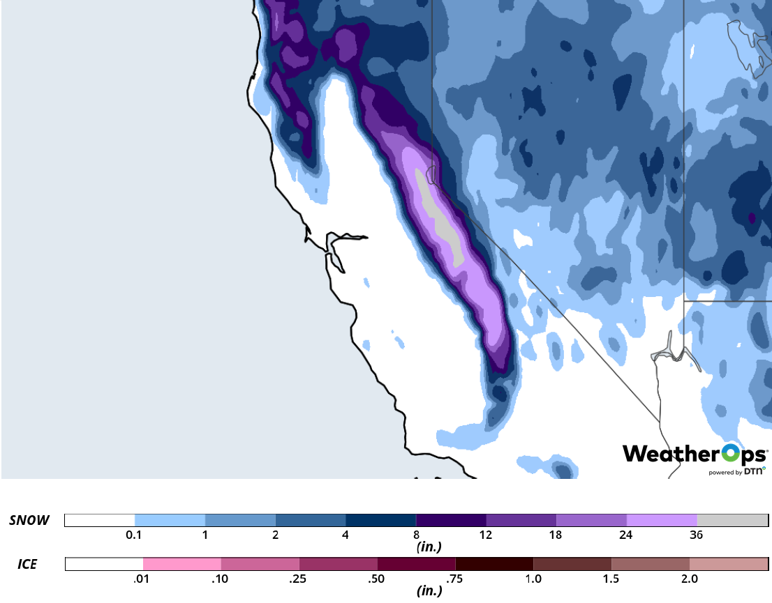
Snow Accumulation through Saturday
Snow Friday across the Northern and Central Plains
An upper level low is moving eastward, producing wintry precipitation across the Plains. Snow accumulations of 2-5 inches with locally higher amounts in excess of 6 inches are forecast. Freezing rain is expected along the southern edge of the region, generally from northern Oklahoma eastward. Accumulations will range 0.20-0.25 inch.
Major Cities in Region: North Platte, NE, Grand Island, NE, Topeka, KS, Tulsa, OK, Omaha, NE, Kansas City, MO, Springfield, MO, St. Louis, MO
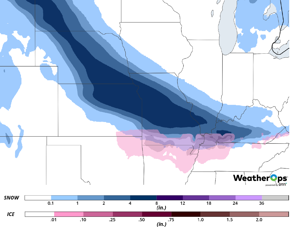
Snow and Ice Accumulation for Friday
Freezing Rain and Snow from the Ozarks into the Mid Atlantic through Saturday
As an upper level low moves eastward, a surface low will develop along a cold front moving across the Southeast. This low will move northeastward, producing freezing rain and snow along and north of the low's track Friday into Saturday. Freezing rain is expected from the Ozarks into eastern Tennessee with accumulations ranging 0.10-0.20 inch. Snow will mainly fall from Kentucky eastward; accumulations will range 2-4 inches with locally higher amounts in excess of 5 inches.
Major Cities in Region: Springfield, MO, Evansville, IN, Lexington, KY, Richmond, VA
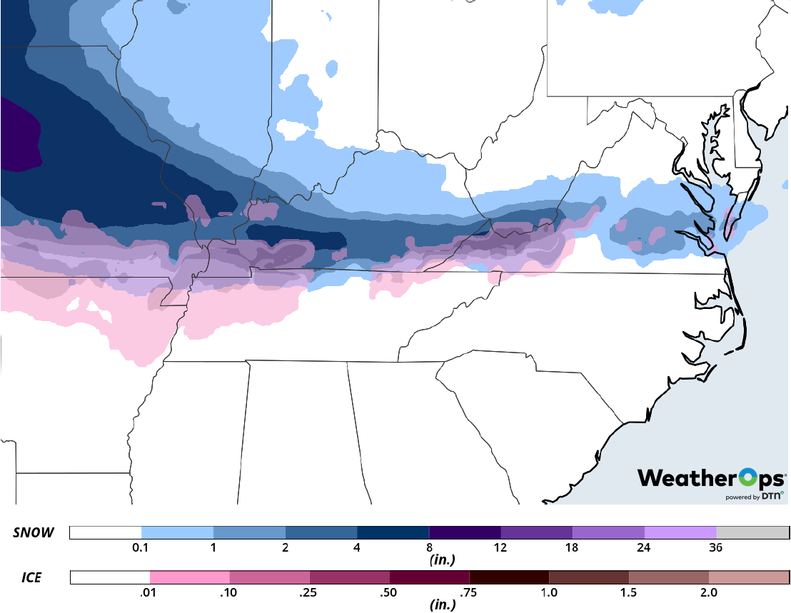
Snow and Ice Accumulation through Saturday
Potential for Snow Saturday and Sunday across the Northern Plains
An upper level trough will move across the western US and into the Plains this weekend; snow is expected to develop from Montana into Iowa. Accumulations will range from 4-8 inches across Montana and 3-7 inches from the Dakotas into Iowa.
Major Cities in Region: Rapid City, SD, Pierre, SD, Sioux Falls, SD, Sioux City, IA, Des Moines, IA
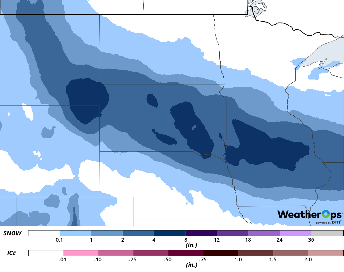
Snow Accumulation for Saturday and Sunday
A Look Ahead
Light to moderate snow is expected across the Northeast on Monday as an area of low pressure moves eastward. On Tuesday, a wintry mix may develop over portions of the Central and Southern Plains. This activity will move into the Midwest and Ohio Valley on Wednesday. Snow may develop Thursday across the Northeast.
