National Weather Summary for Friday, December 8, 2017
by David Moran, on Dec 8, 2017 10:48:00 AM
Snow will continue from the southeastern US into the Northeast through Sunday behind a cold front. Thunderstorms may develop across portions of Florida tonight as a cold front moves through the state. Elevated winds and seas will continue for much of the Gulf of Mexico through Saturday morning.
- Snow from the Southeast through the Northeast through Sunday
- Thunderstorms Friday for Central Florida
- Elevated Winds and Seas Continuing for the Gulf of Mexico through Saturday Morning
- Thunderstorms Saturday for Southern Florida
- Lake Effect Snow for Western New York on Sunday
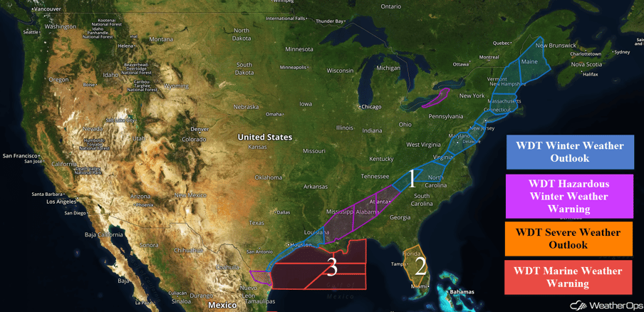 US Hazards
Snow from the Southeast through the Northeast through Sunday
Snow will continue across the Southeast on Friday behind a cold front. Accumulations will generally range 1-4 inches with locally higher amounts across portions of Alabama and Georgia. Further east into the Carolinas and the Mid Atlantic, rain will change to snow through the day on Friday as an upper level system approaches. Snow accumulations of 1-2 inches with locally higher amounts in excess of 3 inches are forecast through Saturday afternoon. An area of low pressure off the East Coast interacting with another area of low pressure further inland will bring snow to portions of the Northeast Saturday morning through Sunday afternoon. Snowfall amounts of 2-4 inches with locally higher amounts in excess of 6 inches are expected. From Vermont northeastward into Maine, snowfall accumulations of 3-6 inches with locally higher amounts in excess of 8 inches are forecast.
Major Cities in Region: Baton Rouge, LA, Jackson, MS, Birmingham, AL, Atlanta, GA, Asheville, NC, Washington, DC, Philadelphia, PA, New York, NY, Boston, MA, Augusta, ME, Bangor, ME
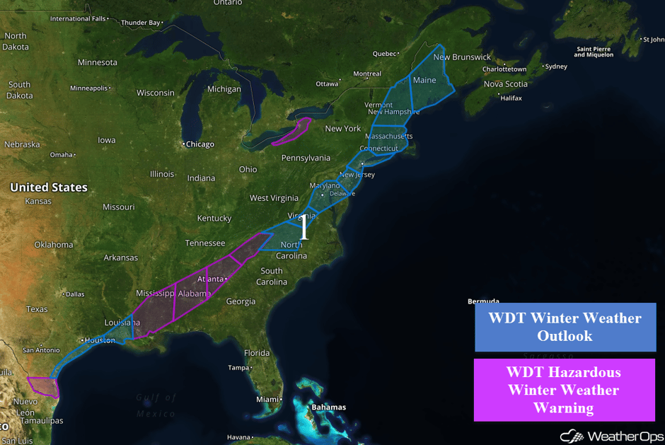 Region 1
Thunderstorms Friday for Central Florida
A cold front located across the eastern Gulf of Mexico will push eastward today. Conditions ahead of the front will be favorable for the development of thunderstorms capable of damaging winds and possibly some tornadoes. Later this evening, thunderstorms will push into central Florida with a continued risk for damaging winds.
Major Cities in Region: Tampa, FL, Orlando, FL, Daytona Beach, FL
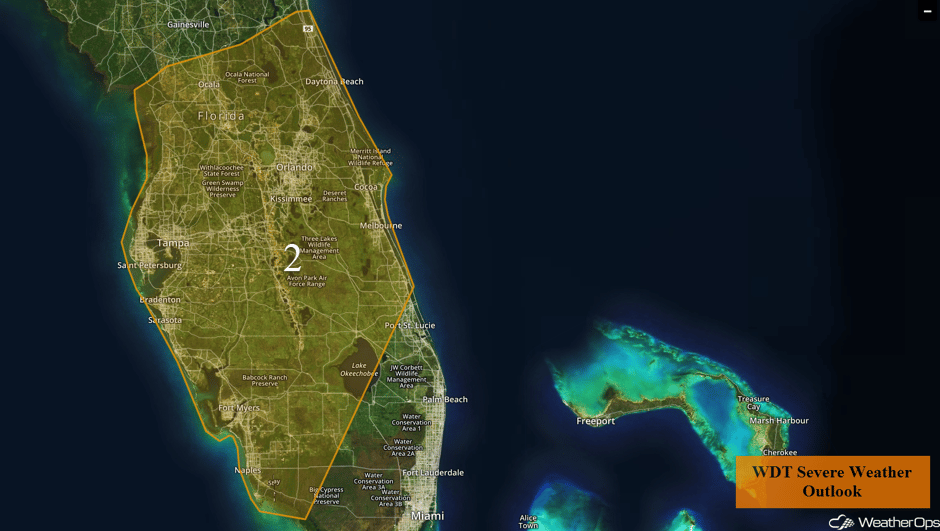 Region 2
Elevated Winds and Seas Continuing for the Gulf of Mexico through Saturday Morning
Strong north-northeasterly to northerly winds will continue across portions of the Gulf of Mexico through Saturday morning behind a cold front. Sustained winds of 35-45 knots with gusts in excess of 50 knots are expected. Near shore swells will be 9-14 feet with deep water swells of 14-18 feet (may exceed 20 feet at times) in southeastern parts of the region. Across northeastern areas, seas will be 6-10 feet near the shore and 11-15 feet in deeper waters.
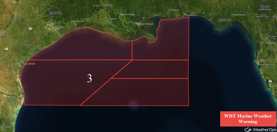 Region 3
Thunderstorms Saturday for Southern Florida
A line of thunderstorms expected to develop late Friday is expected to continue to progress southward during the early morning hours. Strong winds and perhaps an isolated tornado will be the main hazards before the storms move offshore during the late morning.
Major Cities in Region: Naples, FL, Miami, FL, Palm Beach, FL
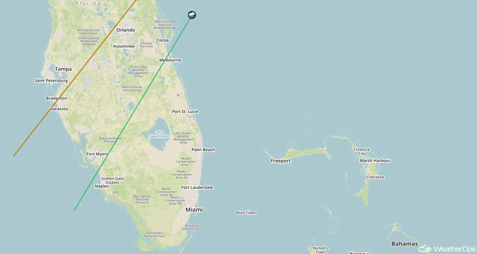 SPC Convective Outlook for Saturday
Lake Effect Snow for Western New York on Sunday
Lake effect snow is expected Sunday across portions of western New York as an area of low pressure moves into the region. Accumulations of 2-4 inches are forecast from Buffalo through Watertown.
Major Cities in Region: Buffalo, NY, Rochester, NY, Watertown, NY
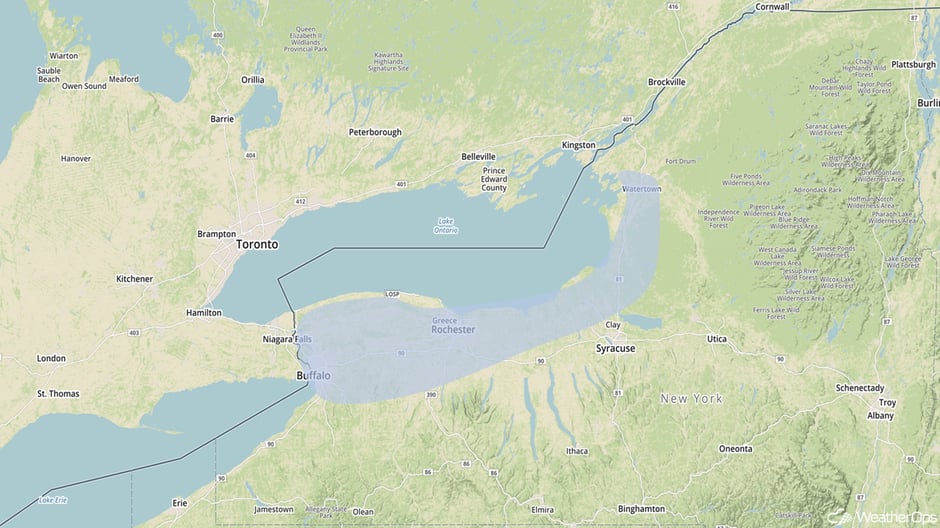 Snow Risk Outline for Sunday
A Look Ahead
The area of low pressure that brought snow to the Northeast on Sunday will slow over the next few days, bringing a more significant risk for snow Tuesday into Wednesday. Two day snowfall totals of 6-9 inches with locally higher amounts expected.
This is just a brief look at current weather hazards. We can provide you site-specific weather forecast information for the purpose of protecting your personnel and assets and to assess your weather risk. Try a 7-day demo right away and learn how timely precision weather information can enhance your bottom line.


