National Weather Summary for Friday, December 29, 2017
by David Moran, on Dec 29, 2017 10:40:28 AM
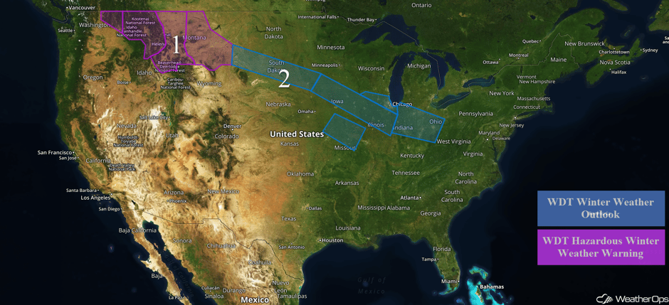
Snow will continue from the Northern Rockies into the Northern High Plains through Saturday as an area of low pressure moves through the region. A fast moving disturbance will bring snow to portions of the Northern Plains into the Midwest through early Saturday.
- Snow Continues for the Northern Rockies and Northern High Plains through Saturday
- Continued Snow Friday into Early Saturday from the Northern Plains into the Midwest
 US Hazards
Snow Continues for the Northern Rockies and Northern High Plains through Saturday
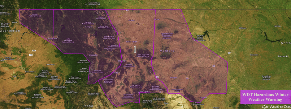
Snow is expected to continue for portions of the Northern Rockies and High Plains as a disturbance moves through the region. Accumulations of 12-20 inches with locally heavier amounts in excess of 2 feet are expected across northern Idaho and western Montana. Visibilities will be less than a quarter mile at times. Across Central Montana, 10-15 inches of snow are forecast in the Plains and 2-3 feet in the mountains. For eastern Montana, 10-15 inches of snow are forecast in the lower elevations with accumulations in excess of 16 inches in the higher elevations. Wind chills will range from -15°F to -30°F.
Major Cities in Region: Missoula, MT, Butte, MT, Helena, MT, Great Falls, MT, Billings, MT
 Region 1
Continued Snow Friday into Early Saturday from the Northern Plains into the Midwest
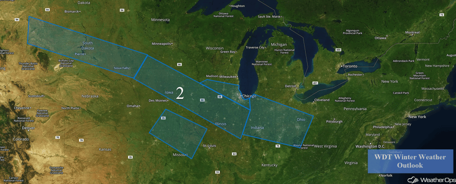
Snow will continue from the Plains into the Midwest Friday into Saturday morning as a fast moving disturbance moves through the region. Accumulations of 3-5 inches with locally higher amounts in excess of 6 inches are expected from the Dakotas into western Indiana. From western Indiana eastward into Ohio, snow accumulations of 2-4 inches with locally higher amounts in excess of 5 inches are forecast. Across southern Iowa, much of Missouri, and western Illinois, freezing rain is expected to develop this afternoon and evening in association with a cold front. Forecast ice accumulations up to a tenth of an inch are expected, which could cause travel difficulties on roads and especially overpasses.
Major Cities in Region: Pierre, SD, Sioux Falls, SD, Davenport, IA, Chicago, IL Indianapolis, IN, Cincinnati, OH, Columbus, OH
 Region 2
A Look Ahead
Some wintry precipitation may develop near the Texas/Oklahoma border on Sunday behind a strong cold front. Some light rain, and possibly some wintry precipitation, may develop along the Gulf and Southeast coasts on Monday.
This is just a brief look at current weather hazards. We can provide you site-specific weather forecast information for the purpose of protecting your personnel and assets and to assess your weather risk. Try a 7-day demo right away and learn how timely precision weather information can enhance your bottom line.


