National Weather Summary for Friday, August 19, 2016
by David Moran, on Aug 19, 2016 11:58:47 AM
Scattered thunderstorms are expected to develop over portions of the Central and Southern Plains, as well as into the Upper Mississippi Valley, on Friday as a cold front moves across the Plains. Across Eastern Colorado, a few thunderstorms may develop as an upper level trough moves across the region. Deep moisture in place across southwest Texas will allow for heavy rain across the region. The cold front moving across the Plains will allow for the development of strong to severe thunderstorms across portions of the Midwest. The same cold front will act as a focus for the development of thunderstorms capable of heavy rain across portions of Central and Southern Texas. This activity will continue into Sunday, leading to flash flooding in some areas.
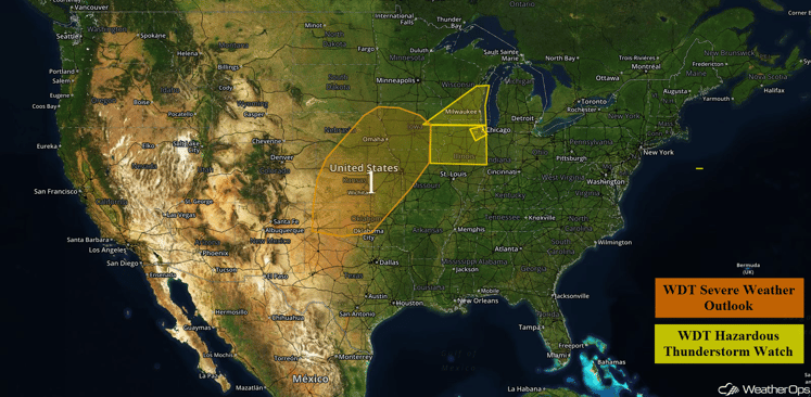
US Hazards
Region 1
A cold front tracking southeastward across much of the central US will provide a focus for thunderstorm development across Region 1 today. As instability increases ahead of the front by this afternoon, conditions are expected to become favorable for the development of strong to severe thunderstorms. The storms are expected to evolve into a squall line during the evening and may persist into the overnight hours . The primary hazards with these storms will be large hail and damaging winds. In addition, locally heavy rainfall is expected. Rainfall amounts of 1-2 inches will be possible with locally higher amounts in excess of 3 inches.
Update 1:30pm CDT: Severe thunderstorms capable of large hail and damaging winds are developing over North Central Kansas.
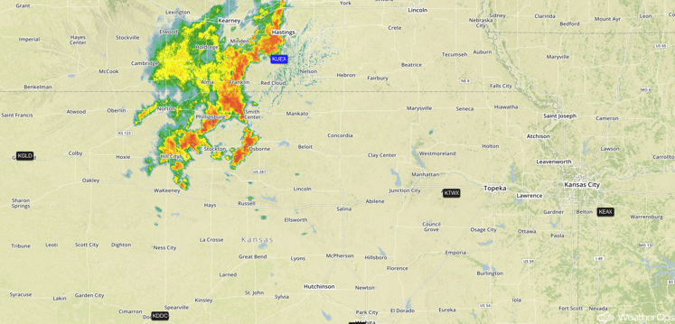
Radar 1:30pm CDT
Major Cities in Region: Amarillo, TX, Oklahoma City, OK, Dodge City, KS, Kansas City, MO, Omaha, NE, Des Moines, IA
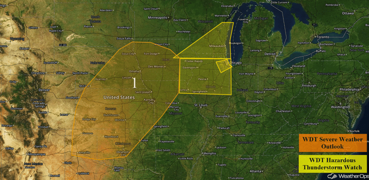
Region 1
Strong to Severe Thunderstorms Possible Friday across Eastern Colorado
A few thunderstorms may develop in response to a weak upper-level trough moving into the Rocky Mountains. While thunderstorms are expected to be limited in coverage, the thunderstorms that do develop may become severe, with large hail and damaging winds likely to be the main hazards.
Major Cities in Region: Denver, CO, Colorado Springs, CO
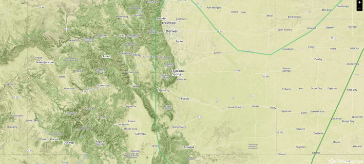
SPC Convective Outlook for Friday
Strong to Severe Thunderstorms Possible for Portions of the Upper Mississippi Valley on Friday
Thunderstorms will develop ahead of an advancing cold front by late afternoon. While conditions will not be as favorable for severe weather as points to the south and west, a few storms may become strong with wind gusts in excess of 50 mph likely to be the main hazard.
Major Cities in Region: Cedar Rapids, IA, Madison, WI, Milwaukee, WI
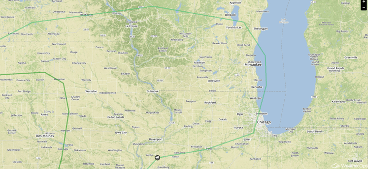
SPC Convective Outlook for Friday
Excessive Rainfall Possible Friday across Southwest Texas
Showers and thunderstorms are ongoing this morning, but will increase in coverage throughout the day. Deep moisture in place across this region will allow for thunderstorms to produce heavy downpours. Widespread rainfall accumulations of around one inch are expected, but locally higher amounts in excess of three inches will be possible in some locations.
Major Cities in Region: San Antonio, TX, Austin, TX
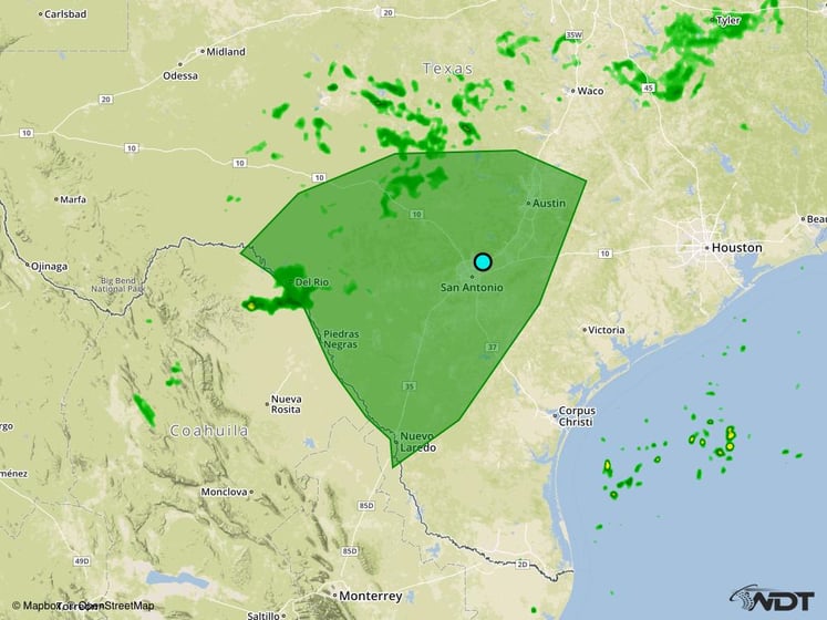
Excessive Rainfall Risk Outline for Friday
Strong to Severe Thunderstorms Possible Across the Midwest on Friday
A few strong to severe thunderstorms are expected to develop Saturday across portions of the Midwest ahead of a cold front. Large hail and damaging winds will be the main hazards, though these hazards should remain isolated in nature.
Major Cities in Region: Milwaukee, WI, Evansville, IN, Chicago, IL, Fort Wayne, IN, Detroit, MI
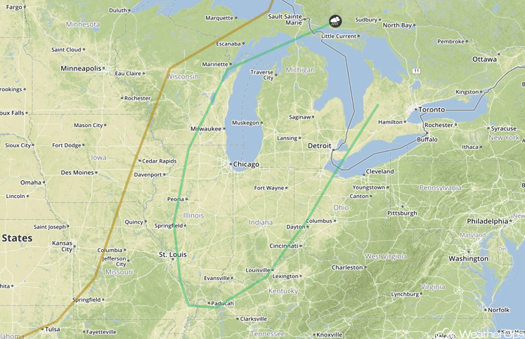
SPC Convective Outlook for Saturday
Excessive Rainfall Possible Saturday and Sunday across Southern and Central Texas
Heavy rainfall will be possible across portions of Southern and Central Texas Saturday and Sunday ahead of a slow moving cold front. Two day rainfall totals of 2-4 inches with isolated higher amounts in excess of 6 inches are likely, in addition to some flooding.
Major Cities in Region: Del Rio, TX, San Antonio, TX, Austin, TX
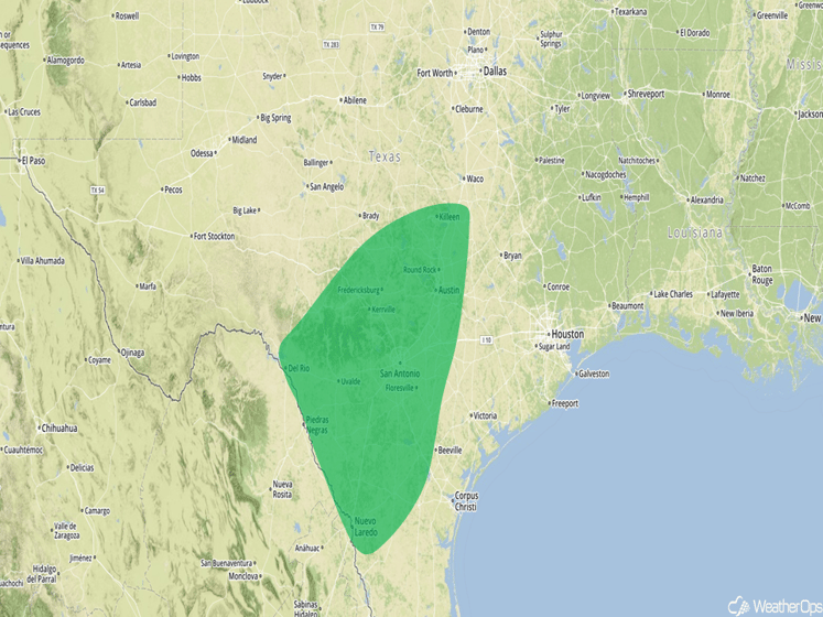
Excessive Rainfall Risk Outline for Saturday and Sunday
Tropical Storm Fiona Moving Across the Atlantic
Tropical Storm Fiona is continuing to move west-northwestward across the Atlantic with maximum sustained winds at 45 mph. It is expected to increase in speed over the next few days, but is also expected to weaken to a depression over the weekend.
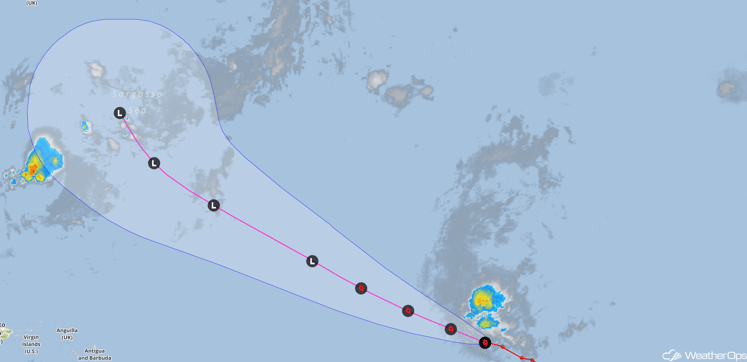
Tropical Storm Fiona Forecast Track and Satellite
Tropical Wave Moving off the African Coast
A tropical wave is forecast to move off the African coast over the weekend. Gradual intensification of this system is expected early next week while continuing on a west-northwestward track.
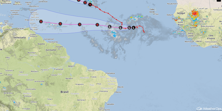
Invest 99-L Satellite and Track
This is just a brief look at current weather hazards. We can provide you site-specific forecast information for the purpose of protecting your personnel and assets. Try a 7-day demo right away and learn how timely precision weather information can enhance your bottom line.


