by WeatherOps, on Jun 6, 2014 9:37:37 AM

by WeatherOps, on Jun 6, 2014 9:37:37 AM
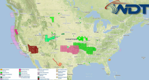
Thunderstorms will move through portions of the Rockies, Plains, and South. These storms will have the potential to become severe with large hail, damaging winds, and tornadoes possible.
Current NWS Advisories/Watches/Warnings in iMapPro:

An upper level disturbance will move into the Southern Plains with severe weather expected from the Central Rockies through the Plains and Mid South. By late afternoon, large hail, damaging winds, and tornadoes will be possible. Heavy rain will be possible over portions of the Plains, leading to flash flooding. 3 or more inches of rain will be possible in some areas.
This is where you give the visitor a brief introduction to both this blog and your company. Keep it short. More →