by WeatherOps, on May 30, 2014 9:45:03 AM

by WeatherOps, on May 30, 2014 9:45:03 AM
Showers and thunderstorms will be possible today across portions of the Plains and Southeast.
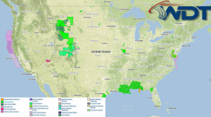
Current NWS Advisories/Watches/Warnings in iMapPro:

An area of low pressure will continue to lift northward into Saskatchewan with showers and thunderstorms developing along a stationary front. Into the Southern Plains and Southeast, the closed low will continue to weaken. General thunderstorms are expected with this system. To the west, another area of low pressure will develop and move into the Southwestern US. Showers and thunderstorms are expected to develop across the Great Basin and Northern Rockies. Severe weather is not anticipated.
Showers and thunderstorms will continue across the Southeast ahead of a closed low. Accumulations of .5 to 1.5 inches of rain will be possible. Flooding should continue to be expected.
This is where you give the visitor a brief introduction to both this blog and your company. Keep it short. More →