by WeatherOps, on Jun 24, 2014 9:57:25 AM

by WeatherOps, on Jun 24, 2014 9:57:25 AM
Severe thunderstorms are possible today across the Colorado High Plains. Strong thunderstorms are possible for the Lower Great Lakes and the Ohio River Valley.
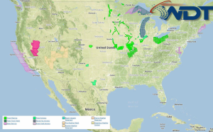
NWS Advisories/Watches/Warnings in iMapPro:

Today's primary severe weather threat will be along the Front Range of Colorado into West Texas. Storms capable of large hail and damaging winds possible; an isolated tornado can't be ruled out. These storms will develop and move southeast overnight. Strong winds and large hail will remain the main threats. A trough moving through the Ohio River Valley and Lower Great Lakes will allow for a convective system of thunderstorms with some severe wind gusts possible.
This is where you give the visitor a brief introduction to both this blog and your company. Keep it short. More →