by WeatherOps, on Jun 23, 2014 9:47:07 AM

by WeatherOps, on Jun 23, 2014 9:47:07 AM
Severe thunderstorms will be possible today for the High Plains of Colorado, as well as Texas through the Ohio River Valley.
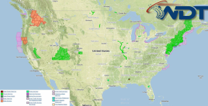
Current NWS Advisories/Watches/Warnings in iMapPro:

Today's primary severe weather risk will be across the Colorado High Plains where upslope flow will allow for thunderstorm development. Supercells capable of large hail, damaging winds, and tornadoes will be possible. As storms evolve, the tornado potential will be highest across the Northern Plains. Thunderstorms will also be possible from portions of the Ohio River Valley into Texas; hail and gusty winds will be the main threats. Excessive rainfall will also be possible across portions of the Southern Plains due to heavy thunderstorms. Up to 2" of rain will be possible.
This is where you give the visitor a brief introduction to both this blog and your company. Keep it short. More →