National Weather Summary for Monday, February 17, 2014
by WeatherOps, on Feb 17, 2014 9:34:11 AM
Moderate to heavy snow will continue in the higher elevations of portions of the Pacific Northwest and Northern California as rain continues for the lower elevations. Light to moderate snow will move into portions of the Ohio River Valley and the Northeast ahead of an area of low pressure.
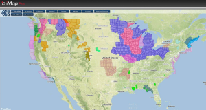
Current NWS Advisories/Watches/Warnings from iMapPro:

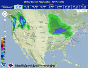
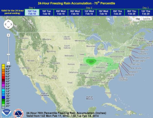
A light to moderate rain/snow mix will move across the Ohio River Valley today and into the Northeast late in the day. 4-8 inches of snow will be possible from portions of Wisconsin and eastward into western portions of New York and Pennsylvania. On the southern edge of the system, a tenth to a quarter inch of sleet and freezing rain is possible for portions of Illinois, Indiana, and Ohio. The heaviest of this precipitation will occur over portions of Southern Illinois and could cause some power outages and travel disruptions. The snow out west is associated with several shortwaves that will move into the region. Heavy snow will likely continue across the west through at least midweek. Across the Pacific Northwest and Northern Rockies, snow accumulations of 12-15 inches of snow will be possible in the highest elevations.
WDT preferred forecast for 24 hour snow and ice accumulations


