Very Active Tropical Weather Across the Globe
by Chris Kerr, on Aug 19, 2016 3:52:20 PM
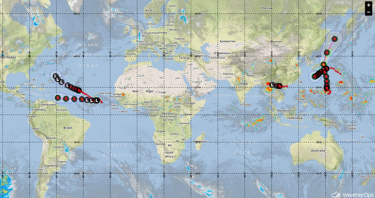
We are rapidly approaching the peak of the 2016 Atlantic Tropical season. Tropical Storm Fiona and Invest 99L are currently in the Atlantic with more storms expected to develop.
Tropical Storm Fiona is located across the Central Atlantic and will track west-northwestward through the open ocean the next several days as it gradually weakens and possibly degenerates into a remnant low by early next week. Invest 99L, which is located several hundred miles to the southwest of the Cape Verde Islands is rapidly tracking westward through the tropical Atlantic. Some gradual organization is possible over the next several days as the system remains anchored to the ITCZ (Intertropical Convergence Zone). Further development may be possible next week near the Leeward Islands as we get into early to mid-next week. Finally, a tropical wave will track off the West African coast by Saturday morning, and pass over or near the Cape Verde Islands. There are many details yet to work out and it remains to be seen whether significant development will occur in regards to Invest 99L and the tropical wave moving off Africa this week, but that all being said it looks to be a busy few weeks across the basin!

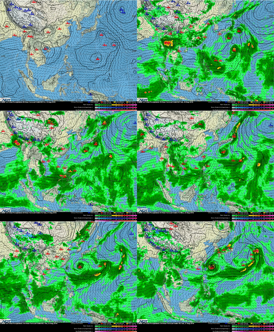
The Eastern hemisphere is joining in on the tropical party was well. Tropical cyclone activity has been high in the West Pacific basin over the past week and this trend will continue over the next week if not longer. A monsoon gyre has developed across the sub-tropical West Pacific. What exactly is a monsoon gyre? From the American Meteorological Society glossary: A convection of the summer monsoon circulation of the western North Pacific characterized by 1) a very large nearly circular low-level cyclonic vortex (not the result of the expanding wind field of a preexisting monsoon depression or tropical cyclone) that has an outermost closed isobar with a diameter on the order of 1200 n mi (2500 km); 2) a cloud band bordering the southern through eastern periphery of the vortex/surface low; and 3) a relatively long (two week) life span.

In the model image above, from the ECMWF, you can see several tropical systems rotating through this basin over the next several days. Forecasting the track and intensity of tropical cyclones that develop near the monsoon gyre can be very difficult!
For more forecasting information, try a 7-day trial of WeatherOps today.


