Severe Weather Expected This Weekend
by Chris Kerr, on Mar 24, 2017 2:52:18 PM
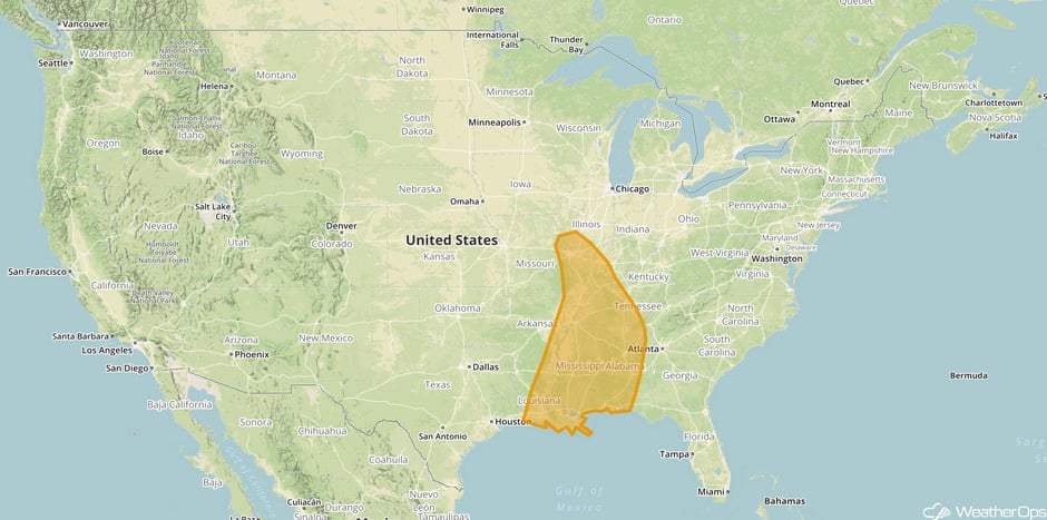
The severe weather threat will continue across the Plains and into the Mid-Mississippi Valley this weekend and into next week. Areas from the central Gulf coast and northward into the Lower and Mid-Mississippi Valley will likely see severe thunderstorms with damaging winds, large hail, and a few tornadoes on Saturday as a cold front pushes through the region. Ahead of this front, plentiful moisture will be drawn northward from the Gulf Mexico, providing the fuel for this thunderstorm activity. While storms are expected to be mostly linear in nature, a few discrete supercells may form during the afternoon hours and these will have the capability to produce a few tornadoes. Into the evening on Saturday the main threat will be strong and damaging winds.
 Saturday Severe Weather Threat
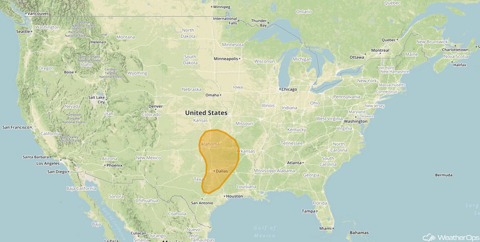
By Sunday, attention shifts to the Southern Plains as another upper-level low pressure system tracks through the Rockies and into the Plains. As this occurs, moisture will stream northward into the region on Saturday and Sunday. However, there remains some question regarding the depth of this moisture, and that will likely play a role in the overall severity of the thunderstorm activity on Sunday across the region. Nevertheless, the more robust thunderstorms across this are will have the capability to produce damaging winds, large hail, and a few tornadoes.
 Sunday Severe Weather Threat
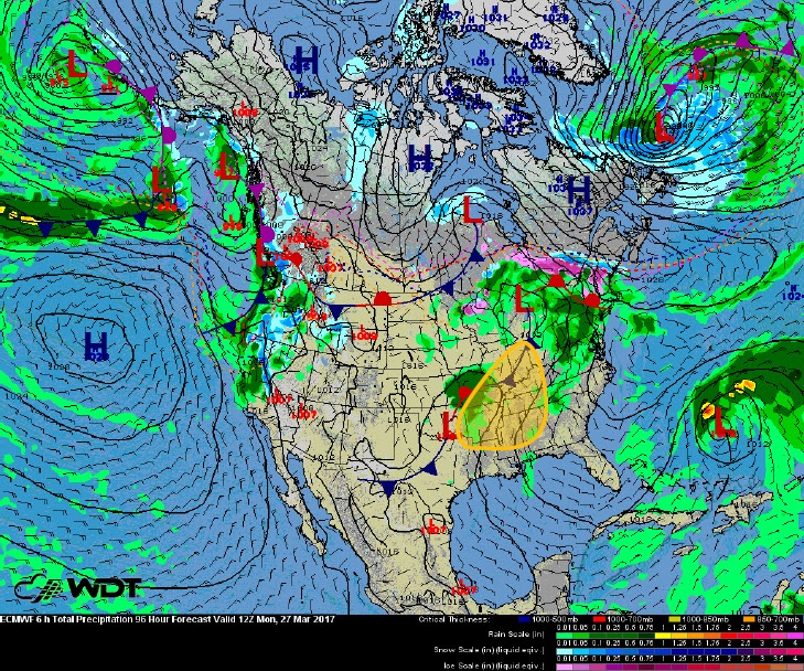
On Monday the severe weather threat will shift into the Mid-Mississippi Valley as the upper-level low pressure system tracks from the Plains into the region. At this time, the main threat looks to be damaging wind and large hail, though a tornado or two cannot be ruled out.
 Monday Severe Weather Threat
By the middle of next week yet another upper-level low will track out of the Rockies and into the Southern Plains, setting the stage for another round of severe thunderstorms for parts of Oklahoma and Texas. Severity and coverage is still in question this far out, however people living in this region should continue to monitor the weather closely over the next several days.
WeatherOps produces a Hazardous Weather Outlook for severe weather threats out to 7-days. Contact us today and find out how our forecasts can help reduce your weather risk.


