National Weather Summary for Wednesday, September 21, 2016
by David Moran, on Sep 21, 2016 11:11:08 AM
A warm front lifting over the Upper Midwest will be the main focus for strong to severe thunderstorms on Wednesday. Across the Central Rockies, a large upper level trough moving through the Pacific Northwest and cold front at the surface will allow for the potential for thunderstorm development on Thursday. Further east, thunderstorm development will be possible across the Upper Midwest along a stalled front. By Friday, a developing area of low pressure over the Colorado Front Range will promote thunderstorm development across the Central High Plains.
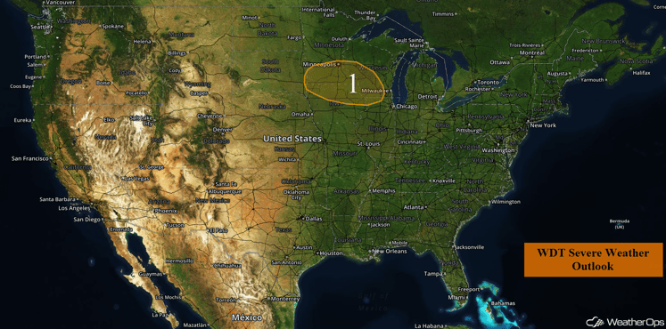
US Hazards
Region 1
A very moist and unstable air mass is in place over Region 1. A weak area of low pressure in Nebraska, a warm front extending to the northeast, and a cold front extending to the south and southwest will serve as the focal point for thunderstorm development today. Storms will likely develop during the mid to late afternoon when daytime heating will be the strongest. These storms may consolidate into clusters during the evening hours. Large hail and damaging winds will be the primary threats with these storms although a tornado, especially during the afternoon and early evening, cannot be ruled out.
Heavy rain will be possible with these storms. Rainfall amounts of 2-3 inches with locally higher amounts in excess of 4 inches will be possible, in addition to the localized flooding and runoff.
Update 12:02pm CDT: Thunderstorms capable of gusty winds and small hail have developed across portions of southern Wisconsin and northern Illinois.
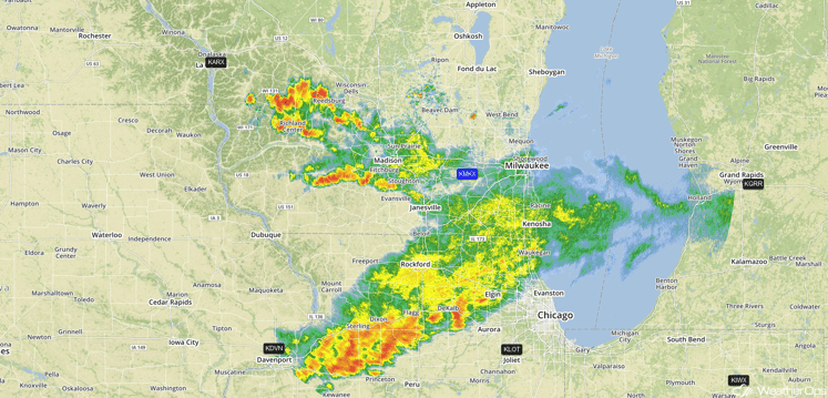
Radar 12:02pm CDT
Update 12:43pm CDT: Thunderstorms capable of gusty winds moving through southeastern Minnesota.
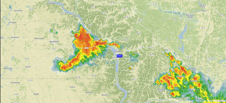
Radar 12:43pm CDT
Update 1:24pm CDT: Severe thunderstorms in North Central Illinois capable of producing large hail and damaging winds.
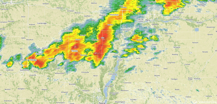
Radar 1:24pm CDT
Update 2:03pm CDT: Severe thunderstorms capable of large hail and damaging winds northeast of Eau Claire, WI.
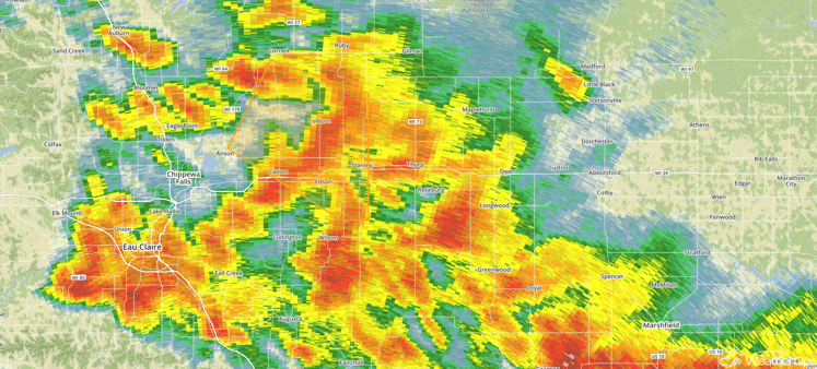
Radar 2:03pm CDT
Major Cities in Region: Omaha, NE, Sioux Falls, SD, Des Moines, IA, Minneapolis, MN, Chicago, IL, Milwaukee, WI
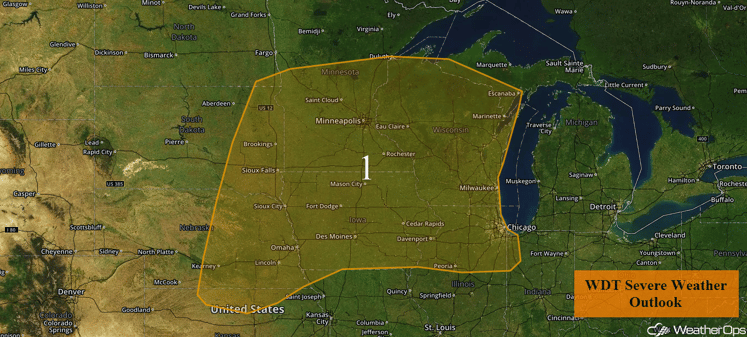
Region 1
Strong to Severe Thunderstorms Possible Across the Central Rockies on Thursday
Showers and thunderstorms, some severe, will be possible on Thursday downstream from an area of low pressure moving through the Pacific Northwest. At the surface, a cold front will be the focus for thunderstorm development. Severe winds and small hail will be possible.
Major Cities in Region: Salt Lake City, UT, Grand Junction, CO
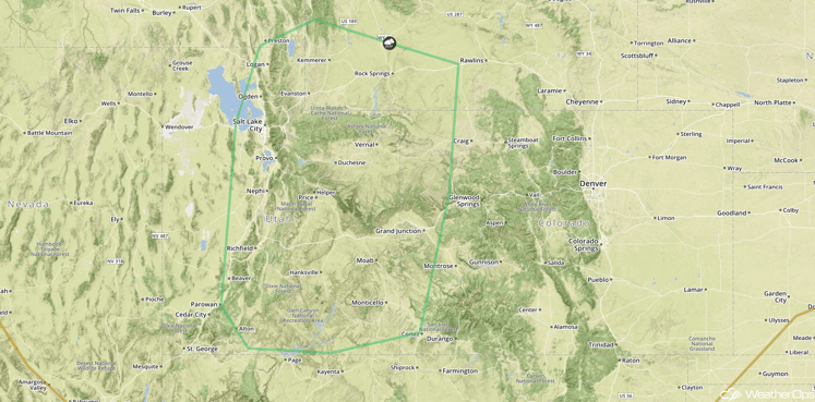
SPC Convective Outlook for Thursday
Strong to Severe Thunderstorms Possible Across the Upper Midwest on Thursday
The remnants of a stationary front over the Upper Midwest may allow for a few strong to severe thunderstorms to develop during the afternoon and evening hours. Severe wind and isolated large hail will be the primary hazards with the stronger storms. Activity should gradually weaken by or just after dark.
In addition, heavy rainfall amounts of 2-3 inches will be possible, especially along the Minnesota and Iowa border.
Major Cities in Region: Sioux Falls, SD, Sioux City, IA, Des Moines, IA, Waterloo, IA
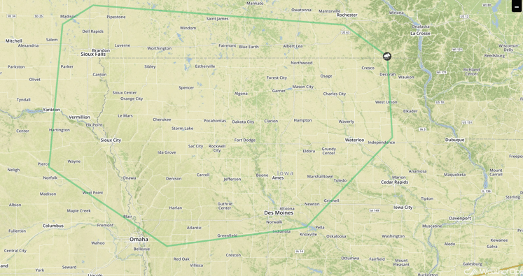
SPC Convective Outlook for Thursday
Strong to Severe Thunderstorms Possible for the Central High Plains on Friday
A developing surface low over the Colorado Front Range will result in enhanced southeasterly winds across the High Plains. This should promote the development of isolated to scattered thunderstorms, some possibly severe, with a primary risk for severe wind and hail during the late afternoon and early evening hours on Friday.
Major Cities in Region: Goodland, KS, North Platte, NE
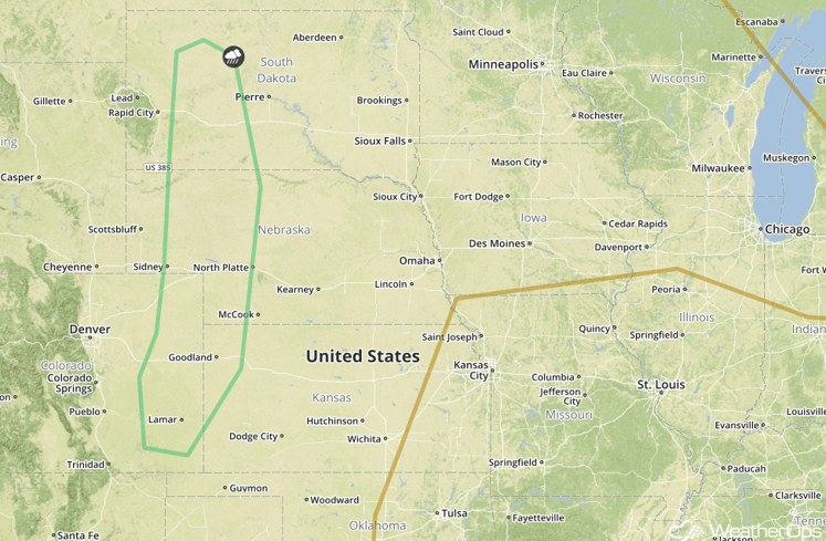
SPC Convective Outlook for Friday
Tropical Update
Tropical Storm Lisa (green oval) is continuing to move toward the northwest at 8 mph. This motion is expected to continue over the next few days with a slight increase in forward speed. Maximum sustained winds are near 50 mph with higher gusts. Some strengthening is expected today with gradual weakening expected to begin on Thursday.
Further to the west, Tropical Storm Karl (red oval) is now a Tropical Depression moving west-northwestward at 9 mph. A turn to the northwest and an increase in forward speed should continue through early Friday. Maximum sustained winds are near 35 mph with higher gusts. Little strengthening is expected on Wednesday, but some strengthening is forecast on Thursday.
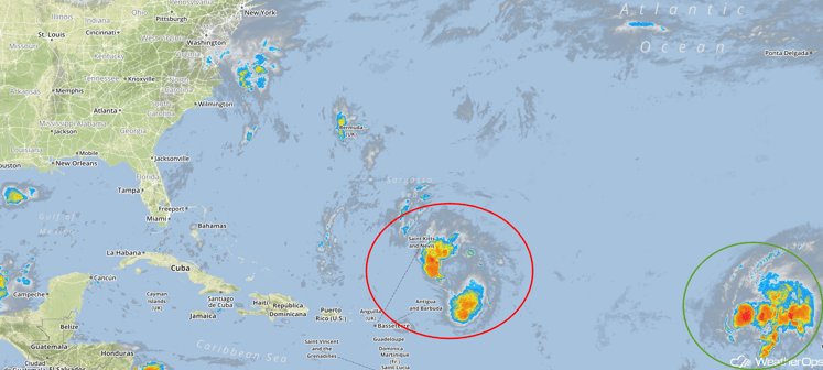
Tropical Infrared Satellite
A Look Ahead
Going into the weekend, an upper level low will move through the Northern Plains, bringing a risk for thunderstorms to the region. As the cold front associated with this area of low pressure moves eastward on Sunday, thunderstorms will be possible for the Missouri Ozarks into the Southern Plains. Heavy rain and thunderstorms will likely extend from the Great Lakes to the Southern Plains as the front stalls.
This is just a brief look at current weather hazards. We can provide you site-specific forecast information for the purpose of protecting your personnel and assets. Try a 7-day demo right away and learn how timely precision weather information can enhance your bottom line.


