National Weather Summary for Wednesday, September 20, 2017
by David Moran, on Sep 20, 2017 10:50:42 AM
A cold front moving through the Midwest and Great Lakes will be the focus for the development of thunderstorms on Wednesday. Tropical storm conditions will continue Wednesday across the Northeast.
- Tropical Storm Conditions Continuing Wednesday across the Northeast
- Thunderstorms from the Great Lakes through the Midwest on Wednesday
- Risk for Thunderstorms Thursday across the Dakotas and Minnesota
- Thunderstorm Potential from Nebraska through Minnesota on Friday
- Thunderstorms Friday from Southern Nebraska through Texas
- Tropical Update
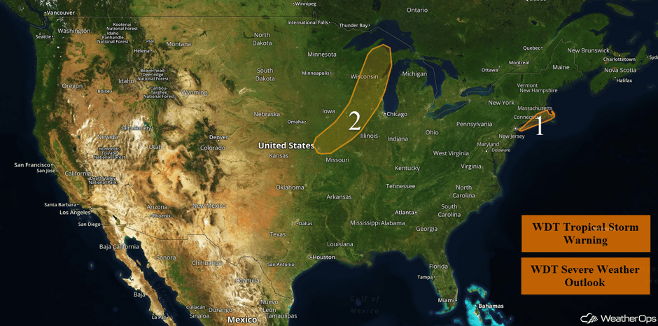 US Hazards
Tropical Storm Conditions Continuing Wednesday across the Northeast
Tropical Storm Jose continues to weaken offshore the Northeast coast. Winds of 30-40 mph with gusts in excess of 50 mph are forecast over portions of Long Island Wednesday morning. These winds will spread northward throughout the day. The greatest potential for tropical storm force winds will exist from far eastern Long Island into Cape Cod. These conditions will continue over Cape Cod into Thursday evening. Rainfall amounts of 1-2 inches with locally higher amounts in excess of 3 inches are forecast.
Major Cities in Region: New London, CT, Providence, RI, Newport, RI
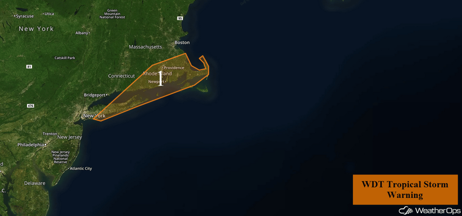 Region 1
Thunderstorms from the Great Lakes through the Midwest on Wednesday
An upper level trough is forecast to move through the region as a cold front at the surface progresses to the east. Warm surface temperatures in the afternoon, along with increasing moisture, will allow instability to build during the afternoon. However, a layer of warm air aloft will reduce storm coverage. Widely scattered strong to severe thunderstorms will continue to develop with gusty winds and large hail the main severe weather threats. Thunderstorms will be most likely in the late afternoon through the evening.
Major Cities in Region: Kansas City, MO, Cedar Rapids, IA, Madison, WI, Green Bay, WI, Milwaukee, WI
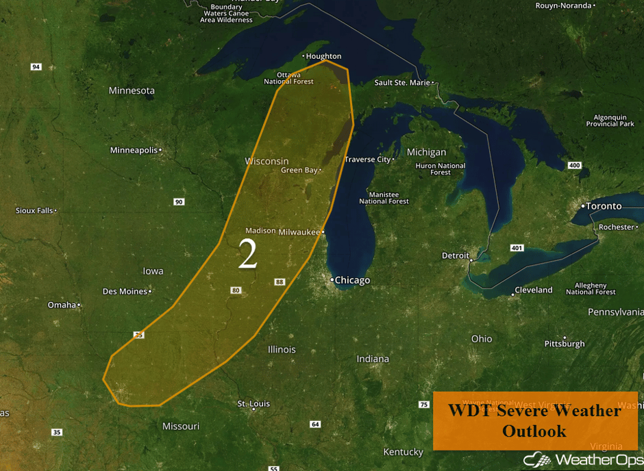 Region 2
Risk for Thunderstorms Thursday across the Dakotas and Minnesota
There will be a marginal risk for thunderstorms on Thursday. A low level jet strengthening across the region and a warm front lifting northward will promote the development of thunderstorms during the evening into the nighttime hours. Large hail will be the primary hazard with these storms.
Major Cities in Region: Grand Forks, ND, Fargo, ND, International Falls, MN, Minneapolis, MN
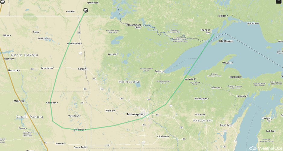 SPC Convective Outlook for Thursday
Thunderstorm Potential from Nebraska through Minnesota on Friday
Scattered thunderstorms are expected across the North Central US on Friday in association with an area of low pressure and cold front across the region. Instability and moisture will be sufficient for the development of thunderstorms capable of large hail, damaging winds, and a few tornadoes.
Major Cities in Region: Sioux Falls, SD, Fargo, ND, International Falls, MN
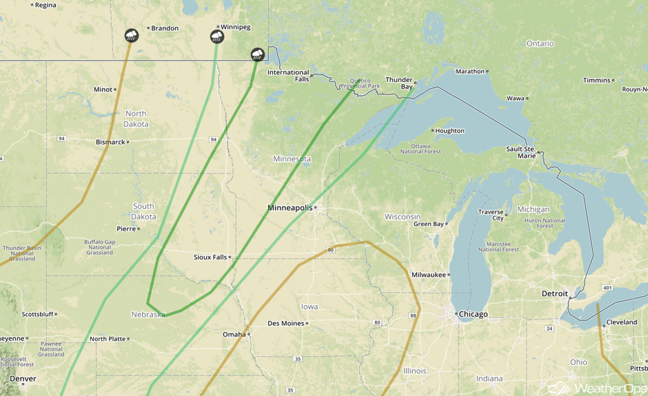 SPC Convective Outlook for Friday
Thunderstorms Friday from Southern Nebraska through Texas
While moisture may be lacking on Friday, some high based thunderstorms may develop across the region. Strong wind shear may support some rotating thunderstorms with large hail and damaging winds the primary hazards.
Major Cities in Region: Clovis, NM, Goodland, KS, North Platte, NE
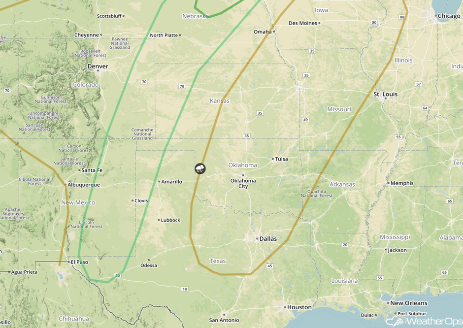 SPC Convective Outlook for Friday
Tropical Update
Tropical Storm Jose (green oval) is 150 miles south of Nantucket, Massachusetts and is moving toward the northeast at 8 mph. This general motion is expected to continue with a decrease in forward speed through tonight. A slow westward motion is expected to begin on Thursday. On the forecast track, the center of Jose is forecast to pass well to the east of the New Jersey coast today and pass offshore of southeastern Massachusetts on Thursday. Maximum sustained winds are near 70 mph. Gradual weakening is forecast during the next couple of days.
Hurricane Maria (red oval) is 25 miles west of San Juan, Puerto Rico and is moving northwestward at 12 mph. This general motion is forecast to continue with a decrease in forward speed through early Friday. On the forecast track, the center of Maria will move offshore of the northern coast of Puerto Rico during the next couple of hours. The center will then pass offshore of the northeastern coast of the Dominican Republic tonight and Thursday. It will then move near the Turks and Caicos Islands and southeastern Bahamas Thursday night and Friday. Maximum sustained winds are near 140 mph with higher gusts. Little change in strength is forecast and Maria is expected to remain a major hurricane through Friday.
Showers and thunderstorms have not become any better organized in association with the remnants of Lee (blue oval). Although environmental conditions are marginal for development, only a small increase in the organization would result in the regeneration of Lee. This area of low pressure is expected to move northward over the central Atlantic during the next few days.
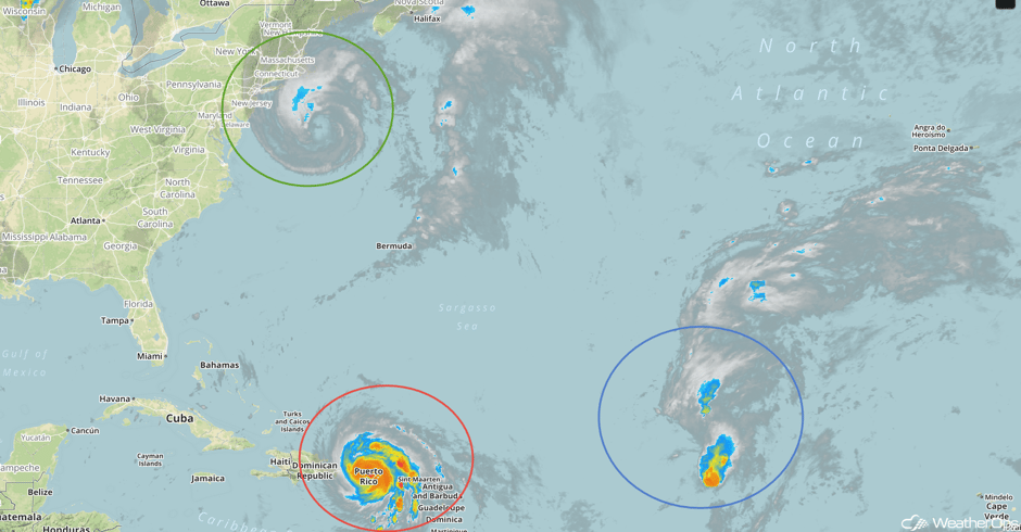 Enhanced Infrared Tropical Satellite
A Look Ahead
There will be a risk for strong to severe thunderstorms from the Midwest through Texas Saturday and Sunday as a cold front slowly moves across the region. Within this activity, there will be an excessive rainfall threat from Nebraska through Minnesota. Rainfall amounts of 2-4 inches with locally higher amounts in excess of 5 inches are forecast over these two days. The severe threat will shift eastward across the Midwest and Great Lakes early next week. Across West Texas, there will be a risk for heavy rainfall Monday and Tuesday. Two day rainfall amounts of 3-4 inches with isolated higher amounts in excess of 5 inches are expected.
This is just a brief look at current weather hazards. We can provide you site-specific weather forecast information for the purpose of protecting your personnel and assets and to assess your weather risk. Try a 7-day demo right away and learn how timely precision weather information can enhance your bottom line.


