


by David Moran, on Sep 19, 2018 11:12:34 AM
A stalled front will be the focus for thunderstorms from the Front Range of the Rockies into the Midwest on Wednesday. This activity and additional thunderstorms on Thursday will have the potential to produce excessive rainfall across the Upper Midwest and Northern Great Lakes. Tropical moisture will bring a risk for excessive rainfall across portions of the Desert Southwest.
- Thunderstorms from the Front Range into the Midwest Wednesday
- Excessive Rainfall through Thursday from the Upper Midwest to the Northern Great Lakes
- Risk for Excessive Rainfall across the Desert Southwest Wednesday
- Potential for Thunderstorms Thursday from the Central Plains to the Upper Great Lakes
- Thunderstorms from the Ohio Valley into the Northeast on Friday
- Excessive Rainfall Friday for the Southern Plains
- Tropical Update
US Hazards
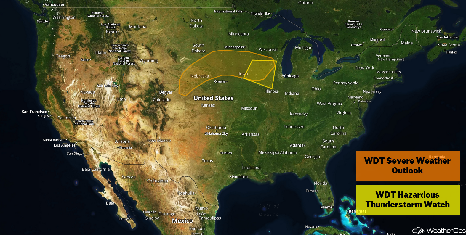
Thunderstorms from the Front Range into the Midwest Wednesday
A stalled front is expected to stretch from the Rockies to the Great Lakes today and tonight. Ongoing rain and thunderstorm activity will continue across portions of the Midwest this morning. This activity will be below severe limits but will have the potential to produce small hail and heavy rain. Into the evening as instability builds across the region, increasing wind shear and moisture in place will allow for the development of additional thunderstorms. Some storms will be strong to severe with large hail, damaging winds, and tornadoes potential hazards.
Major Cities in Region: North Platte, NE, Sioux Falls, SD, Minneapolis, MN
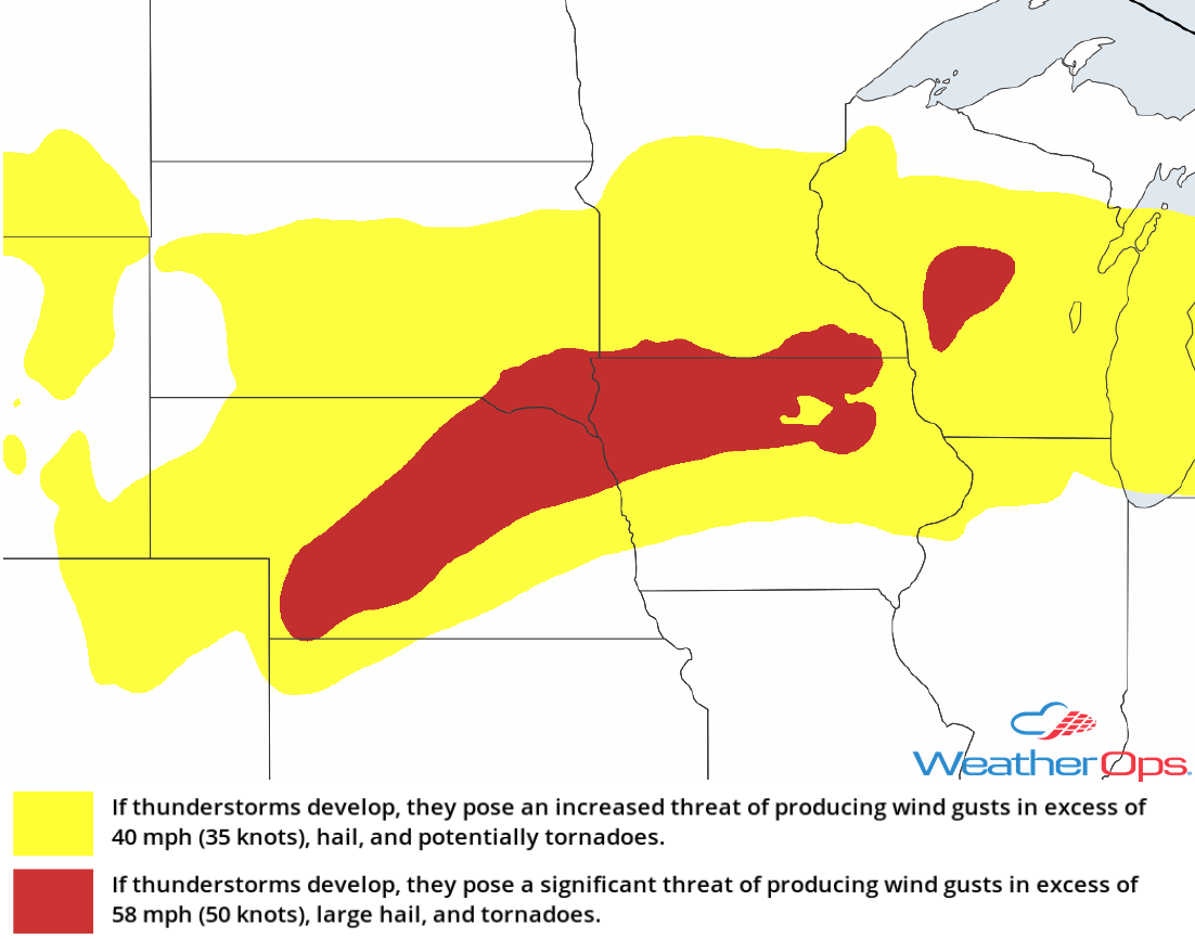
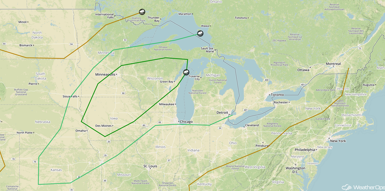
Thunderstorm Risk for Wednesday
Excessive Rainfall through Thursday from the Upper Midwest to the Northern Great Lakes
Some of the thunderstorm activity described above will pose a risk for excessive rainfall. The stalled front will move northward as a warm front on Thursday. As the associated area of low pressure tracks northeastward, multiple rounds of showers and thunderstorms are expected to develop. Two day rainfall amounts of 2-4 inches, with locally higher amounts in excess of 6 inches are forecast, will result in an increased risk for flash flooding.
Major Cities in Region: Sioux Falls, SD, Minneapolis, MN, Wausau, WI, Marquette, MI
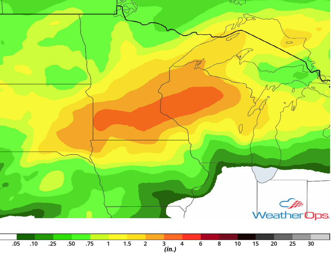
Rainfall Accumulation through Thursday
Risk for Excessive Rainfall across the Desert Southwest Wednesday
Moisture from a tropical wave lifting northward across Baja California will interact with an upper level trough tracking across the Southwest this afternoon and evening. At the same time, instability will build as a result of daytime heating. This instability combined with strong forcing from the trough and deep moisture will allow for the development of widespread rain and thunderstorms. With this tropical air mass in place, heavy to excessive rainfall is expected. Rainfall amounts of 1-2 inches with locally higher amounts in excess of 3 inches are forecast, resulting in an increased risk of flash flooding and runoff.
Major Cities in Region: Phoenix, AZ, Tucson, AZ
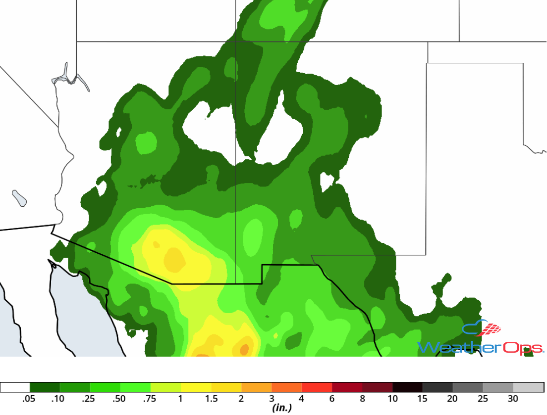
Rainfall Accumulation for Wednesday
Potential for Thunderstorms Thursday from the Central Plains to the Upper Great Lakes
An area of low pressure over the Central Plains will track northeastward throughout the day on Thursday. At the same time, the associated cold front will be tracking east to southeastward across the Central Plains and the Upper Midwest. Ahead of the cold front, warm moist air will be brought northward. As daytime heating increases, instability will build ahead of the cold front. With strong wind shear in place, scattered strong to severe thunderstorms will develop along and ahead of the cold front during the afternoon. This activity is forecast to develop into a squall line as they track eastward with a risk for large hail, damaging winds, and an isolated tornado or two.
Major Cities in Region: Dodge City, KS, Wichita, KS, Omaha, NE, Kansas City, MO, Des Moines, IA, Minneapolis, MN, Green Bay, WI, Milwaukee, WI, Chicago, IL, Detroit, MI
SPC Convective Outlook for Thursday
Thunderstorms from the Ohio Valley into the Northeast on Friday
The cold front described above will continue to move eastward across the Ohio Valley and Northeast on Friday. While instability will be limited, strong wind shear will be in place. This will allow for the development of scattered showers and thunderstorms during the afternoon on Friday. Some storms will become severe with damaging winds the primary hazard. This activity will move eastward along the front and decrease in coverage and intensity during the overnight hours.
Major Cities in Region: Evansville, IN, Indianapolis, IN, Louisville, KY, Cincinnati, OH, Columbus, OH, Cleveland, OH, Pittsburgh, PA, Buffalo, NY, Syracuse, NY, Albany, NY, Portland, ME, Augusta, ME
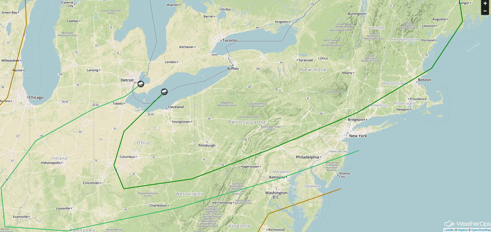
SPC Convective Outlook for Friday
Excessive Rainfall Friday for the Southern Plains
A cold front will track southward toward Oklahoma and Texas on Friday and stall across the region. As this occurs, some deep low level moisture related to a tropical wave from the Pacific and from the western Gulf of Mexico will track northward. With ample forcing from the front and tropical moisture, heavy to excessive rainfall will be likely across the Southern Plains on Friday. Rainfall amounts of 1-3 inches with locally higher amounts in excess of 4 inches are expected, leading to a risk for widespread flooding and excessive runoff. Additional rainfall is likely on Saturday.
Major Cities in Region: Lubbock, TX, Wichita Falls, TX, Lawton, OK, Oklahoma City, OK, Tulsa, OK
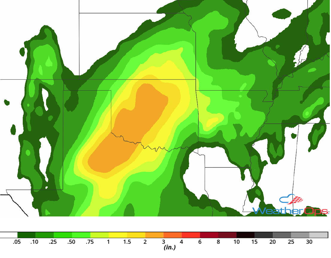
Rainfall Accumulation for Friday
Tropical Update
A large area of disturbed weather approximately 1000 miles east of the Windward Islands is associated with a tropical wave moving westward at 10-15 mph. Some slight development may occur within the next day or two before the environment becomes unfavorable for development.
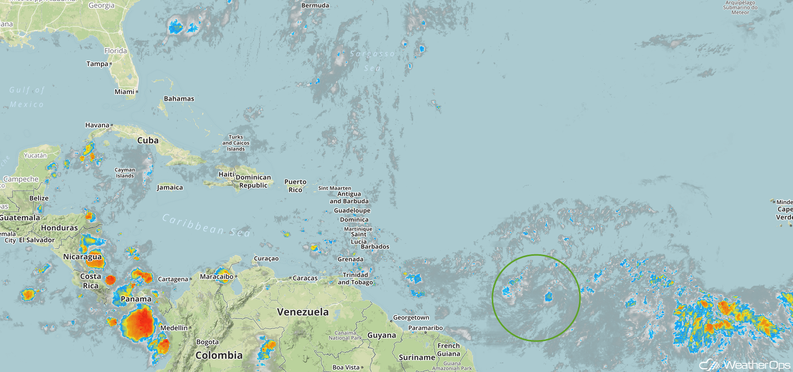
Enhanced Infrared Satellite
A Look Ahead
Tropical moisture will continue to bring heavy rain to portions of Texas and the Southern Plains through the weekend. This activity will move into the Mid Mississippi and Ohio Valleys on Monday. Thunderstorms may develop across the Upper Midwest and Central Plains Monday ahead of a cold front. On Tuesday, this activity will move eastward into the Great Lakes.
