


by David Moran, on Nov 7, 2018 10:35:00 AM
Thunderstorms will continue across southeast Texas and Louisiana on Wednesday ahead of a cold front. Snow is expected along a stalled front from Montana into the Central Plains through Thursday.
- Thunderstorms across Southeast Texas and Louisiana on Wednesday
- Snow through Thursday from Montana into the Central Plains
- Potential for Snow across the Northeast on Friday
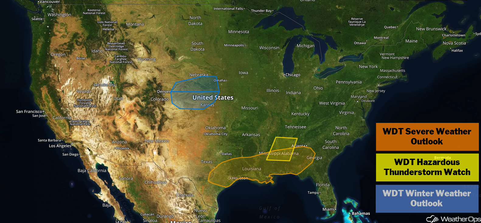
US Hazards
Thunderstorms across Southeast Texas and Louisiana on Wednesday
Ongoing thunderstorm activity across the Arklatex region just to the north of a warm front will slowly move southward. This activity will likely not be severe; however, as this activity moves southward and instability builds due to daytime heating, thunderstorms will increase in coverage and intensity. Some of these storms will become strong to severe with damaging winds and large hail the primary hazards. This activity will diminish after sunset as storms track toward the Gulf Coast.
Major Cities in Region: Houston, TX, Shreveport, LA, Monroe, LA, Baton Rouge, LA
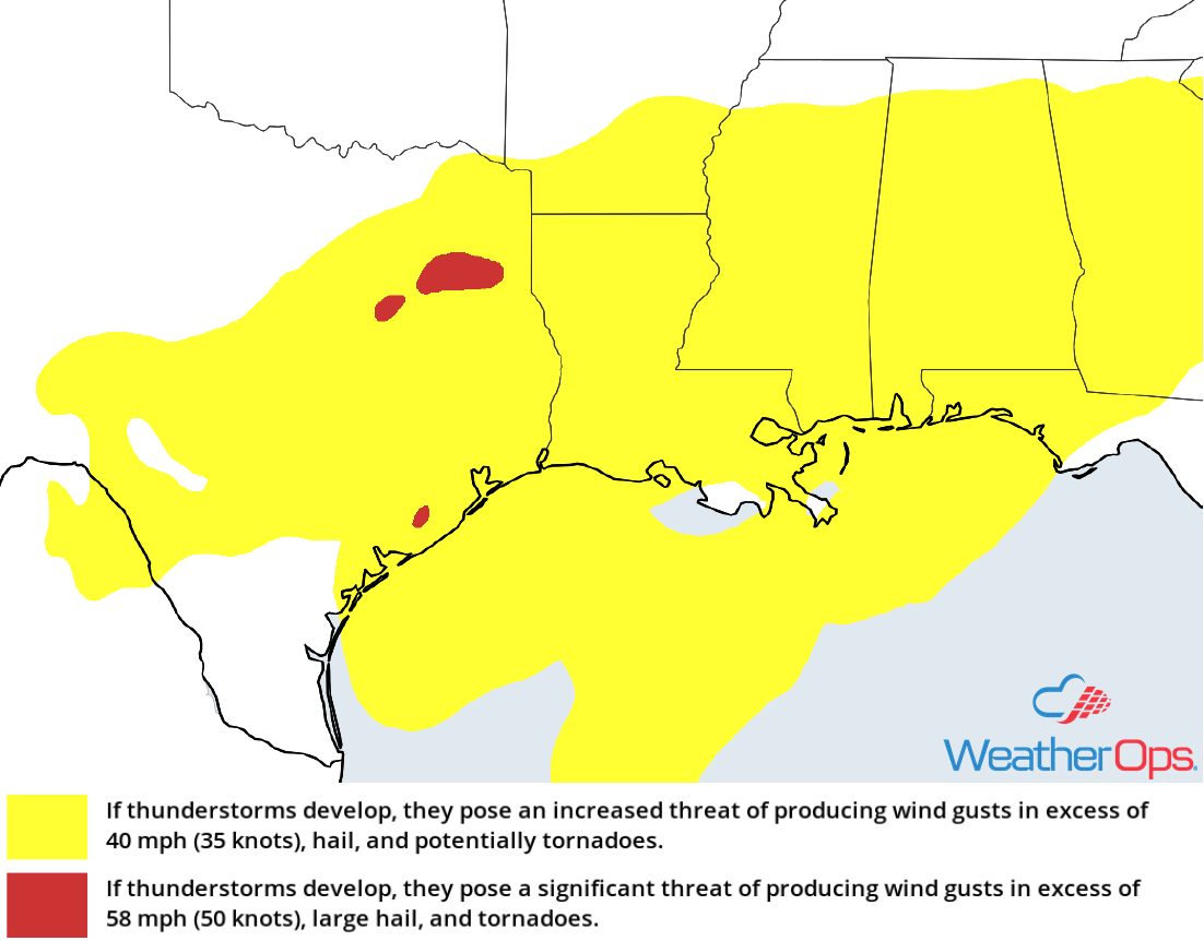
Thunderstorm Risk for Wednesday
Snow through Thursday from Montana into the Central Plains
The combination of a stalled front and an upper level disturbance moving through the region is forecast to bring widespread light to moderate snowfall from portions of Montana into the Central Plains through Thursday. Accumulations of 2-4 inches with locally higher amounts in excess of 5 inches are expected. Further south, precipitation will begin as rain before transitioning to snow.
Major Cities in Region: Missoula, MT, Great Falls, MT, Goodland, KS, North Platte, NE
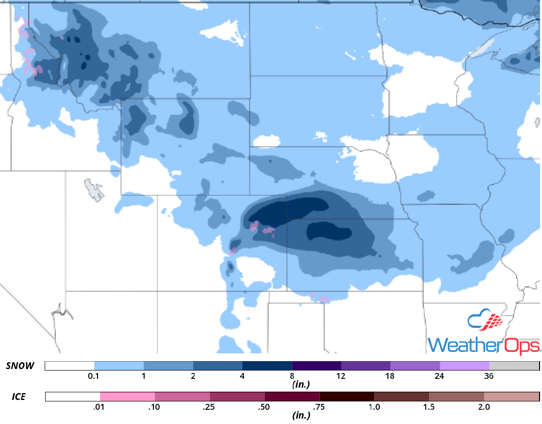
Snow Accumulation through Thursday
Potential for Snow across the Northeast on Friday
A strong upper level trough will be tracking eastward across the Plains and into the Great Lakes Thursday and Friday. At the surface, an area of low pressure will develop in the Deep South and track northeastward toward the Great Lakes while intensifying. As this occurs, the associated warm front will lift northward, bringing moist air into the region. With enough cold air in place, moderate to heavy snow will begin to develop to the north of the warm front. Snowfall accumulations of 4-8 inches with locally higher amounts in excess of a foot are expected from Upstate New York into New England. Closer to the warm front there will be some light icing, creating hazardous travel conditions across the region.
Major Cities in Region: Burlington, VT, Bangor, ME, Presque Isle, ME
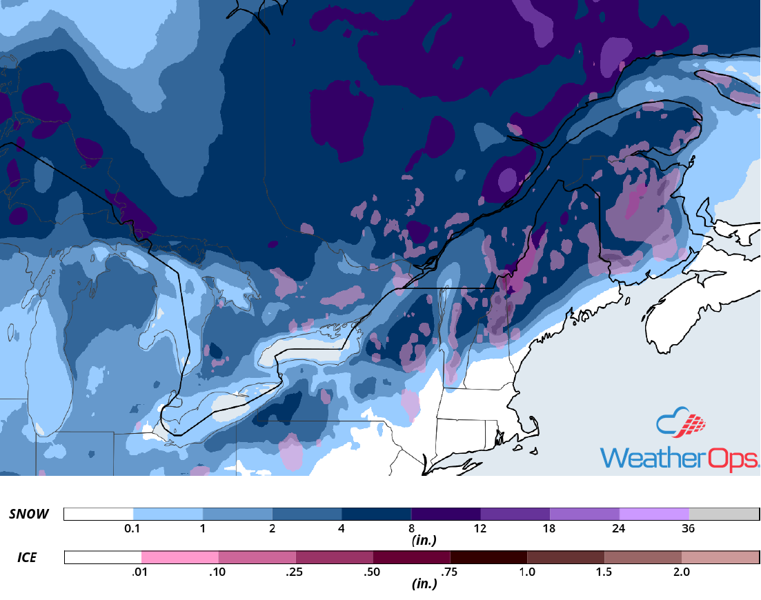
Snow Accumulation for Friday
A Look Ahead
Heavy snow is forecast over portions of Maine on Saturday as an area of low pressure moves across southern Canada and the Northeast. Light snow may develop across the Northern Plains. This snow will spread into the Upper Midwest and Great Lakes on Sunday. Across the High Plains, light snow is forecast as an area of low pressure intensifies. By Monday, moderate to heavy snow is forecast across west Texas. Snow may extend from the Lower Mississippi Valley to the Northeast on Tuesday.
