National Weather Summary for Wednesday, November 22, 2017
by David Moran, on Nov 22, 2017 10:07:08 AM
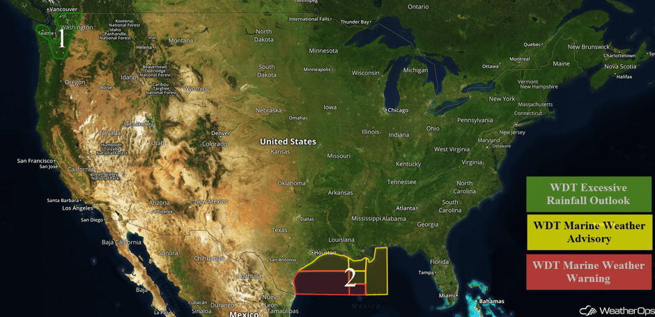
Excessive rainfall will continue across western Washington on Wednesday as moisture continues to stream into the region. Elevated winds and seas will continue for portions of the Gulf of Mexico through Wednesday night as an area of low pressure intensifies over the western Gulf of Mexico.
- Continued Risk for Excessive Rainfall Wednesday for Portions of Washington
- Elevated Winds and Seas Continuing for Gulf of Mexico Wednesday
- Excessive Rainfall Thursday for Portions of Florida, Georgia, and South Carolina
 US Hazards
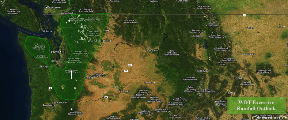
Continued Risk for Excessive Rainfall Wednesday for Portions of Washington
Light to moderate showers are moving northeastward across the region. A stream of low level moisture and associated shower activity will persist ahead of a cold front through tonight. Rainfall totals of 4-5 inches are likely in the higher elevations of the Olympic Mountains and the Cascades. In the lower elevations, rainfall totals between half an inch and an inch are expected.
Major Cities in Region: Olympia, WA
 Region 1
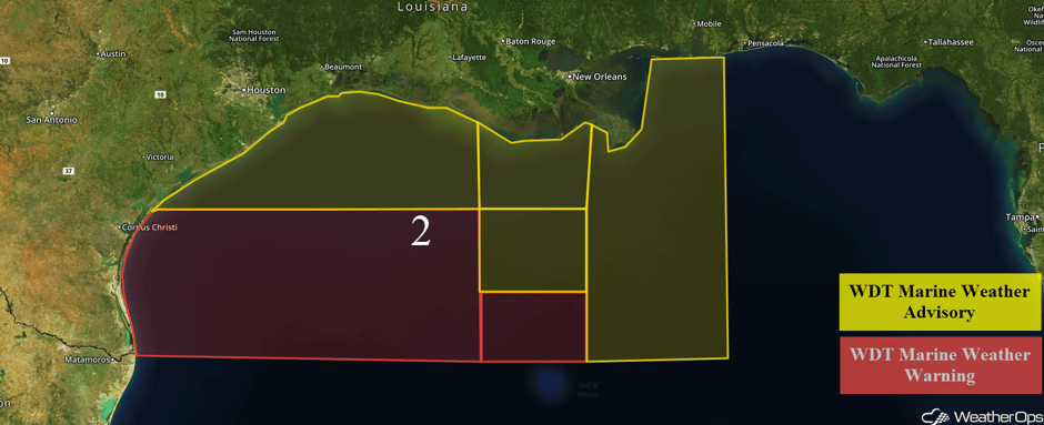
Elevated Winds and Seas Continuing for Gulf of Mexico Wednesday
Elevated winds and seas will continue for portions of the Gulf of Mexico through this evening. Winds of 20-30 knots with gusts in excess of 35 knots are forecast. In addition, seas of 4-7 feet are expected near the shore and 6-9 feet in the deeper waters across northwestern portions of the region. For southwestern areas, seas of 6-9 feet are forecast near the shore and 9-13 feet in the deeper waters. Across eastern portions of the region, seas of 5-7 feet are expected near the shore and 7-9 feet in the deeper waters. Some strong thunderstorms may also develop.
 Region 2
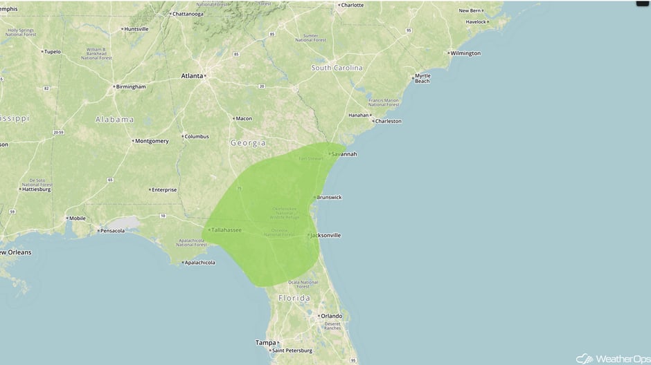
Excessive Rainfall Thursday for Portions of Florida, Georgia, and South Carolina
An area of low pressure in the eastern Gulf of Mexico will track northeastward across the Florida Peninsula throughout the day. Additionally, moderate to heavy rainfall will develop along a warm front, which is likely to extend from the low pressure center into northeast Florida, southern Georgia, and the South Carolina coast. Widespread rain totals of 1-2 inches are likely with locally higher amounts in excess of 3 inches.
Major Cities in Region: Tallahassee, FL, Jacksonville, FL, Savannah, GA
 Excessive Rainfall Risk Outline for Thursday
A Look Ahead
Rain will continue for portions of the Pacific Northwest on Thursday as a cold front approaches the coast; rainfall amounts of 1-3 inches are likely across the Cascades. Into Friday, some light rain may develop across the Northern Plains into the Great Lakes. Rain may linger across portions of Florida into the Carolinas as the area of low pressure described above continues to move away from the region. Into the weekend, lake effect snow showers may develop across Upstate New York, northwest Pennsylvania, and Northern Ohio. Rain will continue for portions of the Pacific Northwest with rainfall totals of 1-3 inches forecast on Saturday. A cold front moving into the western US will produce snow for portions of the Cascades, Sierra Nevada, and Rockies across western Montana on Sunday.
This is just a brief look at current weather hazards. We can provide you site-specific weather forecast information for the purpose of protecting your personnel and assets and to assess your weather risk. Try a 7-day demo right away and learn how timely precision weather information can enhance your bottom line.


