National Weather Summary for Wednesday, November 1, 2017
by David Moran, on Nov 1, 2017 11:00:49 AM
Thunderstorms are ongoing for portions of Texas and Louisiana on Wednesday ahead of a cold front. Rain will change over to snow across portions of the Rockies. Elevated winds and seas will continue across the northwestern Gulf of Mexico ahead of an area of low pressure.
- Thunderstorms for Texas and Louisiana on Wednesday
- Snow Wednesday Across the Northern Rockies
- Potential for Snow Across Portions of the Northern Plains on Wednesday
- Elevated Winds and Seas Wednesday for the Northwestern Gulf of Mexico
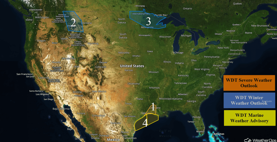 US Hazards
Thunderstorms for Texas and Louisiana on Wednesday
Thunderstorms will continue across portions of Texas and Louisiana. Strong winds and perhaps an isolated tornado will be the primary hazards with this activity. Precipitation should begin to dissipate by the early afternoon.
Major Cities in Region: Beaumont, TX, Alexandria, LA, Lafayette, LA
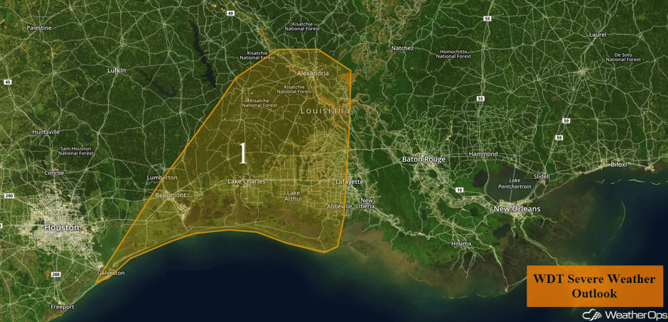 Region 1
Snow Wednesday Across the Northern Rockies
Rain at the lower elevations is expected to gradually transition to all snow on Wednesday. Snowfall accumulations of 2-4 inches are forecast with locally higher amounts in excess of 5 inches. Across the higher elevations, snow is already falling and accumulations through Wednesday night are expected to range 6-8 inches above 5000 feet. Locally higher amounts may exceed a foot.
Major Cities in Region: Butte, MT, Helena, MT, Great Falls, MT
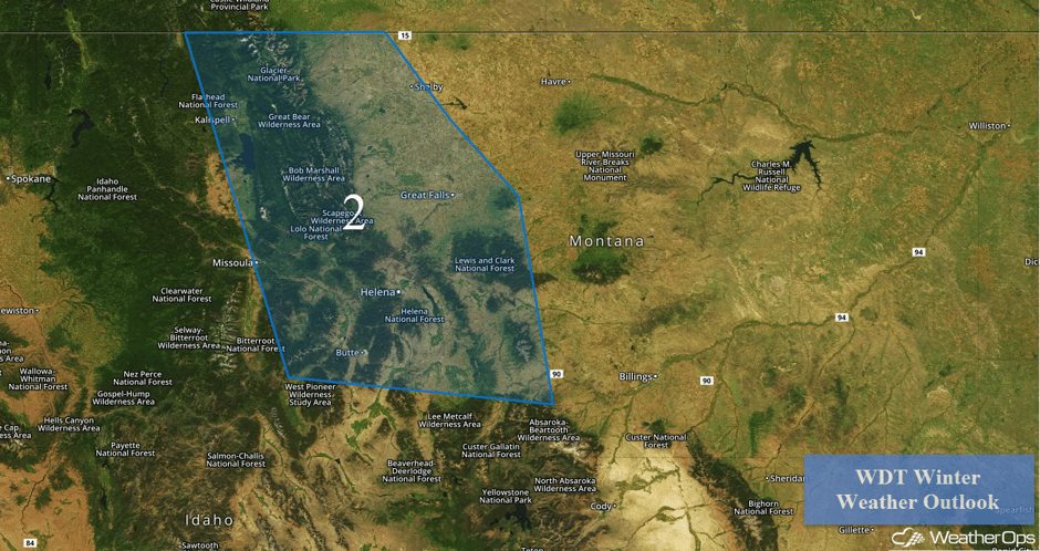 Region 2
Potential for Snow Across Portions of the Northern Plains on Wednesday
A mix of rain and snow is forecast on Wednesday as a weak disturbance moves across the region. Temperatures will hover at or just below freezing, which may limit snowfall amounts over southern portions of the region. Snowfall accumulations of 2-4 inches are forecast with locally higher amounts in excess of 5 inches closer to the Canadian border.
Major Cities in Region: Grand Forks, ND, International Falls, MN, Duluth, MN
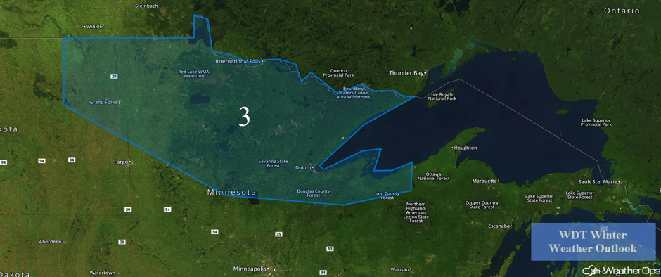 Region 3
Elevated Winds and Seas Wednesday for the Northwestern Gulf of Mexico
Increased southerly winds will continue across portions of the northwestern Gulf of Mexico ahead of an area of low pressure through late Wednesday. Winds of 25-30 knots with gusts in excess of 35 knots and seas of 7-9 feet are forecast. Some thunderstorms may also develop.
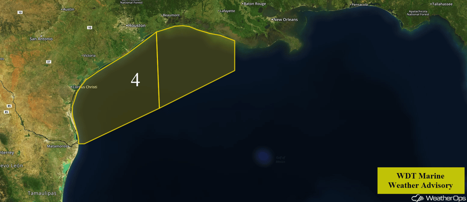 Region 4
A Look Ahead
Snow is forecast over the higher elevations of the Northern Rockies Friday as an area of low pressure develops over the Pacific Northwest. This snow should move out of the Rockies and into the High Plains on Saturday. A cold front moving into Northern California on Saturday may bring some light rain to the region. By Sunday, a rain/snow mix may impact portions of the Upper Midwest.
Learn what to expect this winter by signing up for our Winter Weather Outlook webinar today.
This is just a brief look at current weather hazards. We can provide you site-specific weather forecast information for the purpose of protecting your personnel and assets and to assess your weather risk. Try a 7-day demo right away and learn how timely precision weather information can enhance your bottom line.


