National Weather Summary for Wednesday, May 31, 2017
by David Moran, on May 31, 2017 11:08:17 AM
Thunderstorms may develop on Wednesday across the Northeast and Mid-Atlantic ahead of a cold front. A stalled front will be the focus for thunderstorm development across the Central Plains on Wednesday. Across southwestern Texas, a few thunderstorms may develop today. A few storms are also possible across the higher terrain of the Northern Rockies.
- Risk for Thunderstorms Wednesday from the Northeast through the Mid Atlantic
- Thunderstorms for the Central Plains on Wednesday
- Potential for Thunderstorms Wednesday across Southwestern Texas
- Strong to Severe Thunderstorms Possible for the Northern Rockies on Wednesday
- Thunderstorms for Portions of Texas on Thursday
- Risk for Thunderstorms across the Midwest on Thursday
- Thunderstorm Potential Friday from the Northern Plains through the Midwest
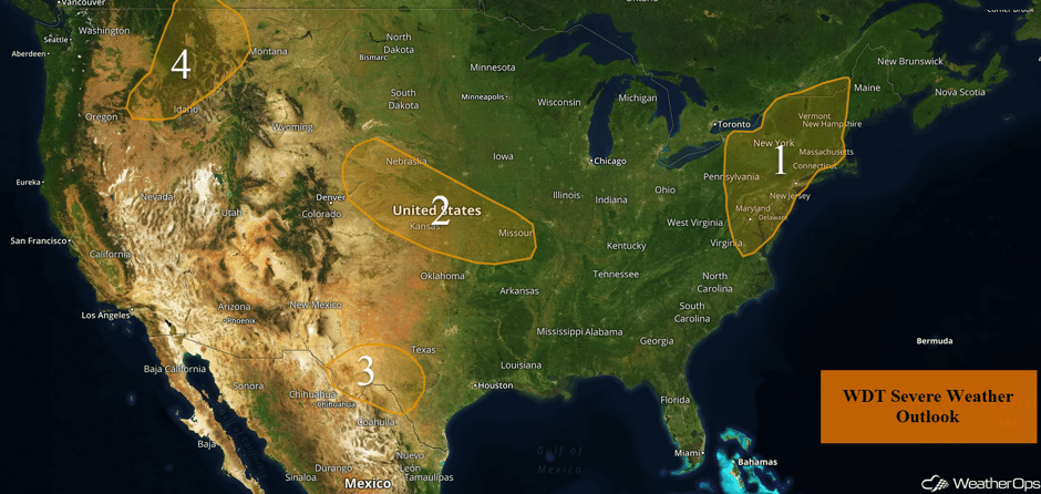 US Hazards
Risk for Thunderstorms Wednesday from the Northeast through the Mid Atlantic
A marginal to slight risk of isolated strong to severe thunderstorms will be possible across the Northeast US today with the highest potential located from eastern New York southward into New England. Instability will increase throughout the day along a trough of low pressure combined with moderate wind shear. As a result, thunderstorms are likely to develop during the afternoon and early evening. The primary hazards with the strongest storms will be strong wind gusts and large hail. Toward the evening hours, the threat of large hail will decrease as storms merge into a squall line. A brief, isolated tornado cannot be ruled out.
Update 12:54pm EDT: Severe thunderstorm capable of damaging winds SE of Charleston, WV.
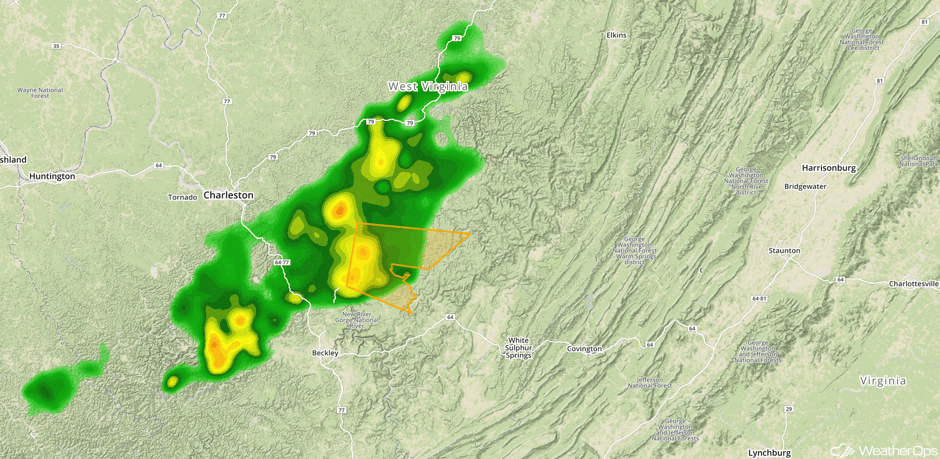 Radar 12:54pm EDT
Update 1:40pm EDT: Severe Thunderstorm Watch in effect for portions of Connecticut, Massachusetts, Maine, New Hampshire, New York, and Vermont until 9pm EDT.
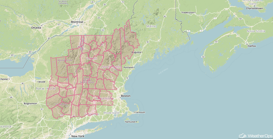 Severe Thunderstorm Watch
Update 2:36pm EDT: Severe thunderstorms capable of hail and damaging winds approaching Burlington, VT.
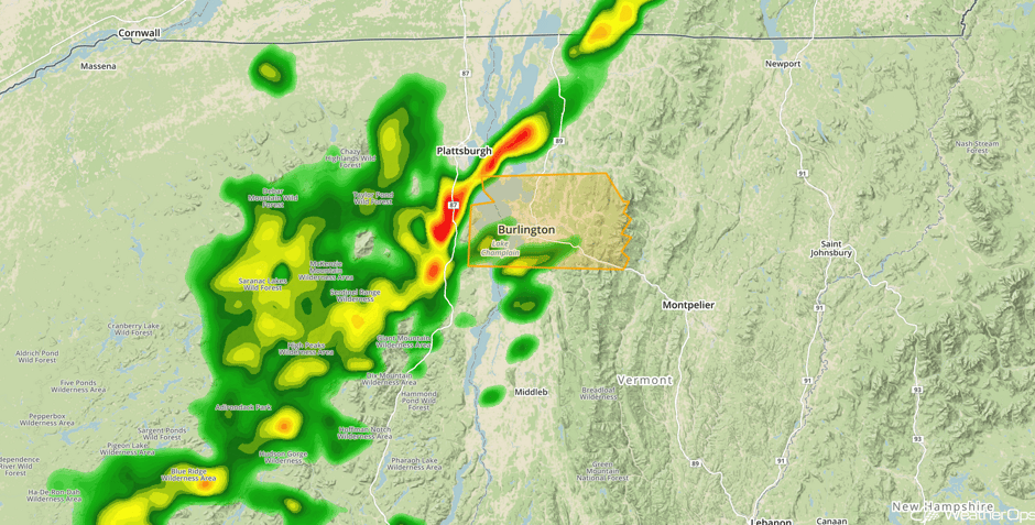 Radar 2:36pm EDT
Major Cities in Region: Rochester, NY, Washington, DC, Philadelphia, PA, Boston, MA
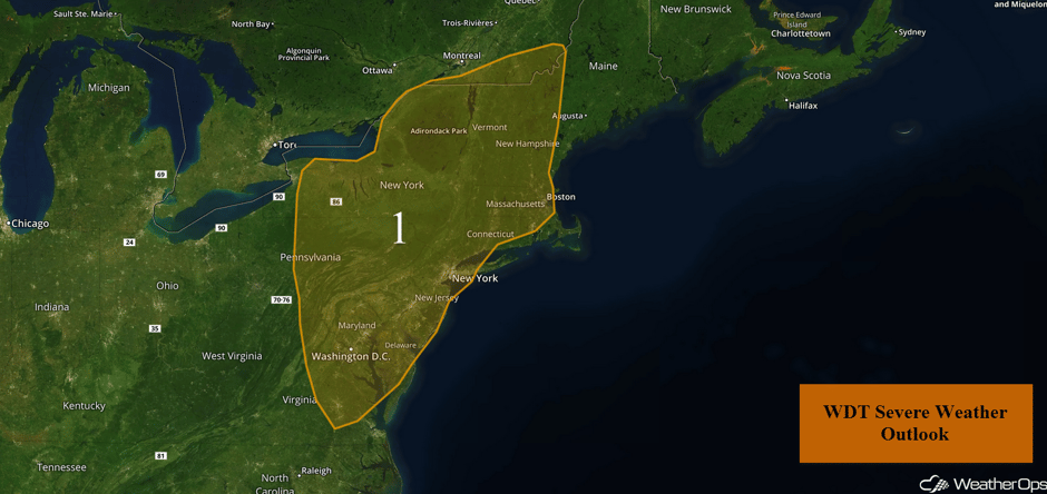 Region 1
Thunderstorms for the Central Plains on Wednesday
A few isolated severe thunderstorms capable of large hail and damaging winds may develop across the region this afternoon and evening. A stalled front will be the focus for the development of thunderstorms. While there are currently thunderstorms ongoing along the front from western Missouri into Kansas and Nebraska, storm intensity is likely to increase throughout the day. Isolated strong storms are likely to persist this afternoon through the evening.
Update 11:58am CDT: Severe thunderstorm capable of large hail south of Topeka.
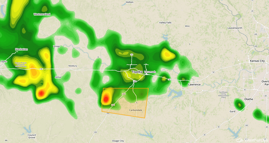 Radar 11:58am CDT
Update 12:51pm CDT: Thunderstorms near Topeka continuing to move eastward.
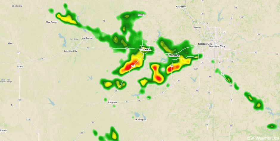 Radar 12:51pm CDT
Update 1:07pm CDT: Hail in excess of 2 inches estimated near Ottawa, KS.
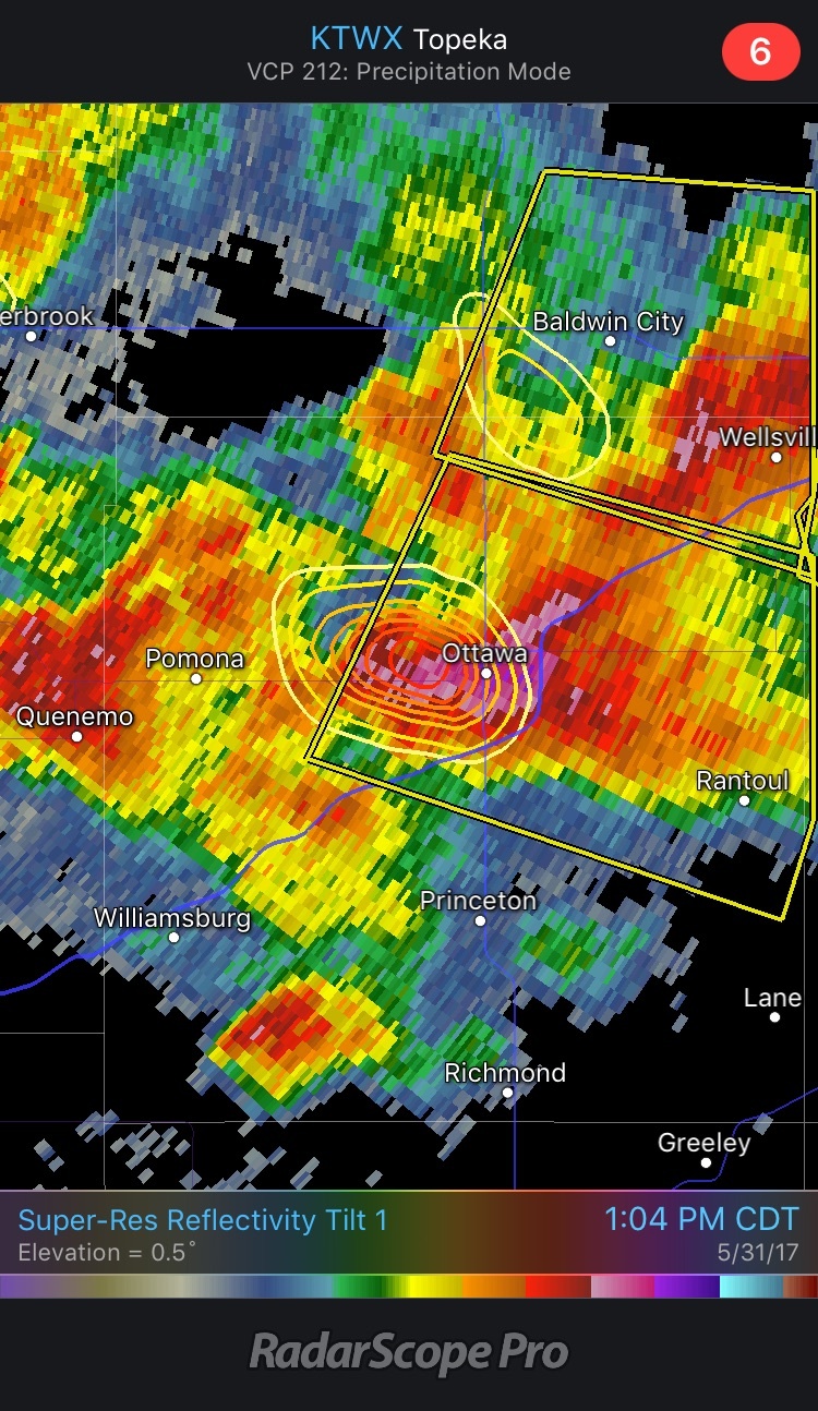 Radar 1:09pm CDT
Update 1:46pm CDT: Severe Thunderstorm Watch for portions of Kansas and Missouri until 8pm CDT.
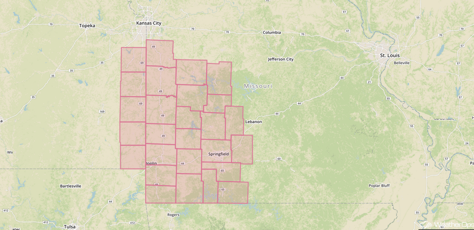 Severe Thunderstorm Watch
Major Cities in Region: North Platte, NE, Grand Island, NE, Topeka, KS, Kansas City, MO, Springfield, MO, Jefferson City, MO
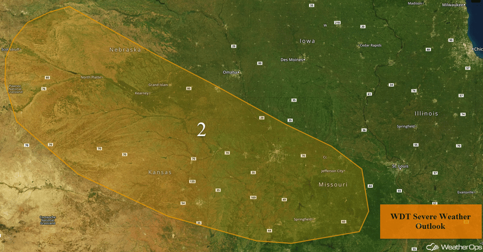 Region 2
Potential for Thunderstorms Wednesday across Southwestern Texas
Widely scattered showers and thunderstorms are ongoing across portions of southwest Texas. This activity is in response to plentiful low level moisture and instability across the region. Later today, storms are forecast to become aided by an upper level system arriving from Mexico. Additional storms are likely to develop across the high terrain of northern Mexico before advancing northeastward through southwest Texas late this afternoon and evening. Large hail, damaging winds, and heavy rain will be the primary hazards with these storms.
Major Cities in Region: Odessa, TX, Del Rio, TX
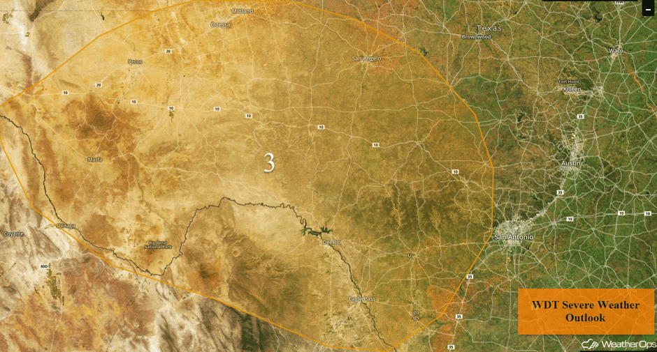 Region 3
Strong to Severe Thunderstorms Possible for the Northern Rockies on Wednesday
A marginal threat of a few strong to severe thunderstorms will exist across portions of the Pacific Northwest on Wednesday. An upper level system will bring cold air aloft, aiding in destabilization. Gusty winds in excess of 50 mph will be possible with any organized thunderstorm activity.
Major Cities in Region: Missoula, MT, Helena, MT
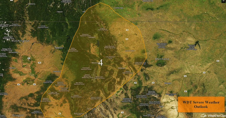 Region 4
Thunderstorms for Portions of Texas on Thursday
A weak area of low pressure combined with plentiful moisture should allow for the development of thunderstorms across Texas on Thursday. Storms will likely develop during the afternoon and continue into the evening with large hail and damaging winds the primary hazards.
Major Cities in Region: Lubbock, TX, Abilene, TX, Wichita Falls, TX
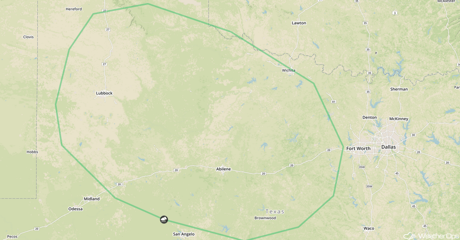 SPC Convective Outlook for Thursday
Risk for Thunderstorms across the Midwest on Thursday
Moisture will be plentiful as a warm front lifts northward across the region on Thursday. While instability will be rather weak, thunderstorms capable of producing hail may develop during the afternoon.
Major Cities in Region: Des Moines, IA, Jefferson City, MO, St. Louis, MO, Springfield, IL
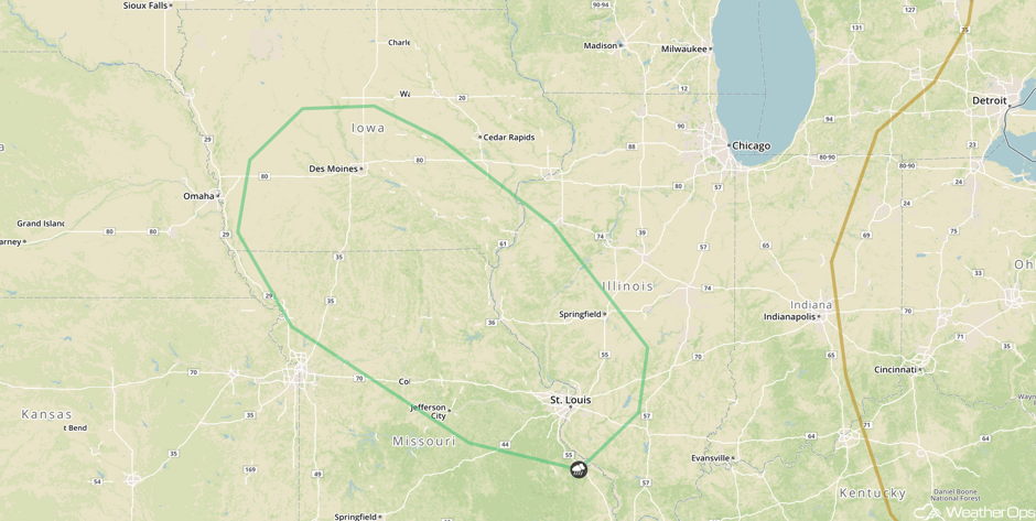 SPC Convective Outlook for Thursday
Thunderstorm Potential Friday from the Northern Plains through the Midwest
A strengthening area of low pressure across the Northern US on Friday will allow for the development of thunderstorms across the Northern Plains and Midwest. A cold front moving across the Northern Plains will be the focus for the development of thunderstorms. Large hail and damaging winds will be the primary hazards.
Further to the east across the Midwest, thunderstorms may develop along a warm front. Increasing moisture and wind shear will allow for some stronger storms during the afternoon and evening. The primary hazards with any storms that develop will be strong winds and large hail.
Major Cities in Region: Bismarck, ND, Pierre, SD, Minneapolis, MN, Chicago, IL
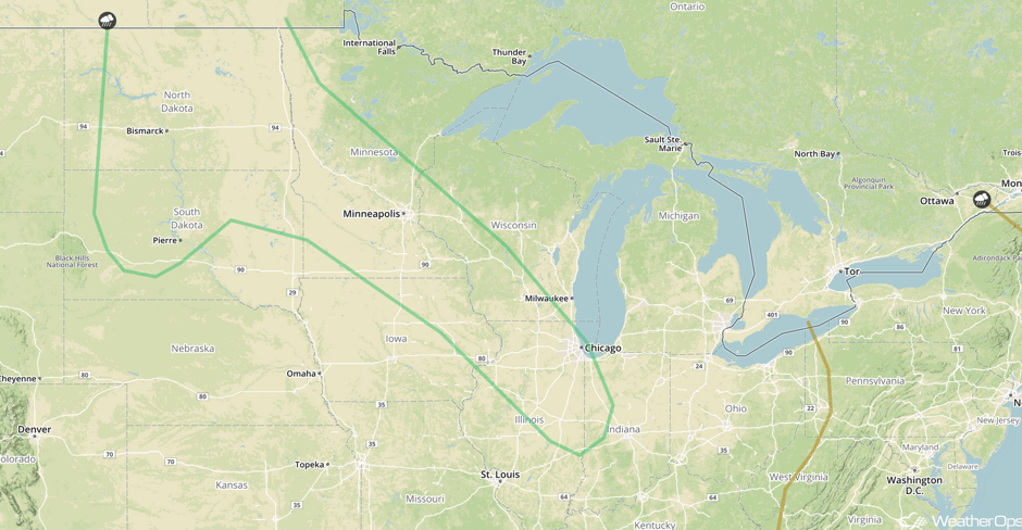 SPC Convective Outlook for Friday
A Look Ahead
As an area of low pressure and cold front continues to progress eastward on Saturday, thunderstorms may develop from the Mississippi Valley through the Southern Plains. By Sunday, the thunderstorm risk will move eastward toward the Mid Atlantic as the area of low pressure continues to progress eastward.
This is just a brief look at current weather hazards. We can provide you site-specific weather forecast information for the purpose of protecting your personnel and assets and to assess your weather risk. Try a 7-day demo right away and learn how timely precision weather information can enhance your bottom line.


