National Weather Summary for Wednesday, May 3, 2017
by David Moran, on May 3, 2017 10:55:31 AM
An area of low pressure will intensify across the Southern Plains on Wednesday, allowing for the development of severe thunderstorms from the Gulf Coast into the Arklatex. Further to the north, this same system will bring a risk for excessive rainfall from the South Central Plains through the Midwest.
- Severe Thunderstorms Expected Wednesday from the Gulf Coast Through the Arklatex
- Elevated Winds and Seas Expected for Western Gulf of Mexico Late Wednesday and Thursday
- Excessive Rainfall Possible from the South Central Plains through the Midwest on Wednesday
- Strong to Severe Thunderstorms for the Southeast Thursday
- Thunderstorm Potential Thursday for the Pacific Northwest
- Excessive Rainfall Potential for the Midwest on Thursday
- Potential for Strong to Severe Thunderstorms Friday for Washington and Idaho
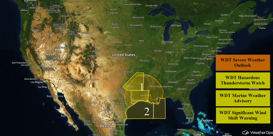 US Hazards
Severe Thunderstorms Expected Wednesday from the Gulf Coast Through the Arklatex
Isolated to widely scattered strong to severe thunderstorms are forecast across much of eastern Texas, Louisiana, and Mississippi today. Two rounds of severe storms will be possible in some areas. An area of low pressure is slowly intensifying over far northeast Texas and southeast Oklahoma. A warm front is also lifting northward across eastern Texas and western Louisiana ahead of the low. Plentiful moisture will create moderate to high instability. This instability combined with wind shear will allow for the development of thunderstorms capable of large hail, damaging winds, and tornadoes. The greatest threat for tornadoes will be across southeast Texas and southwest Louisiana. Further north, large hail and damaging winds will be the primary hazards. By mid to late afternoon, storms may begin to form into a squall line ahead of a cold front over east Texas. This front will move into the upper Texas coast tonight, when the severe threat will end. The front may not reach southeastern Louisiana and southern Mississippi until after midnight, allowing the threat to continue into the overnight hours.
Update 11:10am CST: Severe thunderstorms capable of hail and damaging winds moving across southern Louisiana.
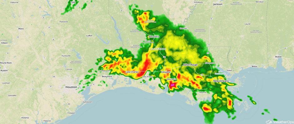 Radar 11:10am CST
Update 11:25am CST: Severe thunderstorms capable of large hail approaching Little Rock, AR.
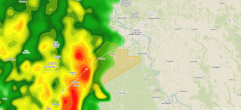 Radar 11:25am CST
Update 11:47am CDT: Tornado Warning in south central Louisiana until 12:15pm CDT.
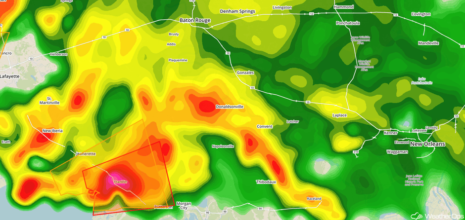 Radar 11:47am CDT
Update 12:30pm CDT: Severe thunderstorm capable of large hail south of Dallas, TX.
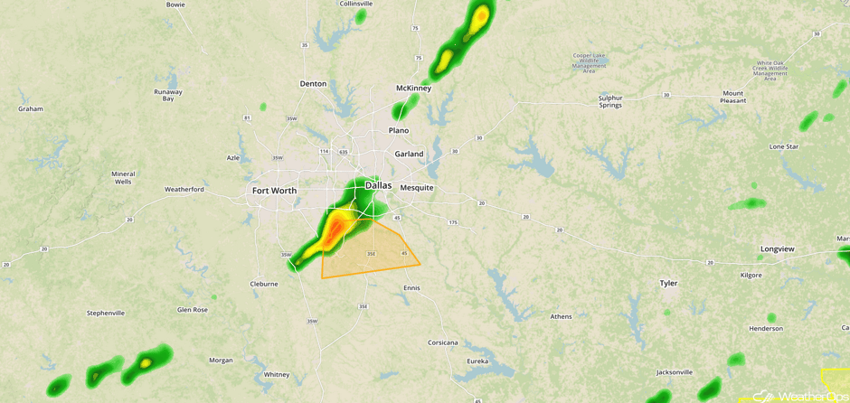 Radar 12:30pm CDT
Update 12:48pm CDT: Severe Thunderstorm Watch for portions of Arkansas, Louisiana, and Texas until 7pm CDT.
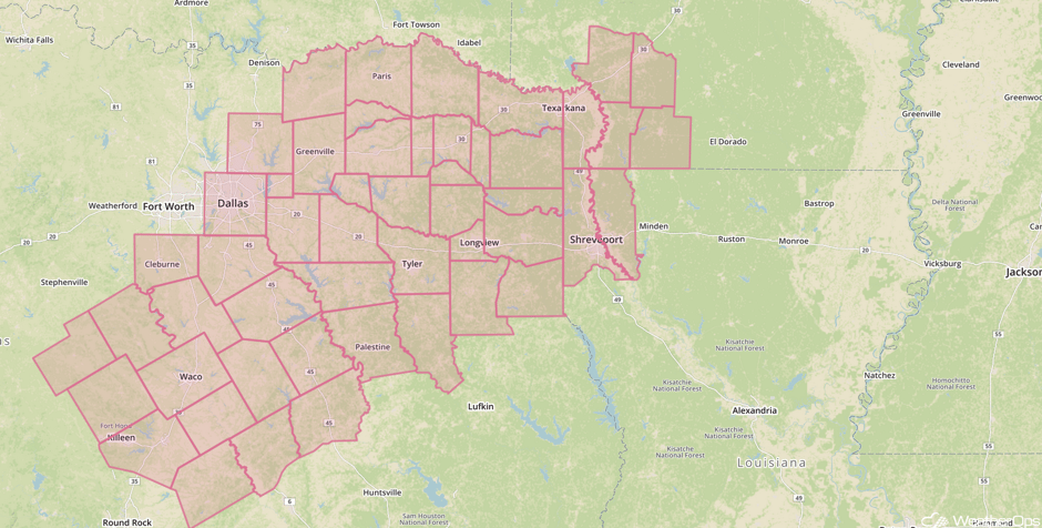 Severe Thunderstorm Watch
Update 1:04pm CDT: Storm near Dallas is intensifying.
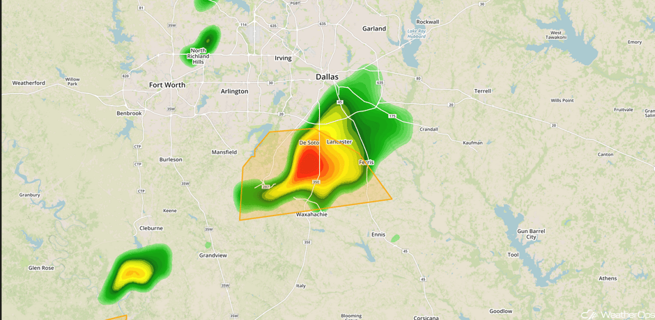 Radar 1:04pm CDT
Update 2pm CDT: Severe thunderstorms capable of hail and damaging winds near Lufkin, TX.
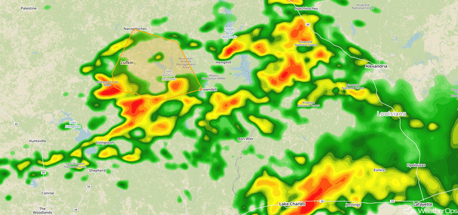 Radar 2pm CDT
Major Cities in Region: Dallas, TX, Houston, TX, Shreveport, LA, Little Rock, AR, New Orleans, LA, Jackson, MS
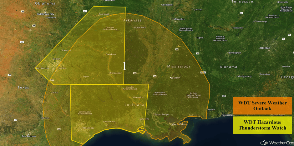 Region 1
Elevated Winds and Seas Expected for Western Gulf of Mexico Late Wednesday and Thursday
A strong area of low pressure is forecast to move across the Southern Plains on Wednesday, then northeastward into the Ohio Valley on Thursday. The cold front associated with this low will move over the Gulf late Wednesday night into Thursday, bringing a wind shift along with elevated winds and seas. The front should move off the east Texas coast late Wednesday evening and will move across the region Thursday morning. Winds will shift from southeasterly at 15-20 knots to northwesterly at 20-30 knots as the front passes. Wind gusts in excess of 35 knots are expected. Seas will build to 8-10 feet behind the front. Conditions will subside Thursday evening with winds decreasing to around 20 knots and seas to around 7 feet.
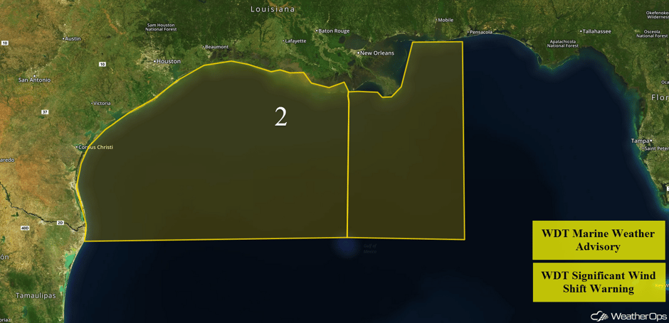 Region 2
Excessive Rainfall Possible from the South Central Plains through the Midwest on Wednesday
With the region still saturated from previous storms, moderate to heavy rainfall will cause areas of flooding today. Widespread rainfall totals of 1-3 inches are expected, with locally higher amounts in excess of 4 inches possible.
Major Cities in Region: Houston, TX, Shreveport, LA, Fort Smith, AR, Little Rock, AR, St. Louis, MO, New Orleans, LA, Jackson, MS
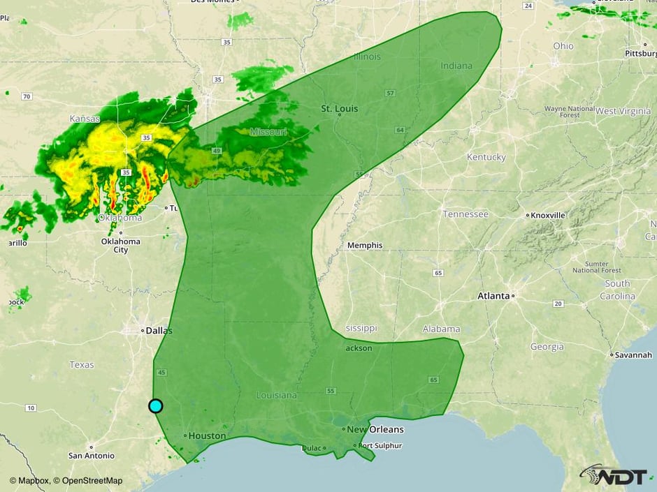 Excessive Rainfall Risk Outline for Wednesday
Strong to Severe Thunderstorms for the Southeast Thursday
A line of ongoing thunderstorms will progress across the Southeast Thursday morning. Some storms will continue to be severe with damaging winds and an embedded tornado possible. During the afternoon, new development will be possible ahead of a cold front. There is a high degree of uncertainty in the strength of this activity due to limited instability from cloud cover and the earlier morning storms. Regardless, a few strong to severe thunderstorms will be possible, with damaging winds and tornadoes the primary hazards. Heavy rainfall with amounts in excess of 2.5 inches expected.
Major Cities in Region: Montgomery, AL, Tallahassee, FL, Atlanta, GA, Tampa, FL, Orlando, FL, Jacksonville, FL, Savannah, GA, Myrtle Beach. SC
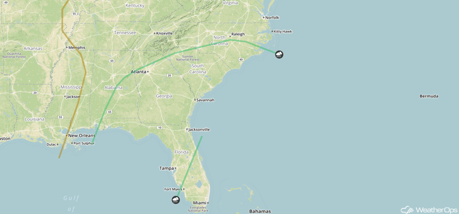 SPC Convective Outlook for Thursday
Thunderstorm Potential Thursday for the Pacific Northwest
A few severe thunderstorms may develop on Thursday ahead of an area of low pressure. Wind shear and instability should be sufficient for an isolated thunderstorm or two capable of large hail or damaging winds cannot be ruled out.
Major Cities in Region: Yakima, WA, Bend, OR
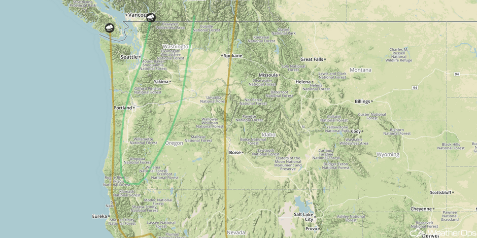 SPC Convective Outlook for Thursday
Excessive Rainfall Potential for the Midwest on Thursday
Another round of rainfall ahead of an area of low pressure and warm front lifting across the region will allow for rainfall totals in excess of 2.5 inches. Two day rainfall totals in excess of 5 inches will be possible, allowing the risk for flash flooding to continue.
Major Cities in Region: Indianapolis, IN, Louisville, KY, Cincinnati, OH, Toledo, OH, Columbus, OH
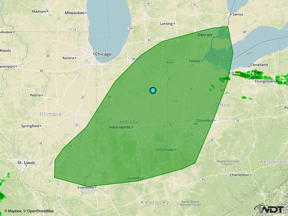 Excessive Rainfall Risk Outline for Thursday
Potential for Strong to Severe Thunderstorms Friday for Washington and Idaho
There will be the potential for additional thunderstorms on Friday across Washington and Idaho as a cold front and area of low pressure push through the region. Moderate wind shear should cause at least a few thunderstorms capable of hail and damaging winds.
Major Cities in Region: Spokane, WA
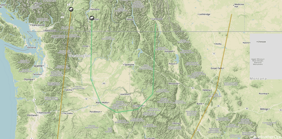 SPC Convective Outlook for Friday
A Look Ahead
Fairly quiet conditions are expected through the weekend and early next week. A few showers and thunderstorms, however, may develop across the western US on Sunday as an area of low pressure approaches the West Coast.
This is just a brief look at current weather hazards. We can provide you site-specific weather forecast information for the purpose of protecting your personnel and assets and to assess your weather risk. Try a 7-day demo right away and learn how timely precision weather information can enhance your bottom line.


