National Weather Summary for Wednesday, May 10, 2017
by David Moran, on May 10, 2017 11:01:18 AM
Severe thunderstorms are expected on Wednesday from the Plains to the Ohio Valley as an upper level low moves out of the Four Corners region. Heavy to excessive rainfall will also be a concern with some storms from the Plains to the Mid-Mississippi Valley.
- Severe Thunderstorms Expected Wednesday from the Great Plains to the Ohio Valley
- Excessive Rainfall Possible from Central Plains to Mid-Mississippi Valley on Wednesday
- Strong to Severe Thunderstorms from the Great Plains to Mid Atlantic on Thursday
- Excessive Rainfall Thursday for Ohio Valley and Central Appalachians
- Thunderstorm Potential across the Southeast on Friday
- Excessive Rainfall Friday for the Central Appalachians
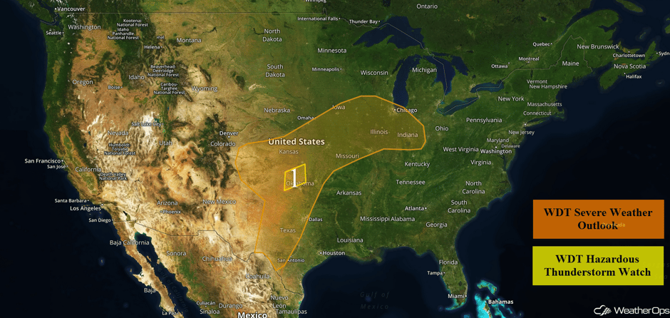 US Hazards
Severe Thunderstorms Expected Wednesday from the Great Plains to the Ohio Valley
An upper level low over the Four Corners region will allow for the development of strong to severe thunderstorms this afternoon and evening across Region 1. A few areas of thunderstorms are ongoing this morning from northwest Oklahoma into Iowa. This activity may produce severe winds and hail through the morning hours. Activity should redevelop or reintensify over eastern Kansas, northwest Missouri, and portions of Iowa this afternoon as daytime heating increases. Severe winds and hail will be the primary hazards with the stronger storms, although an isolated tornado or two cannot be ruled out. After dark, a lesser threat for marginally severe winds will continue into Illinois and Indiana as storms push off to the east.
Further south, moisture return will allow instability to increase across the Southern Plains. Scattered thunderstorms will develop across the Texas Panhandle this afternoon and will quickly become severe. Large hail, damaging winds, and isolated tornadoes will all be possible as activity spreads into western Oklahoma and southwest Kansas through the evening hours. Isolated storms may reach the Interstate 35 corridor between 7pm and 9 pm before weakening and dissipating. Additional storms may develop further south into the Del Rio region along a dryline. Hail and damaging winds will be the primary hazards with these storms.
Lastly, strong to severe thunderstorms may develop across the High Plains of Colorado and New Mexico. Large hail and severe winds will be the primary hazards with activity weakening after dark.
Update 11:40am CDT: Severe thunderstorm capable of large hail SW of Des Moines, IA.
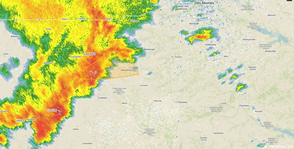 Radar 11:40am CDT
Update 11:57am CDT: Severe thunderstorm capable of large hail and damaging winds in North Central Oklahoma.
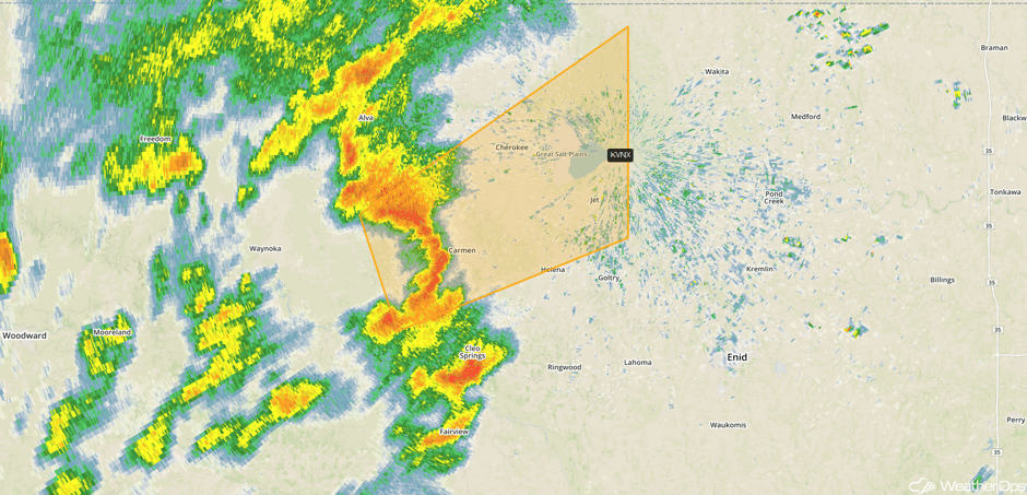 Radar 11:57am CDT
Update 12:19pm CDT: Severe thunderstorms continuing across southern Iowa. Damaging winds likely along the leading edge of the line.
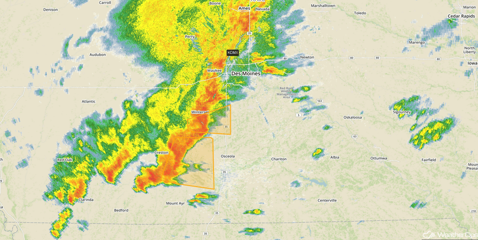 Radar 12:19pm CDT
Update 1:05pm CDT: Severe Thunderstorm Watch in effect for portions of Illinois, Iowa, and Missouri until 8pm. Large hail, damaging winds, and tornadoes will be possible.
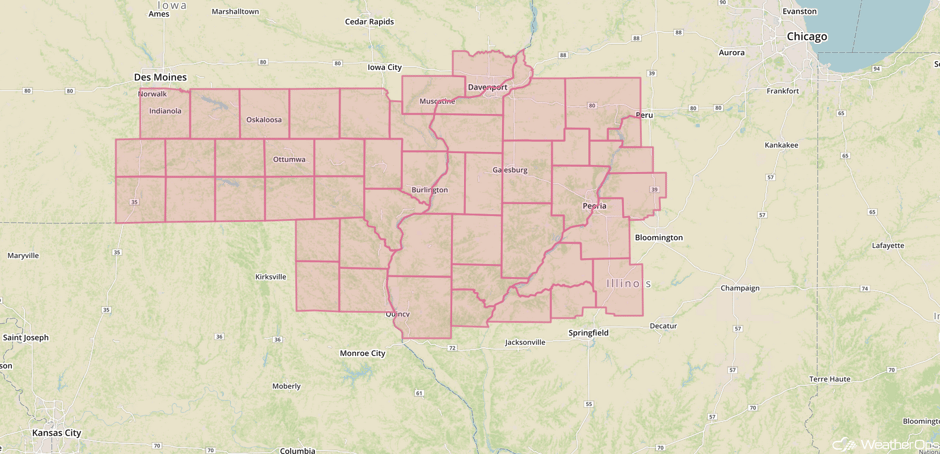 Severe Thunderstorm Watch
Update 1:50pm CDT: Severe thunderstorms capable of damaging winds south of Kansas City.
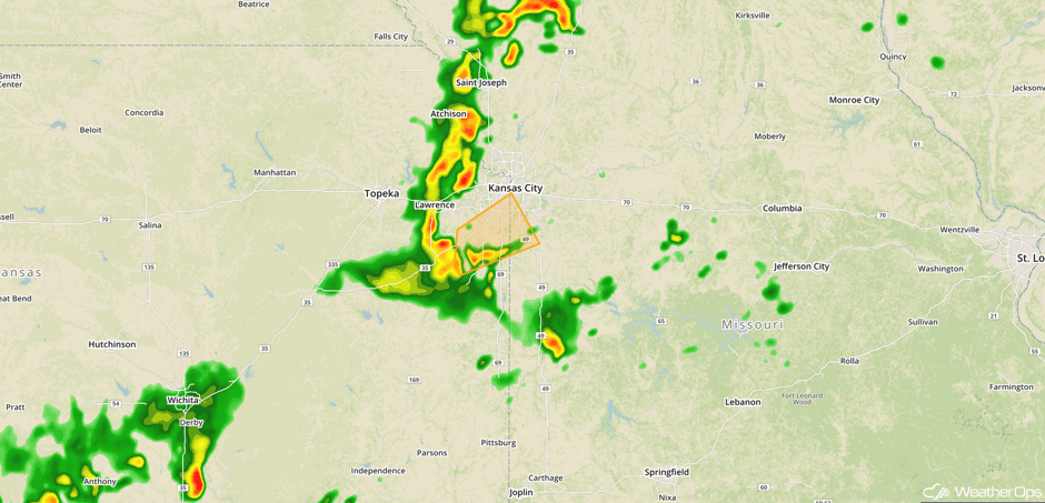 Radar 1:50pm CDT
Major Cities in Region: Amarillo, TX, Oklahoma City, OK, Dallas, TX, Tulsa, OK, Omaha, NE, Kansas City, MO, Des Moines, IA, St. Louis, MO, Chicago, IL, Indianapolis, IN
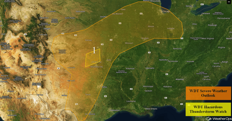 Region 1
Excessive Rainfall Possible from Central Plains to Mid-Mississippi Valley on Wednesday
In addition to the severe weather potential described above, there will also be a potential for heavy rainfall from southeast Colorado northeastward toward the Iowa-Missouri border. Some areas may receive multiple rounds of showers and thunderstorms for some locations, with most of the activity occurring from late afternoon into the evening and overnight hours along and near a frontal boundary as an area of low pressure slowly moves eastward. Rainfall amounts of 1-2 inches with isolated higher amounts in excess of 3 inches are expected.
Major Cities in Region: Dodge City, KS, Topeka, KS, Kansas City, MO
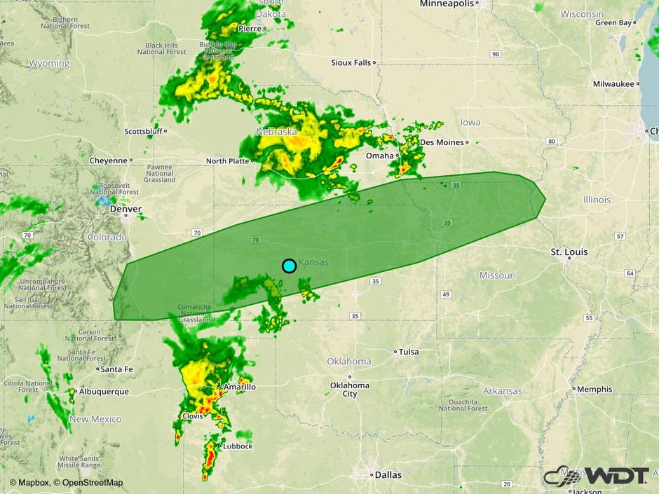 Excessive Rainfall Outline for Wednesday
Strong to Severe Thunderstorms from the Great Plains to Mid Atlantic on Thursday
The upper level low described above will transition into an open trough on Thursday as it moves out of the Plains and into the Ohio Valley. An area of low pressure and its associated fronts will be the focus for the development of thunderstorms across the region. Some thunderstorms may be ongoing during the morning hours, but more robust thunderstorm development is expected during the afternoon and evening. Strong to severe thunderstorms will be possible throughout the region, with large hail and damaging winds the primary hazards. A low tornado threat may exist with some of the stronger storms.
Major Cities in Region: San Antonio, TX, Oklahoma City, OK, Dallas, TX, Tulsa, OK, Little Rock, AR, St. Louis, MO, Evansville, IN, Louisville, KY, Charleston, WV, Raleigh, NC
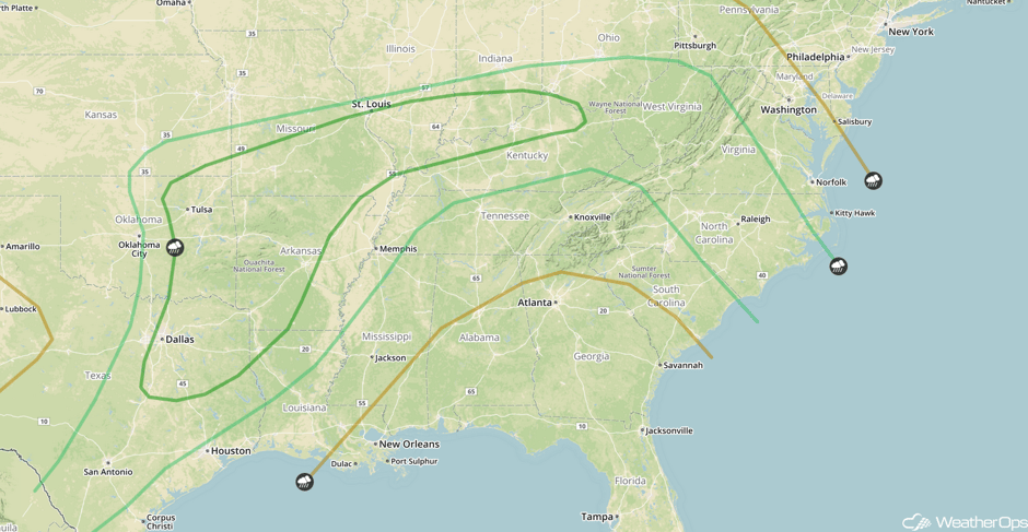 SPC Convective Outlook for Thursday
Excessive Rainfall Thursday for Ohio Valley and Central Appalachians
Scattered to widespread showers and thunderstorms are forecast to develop across portions of the Ohio Valley and central Appalachians on Thursday as an area of low pressure tracks southeastward along a nearly stalled front. Forecast rain amounts of 0.75-1.50 inches with locally higher amounts of 2.50 inches are expected. The highest amounts will be likely over the Appalachians.
Major Cities in Region: Cincinnati, OH, Charleston, WV
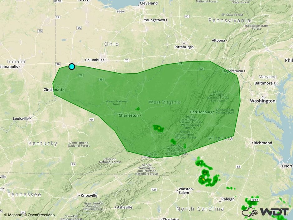 Excessive Rainfall Risk Outline for Thursday
Thunderstorm Potential across the Southeast on Friday
A cold front is forecast to move into the Southeast on Friday, with thunderstorms developing along and ahead of it during the afternoon and evening. As instability increases with daytime heating, there will be a potential for a few strong to severe thunderstorms, with gusty winds and hail the primary hazards.
Major Cities in Region: Baton Rouge, LA, Jackson, MS, Birmingham, AL, Montgomery, AL, Atlanta, GA, Charlotte, NC
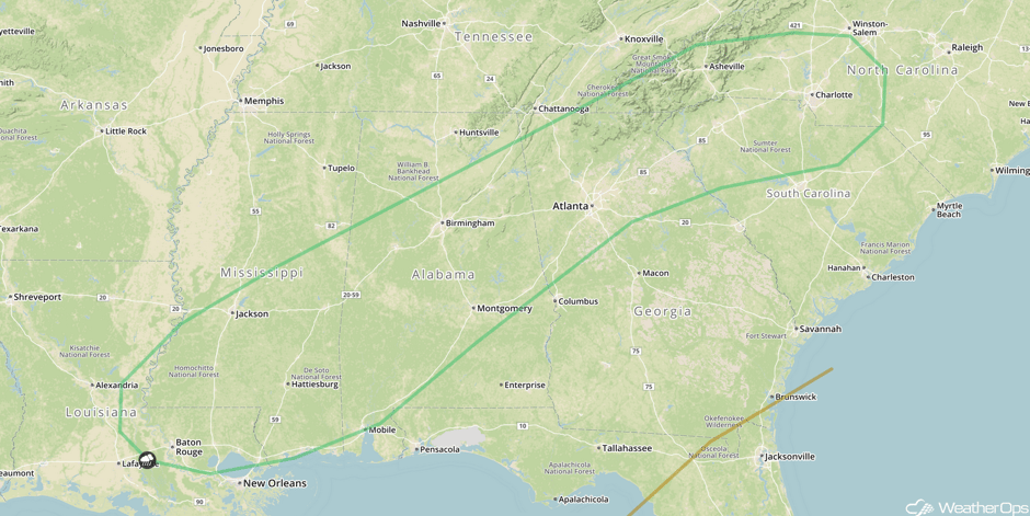 SPC Convective Outlook for Friday
Excessive Rainfall Friday for the Central Appalachians
Showers and thunderstorms are forecast to continue across the central Appalachians on Friday as an area of low pressure remains nearly stationary. General rainfall amounts of 0.75-1.50 inches with isolated higher amounts in excess of 2.50 inches are expected. Rain will begin to decrease in intensity after sunset. An increased risk of flooding or runoff may develop for areas that receive heavy rains on both Thursday and Friday.
Major Cities in Region: Charleston, WV, Roanoke, VA
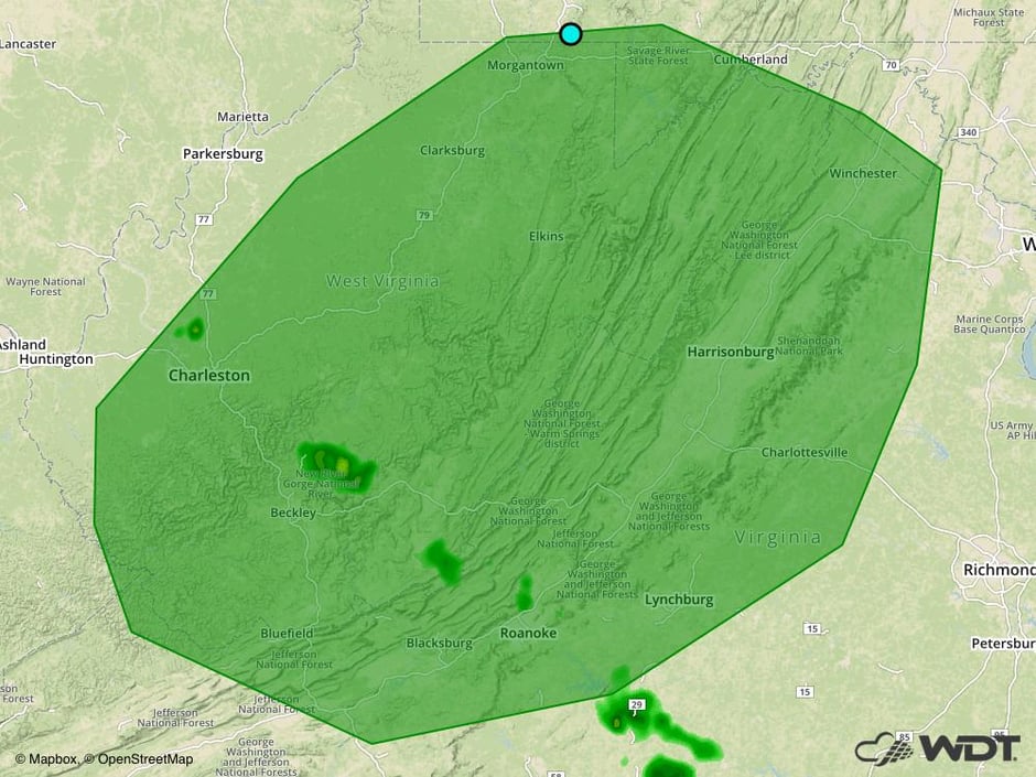 Excessive Rainfall Risk Outline for Friday
A Look Ahead
An area of low pressure will develop in the lee of the Rockies early next week, bringing a risk for thunderstorms to portions of the Northern Plains on Monday, This risk will shift southward across portions of the Southern Plains on Tuesday.
This is just a brief look at current weather hazards. We can provide you site-specific weather forecast information for the purpose of protecting your personnel and assets and to assess your weather risk. Try a 7-day demo right away and learn how timely precision weather information can enhance your bottom line.


