


by David Moran, on Mar 7, 2018 10:23:47 AM
Snow will continue for much of the Northeast through Friday as an area of low pressure develops into a strong Nor'Easter off the East Coast. Elevated winds and seas will continue for portions of the Gulf of Mexico through early Wednesday afternoon. Snow will continue for portions of Michigan on Wednesday in association with a weak area of low pressure.
- Winter Storm for the Northeast through Friday
- Elevated Winds and Seas Continue through Early Wednesday Afternoon for Portions of the Gulf of Mexico
- Snow Continuing for Portions of Michigan on Wednesday
 US Hazards

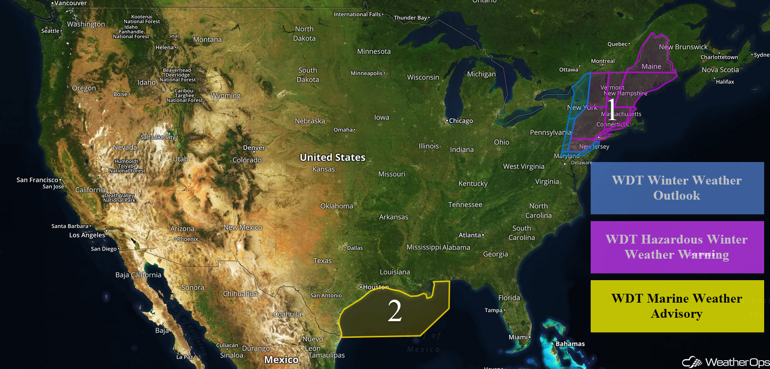
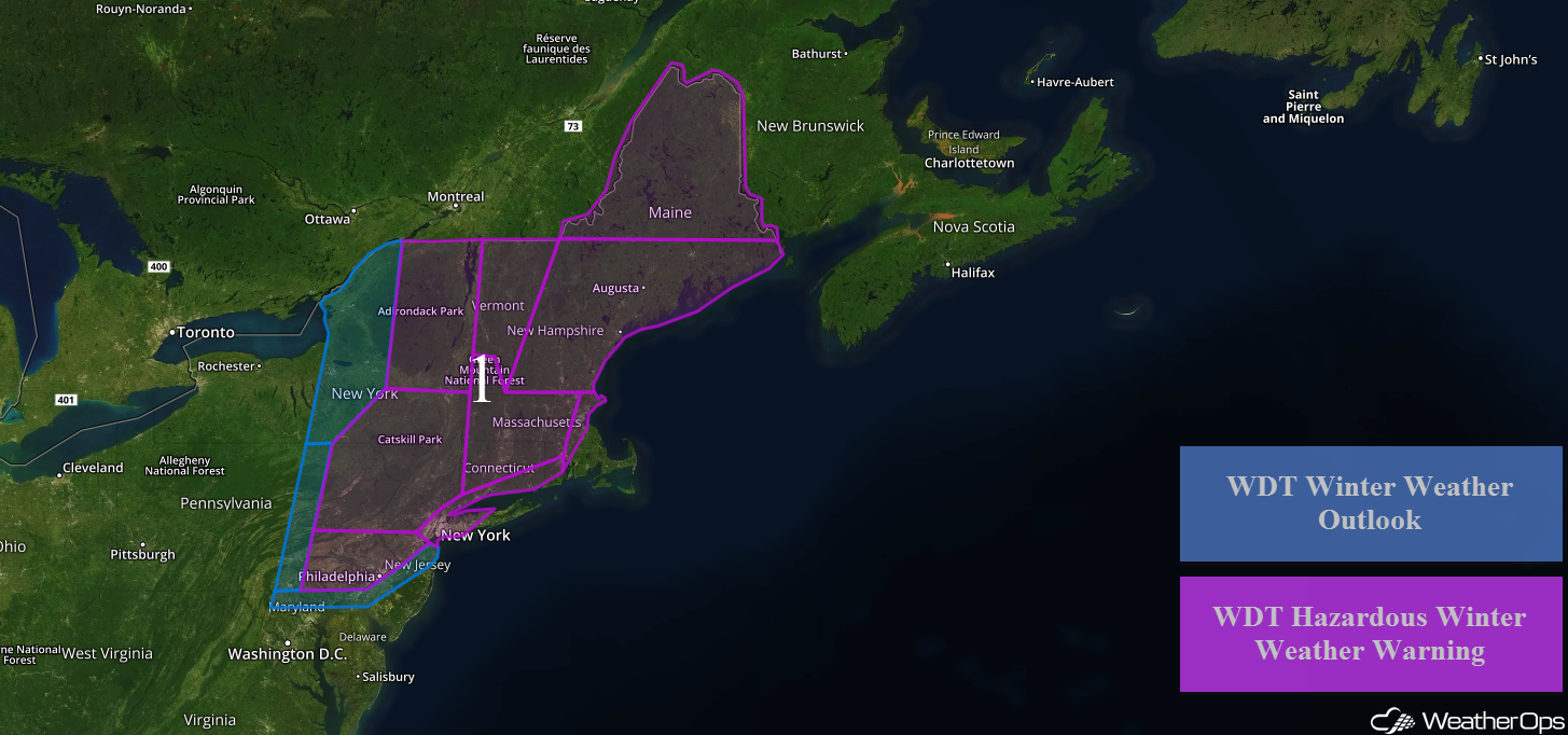
Winter Storm for the Northeast through Friday
An area of low pressure moving offshore the Mid Atlantic coast will bring heavy snowfall to much of the Northeast as the system intensifies rapidly. Across portions of Pennsylvania, eastern New York, Connecticut, Massachusetts, Rhode Island, and Vermont, snowfall totals through Friday will range 6-14 inches with locally heavier amounts. Further north across portions of Vermont, New Hampshire, and Maine, snow accumulations of 8-16 inches are forecast with locally higher amounts in excess of 2 feet in the higher elevations. Areas along the coast may see lower totals. Winds of 15-25 mph with gusts in excess of 40 mph will allow for blowing snow and whiteout conditions; visibilities may be less than a quarter mile at times.
Along the coast, winds will range 30-40 mph with gusts in excess of 50 mph, allowing for high seas. Seas of 15-25 feet are forecast along the Mid Atlantic and Northeast coasts.
Travel disruptions are already occurring across the Northeast. More than 1,700 flights have been cancelled as of Wednesday morning. Major hubs such as New York and Boston are being impacted.
Major Cities in Region: Syracuse. NY, Philadelphia, PA, Albany, NY, New York City, NY, Boston, MA, Portland, ME, Augusta, ME, Caribou, ME
 Region 1
Elevated Winds and Seas Continue through Early Wednesday Afternoon for Portions of the Gulf of Mexico
Elevated winds and seas will continue for portions of the Gulf of Mexico through Wednesday as a result of high pressure building into the Southern Plains. Winds will be northerly at 20-28 knots with gusts in excess of 32 knots. Seas will range 6-8 feet in the deeper waters and 3-5 feet near the shore.
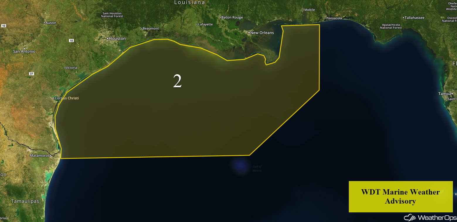 Region 2
Snow Continuing for Portions of Michigan on Wednesday
Lake effect snow will continue for portions of Michigan in response to a weakening area of low pressure. Snowfall accumulations of 2-4 inches with locally higher amounts in excess of 6 inches are forecast..
Major Cities in Region: Marquette, MI, Lansing, MI, Detroit, MI
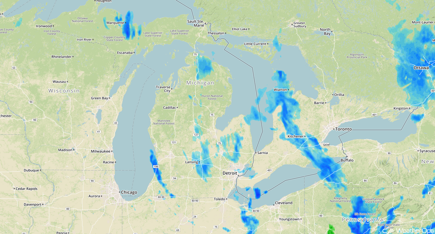 Radar 10:10am EST
A Look Ahead
Light snow may develop across the Northern Rockies on Saturday as an upper level system moves across the region. On Saturday, an area of low pressure will develop across the Southern Plains, bringing the potential for showers and thunderstorms. As this system moves eastward, showers and thunderstorms may develop over the Tennessee and Ohio Valleys on Sunday. Some snow may develop Sunday across the Appalachians.
That is a brief look at current weather hazards. We can provide you site-specific weather forecast information to protect your staff and assets and to assess your weather risk. Try a 7-day demo right away and learn how timely precision weather information can enhance your bottom line.
