National Weather Summary for Wednesday, June 7, 2017
by David Moran, on Jun 7, 2017 10:47:09 AM
Building instability across the High Plains today will result in the development of thunderstorms. A stalled front will be the focus for the potential of thunderstorms across the Upper Mississippi Valley. Heavy to excessive rainfall will continue across the Southeast throughout the day on Wednesday.
- Thunderstorm Potential for the High Plains into the Upper Midwest on Wednesday
- Thunderstorms Continue for Portions of Florida on Wednesday
- Excessive Rainfall to Continue across the Southeast on Wednesday
- Thunderstorms Continue Thursday for the High Plains
- Potential for Thunderstorms across the Northern Plains on Friday
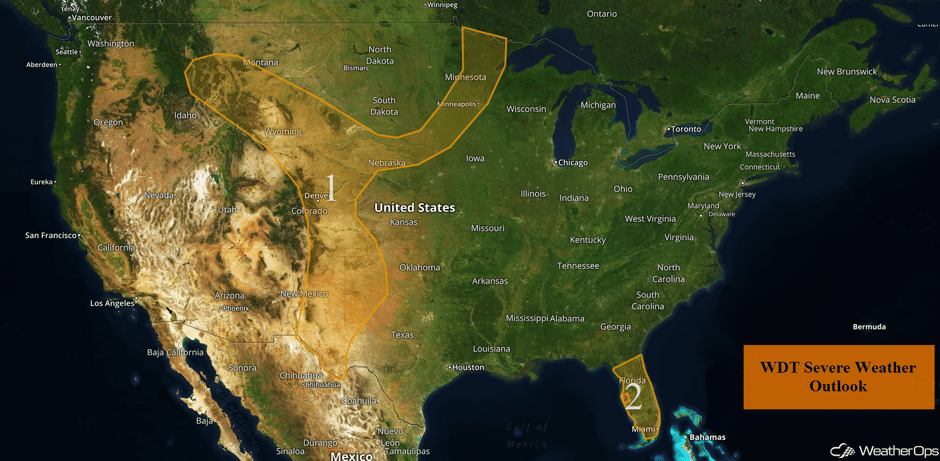 US Hazards
Thunderstorm Potential for the High Plains into the Upper Midwest on Wednesday
Plentiful moisture overspreading the high terrain of the Central and Western US will provide an environment favorable for the development of thunderstorms during the day. This activity is expected ahead of a cold front extending from Minnesota into the Northern Plains and into the Rockies. While wind shear is weak, most activity is expected to remain below severe limits, a few storms may produce some strong winds or small hail. Activity should weaken as the sun sets, but a few storms may linger into the evening.
Major Cities in Region: Helena, MT, Billings, MT, Cheyenne, WY, Denver, CO, Odessa, TX, Lubbock, TX, Amarillo, TX, Sioux Falls, SD, International Falls, MN, Minneapolis, MN, Duluth, MN
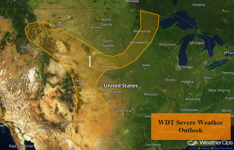 Region 1
Thunderstorms Continue for Portions of Florida on Wednesday
Thunderstorms will continue for much of Florida on Wednesday as an area of low pressure and cold front slowly progresses across the region. Overall conditions will be limited for severe weather due to ongoing cloud cover and precipitation, but a few strong wind gusts and a brief tornado or two will be possible.
Update 12:25pm EDT: Severe thunderstorm capable of damaging winds SE of Sarasota, FL.
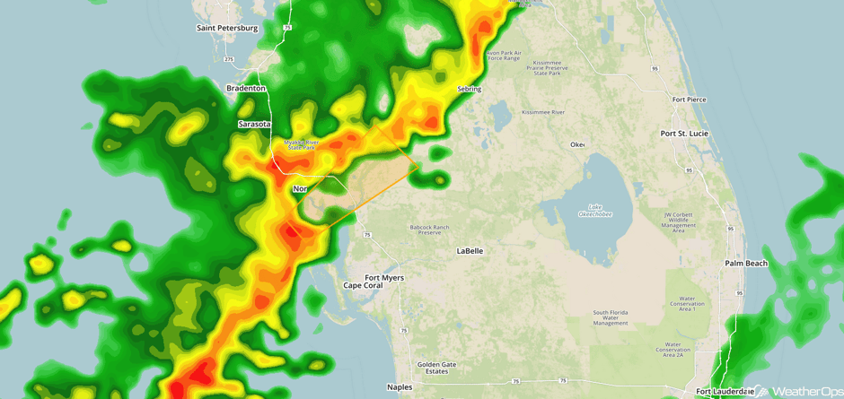 Radar 12:25pm EDT
Update 1:10pm EDT: Severe thunderstorms capable of damaging winds approaching Cape Coral, FL.
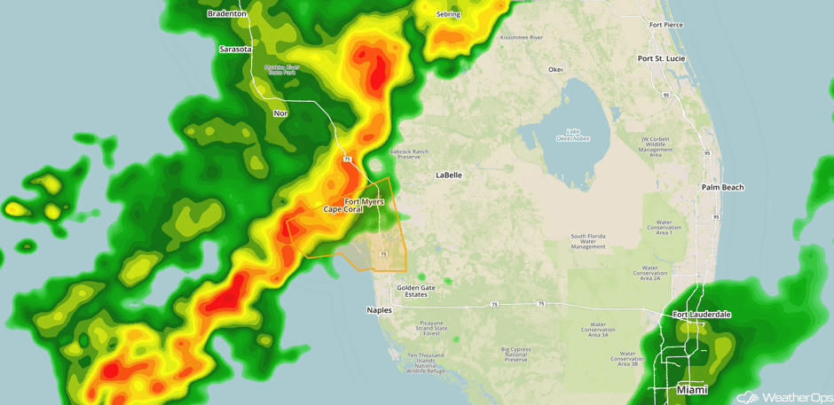 Radar 1:10pm EDT
Update 2:37pm EDT: Severe thunderstorms capable of damaging winds approaching Naples, FL.
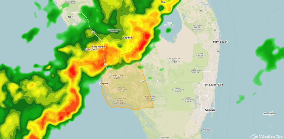 Radar 2:37pm EDT
Major Cities in Region: Tampa, FL, Orlando, FL, Jacksonville, FL, Miami, FL
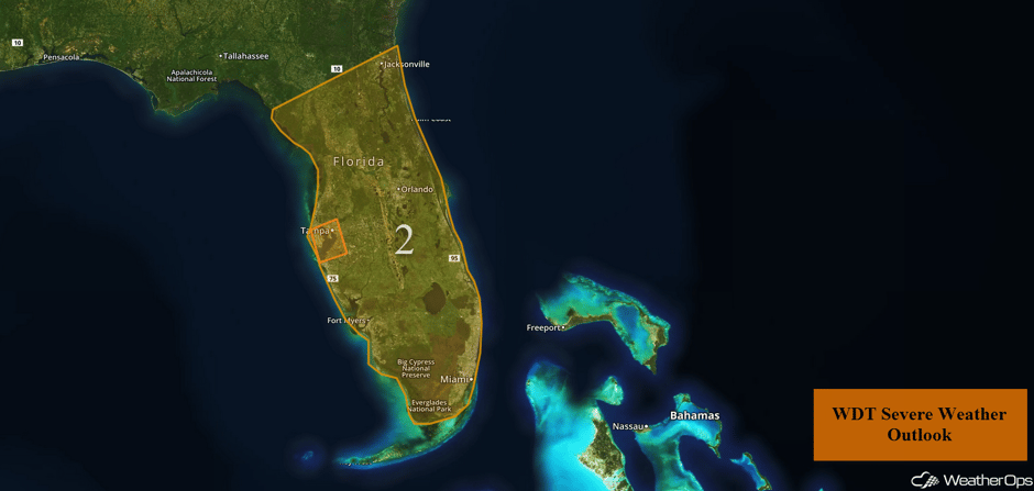 Region 2
Excessive Rainfall to Continue across the Southeast on Wednesday
Heavy to excessive rainfall is likely across the Southeast on Wednesday, especially across South Florida. Rich, tropical moisture will be present across the region with showers and thunderstorms expected to the east of an area of low pressure in the eastern Gulf of Mexico. Total rainfall accumulations of 2-3 inches with locally heavier amounts in excess of 5 inches are possible with the strongest storms.
Major Cities in Region: Tampa, FL, Orlando, FL, Miami, FL, Jacksonville, FL, Savannah, GA, Charleston, SC
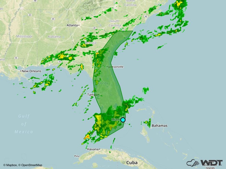 Excessive Rainfall Risk Outline for Wednesday
Thunderstorms Continue Thursday for the High Plains
Thunderstorms are expected once again on Thursday across the High Plains. Moisture advection and strong daytime heating will allow instability to build into the afternoon. Strong winds aloft will help sustain thunderstorm development. Strong winds and large hail will be the primary hazards with any storms that develop. These storms will continue into the evening and overnight hours.
Major Cities in Region: Billings, MT, Cheyenne, WY, Denver, CO, Amarillo, TX, Pierre, SD, Rapid City, SD
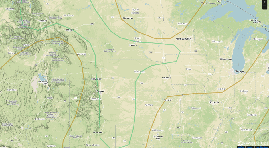 SPC Convective Outlook for Thursday
Potential for Thunderstorms across the Northern Plains on Friday
Enough moisture will be available to the north of a warm front to allow for the development of strong to severe thunderstorms across portions of the Northern Plains Friday afternoon and evening. Surface heating will increase instability while a strong jet stream provides the upper level support for the development of thunderstorms. Large hail and damaging winds will be the primary hazards with any storm that develops.
Major Cities in Region: Minot, ND, Bismarck, ND, Grand Forks, ND, Fargo, ND
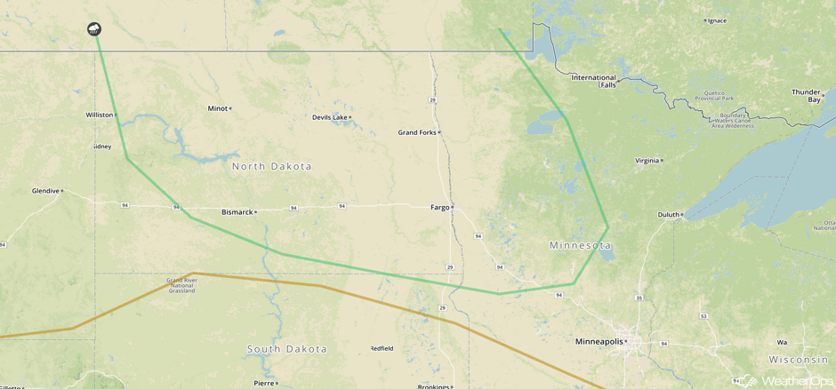 SPC Convective Outlook for Friday
A Look Ahead
By Saturday, the severe weather threat will shift northward with the advancement of a surface low and warm front. Large hail and damaging winds will be the primary hazards with any storms. A new area of low pressure will develop in the lee of the Rockies on Sunday, bringing a risk for thunderstorms across portions of the Central Plains. Thunderstorms will continue across the Plains and spread into the Midwest Monday and Tuesday.
This is just a brief look at current weather hazards. We can provide you site-specific weather forecast information for the purpose of protecting your personnel and assets and to assess your weather risk. Try a 7-day demo right away and learn how timely precision weather information can enhance your bottom line.


