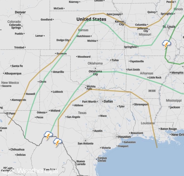
National Weather Summary for Wednesday, June 15, 2016
by David Moran, on Jun 15, 2016 11:33:24 AM
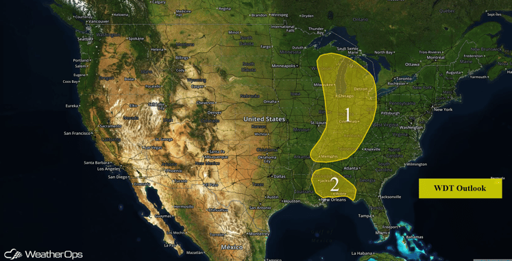
Strong to severe thunderstorms are possible Wednesday from the Great Lakes through the Ohio and Tennessee Valleys, as well as across portions of the Northern Rockies and Southern Plains. There is a potential for heavy rainfall across the Deep South. On Thursday, as an area of low pressure and cold front continue to progress eastward, strong to severe thunderstorms are possible for the Ohio Valley through the Southeast as well as Missouri into the Tennessee Valley. As the cold front approaches the Gulf Coast on Friday, thunderstorm development will be possible across the Southeast. An area of low pressure moving through the Northern Plains will allow for the development of thunderstorms across the region.
US Hazards
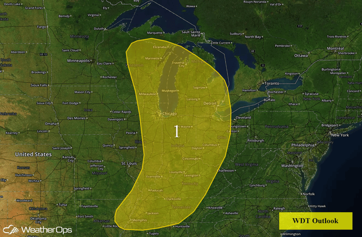
Region 1
A shortwave trough over the Midwest will allow for the development of isolated to scattered showers and thunderstorms from Minnesota southward into the Missouri Bootheel. Environmental conditions should limit potential impacts to damaging winds and isolated large hail. Expect mid to late afternoon storm development with activity gradually weakening after dark.
Region 1
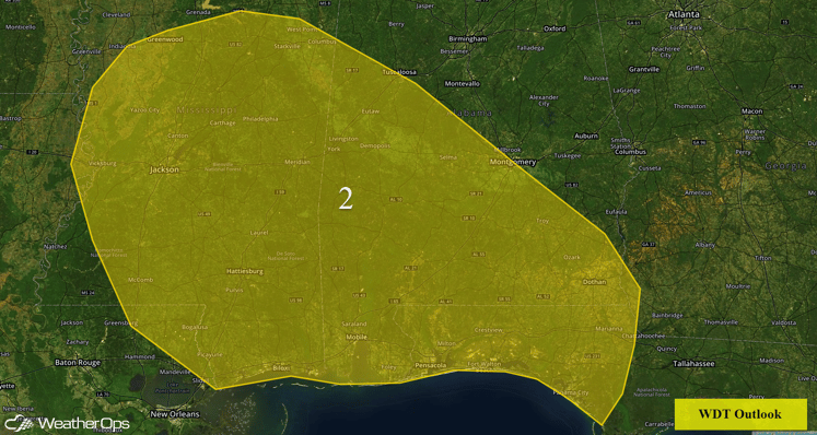
Region 2
A weak upper level disturbance will move over the Southeast today. Plentiful moisture is in place across Region 2. Periods of slow moving showers and thunderstorms are possible throughout the day with rainfall totals in excess of an inch possible through Thursday morning. Some areas could experience minor flooding and local runoff.
Region 2
Strong to Severe Thunderstorms Possible on Wednesday for Northern Rockies
A weak low pressure system and moisture flowing into the Northern Rockies is expected to promote late day thunderstorm development around Montana. As the low level jet intensifies during the evening, it should promote thunderstorm development with high based storms expected. Large hail will be the primary risk, with a low chance for some damaging wind gusts.
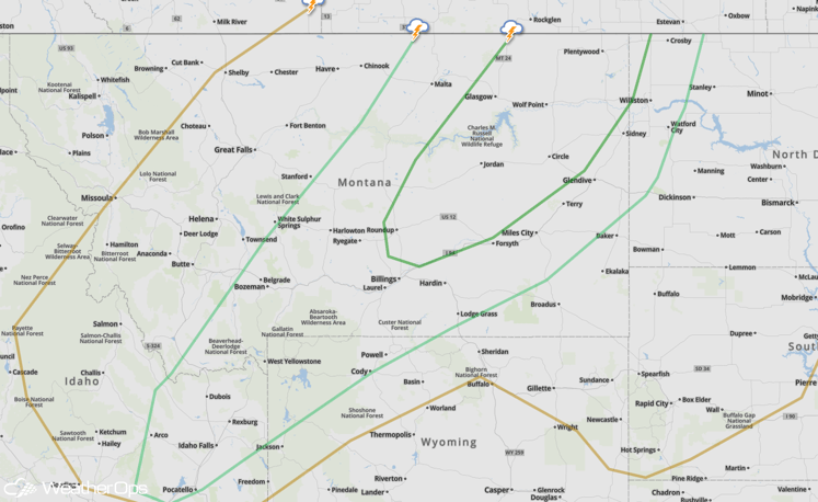
SPC Convective Outlook for Wednesday
Strong to Severe Thunderstorms Possible for Southern Plains on Wednesday
Very moist conditions with large amounts of instability and daytime heating should be sufficient for the development of strong to severe thunderstorms capable of large hail and damaging winds. Storms will begin to weaken and dissipate through the evening and nighttime hours.
SPC Convective Outlook for Wednesday
Strong to Severe Thunderstorms Possible Thursday from Ohio Valley through Southeast
An area of low pressure and trailing cold front will allow for a large area of thunderstorm development across the Eastern US on Thursday. For the Ohio Valley through the the Atlantic and Gulf Coastlines, thunderstorms are expected to resume during the afternoon. Initially, some supercells capable of large hail and damaging winds are possible, but the storms should quickly cluster out and form line segments with damaging winds being the primary threat. Areas of heavy rainfall may also be possible with precipitation totals of 1-3 inches expected across Pennsylvania to Virginia.
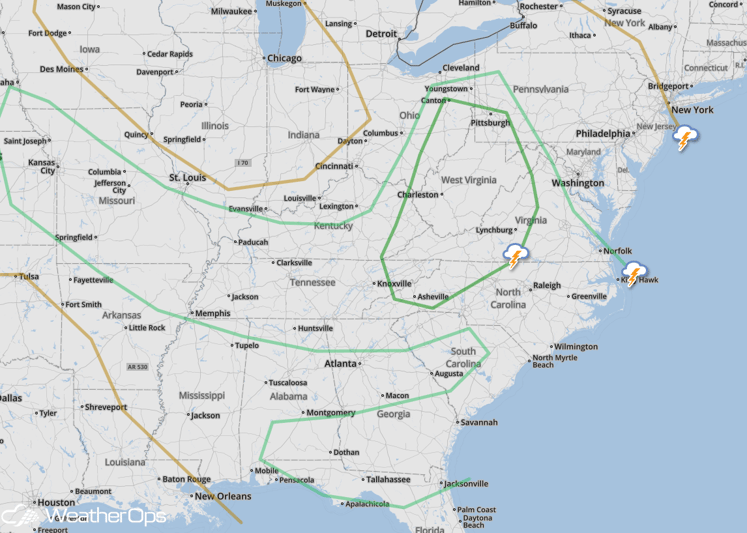
SPC Convective Outlook for Thursday
Strong to Severe Thunderstorms Possible Thursday from Missouri to Tennessee Valley
Thunderstorm development ahead of a cold front is expected across this region. Supercells capable of damaging winds and large hail will be the primary threats.
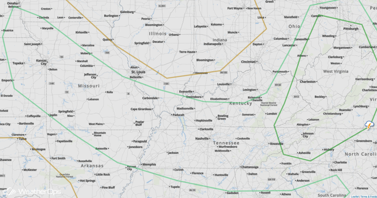
SPC Convective Outlook for Thursday
Strong to Severe Thunderstorms Possible Across Southeast on Friday
As a cold front approaches the Gulf Coastline from the low pressure moving offshore, thunderstorm activity ahead of this boundary will be likely. Moderate instability is expected along with high moisture, leading to thunderstorms capable of producing damaging winds.
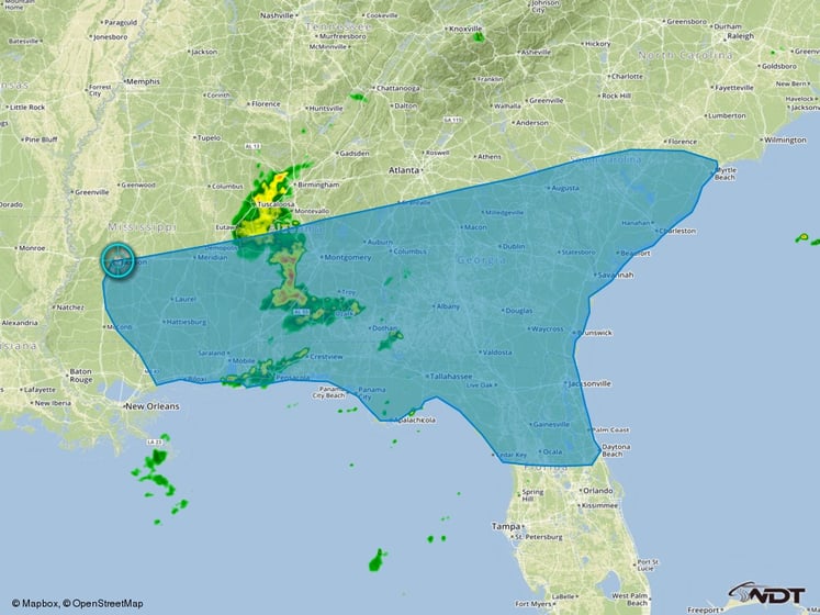
Thunderstorm Risk Outline for Friday
Strong to Severe Thunderstorms Possible for Northern Plains on Friday
A low pressure system in the Northern Plains will promote thunderstorm activity across the region on Friday. Although widespread severe thunderstorms are not likely, at least a few stronger thunderstorms with hail and some strong winds will be possible.
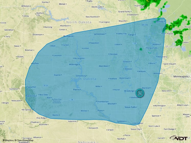
Thunderstorm Risk Outline for Friday


