National Weather Summary for Wednesday, July 20, 2016
by David Moran, on Jul 20, 2016 10:33:28 AM
A warm front moving northward across the Northern Plains and into Wisconsin will aid in the development of thunderstorms across the region on Wednesday. The severe weather potential will shift eastward across the Great Lakes on Thursday. Across the Southeast, isolated to scattered thunderstorm activity will be possible along and ahead of a stalled front. A frontal boundary moving into the Northeast and Great Lakes on Friday will allow for thunderstorms extending from the Northeast into the Ohio Valley. Further west, an area of low pressure developing over the Northern Rockies will allow for strong to severe thunderstorms to portions of the Northern Plains.
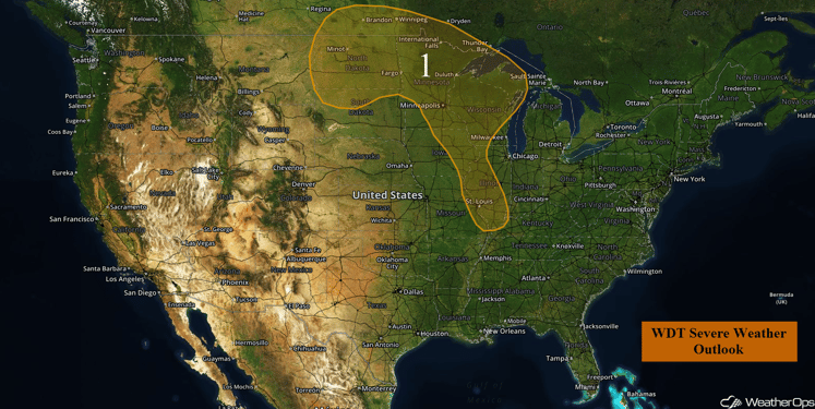
US Hazards
Region 1
High pressure over the Central US will limit severe weather chances to the Northern Plains as well as for areas extending from the Upper Midwest southward into the Mid Mississippi Valley. Large hail and severe winds will be the primary hazards along with a low tornado threat.
Major Cities in Region: Minot, ND, Minneapolis, MN, St. Louis, MO
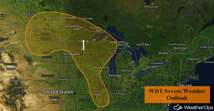
Region 1
Strong to Severe Thunderstorms Possible Thursday for Great Lakes
The severe weather potential will shift into the Great Lakes on Thursday as instability builds across the region. Showers and thunderstorms will likely be ongoing during the morning across northern Wisconsin, with activity becoming strong to severe during the afternoon and evening hours across eastern Wisconsin and Lower Michigan. Large hail and damaging winds will be possible with any storms that become severe.
Major Cities in Region: Green Bay, WI, Milwaukee, WI, Lansing, MI
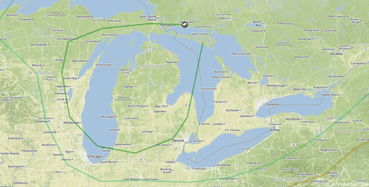
SPC Convective Outlook for Thursday
Strong to Severe Thunderstorms Possible Across the Southeast on Thursday
Isolated to scattered shower and thunderstorm activity can be expected across much of the Southeast on Thursday during the afternoon hours. Overall coverage should be limited, however, some isolated cells could produce an isolated damaging wind gust before the activity diminishes at sunset.
Major Cities in Region: Jackson, MS, Mobile, AL, Birmingham, AL, Atlanta, GA, Tallahassee, FL, Columbia, SC
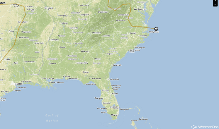
SPC Convective Outlook for Thursday
Update 12:34pm CDT: Thunderstorms are developing across portions of the Southeast. Damaging winds will be the main hazard with these storms.
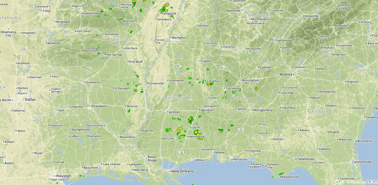
Radar 12:34pm CDT
Strong to Severe Thunderstorms Possible Friday from the Northeast into the Ohio Valley
Strong to severe thunderstorms are possible Friday across portions of the Northeast into the Ohio Valley as a front moves into the region, with ongoing showers and thunderstorms possible in the Northeast during the morning hours, posing a risk for strong wind gusts. Additional thunderstorms capable of hail and damaging winds will be possible during the afternoon.
Major Cities in Region: Detroit, MI, Chicago, IL, Cleveland, OH, Philadelphia, PA
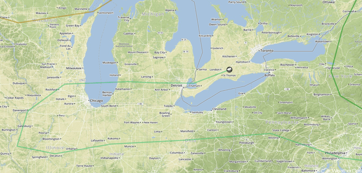
SPC Convective Outlook for Friday
Strong to Severe Thunderstorms Possible for the Northern Plains on Friday
There will be a chance for strong to severe thunderstorms across portions of the Northern Plains on Friday as a low pressure system begins to develop. Thunderstorms will develop across the higher terrain of Wyoming and Montana with large hail, damaging winds, and tornadoes possible. Into the evening and overnight hours, a thunderstorm complex is expected to track across the region with damaging winds being the primary hazard. In addition to the severe threat, there will be a risk for excessive rainfall leading to localized flooding. Rainfall amounts of 1-2 inches with locally higher amounts in excess of 3 inches will be possible.
Major Cities in Region: Bismarck, ND, Fargo, ND
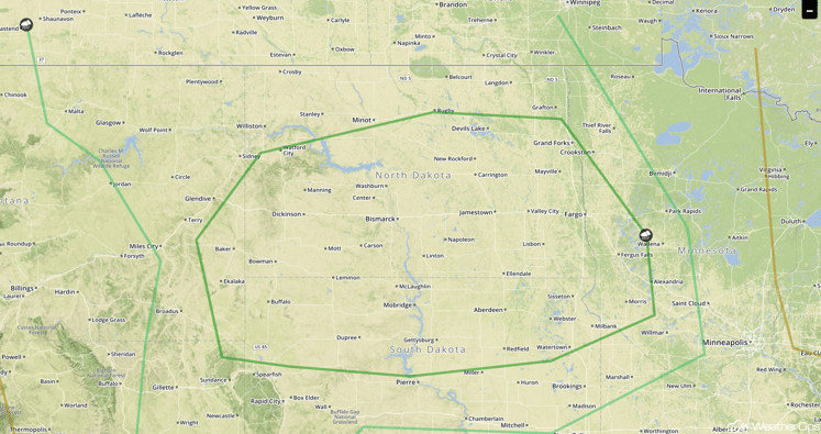
SPC Convective Outlook for Saturday
This is just a brief look at current weather hazards. We can provide you site-specific forecast information for the purpose of protecting your personnel and assets. Try a 7-day demo right away and learn how timely precision weather information can enhance your bottomline.


