National Weather Summary for Wednesday, July 12, 2017
by David Moran, on Jul 12, 2017 9:38:34 AM
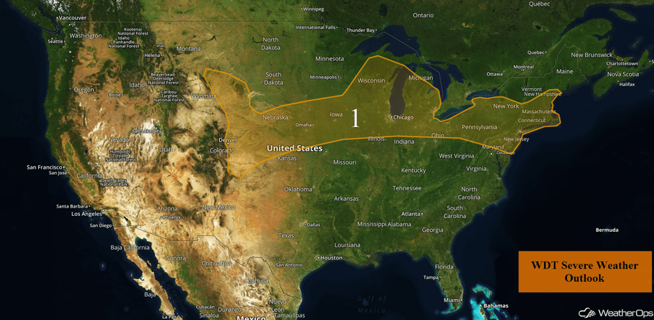
Thunderstorms and excessive rainfall may develop across the Great Lakes and Northeast Wednesday ahead of a cold front. Upslope flow will allow for the potential for thunderstorms across the Central and High Plains on Wednesday.
- Thunderstorm Potential from the High Plains through Northeast on Wednesday
- Thunderstorms from the Central Plains to the Northeast on Thursday
- Strong to Severe Thunderstorms Possible Friday from the Missouri Valley to the Northeast
 US Hazards
Thunderstorm Potential from the High Plains through Northeast on Wednesday
A slow moving front stretching from the Front Range and High Plains eastward through the Great Lakes and into the Northeast will provide a focus for thunderstorm development across the region today. An eastward moving upper level disturbance will help enhance the thunderstorms, allowing for a threat of thunderstorms across the region. Some strong to severe thunderstorms are currently ongoing in the vicinity of Lake Michigan with additional activity possible this afternoon and evening. Large hail and damaging winds will be the primary hazards. The highest severe threat will be over the Great Lakes where there will be a threat for a few tornadoes.
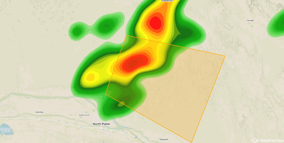
Update 10:06am CDT: Severe thunderstorm capable of hail and damaging winds north of North Platte, NE.
 Radar 10:06am CDT
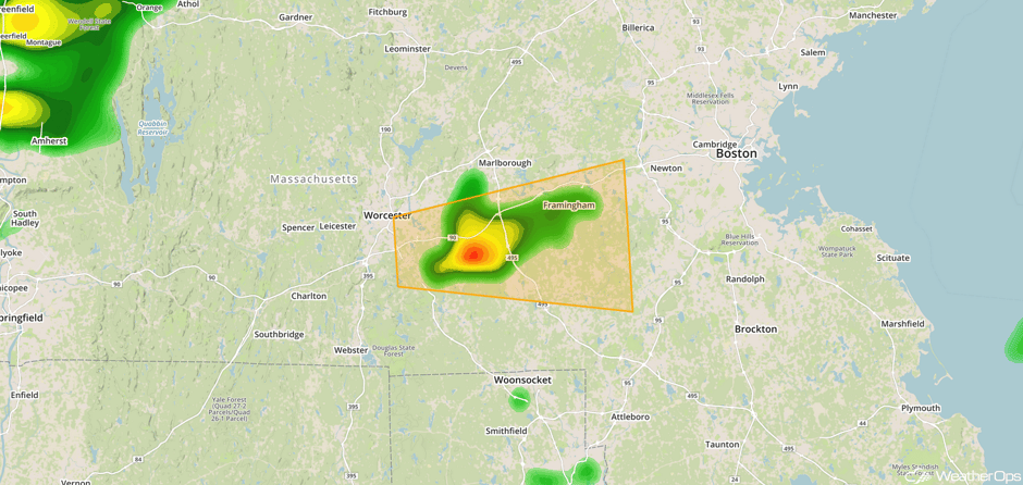
Update 12:49pm EDT: Severe thunderstorm capable of large hail and damaging winds SW of Boston, MA.
 Radar 12:49pm EDT
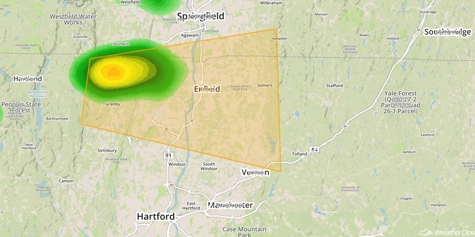
Update 12:56pm EDT: Severe thunderstorm capable of hail and damaging winds north of Hartford, CT.
 Radar 12:56pm EDT
Update 1:57pm EDT: Severe thunderstorm capable of producing large hail and damaging winds north of Lafayette, IN.
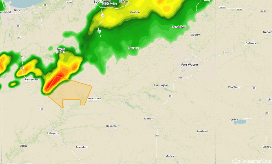 Radar 1:57pm EDT
Update 2:05pm EDT: Tornado warned storm near Monticello, IN.
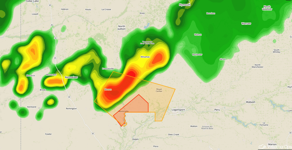 Radar 2:05pm EDT
Update 1:27pm CDT: Severe thunderstorm developing west of Tekamah, NE. Large hail will be the primary hazard.
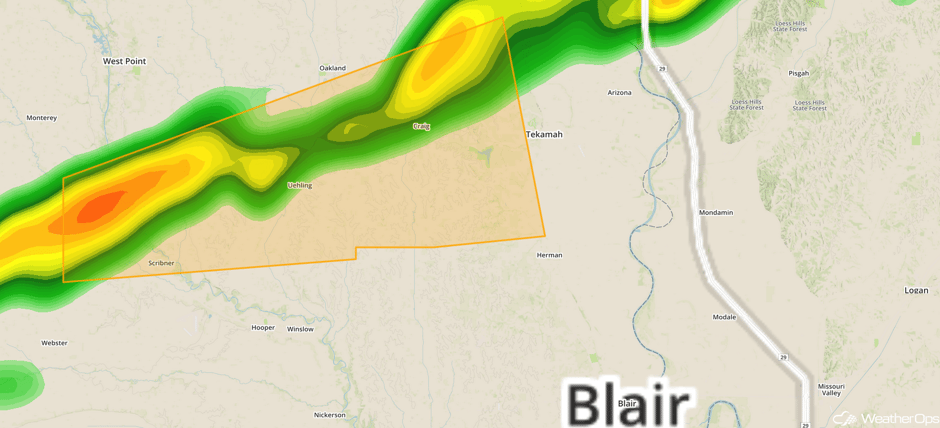 Radar 1:27pm CDT
Major Cities in Region: Denver, CO, Cheyenne, WY, Omaha, NE, Des Moines, IA, Green Bay, WI, Milwaukee, WI, Chicago, IL, Detroit, MI, Cleveland, OH, Pittsburgh, PA, Philadelphia, PA, New York, NY, Boston, MA
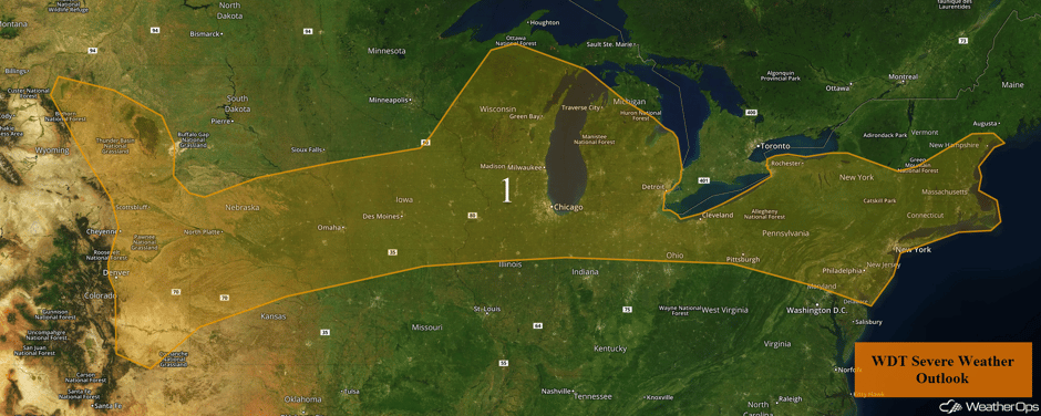 Region 1
Thunderstorms from the Central Plains to the Northeast on Thursday
There will be a risk for strong to severe thunderstorms along and south of a frontal boundary stretching from the Northeast southwestward into the Mid-Missouri Valley. Southerly flow will continue to bring ample moisture northward. Combined with daytime heating, instability will build throughout the day. A few scattered strong to severe thunderstorms may develop with hail and damaging winds becoming the primary hazards.
Major Cities in Region: Denver, CO, Cheyenne, WY, Wichita, KS, Kansas City, MO, St. Louis, MO, Chicago, IL, Indianapolis, IN, Columbus, OH, Pittsburgh, PA, Philadelphia, PA, New York, NY
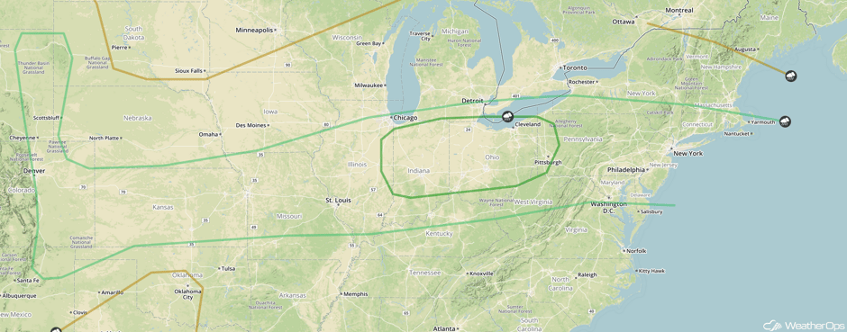 SPC Convective Outlook for Thursday
Strong to Severe Thunderstorms Possible Friday from the Missouri Valley to the Northeast
Thunderstorms may develop from the Missouri Valley to the Northeast on Friday along and ahead of a cold front stretching from the Northeast into the Mid-Missouri Valley. Southerly flow will continue to bring ample moisture northward. With daytime heating, instability will be sufficient for the development of strong to severe thunderstorms. Hail and damaging winds will be the primary hazards with the stronger storms.
Major Cities in Region: Nashville, TN, Louisville, KY, Pittsburgh, PA, Washington, DC. Philadelphia, PA, New York, NY
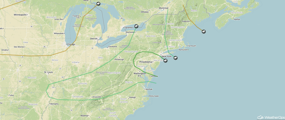 SPC Convective Outlook for Friday
A Look Ahead
Scattered showers and thunderstorms are forecast across the Southeast and central Gulf states on Saturday along a stalled front. A tropical wave will bring showers and thunderstorms as ample tropical moisture spreads from the eastern Gulf into the central and western Gulf of Mexico. This activity will continue into early next week.
This is just a brief look at current weather hazards. We can provide you site-specific weather forecast information for the purpose of protecting your personnel and assets and to assess your weather risk. Try a 7-day demo right away and learn how timely precision weather information can enhance your bottom line.


