National Weather Summary for Wednesday, January 4, 2017
by David Moran, on Jan 4, 2017 11:20:17 AM
Snow will continue across the Northeast on Wednesday as an area of low pressure tracks northeastward. An area of low pressure over the Intermountain West will allow for light to moderate, possibly heavy at times, snow across the Central Rockies Wednesday into Thursday.
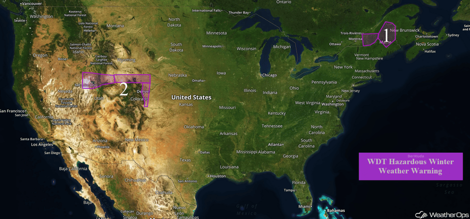 US Hazards
Region 1
An area of low pressure will continue to track into the Northeast through the day on Wednesday, bringing wintry precipitation to the region. Light snow will continue to spread over Northern Maine and increase in intensity. Snow will taper off from west to east Wednesday afternoon as a cold front moves through the region. Total snow accumulations of 4-8 inches will be common.
Major Cities in Region: Caribou, ME
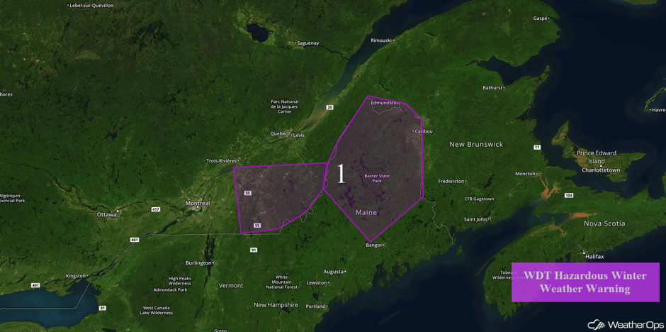 Region 1
Region 2
An area of low pressure is forecast to develop over the Intermountain West on Wednesday and track into the central Rockies through Thursday. Light to moderate snowfall has started to fall and will be heavy at times. Cold air in place will allow snow to fall in the valleys with snowfall amounts of 4-8 inches and locally higher amounts expected across northern Utah. Over a foot of snow is likely over the higher terrain. Across southern Wyoming, snow accumulations of 6-10 inches, with isolated higher amounts in excess of 12 inches, are forecast. Along the Front Range of Colorado, snow accumulations of 4-6 inches with locally higher amounts in excess of 8 inches will be possible. Wind chills of -10 to -5 are also expected. Snow will taper off from north to south by Thursday afternoon as a cold front pushes through the region.
Major Cities in Region: Salt Lake City, UT, Denver, CO, Cheyenne, WY
Look at that snow comin down in the 'boat! It will start getting harder here in Denver during the early afternoon. @skisteamboat #cowx #kdvr pic.twitter.com/juQpAGeV5j
— Greg Dutra (@DutraWeather) January 4, 2017
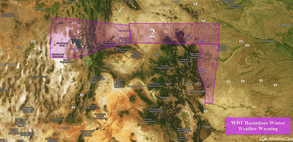 Region 2
Significant Snowfall Possible for the Colorado Rockies into northern New Mexico on Thursday
Heavy snow will persist over the central Rockies into Thursday afternoon with additional snowfall expected. One to three inches of snow will be possible along the Front Range. Further south, a cold front will push through during the morning hours, which will help spread the threat for heavy snow into the higher terrain of New Mexico. Snowfall accumulations of a foot will be possible over the high terrain, with a few inches possible over the valley areas.
Major Cities in Region: Grand Junction, CO, Durango, CO, Alamosa, CO, Trinidad, CO
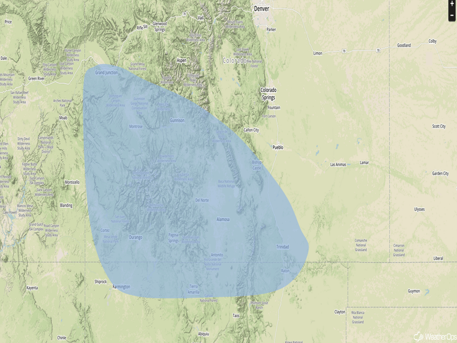 Significant Snowfall Risk Outline for Thursday
Significant Snowfall Possible for Northern New Mexico on Friday
As an area of low pressure moves into the Southern Plains on Friday, snow will continue across northern New Mexico. Two day snowfall accumulations over a foot are forecast in the highest elevations.
Major Cities in Region: Albuquerque, NM, Santa Fe, NM, Tucumcari, NM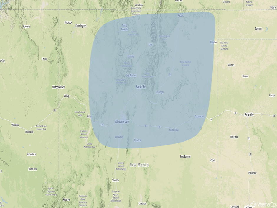
Significant Snowfall Risk Outline for Friday
A Look Ahead
A trough of low pressure will continue to move northward along the East Coast on Saturday, spreading wintry precipitation from the coastal Carolinas into the Delmarva Peninsula. Several hours of moderate to heavy snow will be possible into the evening behind a cold front.
This is just a brief look at current weather hazards. We can provide you site-specific forecast information for the purpose of protecting your personnel and assets. Try a 7-day demo right away and learn how timely precision weather information can enhance your bottom line.


