


by David Moran, on Jan 31, 2018 10:16:08 AM
Snow will continue for the Great Lakes and Northeast on Wednesday as a cold front moves through the region.
- Continued Snow for the Great Lakes and Northeast on Wednesday
- Snow Friday and Saturday for the Northern Rockies and Western High Plains
 US Hazards

Continued Snow for the Great Lakes and Northeast on Wednesday
Light snow will continue across the Great Lakes and Northeast on Wednesday as a cold front moves across the region. Snowfall accumulations should be heaviest across the Upper Peninsula of Michigan and northern portions of the Lower Peninsula where 2-4 inches are forecast. Elsewhere, flurries are generally expected.
Major Cities in Region: Green Bay, WI, Traverse City, MI, Buffalo, NY, Rochester, NY
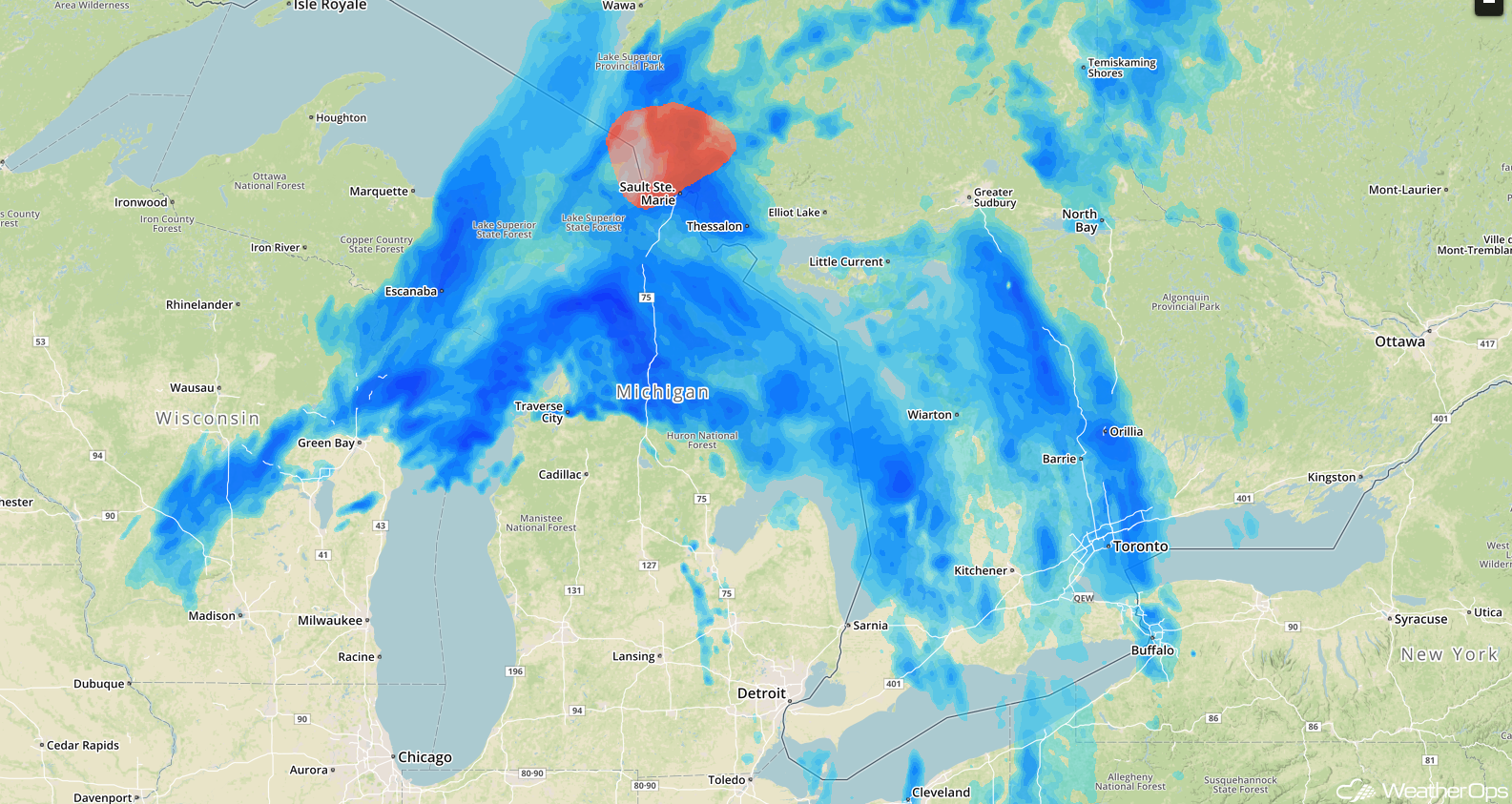 Radar 9:25am EST
Snow Friday and Saturday for the Northern Rockies and Western High Plains
An area of low pressure is forecast to intensify across the western High Plains late Friday and early Saturday morning. Snow is forecast to increase in coverage and intensity near and northwest of the low from the Dakotas westward to Idaho. At least a few inches of snow are forecast on Friday, with additional snowfall on Saturday.
Major Cities in Region: Missoula, MT, Helena, MT, Great Falls, MT, Billings, MT, Rapid City, SD
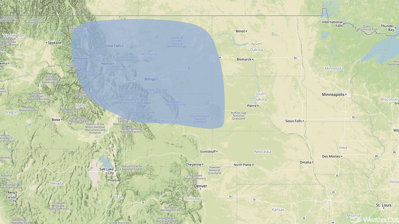 Snowfall Risk Outline for Friday and Saturday
A Look Ahead
A wintry mix of precipitation is forecast from the Midwest into western New York on Saturday as an area of low pressure moves through the region. Further north, precipitation will be all snow from Iowa through the Great Lakes. To the south, a few thunderstorms may develop across Texas and Louisiana at the tail end of a cold front. Heavy rain may extend into Georgia and the Florida Panhandle. Snow will move into the Northeast and Mid Atlantic on Sunday as a cold front moves eastward. Accumulations of 1-3 inches are forecast. Light snow may also develop across portions of Kansas and Nebraska.
This is just a brief look at current weather hazards. We can provide you site-specific weather forecast information to protect your staff and assets and to assess your weather risk. Try a 7-day demo right away and learn how timely precision weather information can enhance your bottom line.
