


by David Moran, on Jan 30, 2019 11:07:16 AM
Snow will continue across the Northeast on Wednesday as an area of low pressure moves eastward. An area of low pressure will continue to produce snow across western New York through Thursday.
- Continued Snow for the Northeast on Wednesday
- Snow Continuing through Thursday across Western New York
- Snow across the Midwest Sunday through Wednesday
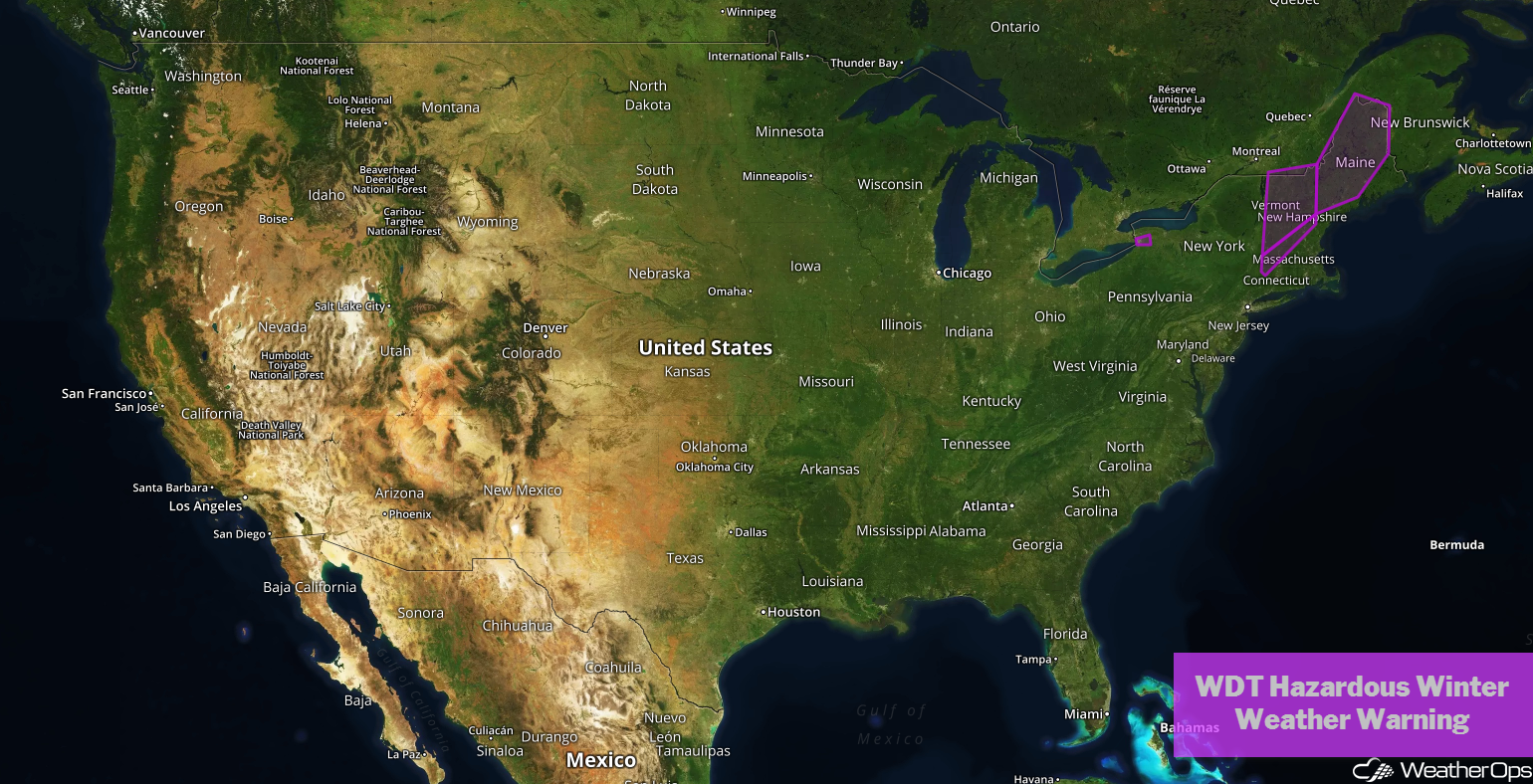
US Hazards
Continued Snow for the Northeast on Wednesday
A strong area of low pressure will continue to progress across the region today, bringing the potential for gusty winds, moderate to heavy snowfall, and cold air to the region. Widespread snowfall amounts of 8-12 inches are forecast, with locally higher amounts. Some light icing may develop along the coast. With the cold air in place, snow will be dry. Combined with wind gusts in excess of 45 mph, there will be the potential for blowing snow and whiteout conditions. Use extreme caution while traveling, as roads will likely become hazardous or impassible in some areas.
Major Cities in Region: Burlington, VT, Augusta, ME, Bangor, ME
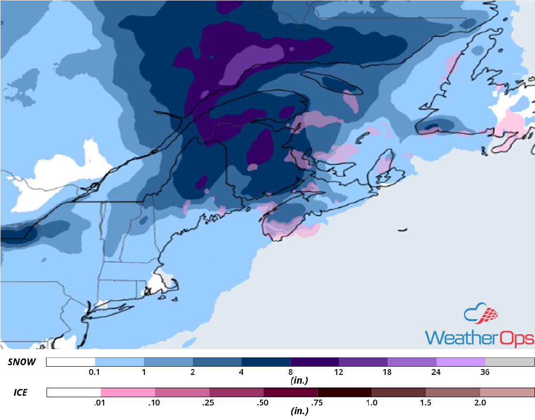
Snow Accumulation for Wednesday
Snow Continuing through Thursday across Western New York
Snow will continue across western New York through Thursday as an area of low pressure moves just to the north of the region. Snowfall accumulations of 18-21 inches are forecast. In addition to the snow, wind gusts in excess of 35 mph will result in blowing snow and wind chills between -15°F and -25°F.
Major Cities in Region: Buffalo, NY, Syracuse, NY
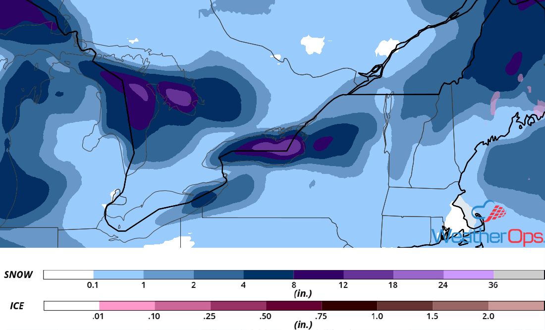
Snow Accumulation through Thursday
Snow across the Midwest Sunday through Wednesday
Two separate systems may track across the Midwest Sunday evening through Wednesday, bringing the potential for moderate to heavy snow, as well as freezing rain. The first system will track from the Northern Plains across the Upper Great Lakes. A second system will come in behind the first system, bringing another potential for moderate to heavy snow.
Major Cities in Region: Grand Forks, ND, International Falls, MN
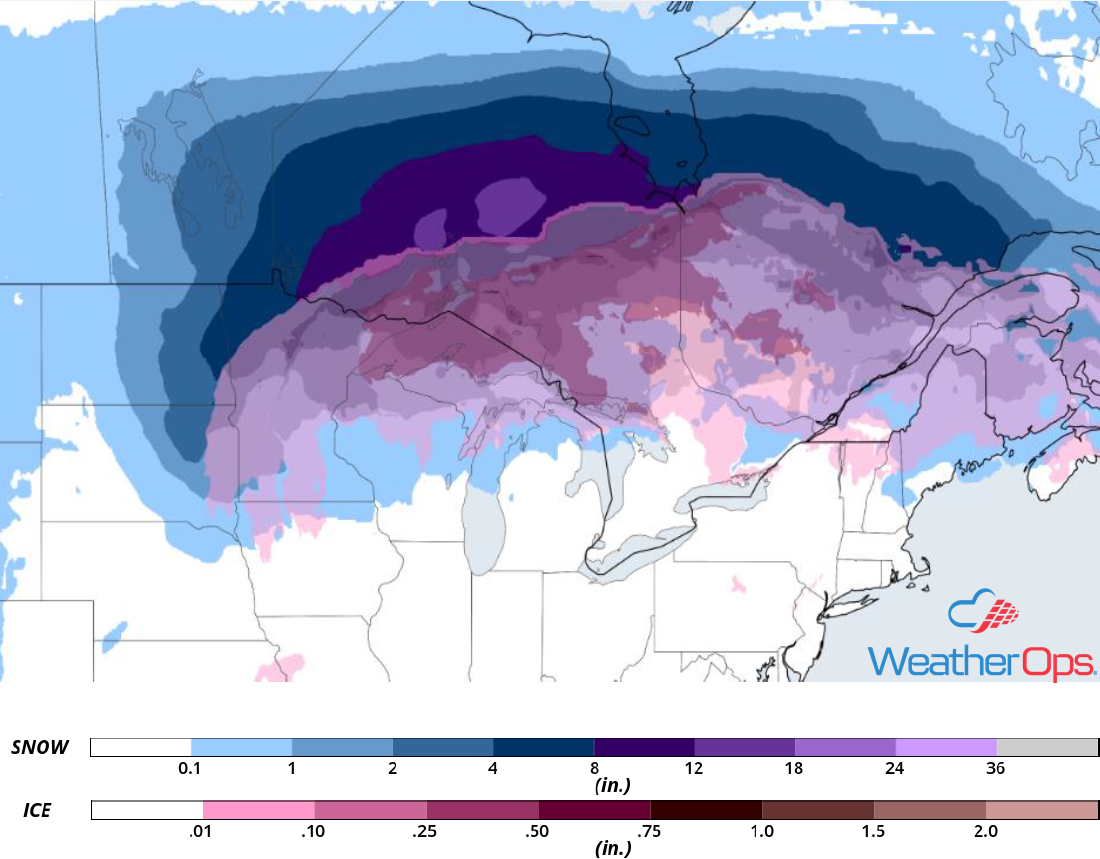
Snow Accumulation for Monday
A Look Ahead
An area of low pressure may bring heavy snow to the Sierra Nevadas on Saturday. This snow will move into the Rockies on Sunday. Showers and thunderstorms are forecast across the Ohio Valley on Monday ahead of a cold front. On Tuesday, showers and thunderstorms may develop across the Mid Mississippi Valley.
