National Weather Summary for Wednesday, January 25, 2017
by David Moran, on Jan 25, 2017 10:31:47 AM
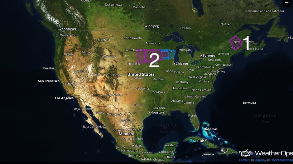
Wintry precipitation will wind down across the Northeast on Wednesday as an area of low pressure departs the region. Moderate to heavy snow is expected across the Upper Midwest as an area of low pressure continues to track northeastward on Wednesday. Thunderstorms may develop ahead of a cold front Wednesday across portions of the Southeast.
 US Hazards
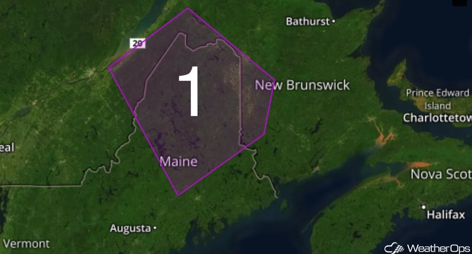
Region 1
Wintry precipitation will wind down across portions of the Northeast as an area of low pressure departs the region. Total snowfall accumulations of 4-8 inches of snow are expected in addition to winds as high as 20 mph with gusts as high as 35 mph.
Major Cities in Region: Bangor, ME, Presque Isle, ME

Region 1
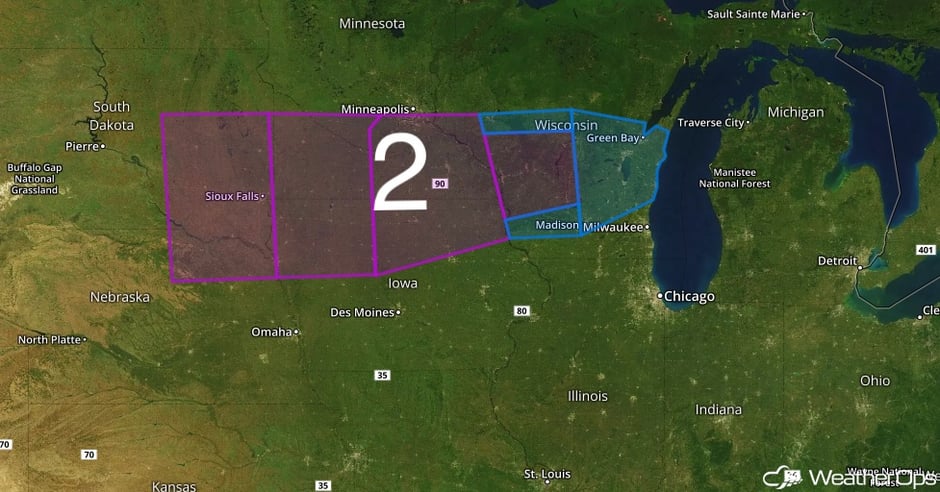
Region 2
As the area of low pressure continues to track to the northeast across the Midwest, moderate to heavy snowfall is forecast to continue during the morning hours and early afternoon. Total snowfall accumulation for the entire system is forecast between 5 to 8 inches across the region.
Major Cities in Region: Sioux Falls, SD, Madison, WI, Green Bay, WI
 Region 2
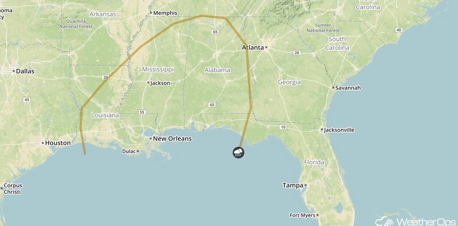
Strong to Severe Thunderstorms Possible for Portions of the Southeast on Wednesday
Ahead of an advancing cold front to enter into the Southeast, some thunderstorm development will be possible especially into the afternoon hours. With warm temperatures and moisture returning ahead of the front, some thunderstorms in the region may become strong with gusty winds as the primary severe weather potential.
Major Cities in Region: Baton Rouge, LA, New Orleans, LA, Jackson, MS, Birmingham, AL
SPC Convection Outlook for Wednesday
A Look Ahead
Generally calm conditions will continue across the country for the next several days. On Friday, some lake effect snow may develop across the Great Lakes. Some light rain may develop across southeastern Texas on Sunday in association with an area of low pressure. Early next week, another round of snow may develop across the Great Lakes.
This is just a brief look at current weather hazards. We can provide you site-specific forecast information for the purpose of protecting your personnel and assets. Try a 7-day demo right away and learn how timely precision weather information can enhance your bottom line.


