


by David Moran, on Jan 23, 2019 10:48:17 AM
Thunderstorms will continue along the Gulf Coast on Wednesday ahead of a cold front. Snow will move across the Great Lakes and Northeast through Thursday as an area of low pressure progresses eastward. An area of low pressure will continue to produce snow across the Northern Rockies. Elevated winds and seas will persist through Thursday afternoon as a cold front moves through the region.
- Thunderstorms along the Gulf Coast on Wednesday
- Snow Wednesday and Thursday across the Great Lakes and Northeast
- Continued Snow across the Northern Rockies on Wednesday
- Elevated Winds and Seas through Thursday Afternoon across the Gulf of Mexico
- Potential for Thunderstorms from Florida to Eastern North Carolina on Thursday
- Excessive Rainfall Thursday for the Mid Atlantic
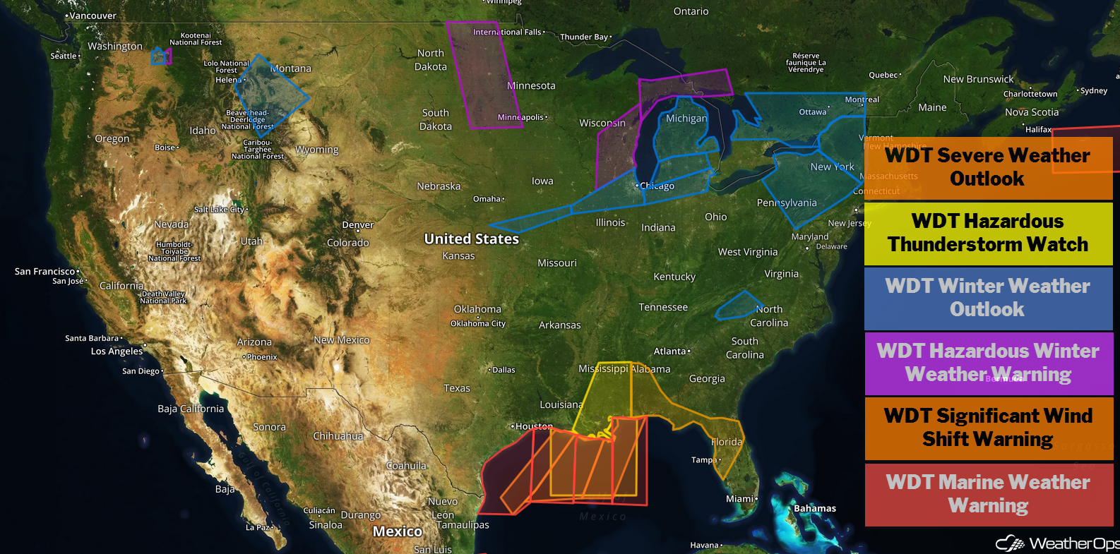
US Hazards
Thunderstorms along the Gulf Coast on Wednesday
A cold front is moving across the region, resulting in widespread shower and thunderstorm activity. The main risk for severe thunderstorms will be along and ahead of the cold front. Damaging winds will be the primary hazard, but an isolated tornado cannot be ruled out.
Major Cities in Region: New Orleans, LA, Mobile, AL, Pensacola, FL, Tallahassee, FL
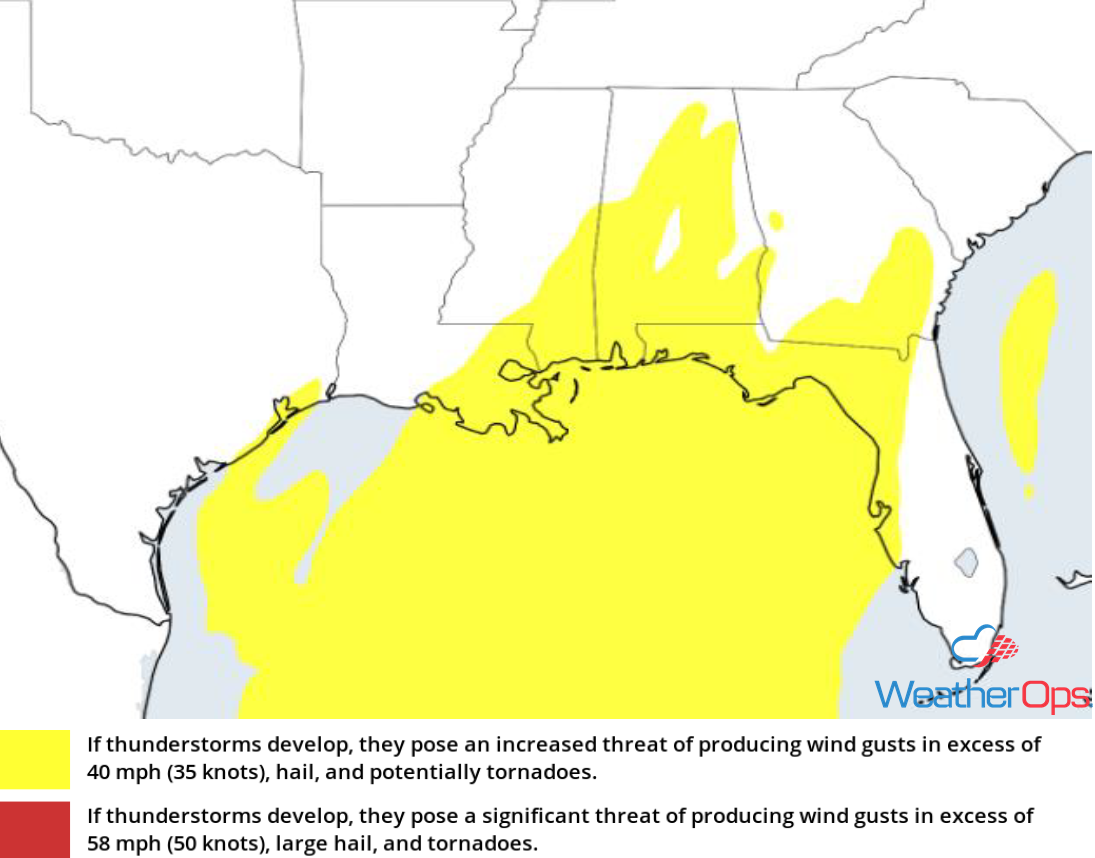
Thunderstorm Risk for Wednesday
Snow Wednesday and Thursday across the Great Lakes and Northeast
Snow will continue across the Great Lakes and Northeast Wednesday into Thursday morning as a system over the Midwest continues to move east-northeastward. Snowfall accumulations of 4-8 inches and locally higher amounts are expected, Freezing rain accumulations up to 0.10 inch are forecast.
Major Cities in Region: Green Bay, WI, Milwaukee, WI, Grand Rapids, MI, Buffalo, NY, Albany, NY, Burlington, VT, Augusta, ME
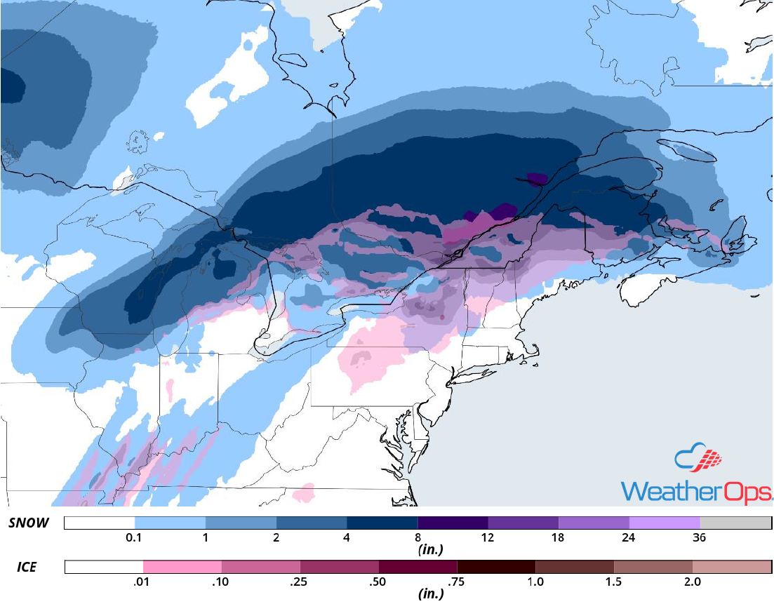
Snow Accumulation through Thursday
Continued Snow across the Northern Rockies on Wednesday
An area of low pressure will continue to move across the region on Wednesday with snow increasing in intensity through the afternoon. A cold front will approach by late Wednesday afternoon and evening; snow may become heavy. Snow accumulations of 3-5 inches with locally higher amounts in excess of 6 inches are expected in the valleys. In the higher elevations, accumulations will range 6-12 inches with locally higher amounts in excess of 14 inches. Gusty winds will allow for blowing snow and reduced visibilities.
Major Cities in Region: Spokane, WA,Helena, MT, Great Falls, MT, Billings, MT
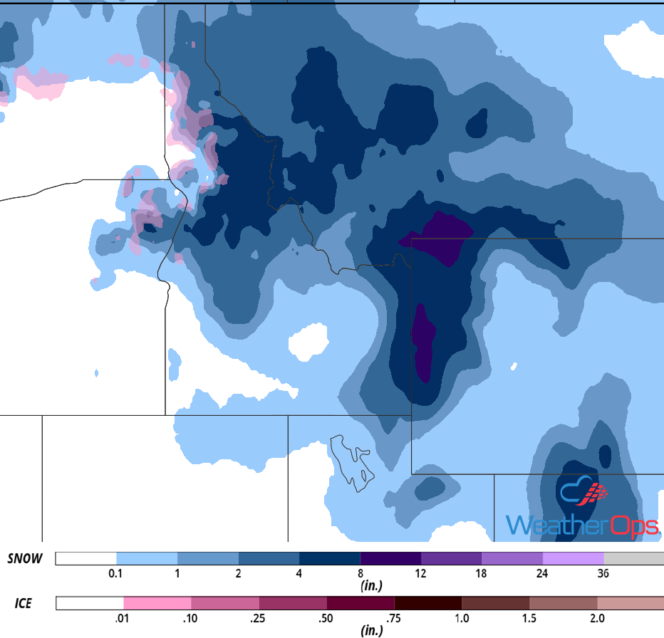
Snow Accumulation for Wednesday
Elevated Winds and Seas through Thursday Afternoon across the Gulf of Mexico
A cold front will continue moving across the Gulf of Mexico through Thursday afternoon. Ahead of the front, winds will be southerly to southwesterly at 15-20 knots. Behind the front, winds will be northerly to northwesterly at 30-35 knots with gusts in excess of 40 knots. Seas will range 7-11 feet near the shore and 10-14 feet in the deeper waters. In addition, thunderstorms are expected to develop along and ahead of the front. Wind gusts in excess of 45 knots, waterspouts, heavy rain, and frequent lightning, will be potential hazards with these storms. Conditions will begin to subside Thursday afternoon.
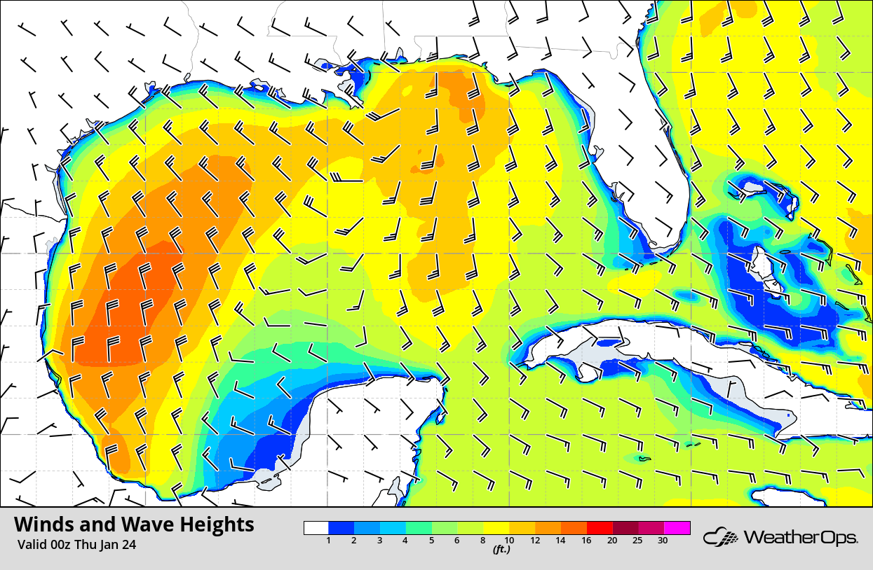
Winds and Wave Heights 6pm CST Wednesday
Potential for Thunderstorms from Florida to Eastern North Carolina on Thursday
A cold front will move into the region late Wednesday into Thursday morning, resulting in widespread showers and thunderstorms. Thunderstorms are expected to develop along and ahead of the front. Damaging winds will be the primary hazard with these storms, but an isolated tornado cannot be ruled out. The threat will decrease through the afternoon as the front passes.
Major Cities in Region: Miami, FL, Tampa, FL, Orlando, FL, Jacksonville, FL, Savannah, GA, Myrtle Beach, SC, Wilmington, NC
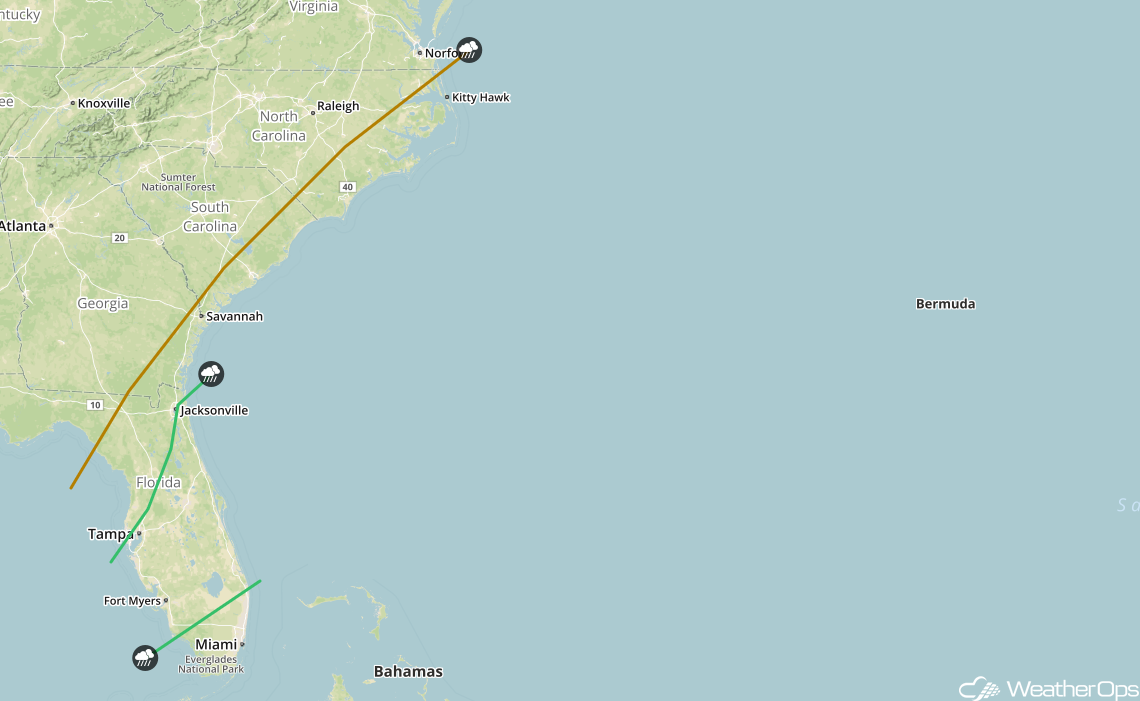
SPC Convective Outlook for Thursday
Excessive Rainfall Thursday for the Mid Atlantic
An area of low pressure moving into the Northeast will bring the potential for moderate to heavy rain to the Mid Atlantic on Thursday. Accumulations will range 1-3 inches. Rainfall rates could be high enough to result in short lived flooding. This could be further enhanced by the frozen ground and snow pack across the region.
Major Cities in Region: Washington, DC, Atlantic City, NJ, New York, NY
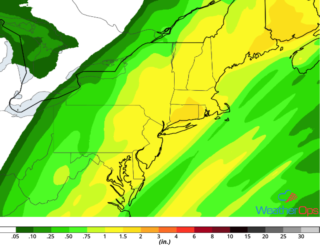
Rainfall Accumulation for Thursday
A Look Ahead
Light snow is forecast across the Northern Plains and Upper Midwest on Saturday as an area of low pressure moves eastward. An additional heavier round of snow may move across the region on Sunday. Snow may develop across portions of the Northeast. Going into Monday, snow will move into the Great Lakes in association with an area of low pressure. On Tuesday, snow is forecast to extend from the Appalachians into the Northeast.
