


by David Moran, on Feb 28, 2018 11:01:49 AM
There will be a potential for thunderstorms from Central Texas into the Mississippi Valley on Wednesday ahead of a cold front. Excessive rainfall will continue from Arkansas into the Tennessee Valley on Wednesday as an area of low pressure intensifies across the Eastern US. Snow is expected across Maine Wednesday night through Thursday night as an upper level trough moves through the region. Across the Great Lakes and Northeast, snow is forecast Thursday morning through Saturday as an area of low pressure moves across the southern Great Lakes and into the Northeast.
- Thunderstorms from Central Texas to the Lower Mississippi Valley on Wednesday
- Excessive Rainfall Wednesday from Arkansas into the Tennessee Valley
- Snow Wednesday Evening through Thursday Evening for Northern Maine
- Snow from the Great Lakes into the Northeast Thursday through Saturday Morning
- Potential for Snow Friday into Saturday for Portions of the Rockies
 US Hazards

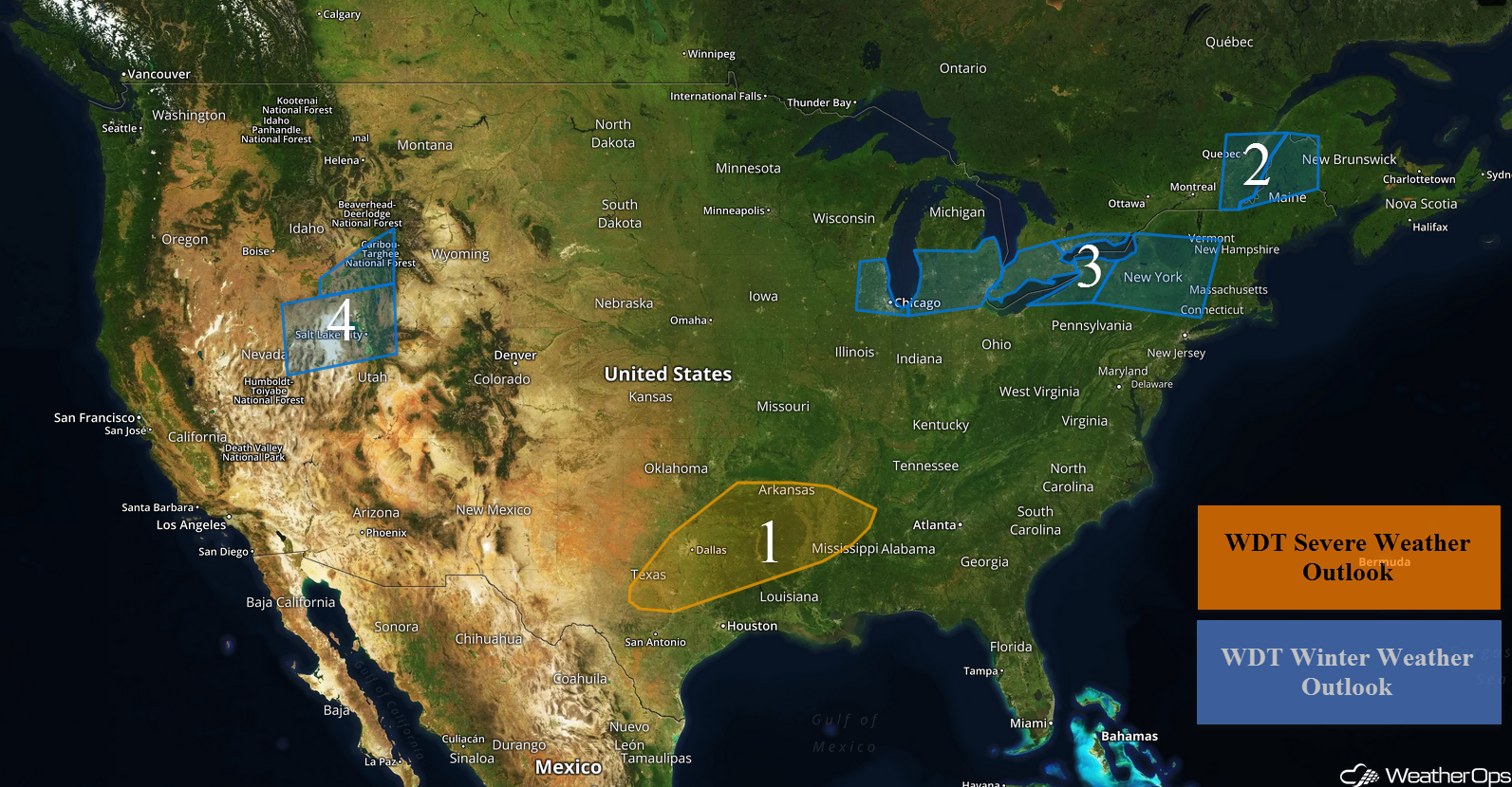
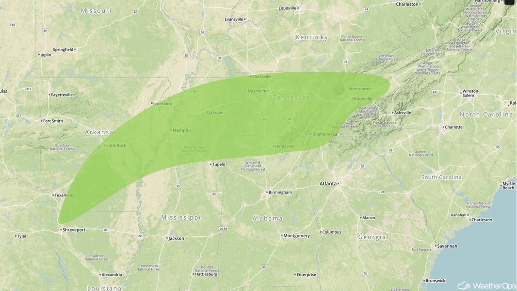
Thunderstorms from Central Texas to the Lower Mississippi Valley on Wednesday
There will be a risk for strong to severe thunderstorms Wednesday from Central Texas to the Lower Mississippi Valley as an area of low pressure develops. Hail and damaging winds will be the primary hazards, with the greatest risk for large hail across northeast Texas. An isolated tornado or two cannot be ruled out.
Major Cities in Region: Waco, TX, Fort Worth, TX, Dallas, TX, Shreveport, LA, Little Rock, AR, Tupelo, MS
 Region 1
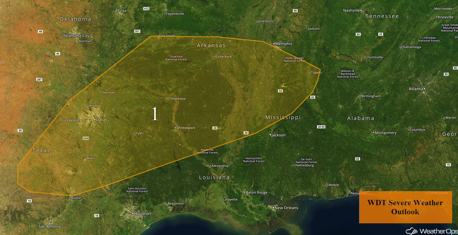
Excessive Rainfall Wednesday from Arkansas into the Tennessee Valley
Heavy rain will continue from Arkansas into the Tennessee Valley on Wednesday as an area of low pressure intensifies across the eastern US. An additional 1-2 inches with locally higher amounts in excess of 4 inches are forecast. Due to rain from previous days, flash flooding and river flooding will be a concern.
Major Cities in Region: Little Rock, AR, Memphis, TN, Nashville, TN, Chattanooga, TN, Knoxville, TN
 Excessive Rainfall Risk Outline for Wednesday
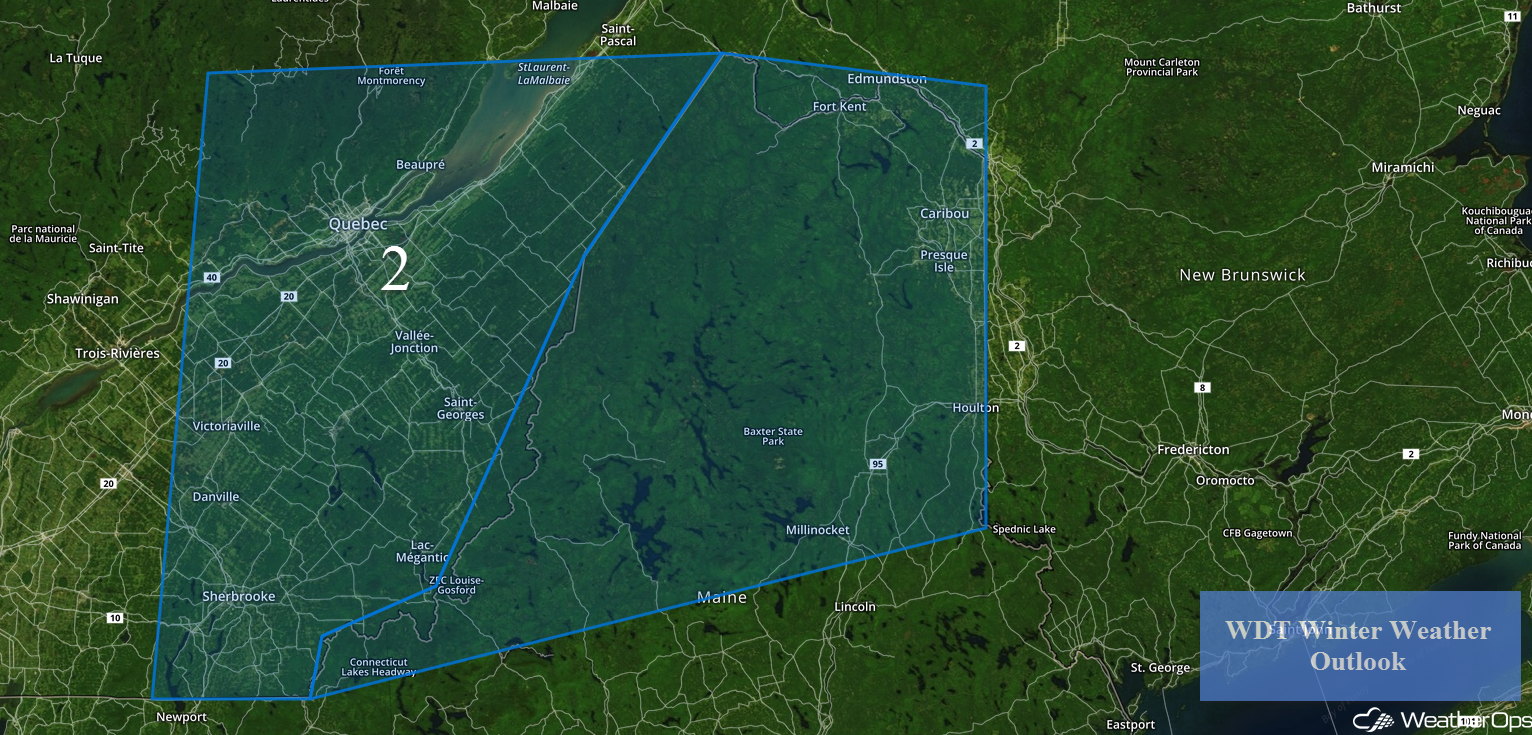
Snow Wednesday Evening through Thursday Evening for Northern Maine
An upper level disturbance will bring the potential for snow to portions of Maine Wednesday night into Thursday. Snow may be moderate to heavy at times with accumulations of 4-8 inches and locally higher amounts in excess of 10 inches forecast.
Major Cities in Region: Caribou, ME
 Region 2
Snow from the Great Lakes into the Northeast Thursday through Saturday Morning
An area of low pressure moving across the southern Great Lakes into the Northeast will bring snow to the region on Thursday. For portions of southeastern Wisconsin and northeastern Illinois, snowfall accumulations of 1-3 inches with locally higher amounts in excess of 4 inches are expected. In addition, winds gusting in excess of 25 mph will allow for blowing snow and reduced visibilities. Across southern Michigan and northern Indiana, snow accumulations will range from 2-4 inches with locally higher amounts in excess of 6 inches.
Snow will move into western New York Thursday evening and continue into Saturday morning. Accumulations of 6-12 inches with locally higher amounts in excess of 15 inches are forecast across much of New York. In addition, winds gusting in excess of 30 mph will allow for blowing snow and reduced visibilities.
Major Cities in Region: Milwaukee, WI, Chicago, IL, Detroit, MI, Buffalo, NY, Syracuse, NY, Albany, NY
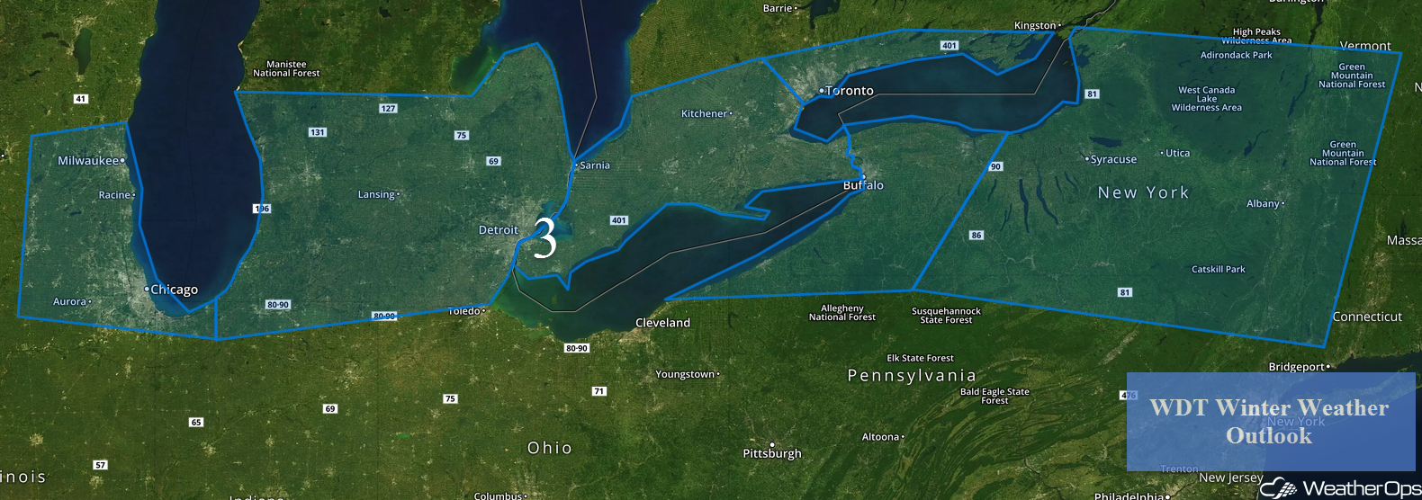 Region 3
Potential for Snow Friday into Saturday for Portions of the Rockies
An area of low pressure is expected to move into the Rockies on Friday, allowing for snow for portions of Idaho and Utah. Snow accumulations of 5-8 inches are forecast in the valleys and 12-16 inches in the mountains from Friday afternoon through Saturday evening for much of northern Utah. Across southeastern Idaho, 2-5 inches of snow are expected for the valleys and 8-12 inches for the mountains.
Major Cities in Region: Pocatello, ID, Salt Lake City, UT
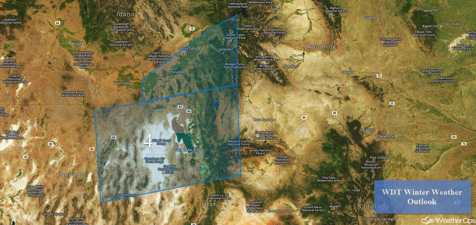 Region 4
A Look Ahead
Going into the weekend, light rain and snow will move into portions of the Rockies and Great Basin on Saturday; no significant accumulations are anticipated. On Sunday, snow may develop across the Northern Plains as an area of low pressure develops. Snow will spread across the Northern Plains and the Great Lakes early next week.
That is a brief look at current weather hazards. We can provide you site-specific weather forecast information to protect your staff and assets and to assess your weather risk. Try a 7-day demo right away and learn how timely precision weather information can enhance your bottom line.
