National Weather Summary for Wednesday, February 15, 2017
by David Moran, on Feb 15, 2017 11:33:02 AM
Thunderstorms are expected to develop across portions of the Southeast on Wednesday ahead of a cold front. As an area of low pressure tracks through the Northeast, snow will continue through Thursday morning. Elevated winds and seas will continue across the Gulf of Mexico behind a front through Wednesday.
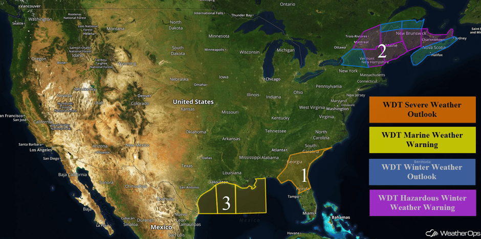 US Hazards
Region 1
A cold front moving across the Southeast will be the focus for the development of thunderstorms today. While thunderstorms are currently ongoing, stronger storms are expected later in the day as instability builds. The main hazards with these storms will be hail and damaging winds, but isolated tornadoes cannot be ruled out.
Update 12:38pm EST: Severe Thunderstorm and Tornado Warnings along the North and South Carolina coasts.
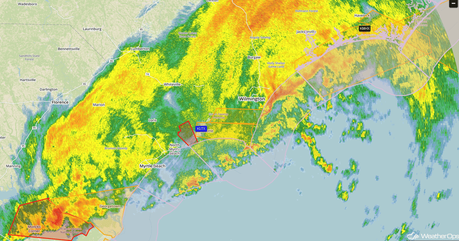 Radar 12:38pm EST
Update 2:35pm EST: Severe thunderstorms developing over north central Florida.
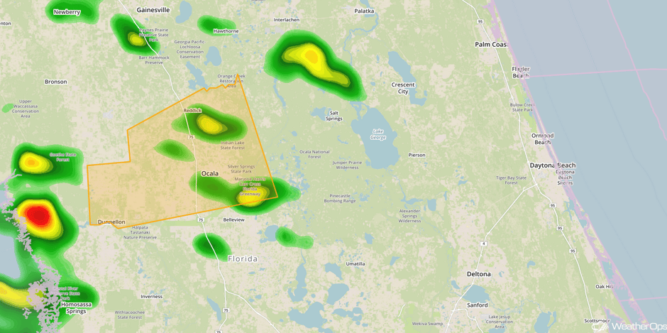 Radar 2:35pm EST
Update 3:35pm EST: Tornado Warning south of Ocala, Florida until 4pm EST.
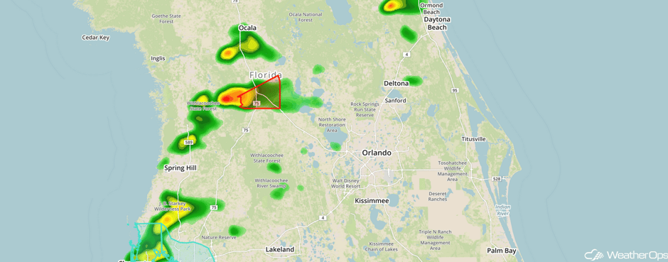 Radar 3:35pm EST
Major Cities in Region: Tallahassee, FL, Jacksonville, FL, Charleston, SC, Myrtle Beach, SC
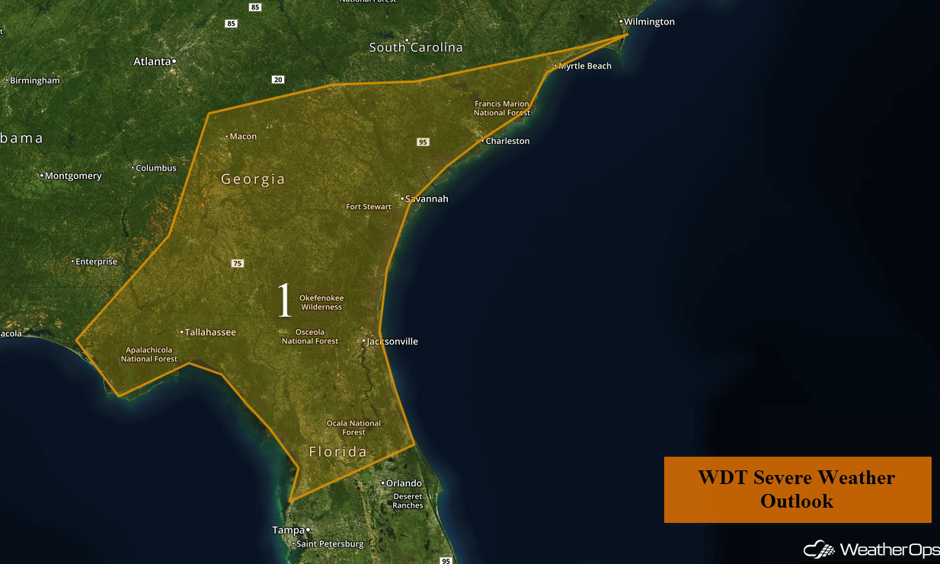 Region 1
Region 2
Snow will continue across the Northeast through Thursday morning as an area of low pressure moves through the region. Light snow will continue through Thursday morning across New York with snow accumulations less than 6 inches likely in the lower elevations. In the higher elevations, 8-10 inches are forecast. Further to the east, from Vermont eastward into Maine, snowfall amounts of 5-8 inches are expected with locally higher amounts in excess of 10 inches.
Major Cities in Region: Burlington, VT, Portland, ME, Augusta, ME, Bangor, ME
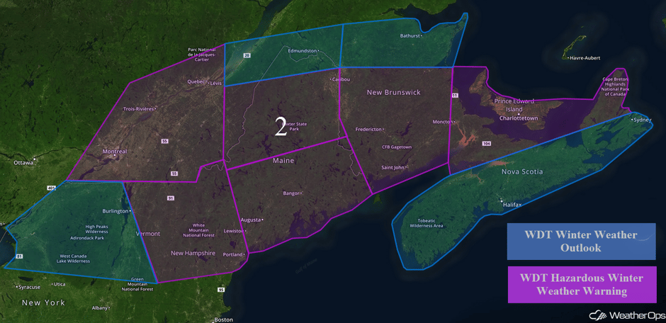 Region 2
Region 3
Elevated winds and seas will continue through Wednesday evening across portions of the Gulf of Mexico in the wake of a cold front. Winds will be westerly to northwesterly at 20-25 knots. Swells of 7-10 feet are expected in the deep waters.
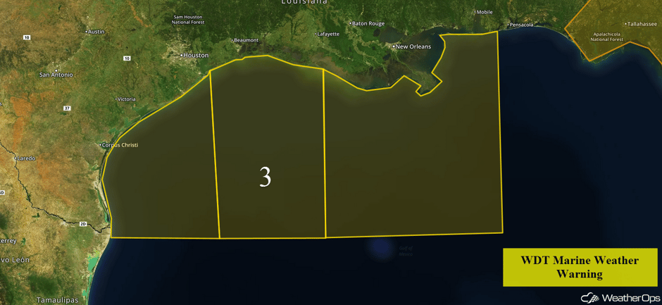 Region 3
Excessive Rainfall Possible for Pacific Northwest on Wednesday
With a Pacific Low approaching the Northwest, heavy to excessive rainfall is expected for much of the Pacific Northwest. Total rainfall accumulations of 2-3 inches with locally heavier amounts in excess of 5 inches will be possible.
Major Cities in Region: Seattle, WA, Portland, OR
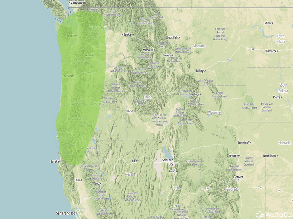 Excessive Rainfall Risk Outline for Wednesday
Excessive Rainfall Possible for Northern California on Thursday
A cold front is forecast to move onshore the West Coast on Thursday, leading to moderate to heavy rainfall across portions of Northern California. Total rainfall accumulations of 1-2 inches are forecast across the region with locally heavier amounts exceeding 3 inches in some locations.
Major Cities in Region: Eureka, CA, San Francisco, CA, Sacramento, CA
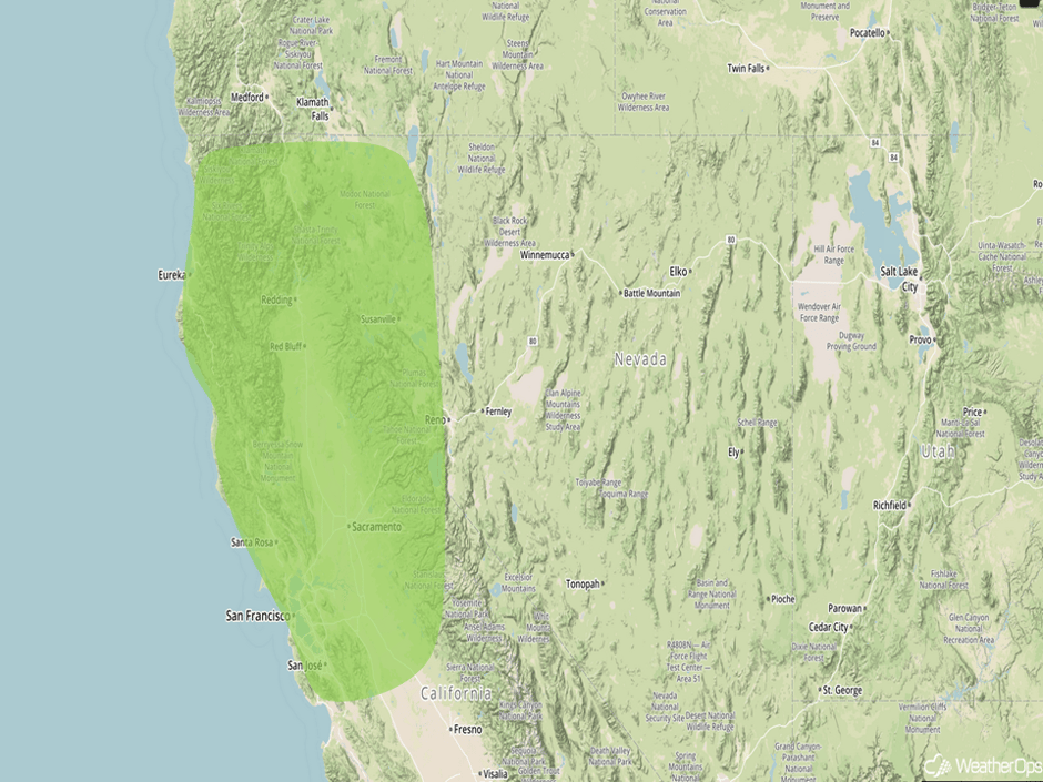 Excessive Rainfall Risk Outline for Thursday
Excessive Rainfall Possible for Southern California on Friday
Heavy to excessive rainfall is forecast across southern California on Friday as an area of low pressure tracks to the southeast throughout the day. As a result, rich moisture and lift provided by the mountains as well as the front associated with the area of low pressure will lead to the potential for heavy to excessive rainfall. Total rainfall accumulations of 2-4 inches with isolated higher amounts in excess of 6 inches. Given the amount of rainfall in previous days, flooding will be a concern on Friday.
Major Cities in Region: Santa Barbara, CA, Los Angeles, CA
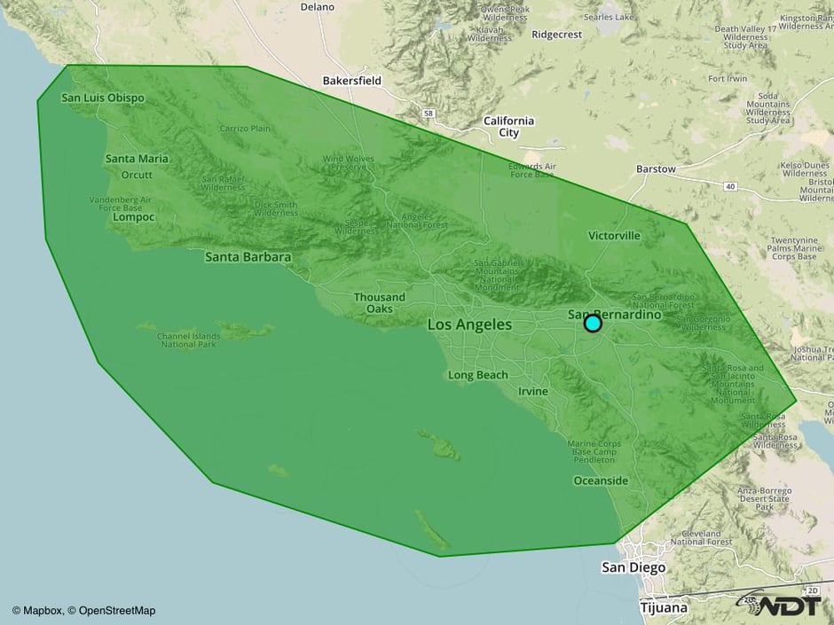 Excessive Rainfall Risk Outline for Friday
A Look Ahead
Moderate to heavy rain is forecast to continue across Southern California on Friday as an area of low pressure moves toward Baja California. Additional rainfall accumulations of 1-2 inches, as well as flooding, will be possible. Early next week, thunderstorms may develop across portions of the Southern Plains on Monday, The thunderstorm risk will shift over the Lower Mississippi Valley on Tuesday.
This is just a brief look at current weather hazards. We can provide you site-specific forecast information for the purpose of protecting your personnel and assets. Try a 7-day demo right away and learn how timely precision weather information can enhance your bottom line.


