National Weather Summary for Wednesday, February 1, 2017
by David Moran, on Feb 1, 2017 11:05:46 AM
Snow will continue across portions of New England on Wednesday morning as an area of low pressure moves out of the region. Snow is expected to continue across the Northern Rockies through much of Wednesday as an upper level low remains nearly stationary. As another system approaches the West Coast, snow and freezing rain is expected for portions of western Oregon Thursday into Friday. This same system will bring snow to the higher elevations of California late Thursday through early Saturday.
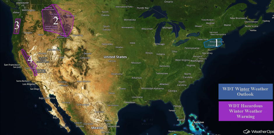 US Hazards
Region 1
Light snow will continue through the morning as an area of low pressure continues to move eastward. Snowfall totals of 2-4 inches are expected across the region.
Major Cities in Region: Albany, NY, New Haven, CT, Providence, RI, Boston, MA
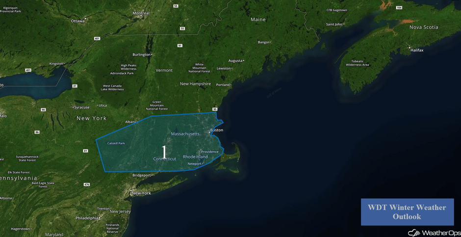 Region 1
Region 2
As an upper level low persists across the Northern Rockies, moderate to heavy snow will continue through Wednesday evening. Widespread snowfall accumulations of 4-8 inches are expected across the valleys with 10-16 inches in the higher elevations. Locally heavier amounts are possible within the heaviest snowbands. Snow accumulations in excess of 20 inches are possible in eastern portions of the region.
#Montana in for another shot of sub-zero weather this week. https://t.co/3CgaXXDxAJ #MTwx pic.twitter.com/jxrHHIEoRx
— MontanaNewsNow (@MontanaNewsNow) February 1, 2017
Major Cities in Region: Missoula, MT, Butte, MT, Helena, MT
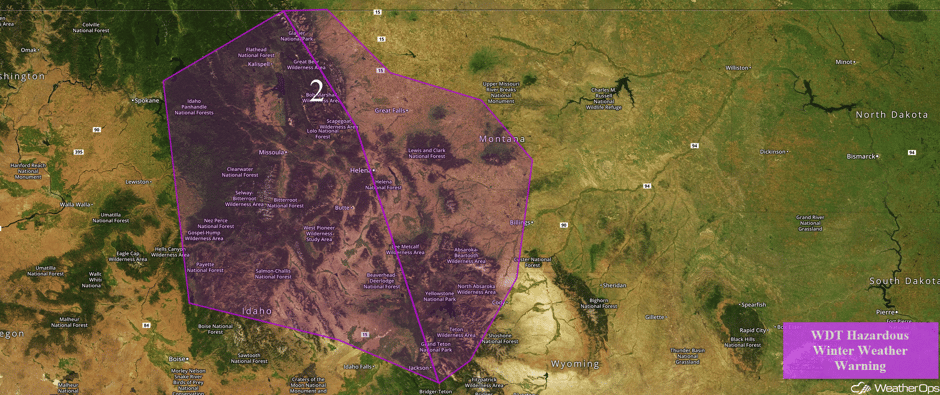 Region 2
Region 3
Wintry precipitation is expected across portions of western Oregon Thursday into Friday as an area of low pressure approaches the West Coast. Snow accumulations of 1-2 inches are expected through late Thursday before transitioning to a wintry mix. Freezing rain accumulations between 0.2 and 0.4 inch are forecast.
Major Cities in Region: Eugene, OR, Portland, OR
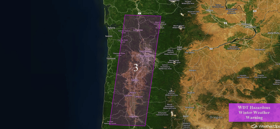 Region 3
Region 4
An area of low pressure will move into the Northwest by the end of the week and into the weekend, allowing for snowfall late Wednesday and continuing through early Saturday across the Sierra Nevadas. Snow levels should be above 5,000 feet. Accumulations of a foot are expected in the mid elevations and up to 4 feet in the highest elevations.
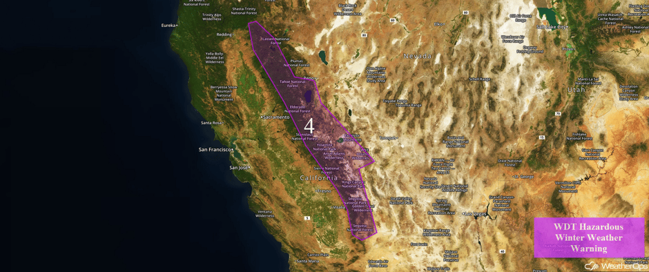 Region 4
Excessive Rainfall Possible for Northern California on Friday
An upper low offshore of the Pacific Northwest will see the arrival of a cold front into Northern California on Friday. Increasing showers are forecast with an attendant threat for excessive rainfall. Forecast rainfall accumulations of 1-2 inches may pose a risk for minor flooding and local runoff.
Major Cities in Region: Eureka, CA, San Francisco, CA, Sacramento, CA, Fresno, CA
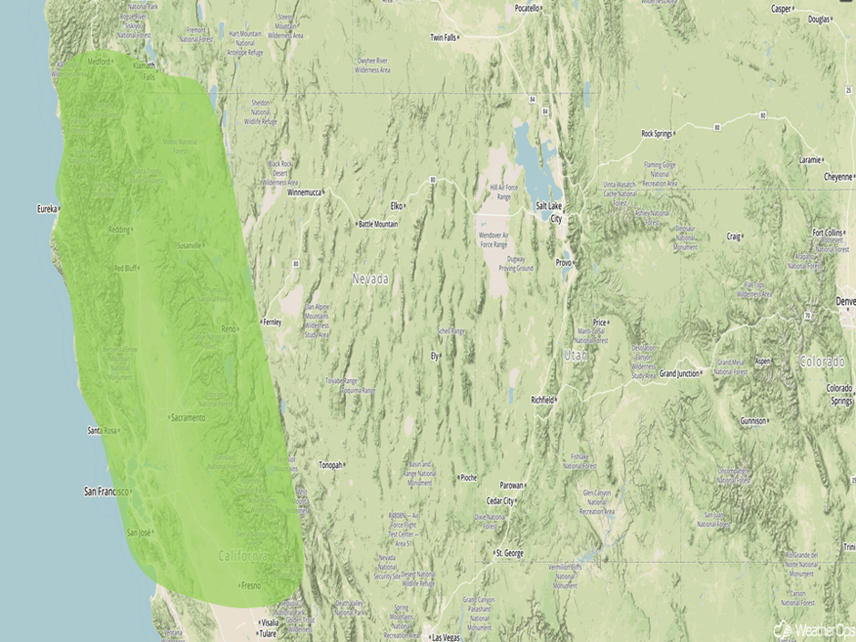 Excessive Rainfall Risk Outline for Friday
A Look Ahead
As an upper level low pushes into the Pacific Northwest, moderate to heavy snow is expected Saturday across portions of the Intermountain West. Snow accumulations of 4-6 inches with locally higher amounts are possible.
This is just a brief look at current weather hazards. We can provide you site-specific forecast information for the purpose of protecting your personnel and assets. Try a 7-day demo right away and learn how timely precision weather information can enhance your bottom line.


