National Weather Summary for Wednesday, December 6, 2017
by David Moran, on Dec 6, 2017 10:49:33 AM
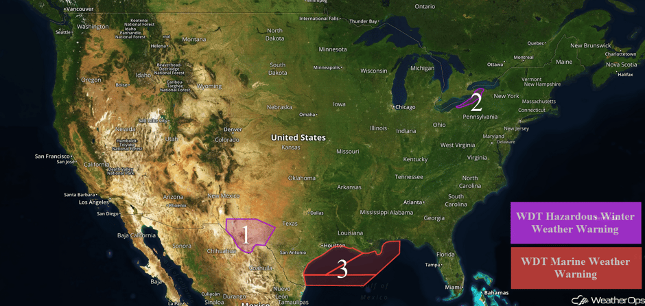
A wintry mix is expected for portions of west Texas and southern New Mexico Wednesday into Thursday as an area of low pressure moves across the region. Lake effect snow will continue for portions of western New York through Friday. Elevated winds and seas will continue for portions of the Gulf of Mexico through Friday.
- Wintry Precipitation for Portions of West Texas and Far Southern New Mexico Wednesday into Thursday
- Lake Effect Snow Through Friday for Western New York
- Elevated Winds and Seas Continuing for the Gulf of Mexico through Friday
 US Hazards
Wintry Precipitation for Portions of West Texas and Far Southern New Mexico Wednesday into Thursday
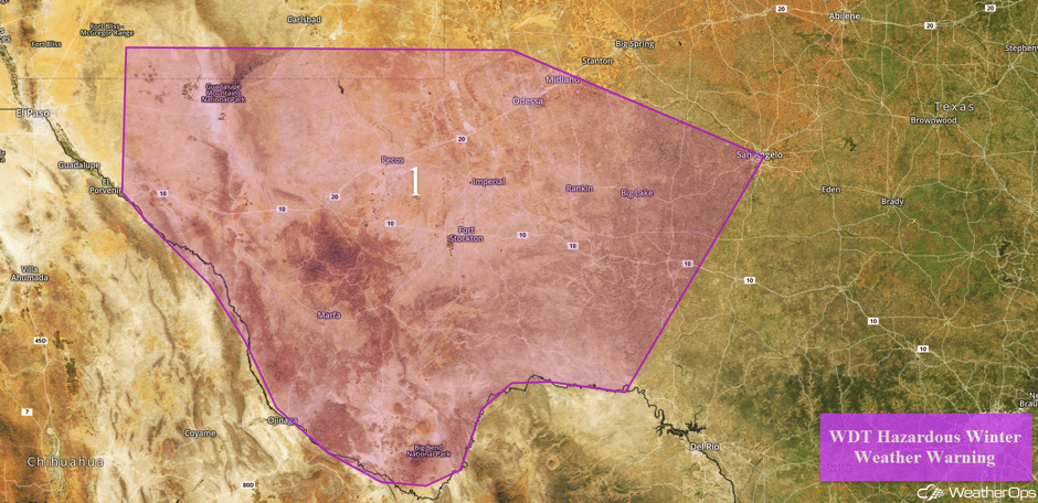
A wintry mix of precipitation is forecast across a large part of west Texas and far southern New Mexico Wednesday into Thursday. Showers will transition to a wintry mix of snow, sleet, and freezing rain throughout the day on Wednesday. By Wednesday night into Thursday, precipitation will transition entirely to snow. Snow accumulations of 1-3 inches are forecast in the lower elevations and 3-5 inches above 4,000 feet. Ice accumulations will range from a trace to a tenth of an inch in lower elevations. Travel may become slick and hazardous over the area by Wednesday afternoon, with the threat persisting through Thursday morning.
Major Cities in Region: Odessa, TX, Midland, TX, San Angelo, TX
 Region 1
Lake Effect Snow Through Friday for Western New York
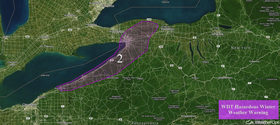
Lake effect snow will continue across western New York through midday Friday. Snow may temporarily diminish on Wednesday before low to mid level moisture returns, allowing for potentially higher snow rates Wednesday evening into Thursday. A sharp cutoff between little snow and significant accumulations may take shape. Having said that, an intense lake effect snow band is likely to develop in a southwest to northeast orientation. Snow accumulations of 10-16 inches are expected with locally higher amounts in excess of 18 inches. Hourly snow rates could be several inches with visibilities less than 1/4 mile and wind gusts in excess of 35-40 mph at times.
Major Cities in Region: Buffalo, NY
 Region 2
Elevated Winds and Seas Continuing for the Gulf of Mexico through Friday
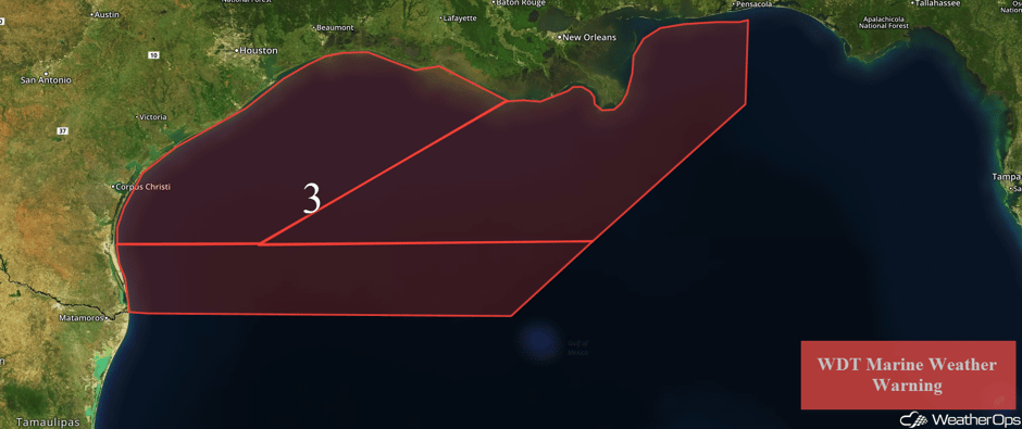
Elevated winds and seas will continue for portions of the Gulf of Mexico through Friday in the wake of a cold front. North-northeasterly to northeasterly winds will range 25-35 knots with gusts in excess of 40 knots expected. Seas will build to 6-10 feet near the shore and 10-18 feet in the deeper waters.
 Region 3
A Look Ahead
By Friday, a large cold front will be offshore except for across portions of Florida; scattered showers may develop behind the front along the Gulf Coast. A fast moving area of low pressure will bring snow to portions of the Great Lakes; snowfall amounts of 1-2 inches are forecast. Into the weekend, flurries may develop across portions of the Northeast and Ohio Valley on Saturday. Across the Northern Plains and Midwest, there will be the potential for some light snow on Sunday in association with an area of low pressure. As this area of low pressure tracks eastward, snow will be possible across portions of the Great Lakes and Northeast early next week.
This is just a brief look at current weather hazards. We can provide you site-specific weather forecast information for the purpose of protecting your personnel and assets and to assess your weather risk. Try a 7-day demo right away and learn how timely precision weather information can enhance your bottom line.


