National Weather Summary for Wednesday, December 14, 2016
by David Moran, on Dec 14, 2016 11:22:34 AM
An area of low pressure moving across the Rockies will continue to bring snow to portions of the Rockies and Northern Plains through the end of the week.
 US Hazards
Region 1
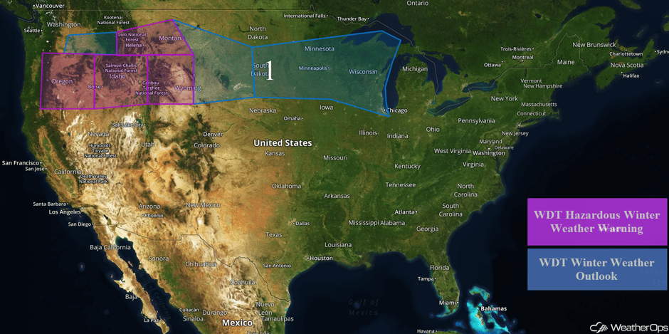
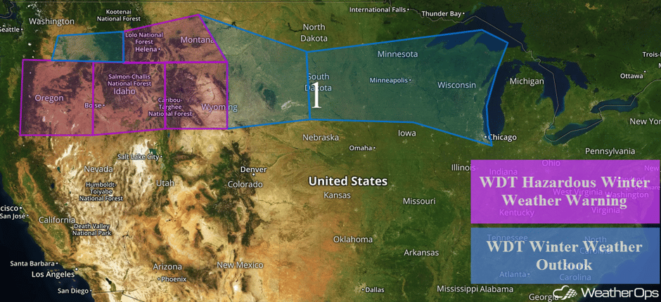
Snow will continue across the Pacific Northwest into the Northern Rockies as an area of low pressure continues to progress eastward. Snowfall accumulations of 5-10 inches, with isolated higher amounts in excess of 12 inches, are expected for portions of Oregon. In addition, light ice accumulations will be possible. Further to the east across Idaho, snowfall amounts of 4-8 inches are expected with isolated higher amounts in excess of 10 inches. In addition to the snow, there will also be the potential for light freezing rain. Across portions of Wyoming, snow amounts could range 5-10 inches with isolated higher amounts in excess of 12 inches through Friday evening. Wind chill values of -30 to -15 are also expected across portions of western Wyoming and south-central Montana.
By late Thursday, the area of low pressure will move out of the Rockies and into the Plains. Snowfall amounts of 3-6 inches with locally heavier amounts in excess of 8 inches are expected for portions of the Dakotas. In addition to the snow, visibilities of less than 4 miles and wind chills of -25 F to -35 F will be likely. As the area of low pressure continues to progress eastward on Friday, snow will extend from eastern portions of the Dakotas eastward into Wisconsin. A few to several inches of snow will be possible, in addition to bitterly cold wind chills.
Major Cities in Region: Boise, ID, Helena, MT, Pierre, SD, Sioux Falls, SD, Minneapolis, MN, Green Bay, WI, Milwaukee, WI, Chicago, IL
 Region 1
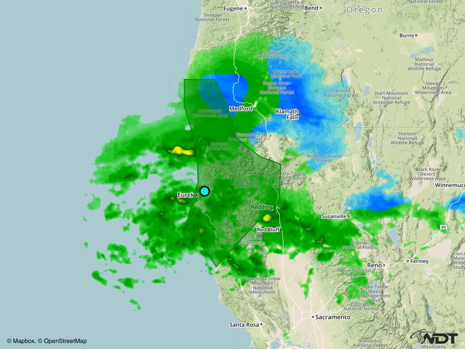
Excessive Rainfall Possible Wednesday for Portions of the West Coast
Periods of heavy rain will continue to spread across portions of northwest California and southwest Oregon today as an area of low pressure moves inland. Widespread rainfall amounts of 3-6 inches with locally higher amounts in excess of 8 inches. This may lead to flooding concerns and possible mudslides.
Major Cities in Region: Eureka, CA
 Excessive Rainfall Risk Outline for Wednesday
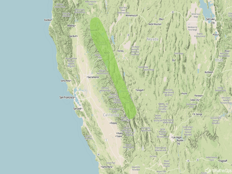
Excessive Rainfall Possible for Portions of Eastern California on Thursday
A cold front associated with an area of low pressure moving through the western US is forecast to push southward and generate periods of heavy rain and showers across the lower levels of the Sierra Nevada as well as adjacent valleys on Thursday. Due to deep moisture in place across the region, there will be a threat of excessive rainfall. Rainfall amounts of 2-4 inches, with isolated higher amounts in excess of 5 inches, will be possible and may lead to some areas of flooding and mudslides.
Major Cities in Region: Reno, NV
 Excessive Rainfall Risk Outline for Thursday
A Look Ahead
As the area of low pressure across the Plains continues to progress eastward, snow will spread across the Great Lakes on Saturday. To the south, thunderstorms may develop across portions of the Lower Mississippi Valley and Southeast ahead of a cold front. Large hail, damaging winds, and tornadoes will be possible with these storms. As the cold front continues to progress eastward on Sunday, wintry precipitation will develop from portions of the Southeast all the way into the Northeast and New England.
This is just a brief look at current weather hazards. We can provide you site-specific forecast information for the purpose of protecting your personnel and assets. Try a 7-day demo right away and learn how timely precision weather information can enhance your bottom line.


