


by David Moran, on Aug 8, 2018 11:10:27 AM
Thunderstorms are forecast to develop from the Carolinas into the Northeast on Wednesday as a cold front moves into the region. These thunderstorms will pose a risk for excessive rainfall. An area of low pressure will provide forcing for the development of thunderstorms from the Central and Southern Plains into the Lower Mississippi Valley. Some of this activity will allow for a risk for excessive rainfall through Thursday. A cold front will be the focus for thunderstorms across eastern Minnesota and Wisconsin. Thunderstorms developing from Arizona to West Texas will pose a risk for excessive rainfall through Friday.
- Thunderstorms from the Carolinas into the Northeast on Wednesday
- Excessive Rainfall Wednesday from the Ohio Valley into the Northeast
- Thunderstorm Potential from the Central and Southern Plains into the Lower Mississippi Valley on Wednesday
- Risk for Excessive Rainfall through Thursday from the Central and Southern Plains into the Lower Mississippi Valley
- Thunderstorms across Eastern Minnesota and Wisconsin on Wednesday
- Excessive Rainfall through Friday from Arizona to West Texas
- Potential for Thunderstorms across Arizona on Thursday
- Tropical Update
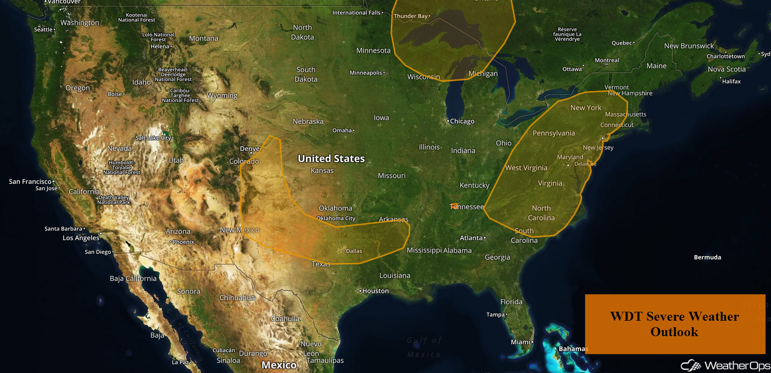
US Hazards
Thunderstorms from the Carolinas into the Northeast on Wednesday
Overcast skies, widely scattered showers, and isolated thunderstorms are ongoing along a slow moving cold front from the Northeast into the Tennessee Valley and Carolinas. Stronger thunderstorms are expected to develop during the afternoon and early evening as daytime heating increases. Damaging winds will be the primary hazard with these storms.
Major Cities in Region: Knoxville, TN, Pittsburgh, PA, Rochester, NY, Raleigh, NC, Baltimore, MD, Washington, DC, Philadelphia, PA, Albany, NY, New York, NY
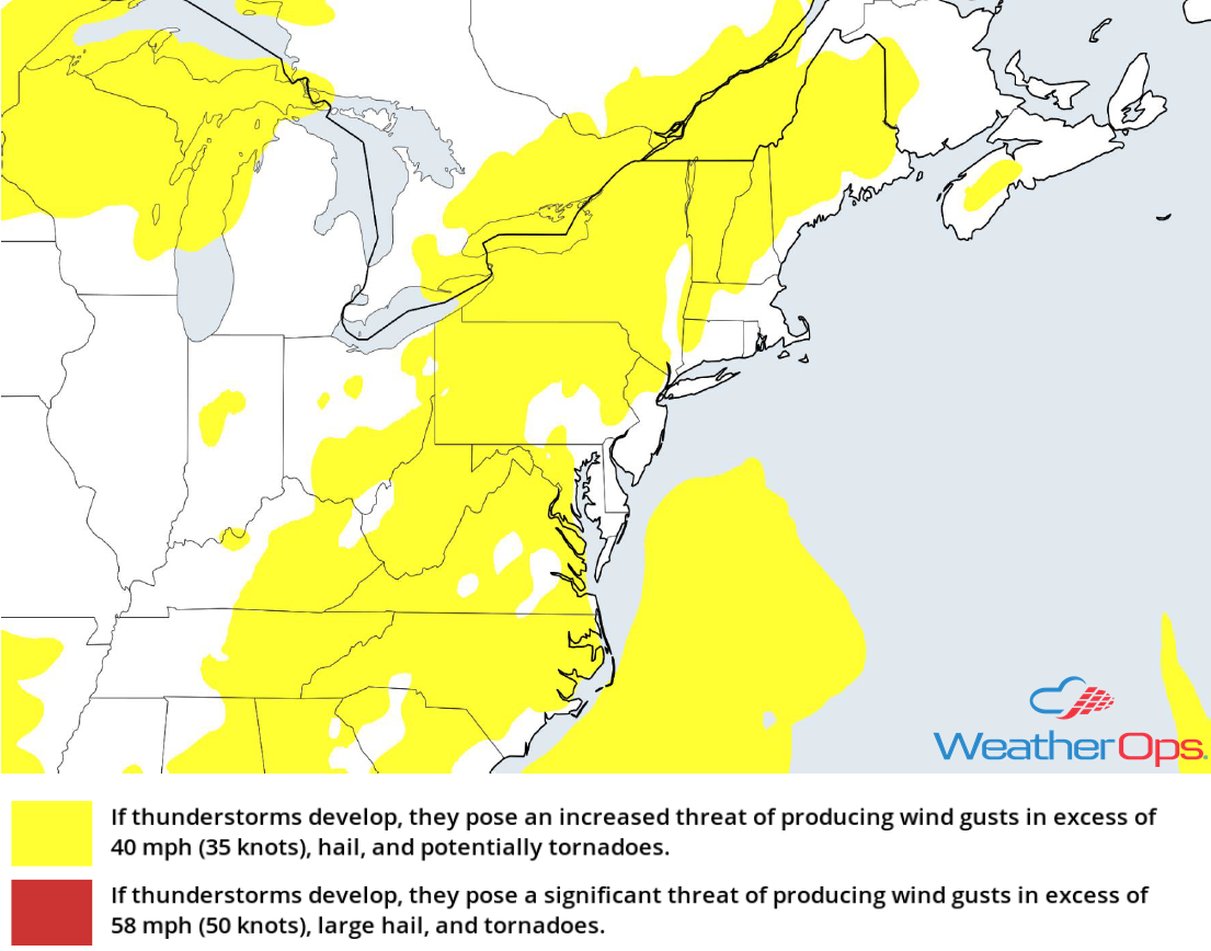
Thunderstorm Risk for Wednesday
Excessive Rainfall Wednesday from the Ohio Valley into the Northeast
In addition to the thunderstorms described above, there will be a risk for excessive rainfall. Rainfall rates of 1-2 inches per hour are forecast, leading to a risk for flash flooding.
Major Cities in Region: Charleston, WV, Pittsburgh, PA, Buffalo, NY
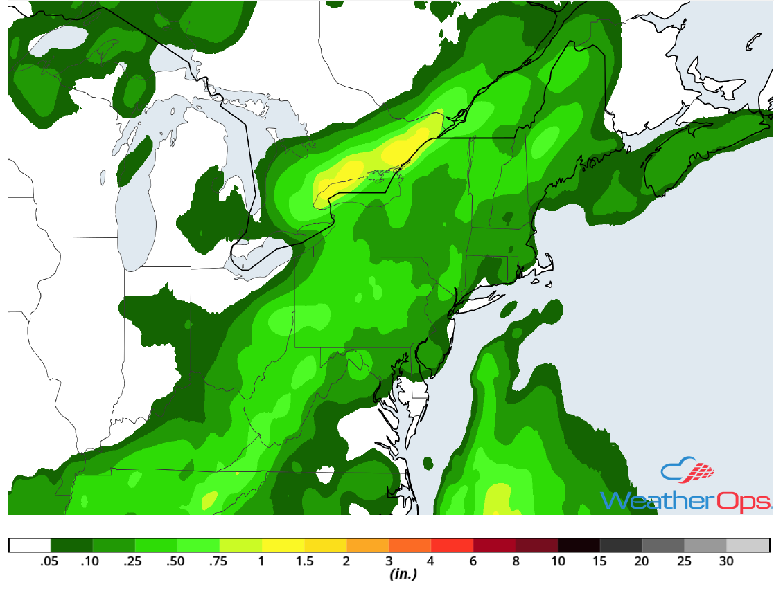
Rainfall Accumulation for Wednesday
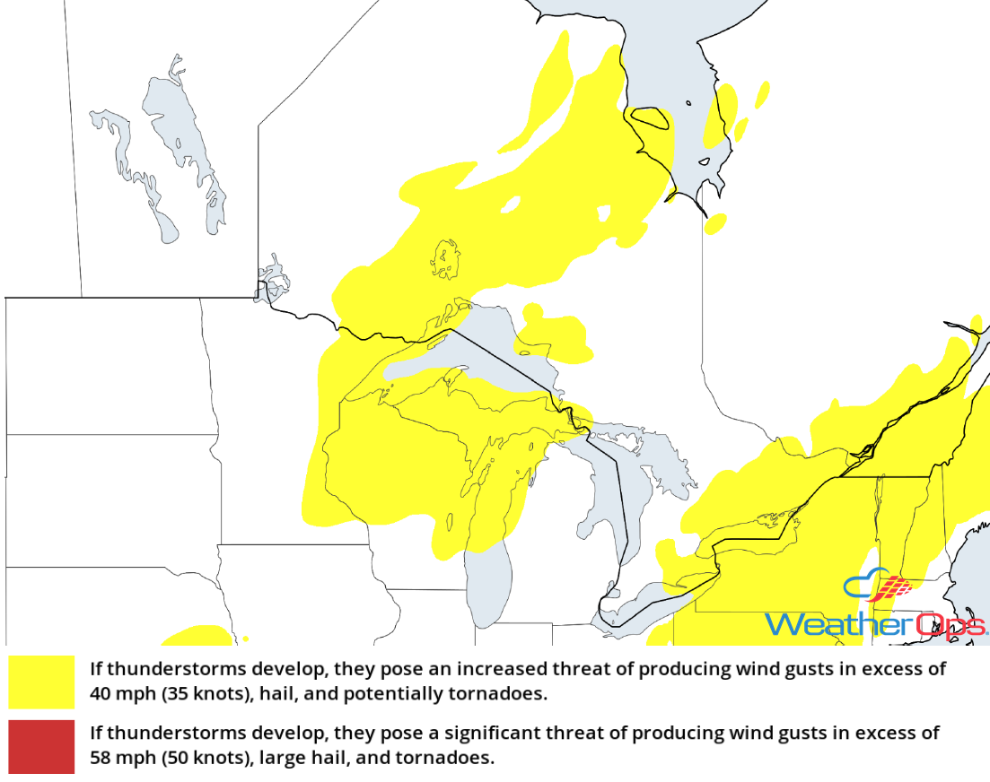
Thunderstorm Potential from the Central and Southern Plains into the Lower Mississippi Valley on Wednesday
There is a high degree of uncertainty regarding thunderstorm potential for Wednesday. Generally non-severe morning showers and thunderstorms will shift south and east over the next several hours. By mid to late afternoon, strong to severe thunderstorms are most likely to develop to the south of the morning activity. Storms will also develop across the western High Plains of Colorado and New Mexico. Strong instability and wind shear will support the potential for damaging winds and large hail with the stronger storms.
Major Cities in Region: Denver, CO, Colorado Springs, CO, Lubbock, TX, Amarillo, TX, Dallas, TX, Shreveport, LA, Little Rock, AR
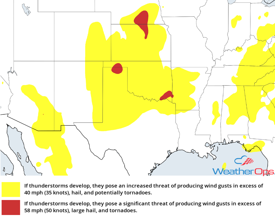
Thunderstorm Risk for Wednesday
Risk for Excessive Rainfall through Thursday from the Central and Southern Plains into the Lower Mississippi Valley
The thunderstorm activity described above will allow for a risk of excessive rainfall. As the front stalls, additional activity is expected on Thursday. Two day rainfall totals of 1-2 inches with locally heavier amounts in excess of 3 inches are expected, resulting in a risk for flash flooding.
Major Cities in Region: Oklahoma City, OK, Fort Smith, AR, Memphis, TN
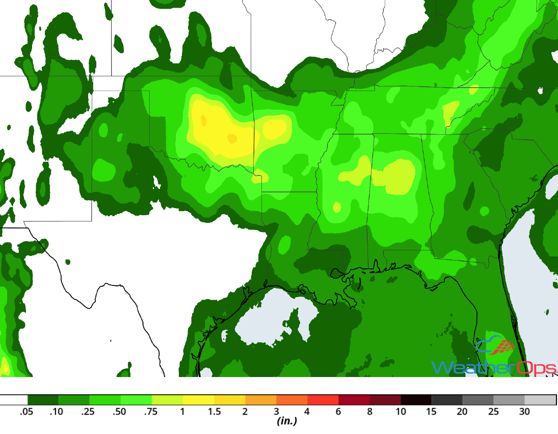
Rainfall Accumulation through Thursday
Thunderstorms across Eastern Minnesota and Wisconsin on Wednesday
Isolated strong thunderstorms will develop ahead of a cold front this afternoon as instability and wind shear increase. Damaging winds and hail will be the primary hazards with these storms.
Major Cities in Region: Duluth, MN, Wausau, WI, Green Bay, WI
Thunderstorm Risk for Wednesday
Excessive Rainfall through Friday from Arizona to West Texas
A slow moving front along the lee side of the Rockies, in addition to an active monsoon pattern, will promote heavy rainfall from Arizona eastward into west Texas through Friday. Storms in eastern parts of the area will move southward or southeastward whereas storms further west will move westward. Weak winds aloft will favor slow storm motions and high hourly rainfall rates. Rainfall rates may exceed an inch per hour, resulting in a slight risk for flash flooding.
Major Cities in Region: Phoenix, AZ, Tucson, AZ, Truth or Consequences, NM, Alamogordo, NM, Roswell, NM, Lubbock, TX
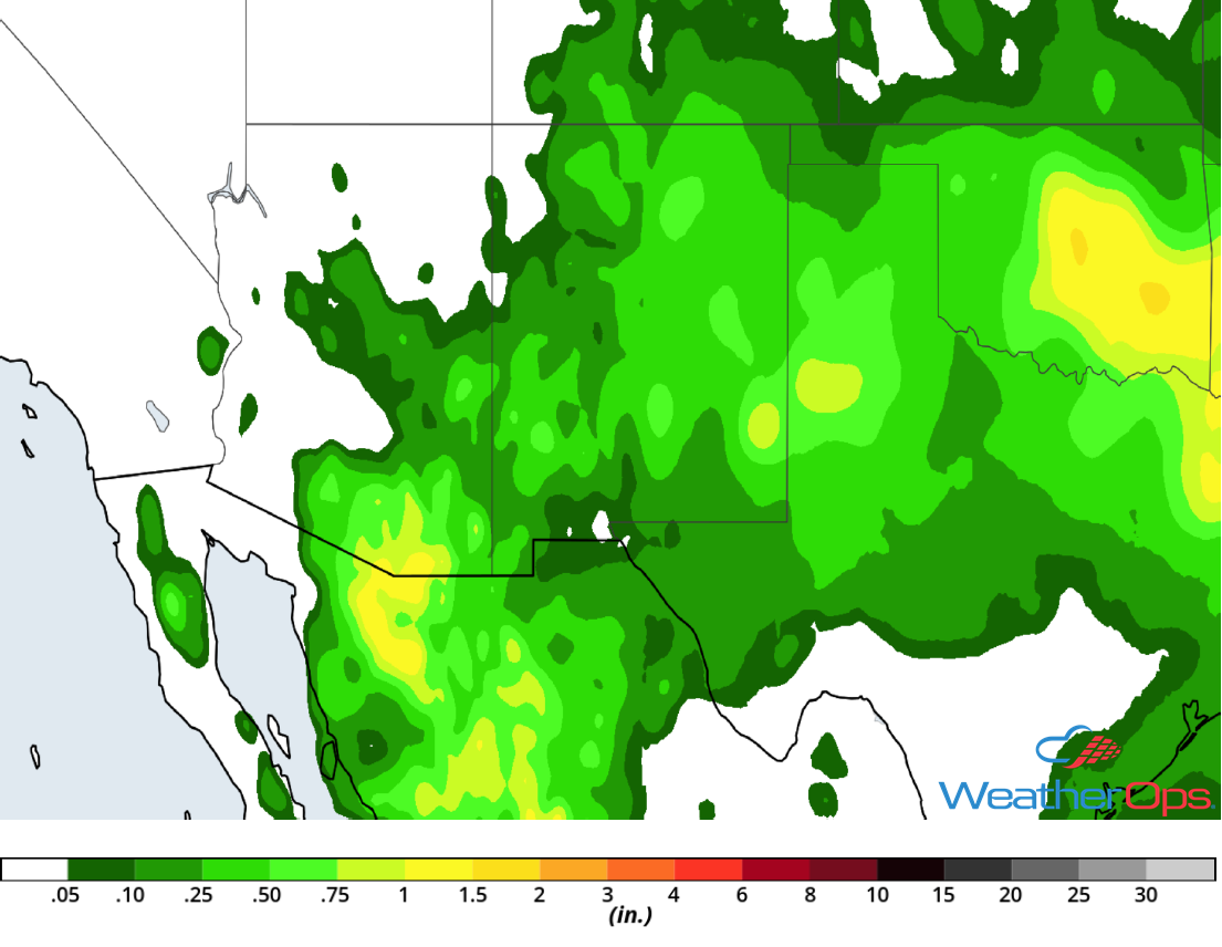
Rainfall Accumulation through Friday
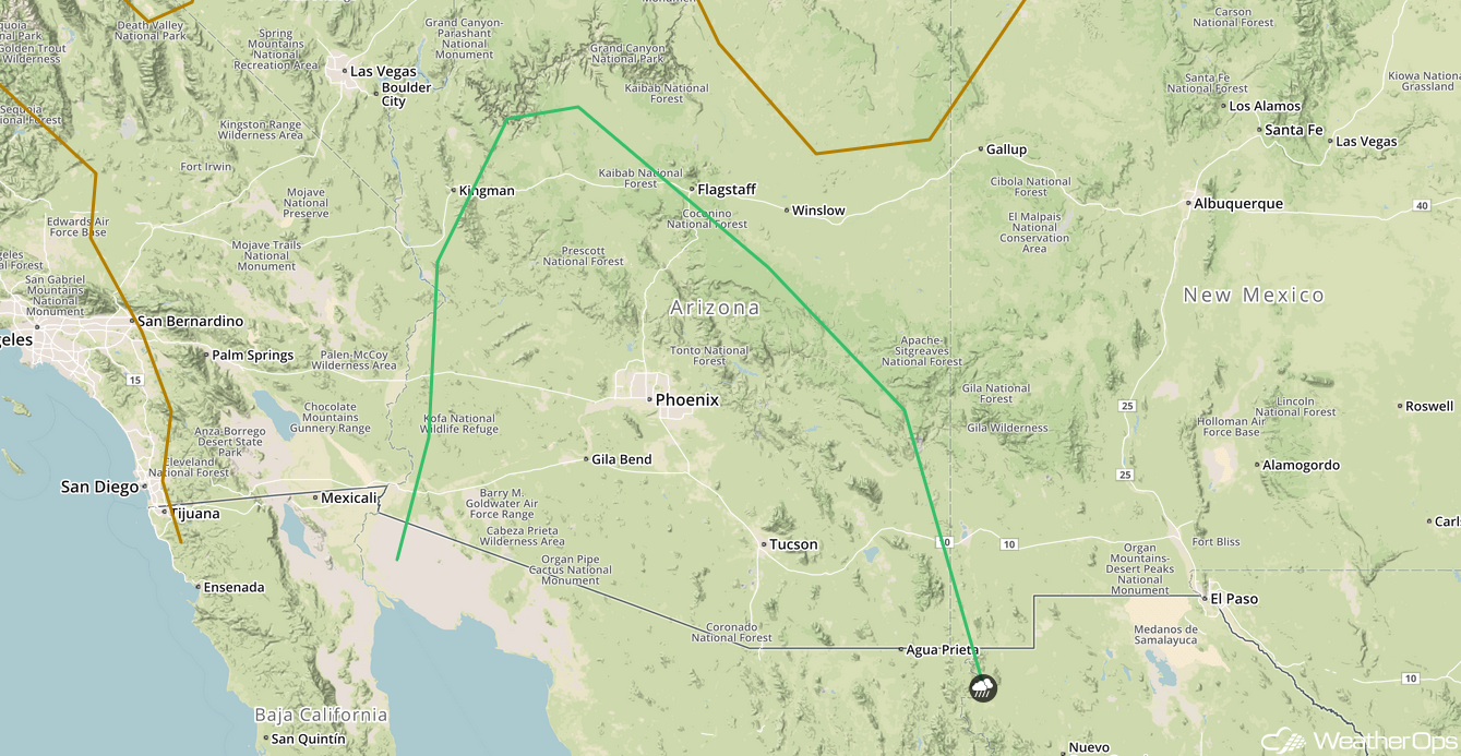
Potential for Thunderstorms across Arizona on Thursday
Weak mid to upper level disturbances will continue to pivot around a ridge centered across the Great Basin. Disturbances moving over the region should allow for the development of thunderstorms across the higher terrain by mid to late afternoon. Storms will generally move southwestward into lower terrain. Damaging winds and hail will be the primary hazards with these storms.
Major Cities in Region: Flagstaff, AZ, Tucson, AZ, Phoenix, AZ
SPC Convective Outlook for Thursday
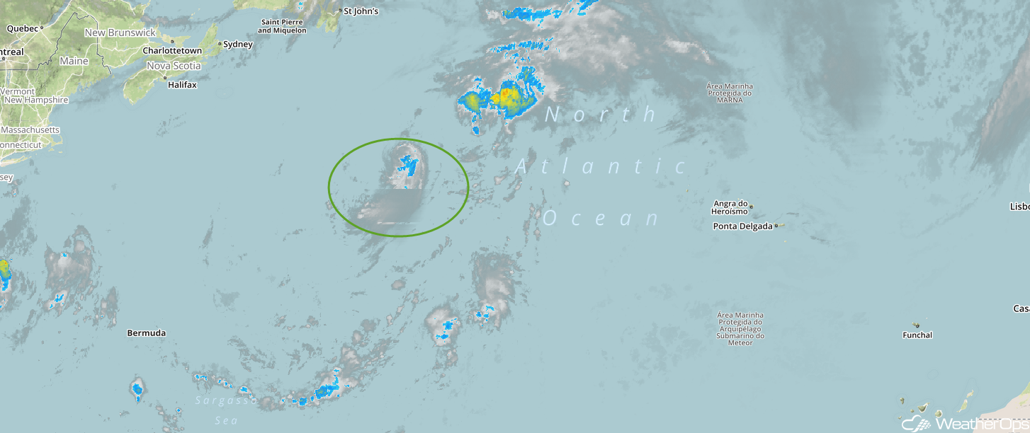
Tropical Update
Tropical Storm Debby is located 1175 miles west-northwest of the Azores and moving north-northeastward at 9 mph. Debby should turn toward the northeast by this afternoon and this motion is expected to continue into Thursday. Sustained winds are near 45 mph. Little change in strength is forecast today, but weakening is expected to begin tonight. Debby should dissipate by Thursday night.
Enhanced Infrared Satellite
A Look Ahead
Showers and thunderstorms will continue across the Southern Plains into the Southeast on Saturday along a stalled front. This activity may continue into Sunday. By Monday, showers and thunderstorms are forecast from the Southern Plains into Southern Texas ahead of a cold front. Shower activity should decrease in intensity across the Plains on Tuesday. An area of low pressure moving through portions of the Northeast on Tuesday may bring some heavy rain to the region.
