National Weather Summary for Wednesday, August 3, 2016
by David Moran, on Aug 3, 2016 11:34:20 AM
An area of low pressure and cold front moving into southern Canada will allow for the potential for severe thunderstorms across the Northern Plains on Wednesday. Monsoonal showers and thunderstorms will continue across the Desert Southwest. Heavy rain is expected along a stalled front across the Southeast. As a cold front continues to move across the Northern Plains on Thursday, strong to severe thunderstorms will be possible across portions of the Western Great Lakes. Showers and thunderstorms will continue across the Desert Southwest along a stalled front. Thunderstorms will be possible on Friday across the Ohio Valley as the cold front associated with the area of low pressure moving through Canada continues to move eastward. Showers and thunderstorms will continue across portions of the Desert Southwest along a stalled front.
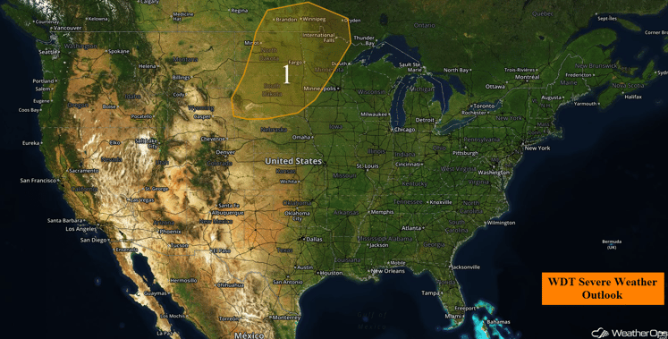
US Hazards
Region 1
A cold front moving through the Northern Plains on Wednesday will act as a focus for the development of thunderstorms during the afternoon. Rich moisture and strong instability will allow for some thunderstorms to become severe. Given the strong wind shear in place, supercell thunderstorms are likely with large hail being the main hazard. Some thunderstorms may produce hail larger than 2 inches in diameter. A few tornadoes will also be possible, with the greatest tornado threat expected to be over North Dakota and southern Manitoba. Thunderstorms will merge into a squall line during the evening hours, and push east into northern and western Minnesota, as well as southwestern Ontario, with damaging winds in excess of 60 mph expected to become the primary hazard, though a threat for hail will remain through the evening hours. The severe weather threat will gradually diminish during the overnight hours. Heavy rainfall will also be possible; rainfall totals of 1-2 inches with locally higher amounts in excess of 3 inches.
Update 1:30pm CDT: Clouds are beginning to build across the Northern Plains ahead of the area of low pressure moving out of the Northern Rockies.
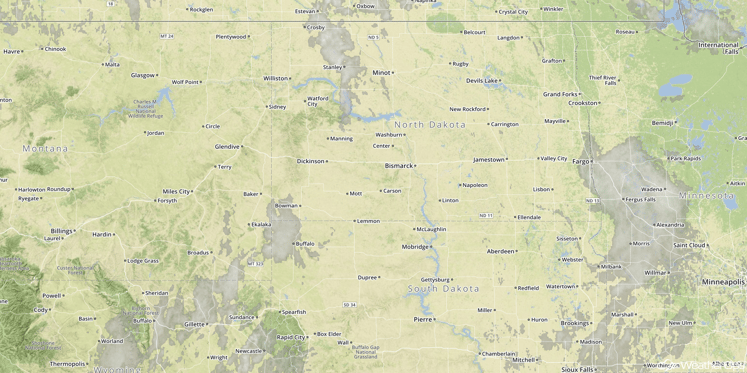
Visible Satellite 1:30pm CDT
Major Cities in Region: Bismarck, ND, Fargo, ND, International Falls, MN, Sioux Falls, SD
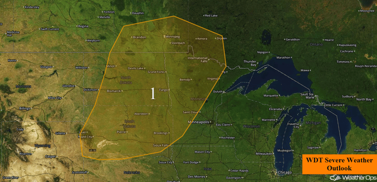
Region 1
Excessive Rainfall Possible for Wednesday Across the Desert Southwest
Monsoonal conditions are forecast to continue across the Desert Southwest on Wednesday. Showers and thunderstorms are expected to continue throughout the day for an additional 1-2 inches of rain with locally higher amounts in excess of 3 inches possible within any heavier areas of showers and thunderstorms. Flooding and flash flooding may occur due to precipitation runoff.
Major Cities in Region: Flagstaff, AZ, Phoenix, AZ, Tucson, AZ, and Albuquerque, NM
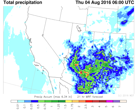
WDT WRF Total Precipitation through Midnight MDT
Excessive Rainfall Possible Across the Southeast on Wednesday
A stalled front will be the focus for shower and thunderstorm activity across portions of the Southeast today. As the afternoon progresses, slow moving thunderstorms are forecast to increase in intensity and coverage, which will lead to scattered areas of heavy rainfall across the region. General rainfall amounts of 1-3 inches are expected across the region today however locally higher amounts in excess of 4 inches are possible, especially within stronger slow moving thunderstorms.
Major Cities in Region: Charlotte, NC, Asheville, NC, Columbia, SC
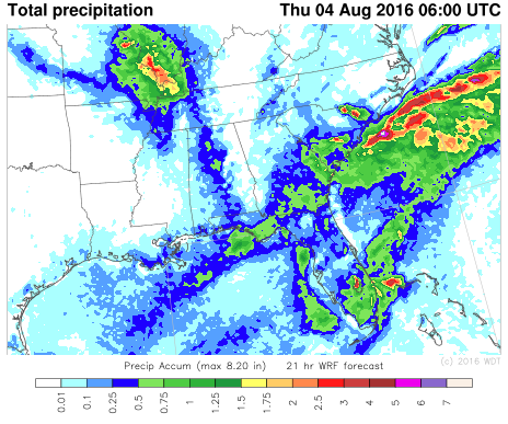
WDT WRF Total Precipitation through 2am EDT
Strong to Severe Thunderstorms Possible Across Western Great Lakes on Thursday
As an area of low pressure in southern Canada continues to move northeastward, the associated cold front will also move eastward into Minnesota. As this cold front continues to move eastward throughout the day, it will be the focus for the development of strong to severe thunderstorms. Strong instability ahead of this cold front combined with plentiful moisture and wind shear will result in an increase in thunderstorm intensity and coverage. The primary threats with any thunderstorm that forms will be large hail and strong winds.
Major Cities in Region: Minneapolis, MN, Eau Claire, WI
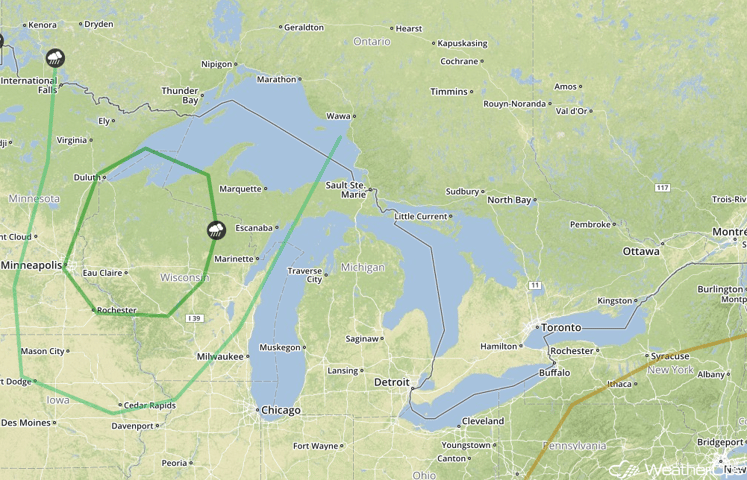
SPC Convective Outlook for Thursday
Excessive Rainfall Possible Thursday Across the Desert Southwest
The cold front across the Plains will drape southwestward into the Desert Southwest and become stationary. With this front as the focal point for forcing across the region, monsoonal conditions are forecast to persist on Thursday. Showers and thunderstorms are expected to continue throughout the day with the potential for an additional 1-2 inches with locally higher amounts in excess of 3 inches possible within heavier areas of showers and thunderstorms. With the heavy rainfall, flooding and flash flooding may be possible due to local runoff.
Major Cities in Region: Flagstaff, AZ, Phoenix, AZ, Tucson, AZ, and Albuquerque, NM
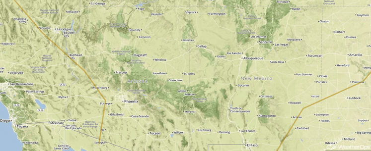
SPC Convective Outlook for Thursday
Strong to Severe Thunderstorms Possible Across the Ohio Valley on Friday
An area of low pressure will continue towards James Bay, Canada. The associated cold front will continue eastward across the Great Lakes and into the Ohio Valley. Once again, this will be the main focus for the development of strong to severe thunderstorms during the afternoon to early evening hours on Friday. Strong to moderate instability as well as low to moderate wind shear across the region is forecast to lead to an increase in coverage and intensity of thunderstorms ahead of this front. At this time, strong wind gusts are forecast to be the primary threat with any thunderstorm that develops.
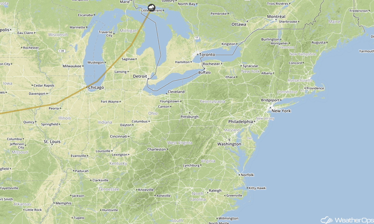
SPC Convective Outlook for Friday
Excessive Rainfall Possible Across the Desert Southwest on Friday
The cold front extending from the Great Lakes to the Plains will stretch southwestward into the Desert Southwest . This leftover boundary will exit the region, however, before it exits, it will be the focal point for monsoonal conditions across the Desert Southwest. Showers and thunderstorms are forecast to lead to rainfall amounts of 1-2 inches across the region.
Major Cities in Region: Flagstaff, AZ, Phoenix, AZ, Tucson, AZ, and Albuquerque, NM
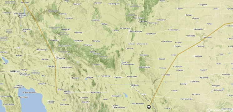
SPC Convective Outlook for Friday
This is just a brief look at current weather hazards. We can provide you site-specific forecast information for the purpose of protecting your personnel and assets. Try a 7-day demo right away and learn how timely precision weather information can enhance your bottom line.


