National Weather Summary for Wednesday, August 17, 2016
by David Moran, on Aug 17, 2016 11:19:53 AM
A weak upper level low and attendant cold front will allow for the development of showers and thunderstorms on Wednesday across portions of Montana and North Dakota. Across portions of the Great Lakes, an upper level trough will provide forcing for the development of thunderstorms. A stalled front will be the focal point for thunderstorms across portions of the Mid Atlantic. Heavy rain and flash flooding will continue across portions of Central Texas. On Thursday, a cold front moving into the Plains will be the focus for thunderstorm development across the Northern Plains. As the cold front progresses southward on Friday, thunderstorms are expected across portions of the Central Plains and Upper Midwest.
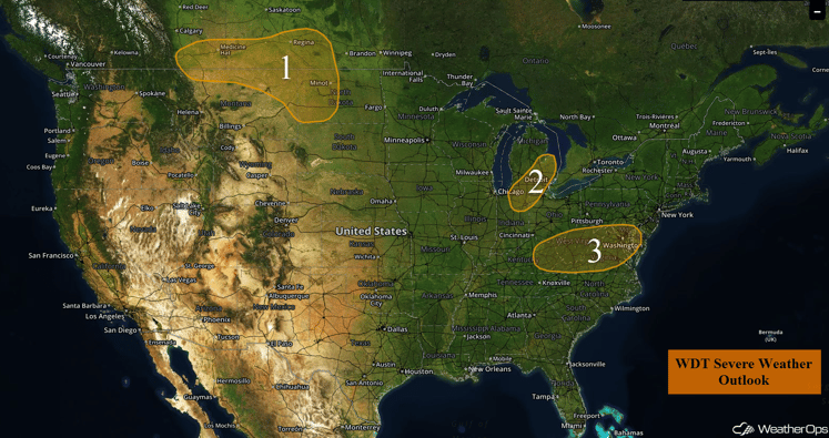
US Hazards
Region 1
A weak upper low and attendant cold front will likely result in isolated to scattered showers and thunderstorms by late afternoon from along the Montana/Canada border, eastward into southern Manitoba and portions of North Dakota. While the threat for severe weather appears rather low, a few storms could become marginally severe with a small risk for severe wind and large hail. Storm activity should follow the front south and eastward into the overnight hours, with the threat of any severe weather gradually diminishing after dark.
Major Cities in Region: Glasgow, MT, Minot, ND, Bismarck, ND
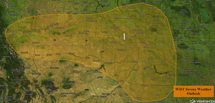
Region 1
Region 2
Isolated to scattered showers and thunderstorms are slowly moving into the Midwest and Great Lakes regions this morning. While significant impacts are not forecast, daytime heating and the passage of a weak upper level trough may allow for some storms to become marginally severe later this afternoon and evening. With any of the stronger storms, the primary impact should be severe wind. Otherwise, storms should quickly weaken as the sun sets.
Update 12:48pm EDT: Severe Thunderstorm and Tornado Warnings in effect in Southwestern Ohio.
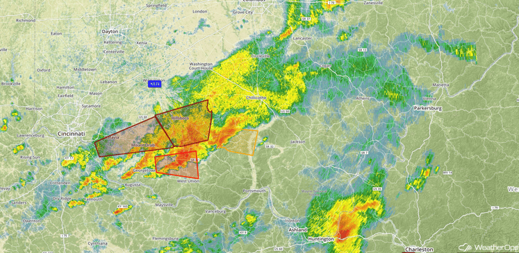
Radar 12:48pm EDT
Update 1:18pm EDT: Tornado Warning near and including Charleston, WV.
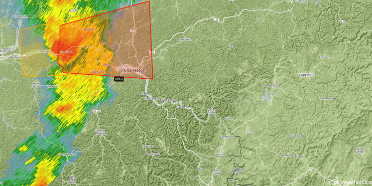
Radar 1:18pm EDT
Update 2:12pm EDT: A Severe Thunderstorm Watch is in effect for portions of Maryland, Virginia, and West Virginia until 8pm EDT. Damaging winds in excess of 70 mph and isolated tornadoes will be possible.
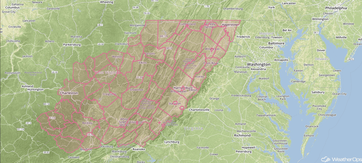
Severe Thunderstorm Watch
Major Cities in Region: Detroit, MI, Fort Wayne, IN
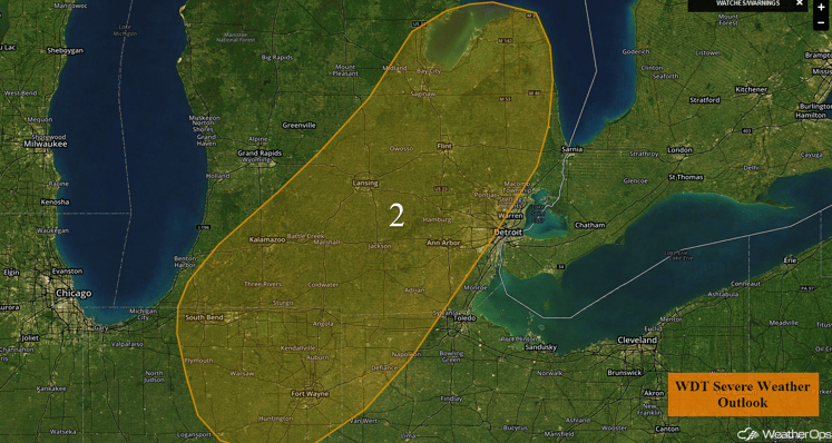
Region 2
Region 3
A stalled front will support the development of scattered showers and thunderstorms this afternoon and evening across Region 3. While overall conditions will not be overly supportive for severe weather, a few thunderstorms could become marginally severe, primarily during the late afternoon and early evening hours, with a low risk for severe wind.
Major Cities in Region: Charleston, WV, Lynchburg, VA, and Washington, DC
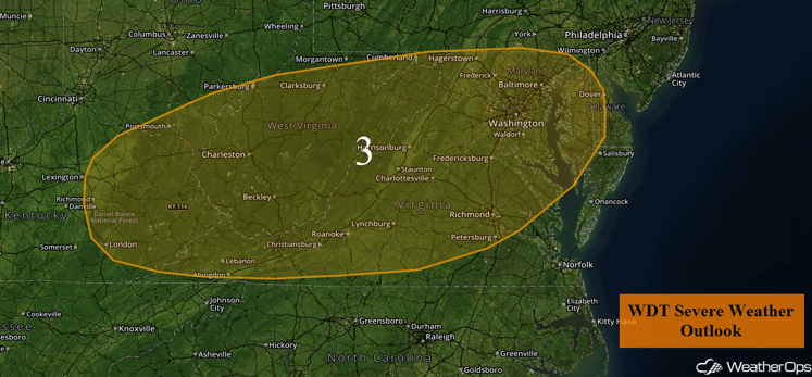
Region 3
Excessive Rainfall Possible Wednesday Across Central Texas
The threat for flash flooding will continue for portions of Central Texas into the Upper Texas Coast on Wednesday as deep tropical moisture remains in place. Scattered to widespread showers and thunderstorms will impact the region throughout the day into the early evening. Heavy rainfall rates leading to localized flash flooding will be possible. Rainfall totals of 1-3 inches with locally higher amounts in excess of 4 inches will be possible.
Major Cities in Region: San Antonio, TX, Austin, TX, Houston, TX
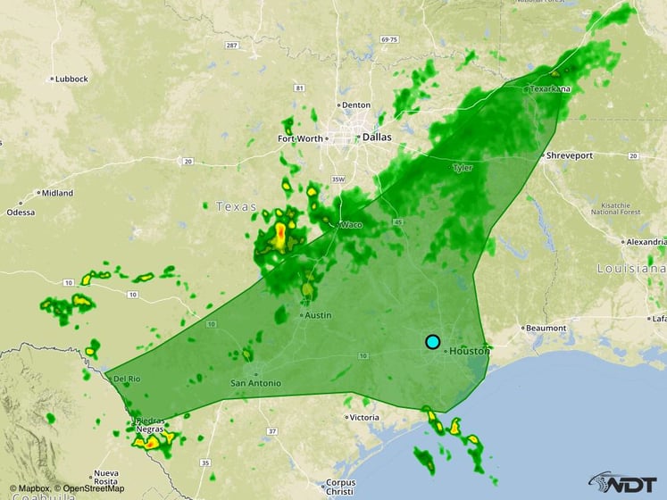
Excessive Rainfall Risk Outline for Wednesday
Strong to Severe Thunderstorms Possible Thursday Across the Northern Plains
Scattered strong to severe thunderstorms will be possible across portions of the Northern Plains on Thursday. A cold front progressing southward into the region during the day will allow for the development of thunderstorms across the region by the afternoon. Thunderstorms are expected to develop along and ahead of the cold front during the late afternoon hours and increase in coverage and intensity during the evening hours as they track eastward. Primary impacts with these storms will be large hail, damaging winds, and isolated tornadoes.
Major Cities in Region: Bismarck, ND, Pierre, ND, Sioux Falls, SD, Minneapolis, MN
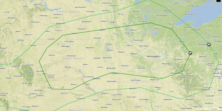
SPC Convective Outlook for Thursday
Strong to Severe Thunderstorms Possible for the Central Plains and Upper Midwest on Friday
Severe weather is expected across portions of the Midwest and Central Plains on Friday as a cold front continues to surge southward across the Northern Plains. Widespread showers and thunderstorms are expected to develop ahead of the front. Clusters of storms will persist into the late evening hours as the activity shifts eastward. Primary hazards will be large hail and damaging winds.
Major Cities in Region: Sioux Falls, SD, Omaha, NE, Des Moines, IA, Kansas City, MO, Dodge City, KS
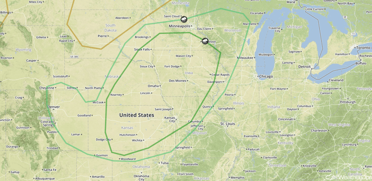
SPC Convective Outlook for Friday
This is just a brief look at current weather hazards. We can provide you site-specific forecast information for the purpose of protecting your personnel and assets. Try a 7-day demo right away and learn how timely precision weather information can enhance your bottom line.


