National Weather Summary for Wednesday, August 16, 2017
by David Moran, on Aug 16, 2017 11:02:07 AM
Thunderstorms may develop across the Central US on Wednesday ahead of an area of low pressure.
- Thunderstorms for the Central US on Wednesday
- Potential for Thunderstorms Thursday across the Great Lakes and Ohio Valley
- Risk for Thunderstorms across the Southern High Plains on Thursday
- Thunderstorm Potential Continuing for the Central US on Friday
- Thunderstorms Friday across the Northeast
- Excessive Rainfall Threat for the South Central US on Friday
- Tropical Update
 US Hazards
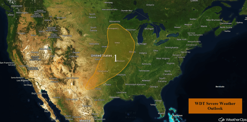
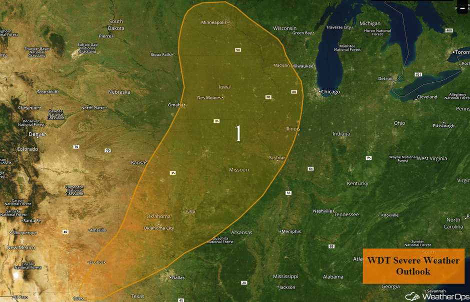
Thunderstorms for the Central US on Wednesday
This morning's thunderstorm activity is forecast to continue to track east to northeastward and slowly weaken into the afternoon. These storms will be capable of damaging winds from eastern Nebraska into northern Missouri and southern Iowa. Into the afternoon, a surface low and cold front will track across the Central and Southern Plains. Ahead of this front, southerly flow will bring moisture northward. Moisture and daytime heating will allow instability to build. With instability and wind shear in place, scattered showers and thunderstorms will develop and increase in coverage and intensity ahead of the front. Supercells and line segments both appear likely with large hail, damaging winds, and tornadoes all being potential hazards. By the evening, most activity is expected to become linear with damaging winds becoming the primary hazard.
Major Cities in Region: Oklahoma City, OK, Wichita, KS, Tulsa, OK, Omaha, NE, Kansas City, MO, Minneapolis, MN, St. Louis, MO
 US Hazards
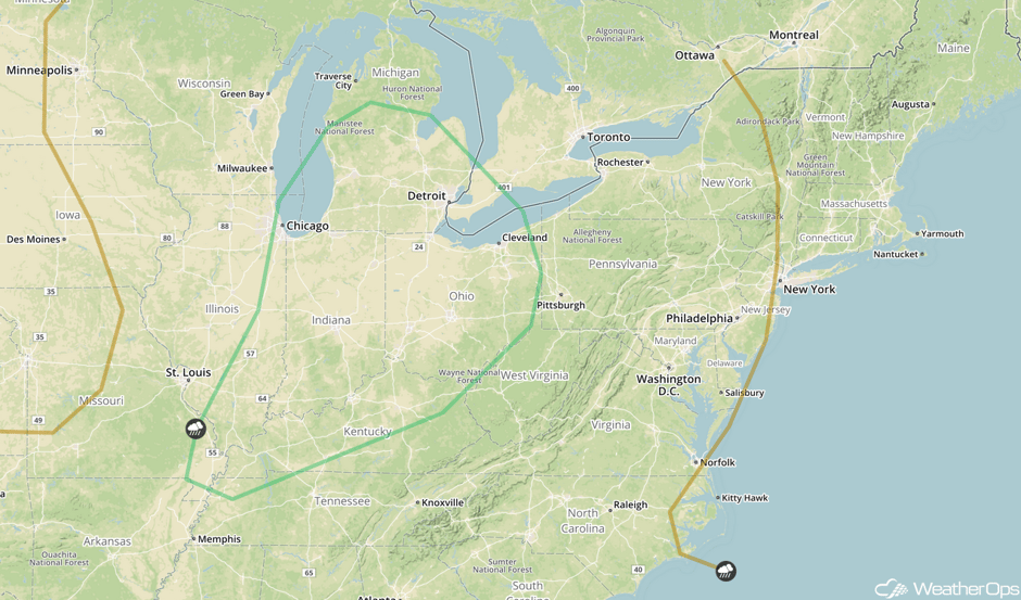
Potential for Thunderstorms Thursday across the Great Lakes and Ohio Valley
An area of low pressure lifting across the Great Lakes is forecast to continue producing thunderstorms on Thursday. A line of thunderstorms should be ongoing during the morning, with some severe winds possible. This activity should inhibit some stronger development later in the day on Thursday, but new thunderstorms may develop with severe winds the primary hazard.
Major Cities in Region: Chicago, IL, Indianapolis, IN, Louisville, KY, Detroit, MI, Cleveland, OH
 SPC Convective Outlook for Thursday
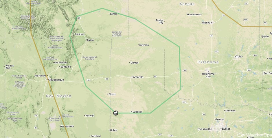
Risk for Thunderstorms across the Southern High Plains on Thursday
The remnants of a front that passed across the region on Wednesday are forecast to lift across the Southern Plains as a warm front on Thursday. Although there will not be a defined area of low pressure, destabilization and a low level jet will allow for the development of strong to severe thunderstorms. Large hail and damaging winds will be the primary hazards, with this activity developing late in the day and continuing into the evening. In addition, rainfall amounts of 1-2 inches are expected, as well as localized flooding.
Major Cities in Region: Lubbock, TX, Amarillo, TX, Guymon, OK
 SPC Convective Outlook for Thursday
Thunderstorm Potential Continuing for the Central US on Friday
An area of low pressure is expected to develop across the Central US on Friday along with a warm front lifting across the region. Storms are expected to develop along the front and move northeastward across the region through the late afternoon and evening. Large hail and damaging winds will be the primary hazards with these storms.
Major Cities in Region: Salina, KS, Topeka, KS, Sioux City, IA, Omaha, NE, Kansas City, MO, Des Moines, IA
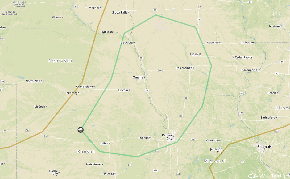 SPC Convective Outlook for Friday
Thunderstorms Friday across the Northeast
A mostly weak environment is expected across the Northeast on Friday as an area of low pressure moves across Canada and its associated fronts move across the region. Nevertheless, a few strong to severe thunderstorms may develop. Activity should be ongoing during the morning, but additional development is expected during the afternoon. Damaging winds will be the primary hazards with these storms.
Major Cities in Region: Buffalo, NY, Albany, NY
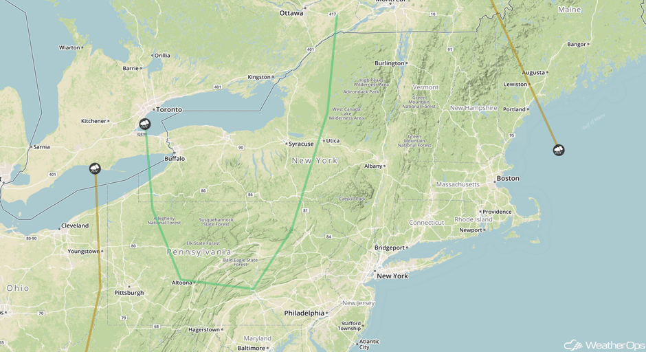 SPC Convective Outlook for Friday
Excessive Rainfall Threat for the South Central US on Friday
As storms lift northward on Friday with a warm front, areas of excessive rainfall are expected across the region. Given recent heavy rain, any additional rainfall will promote flooding. Rainfall amounts of 1-2 inches are forecast.
Major Cities in Region: Tulsa, OK, Joplin, MO, Fayetteville, AR, Springfield, MO, Little Rock AR
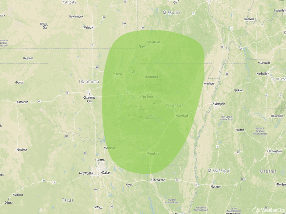 Excessive Rainfall Risk Outline for Friday
Tropical Update
Hurricane Gert (green oval) is moving northeastward at 25 mph. An increase in forward speed is expected through Friday. Sustained winds are near 90 mph with higher gusts. Some strengthening is expected today or tonight before weakening on Thursday.
An area of low pressure located 900 miles east of the Lesser Antilles (red oval) continues to produce showers and thunderstorms. This system is continuing to move westward at 15-20 mph and is forecast to move into the Caribbean on Friday. Conditions are expected to become more conducive on over the next several days.
A second area of low pressure is located several hundred miles west of the Cabo Verde Islands (blue oval) and is producing disorganized showers and thunderstorms. Gradual development may occur over the next few days. This system is expected to move west-northwestward at 15-20 mph.
Lastly, a tropical wave near the west coast of Africa (yellow oval) is producing a large area of disorganized showers and thunderstorms. Environmental conditions appear conducive for gradual development of this wave while it moves westward to west-northwestward at 15-20 mph over the next several days.
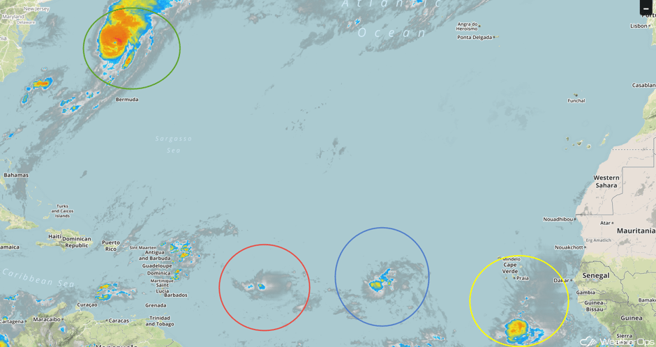 Enhanced Infrared Tropical Satellite
A Look Ahead
A few showers and thunderstorms may develop across the Northern Plains on Sunday as an area of low pressure develops. Thunderstorms will continue to be possible early next week as a cold front continues to move across the Plains.
This is just a brief look at current weather hazards. We can provide you site-specific weather forecast information for the purpose of protecting your personnel and assets and to assess your weather risk. Try a 7-day demo right away and learn how timely precision weather information can enhance your bottom line.


